JP5649298B2 - Object detection apparatus and object detection method - Google Patents
Object detection apparatus and object detection method Download PDFInfo
- Publication number
- JP5649298B2 JP5649298B2 JP2009254043A JP2009254043A JP5649298B2 JP 5649298 B2 JP5649298 B2 JP 5649298B2 JP 2009254043 A JP2009254043 A JP 2009254043A JP 2009254043 A JP2009254043 A JP 2009254043A JP 5649298 B2 JP5649298 B2 JP 5649298B2
- Authority
- JP
- Japan
- Prior art keywords
- person
- candidate
- information
- observation point
- height
- Prior art date
- Legal status (The legal status is an assumption and is not a legal conclusion. Google has not performed a legal analysis and makes no representation as to the accuracy of the status listed.)
- Active
Links
- 238000001514 detection method Methods 0.000 title claims description 228
- 238000000605 extraction Methods 0.000 claims description 81
- 238000000034 method Methods 0.000 claims description 77
- 238000013507 mapping Methods 0.000 claims description 29
- 230000001678 irradiating effect Effects 0.000 claims description 5
- 238000010586 diagram Methods 0.000 description 18
- 239000000284 extract Substances 0.000 description 17
- 230000010354 integration Effects 0.000 description 11
- 238000012545 processing Methods 0.000 description 6
- 230000007423 decrease Effects 0.000 description 2
- 238000009825 accumulation Methods 0.000 description 1
- 238000005219 brazing Methods 0.000 description 1
- 238000006073 displacement reaction Methods 0.000 description 1
- 230000000694 effects Effects 0.000 description 1
- 239000011521 glass Substances 0.000 description 1
- 230000005484 gravity Effects 0.000 description 1
- 238000005259 measurement Methods 0.000 description 1
- 238000012986 modification Methods 0.000 description 1
- 230000004048 modification Effects 0.000 description 1
- 238000013139 quantization Methods 0.000 description 1
Images



Landscapes
- Optical Radar Systems And Details Thereof (AREA)
Description
本発明は、レーザレーダ装置からの情報に基づいて対象物を検出する対象物検出装置および対象物検出方法に関する。 The present invention relates to an object detection apparatus and an object detection method for detecting an object based on information from a laser radar apparatus.
被災地などの危険な場所に物資を輸送するなどの用途のため、予め定められた経路に従って自律的に走行することができる無人の自律走行車両が検討されている。このような自律走行車両には、GPS(Global Positioning System)などの位置センサや、ジャイロセンサ、IMU(Inertial Measurement Unit:慣性計測装置)などの姿勢センサが搭載され、自車両の位置および姿勢に応じて、走行する方向や速度などが制御されている。しかし、自律走行車両は、予め定められた走行経路を走行するのみではなく、走行経路内に存在する障害物を監視して、走行に支障をきたすような不測の事態に対応することが求められている。例えば、走行経路内に人や障害物などが存在する場合には、検出した人や障害物など対象物に応じて停止や迂回が必要となる。 For the purpose of transporting goods to a dangerous place such as a stricken area, an unmanned autonomous traveling vehicle that can travel autonomously according to a predetermined route has been studied. Such autonomously traveling vehicles are equipped with position sensors such as GPS (Global Positioning System), attitude sensors such as gyro sensors and IMU (Inertial Measurement Unit), and depending on the position and attitude of the own vehicle. The traveling direction and speed are controlled. However, autonomous vehicles are required not only to travel on a predetermined travel route but also to monitor obstacles in the travel route to cope with unforeseen circumstances that may impede travel. ing. For example, when a person or an obstacle exists in the travel route, it is necessary to stop or detour depending on the detected person or obstacle.
従来、走行経路内に存在する人や障害物などの対象物を検出するための方法として、例えば、特許文献1、特許文献2に示すような種々の技術が考案されている。特許文献1には、レーザレーダ装置と赤外線カメラとを用いて人を検出する技術が開示されている。具体的には、レーザレーダの検出点において、相互の検出点の距離が近い「固まり」を人の候補とする。そして、赤外線カメラの赤外線画像から人の候補の位置に存在する人を検出する。また、このとき、人の候補までの距離を用いて、検出する対象のサイズを決定する技術である。
Conventionally, as a method for detecting an object such as a person or an obstacle present in a travel route, for example, various techniques as shown in
また、特許文献2には、赤外線カメラと可視カメラとを用いて人を検出する技術が開示されている。具体的には、赤外線カメラの画像中の高輝度部分(ホットポイント)を抽出する。そして、抽出した高輝度部分を可視カメラの画像で確認することによって、「真の対象物」であるか否かを詳細に判断する。さらには、地図および地形データを用いることによって、「地形」によって発生する高輝度部分の誤検知を低減する技術である。
しかしながら、特許文献1に記載の技術では、例えば、直射日光などによって温度が高くなったドラム缶など、人とほぼ同じ太さであるが高さが人と異なる障害物を人として誤検出してしまうという問題がある。
However, with the technique described in
また、特許文献2記載の技術では、例えば、ガラスの後方に存在する対象物を赤外線カメラで写すことができない。また、例えば、夜間などの暗い環境においては、可視カメラで対象物を写すことができない。このように、それぞれのカメラで写すことのできない状態がある場合には、対象物を検知できないという問題がある。
Moreover, with the technique of
本発明は、上記の課題認識に基づいてなされたものであり、車両や自律走行車両などの移動体に搭載され、走行と同時に対象物を監視(検出、追尾、識別などを含む)する対象物検出装置において、目標とする対象物を精度よく検出するとともに、目標の対象物以外の誤検知を低減することができる対象物検出装置および対象物検出方法を提供することを目的としている。 The present invention has been made on the basis of the above-described problem recognition, and is mounted on a moving body such as a vehicle or an autonomous vehicle, and monitors (including detection, tracking, identification, etc.) an object simultaneously with traveling. An object of the present invention is to provide a target detection apparatus and a target detection method capable of accurately detecting a target object and reducing false detection other than the target target.
上記の課題を解決するため、本発明の対象物検出装置は、仰俯角方向に異なる角度を持った複数のレーザビームを照射しながら回転することによって対象物を検出するレーザレーダによる前記対象物の検出に基づいて生成した観測点の観測点情報であって、前記レーザレーダと前記対象物との間の距離の情報と、前記複数のレーザビームによって検出した3次元の空間の座標系における前記観測点それぞれの鉛直方向の高さを示す情報と、を少なくとも含む前記観測点情報から、前記距離の情報を抽出し、人物の幅を示す範囲の連続する観測点についての各距離の情報の変化量に基づき人物が位置するであろう観測点候補を抽出する第一人物候補抽出手段と、人物の体長と想定される体長情報を予め記憶し、前記人物候補抽出手段が抽出した前記人物が位置するであろう観測点候補についての前記観測点情報に含まれる高さを示す情報と、前記人物の体長と想定される体長情報との比較結果に基づいて、当該観測点候補の中から人物の存在する観測点を検出する第二人物候補抽出手段と、を備え、前記第二人物候補抽出手段は、前記第一人物候補抽出手段によって抽出された前記観測点候補と、当該観測点候補についての前記観測点情報に含まれる高さを示す情報とに基づいて、予め定められた距離で二次元の複数のグリッドに分割された人物候補グリッドマップの前記観測点候補に対応する位置に、当該観測点候補の前記観測点情報に含まれる高さを示す情報をマッピングし、前記複数のレーザビームによって検出した前記観測点それぞれの高さを示す情報を、予め定められた距離で二次元の複数のグリッドに分割された地面高さグリッドマップの当該観測点に対応する位置にマッピングし、前記第一人物候補抽出手段によって抽出された人物が位置するであろう観測点候補に対応する前記地面高さグリッドマップの位置に前記高さを示す情報がマッピングされているときは、当該高さを示す情報と、前記人物候補グリッドマップの対応する位置の観測点候補にマッピングされた高さを示す情報のうちの最大値との差に基づいて、その観測点候補に位置する対象物の長さを算出し、その算出した前記対象物の長さと、前記人物の体長と想定される体長情報とに基づいて、前記第一人物候補抽出手段によって抽出された前記人物が位置するであろう観測点候補の中から人物の存在する観測点を検出する、ことを特徴とする。
これにより、人物候補の情報に対して、高さの情報が加味されることにより、精度良く人物を検出することができる。
In order to solve the above-described problems, an object detection apparatus according to the present invention is configured to detect an object by a laser radar that detects the object by rotating while irradiating a plurality of laser beams having different angles in the elevation angle direction. Observation point information of an observation point generated based on detection, information on a distance between the laser radar and the object, and the observation in a coordinate system of a three-dimensional space detected by the plurality of laser beams The distance information is extracted from the observation point information including at least information indicating the vertical height of each point, and the amount of change in the information on each distance for successive observation points in the range indicating the width of the person a first person candidate extracting means for extracting an observation point candidate that would person is located based on previously stores a body length information that is supposed to body length of the person, the person candidate extracting means has extracted Information indicating the height serial person is included in the observation point information will you observation point candidate is located, on the basis of a comparison result between body length information is assumed to body length of the person, of the observation point candidate A second person candidate extracting means for detecting an observation point where a person is present, and the second person candidate extracting means includes the observation point candidate extracted by the first person candidate extracting means and the observation The position corresponding to the observation point candidate of the human candidate grid map divided into a plurality of two-dimensional grids at a predetermined distance based on the information indicating the height included in the observation point information about the point candidate , the mapping information indicating a height included in the observation point information of the observation point candidate, the information indicating the plurality of the observation points each height detected by the laser beam, a predetermined distance In mapping the position corresponding to the observation points of the divided ground level grid map in a two-dimensional plurality of grids, to the likely if the observation point candidates the person extracted by the first person candidate extracting means is located when information indicating the height position of the corresponding ground level grid map is mapped, and information indicating the height, is mapped to a corresponding position of the observation point candidate of the person candidate grid map Based on the difference from the maximum value of the information indicating the height, the length of the object located at the observation point candidate is calculated, and the calculated length of the object and the body length of the person are assumed. Based on the body length information, an observation point where a person exists is detected from observation point candidates that the person extracted by the first person candidate extraction unit will be located.
Thereby, a person can be detected with high accuracy by adding height information to information on a person candidate.
また、本発明の前記第一人物候補抽出手段は、前記レーザレーダが照射した前記レーザビームによって前記対象物の同一高さの前記観測点を検出したときの当該観測点の前記レーザレーダからの距離の情報に基づいて、人物の幅を示す範囲の連続する観測点についての各距離の情報の変化量を算出し、その変化量を異なる複数の前記レーザビームについて同様に行うことにより、人物が位置するであろう観測点候補を抽出する、ことを特徴とする。 Further, the first person candidate extracting means of the present invention is configured to detect a distance from the laser radar of the observation point when the observation point having the same height as the object is detected by the laser beam irradiated by the laser radar. Based on the information, the amount of change in information on each distance for successive observation points in the range indicating the width of the person is calculated, and the amount of change is similarly applied to a plurality of different laser beams , whereby the person is positioned. It is characterized by extracting observation point candidates that will be .
また、本発明は前記人物候補グリッドマップのグリッドの位置を予め定められた距離だけずらした第2の人物候補グリッドマップと、前記地面高さグリッドマップのグリッドの位置を予め定められた距離だけずらした第2の地面高さグリッドマップと、を備える、ことを特徴とする。
これにより、グリッドをずらした2つのグリッドマップに基づいて、より精度良く人物を検出することができる。
Further, the present invention is displaced by a defined distance and the second person candidate grid map which is shifted by a predetermined distance to the position of the grid of the person candidate grid map, the position of the grid of the ground level grid map in advance And a second ground height grid map.
Accordingly, it is possible to detect a person with higher accuracy based on two grid maps in which the grids are shifted.
また、本発明は、前記人物候補グリッドマップに基づいて前記第一人物候補抽出手段が抽出した人物が位置するであろう第1の観測点候補に対応するグリッドの位置にマッピングされた高さを示す情報に応じた得点と、そのグリッドの周囲のグリッドの位置にマッピングされた高さを示す情報に応じた得点、および前記第2の人物候補グリッドマップに基づいて前記人物候補抽出手段が抽出した人物が位置するであろう第2の観測点候補であって前記第1の観測点候補に範囲が重複する観測点候補に対応するグリッドの位置にマッピングされた高さを示す情報に応じた得点、に基づいて、前記人物が位置するであろう観測点候補の中で前記第二人物候補抽出手段が検出した人物の存在する観測点から、さらに最終的な人物の存在する観測点を検出する人物検出手段を備えることを特徴とする。
これにより、検出した人物が位置するグリッドの広がりに基づいて、検出した人物が1人であるか、または複数人であるかなどを判定することができる。
In the present invention , the height mapped to the position of the grid corresponding to the first observation point candidate on which the person extracted by the first person candidate extraction means based on the person candidate grid map is located. a score corresponding to the information indicating the score corresponding to the information indicating the height map to the position of the grid surrounding the grid, and the person candidate extracting means extracts, based on the second person candidate grid map A score according to information indicating the height mapped to the position of the grid corresponding to the observation point candidate that is the second observation point candidate where the person will be located and the range overlaps with the first observation point candidate , based on, from the observation point to the second person candidate extracting means are present person detected in the would will observation point candidates the person is located, further observation points that are present in the final figures Characterized in that it comprises a person detection means for output.
Thereby, based on the spread of the grid where the detected person is located, it can be determined whether the detected person is one person or a plurality of persons.
また、本発明の前記第二人物候補抽出手段は、前記第一人物候補抽出手段によって抽出された人物が位置するであろう観測点候補に対応する前記地面高さグリッドマップの位置に前記高さを示す情報がマッピングされていないときは、前記人物候補グリッドマップの対応する位置の観測点候補にマッピングされた前記複数のレーザビームの検出による高さの最大値を示す情報と最小値を示す情報との差に基づいて、その観測点候補に位置する対象物の長さを算出し、その算出した前記対象物の長さと、前記人物の体長と想定される体長情報とに基づいて、前記第一人物候補抽出手段によって抽出された前記人物が位置するであろう観測点候補の中から人物の存在する観測点を検出する、ことを特徴とする。
これにより、地面高さグリッドマップに基づいた人物候補の高さを算出することができない場合でも、人物候補の高さを算出することができ、レーザレーダと人物候補との距離に応じて人物を判定することができる。
Further, the second person candidate extracting means of the present invention, the height position of the ground level grid map the person extracted by the first person candidate extracting means corresponds to the likely if the observation point candidate located Is not mapped, information indicating the maximum value and information indicating the minimum value by detection of the plurality of laser beams mapped to observation point candidates at corresponding positions in the human candidate grid map And calculating the length of the object located at the observation point candidate based on the calculated length of the object and the length information assumed to be the person's length . detecting the observation points that are present in the person from among the would will observation point candidates the person extracted by a person candidate extracting means is located, characterized in that.
As a result, even when the height of the candidate person cannot be calculated based on the ground height grid map, the height of the candidate person can be calculated, and the person can be selected according to the distance between the laser radar and the candidate person. Can be determined.
また、本発明の前記人物検出手段は、さらに、過去に検出した人物の存在する観測点の位置と、現在検出した人物の存在する観測点の位置とに基づいて、前記人物が移動する方向と距離とを算出し、該算出した前記人物の移動方向と距離とに基づく軌跡によって、その観測点の示す情報が人物の情報であるかどうかを判定することを特徴とする。
これにより、検出した人物の動きを検出することができる。
Further, the person detection means of the present invention further includes a direction in which the person moves based on the position of the observation point where the person detected in the past exists and the position of the observation point where the person detected currently exists. calculating the distance, by based rather locus and the moving direction and distance of the person that the calculated, information indicated by the observation point, wherein the determining whether the information of the person.
Thereby, the motion of the detected person can be detected.
また、本発明の対象物検出方法は、仰俯角方向に異なる角度を持った複数のレーザビームを照射しながら回転することによって対象物を検出するレーザレーダによる前記対象物の検出に基づいて生成した観測点の観測点情報であって、前記レーザレーダと前記対象物との間の距離の情報と、前記複数のレーザビームによって検出した3次元の空間の座標系における前記観測点それぞれの鉛直方向の高さを示す情報と、を少なくとも含む前記観測点情報から、前記距離の情報を抽出し、人物の幅を示す範囲の連続する観測点についての各距離の情報の変化量に基づき人物が位置するであろう観測点候補を抽出する第一人物候補抽出手順と、人物の体長と想定される体長情報を予め記憶し、前記人物候補抽出手順が抽出した前記人物が位置するであろう観測点候補についての前記観測点情報に含まれる高さを示す情報と、前記人物の体長と想定される体長情報との比較結果に基づいて、当該観測点候補の中から人物の存在する観測点を検出する第二人物候補抽出手順と、を含み、前記第二人物候補抽出手順は、前記第一人物候補抽出手順によって抽出された前記観測点候補と、当該観測点候補についての前記観測点情報に含まれる高さを示す情報とに基づいて、予め定められた距離で二次元の複数のグリッドに分割された人物候補グリッドマップの前記観測点候補に対応する位置に、当該観測点候補の前記観測点情報に含まれる高さを示す情報をマッピングし、前記複数のレーザビームによって検出した前記観測点それぞれの高さを示す情報を、予め定められた距離で二次元の複数のグリッドに分割された地面高さグリッドマップの当該観測点に対応する位置にマッピングし、前記第一人物候補抽出手順によって抽出された人物が位置するであろう観測点候補に対応する前記地面高さグリッドマップの位置に前記高さを示す情報がマッピングされているときは、当該高さを示す情報と、前記人物候補グリッドマップの対応する位置の観測点候補にマッピングされた高さを示す情報のうちの最大値との差に基づいて、その観測点候補に位置する対象物の長さを算出し、その算出した前記対象物の長さと、前記人物の体長と想定される体長情報とに基づいて、前記第一人物候補抽出手順によって抽出された前記人物が位置するであろう観測点候補の中から人物の存在する観測点を検出する、ことを特徴とする。 The object detection method of the present invention is generated based on detection of the object by a laser radar that detects the object by rotating while irradiating a plurality of laser beams having different angles in the elevation angle direction. Observation point information of an observation point, the information on the distance between the laser radar and the object, and the vertical direction of each of the observation points in the coordinate system of a three-dimensional space detected by the plurality of laser beams The distance information is extracted from the observation point information including at least the information indicating the height, and the person is positioned based on the amount of change in the information of each distance for the continuous observation points in the range indicating the width of the person a first person candidate extraction procedure for extracting the likely will observation point candidate in prestores body length information that is supposed to body length of a person, in the person the person candidate extraction procedure has been extracted is located Information indicating the height included in the observation point information brazing observation point candidates, based on a comparison result between body length information is assumed to body length of the person, the observation that the presence of a person from among the observation point candidate wherein a second person candidate extraction procedure to detect point, a, the second person candidate extraction procedure, the the observation point candidates extracted by the first person candidate extraction procedure, the observation point for the observation point candidate Based on the information indicating the height included in the information, the observation point candidate is located at a position corresponding to the observation point candidate of the human candidate grid map divided into a plurality of two-dimensional grids at a predetermined distance. the mapping information indicates the height included in the observation point information, said plurality of laser beams information indicating the height of each of the observation points detected by a predetermined distance in the two dimensional multiple grayed Mapped to a position corresponding to the observation points of the divided ground level grid map in head, wherein the ground height person extracted corresponds to a likely if the observation point candidate position by the first person candidate extraction procedure when the information indicating the height is mapped to the position of the grid map, information indicating the information indicating the height, the corresponding height mapped to the observation point candidate position of the person candidate grid map The length of the object located at the observation point candidate is calculated based on the difference between the maximum value and the calculated length of the object and the length information of the person and the assumed body length information. Based on the observation point candidates that the person extracted by the first person candidate extraction procedure will be located, an observation point where a person exists is detected.
本発明によれば、車両や自律走行車両などの移動体に搭載され、走行と同時に対象物を監視(検出、追尾、識別などを含む)する対象物検出装置において、目標とする対象物を精度よく検出するとともに、目標の対象物以外の誤検知を低減することができるという効果が得られる。 According to the present invention, in a target object detection device that is mounted on a moving body such as a vehicle or an autonomous vehicle and monitors a target object (including detection, tracking, identification, etc.) at the same time as traveling, the target target object is accurately While detecting well, the effect that false detection other than the target object can be reduced is acquired.
以下、本発明の実施形態について、図面を参照して説明する。図1は、本実施形態による対象物検出装置を搭載した自律走行車両の概略構成を示したブロック図である。図1において、自律走行車両1は、レーザレーダ10、駆動部11、車両制御部20、GPS30、IMU40、車速パルス検出部50、ブレーキ/アクセルアクチュエータ60、ステアリングアクチュエータ70を有する。
Hereinafter, embodiments of the present invention will be described with reference to the drawings. FIG. 1 is a block diagram showing a schematic configuration of an autonomous vehicle equipped with an object detection device according to the present embodiment. In FIG. 1, the
レーザレーダ10は、仰俯角方向に異なる角度を持った複数のレーザビームを照射し、その反射波を観測することによって、自レーザレーダ10とレーザビームを反射した対象物との距離を検出する。そして、レーザビームを反射した対象物までの距離の情報(以下「距離情報」という)および照射したレーザビームの仰俯角の情報(以下、「ビーム角度」という)を含む検出情報を、車両制御部20に出力する。
The
また、レーザレーダ10は、駆動部11によって水平面内で、一定速度で回転される。そして、レーザレーダ10がレーザビームを照射した方向(以下、「照射方向」という)の情報を、車両制御部20に出力する。なお、以下の説明においては、上述した距離情報、ビーム角度、照射方向を合わせて、レーザレーダ10の検出情報という。また、特に明示しない場合は、レーザレーダ10と駆動部11とを合わせた構成を、レーザレーダ10として説明する。
The
GPS30は、自律走行車両1の位置の情報を取得し、その取得した位置情報を車両制御部20に出力する。
IMU40は、自律走行車両1の姿勢の情報を取得し、その取得した姿勢情報を車両制御部20に出力する。
車速パルス検出部50は、自律走行車両1の走行速度の情報を取得し、その取得した走行速度情報を車両制御部20に出力する。
The
The
The vehicle speed
車両制御部20は、レーザレーダ10から入力された検出情報、GPS30から入力された位置情報、IMU40から入力された姿勢情報、および車速パルス検出部50から入力された走行速度情報に基づいて、自律走行車両1の走行を制御する。車両制御部20は、自律走行車両1の制御情報を、ブレーキ/アクセルアクチュエータ60およびステアリングアクチュエータ70に出力する。
The
また、車両制御部20は、対象物検出部200を備えており、レーザレーダ10から入力された検出情報に基づいて、自律走行車両1の周辺の対象物、特に人物を検出する。なお、対象物検出部200に関する詳細な説明は、後述する。
In addition, the
ブレーキ/アクセルアクチュエータ60は、車両制御部20から入力された制御情報内の主に車両が走行する速度に関する情報に基づいて、自律走行車両1のアクセルおよびブレーキを制御する。このブレーキ/アクセルアクチュエータ60による制御によって、自律走行車両1が発進、加速、減速、または停止などの動作を行う。
ステアリングアクチュエータ70は、車両制御部20から入力された制御情報内の主に車両が走行する方向に関する情報に基づいて、自律走行車両1のステアリングを制御する。このステアリングアクチュエータ70による制御によって、自律走行車両1の進行方向が変更される。
The brake /
The steering
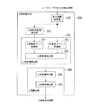
次に、本実施形態の対象物検出装置における対象物の検出方法について説明する。図2は、本実施形態の対象物検出装置における対象物検出部200の概略構成を示したブロック図である。図2において、対象物検出部200は、検出情報取得部210、人物候補断面抽出部220、人物候補検出部230、人物検出部240、から構成される。また、人物候補検出部230は、人物候補マップ登録部231、地面高さマップ登録部232、人物候補抽出部233、から構成される。また、人物検出部240は、人物候補統合部241、人物移動検出部242、から構成される。
Next, a method for detecting an object in the object detection apparatus of this embodiment will be described. FIG. 2 is a block diagram showing a schematic configuration of the
また、図2に示した対象物検出部200の各構成要素の処理に関して、具体的な処理の一例を図3〜図14を参照して以下に説明する。
In addition, regarding the processing of each component of the
対象物検出部200は、レーザレーダ10から入力された検出情報に基づいて、人物などの対象物を検出する。そして、検出した人物の情報(以下、「人物検出情報」という)を、対象物検出部200が検出した人物検出の結果として、例えば、車両制御部20内に備えられた走行経路決定部などに出力する。
The
検出情報取得部210は、レーザレーダ10から入力された一周分(一回転分)の検出情報を取得する。また、検出情報取得部210は、取得した検出情報からレーザレーダ10の観測範囲における観測点の情報を抽出し、抽出した観測点情報を、人物候補断面抽出部220と人物候補検出部230とに出力する。
The detection
また、検出情報取得部210は、レーザレーダ10から入力された検出情報が、自律走行車両1の走行(移動)中に検出された検出情報である場合には、例えば、GPS30から入力された位置情報、IMU40から入力された姿勢情報、および車速パルス検出部50から入力された走行速度情報に基づいて、自律走行車両1の走行に伴う検出情報の補正を行う。そして、補正を行った観測点情報を、抽出した観測点情報として人物候補断面抽出部220と人物候補検出部230とに出力する。
In addition, when the detection information input from the
ここで、検出情報取得部210における観測点情報の抽出方法、および自律走行車両1の走行に伴う観測点情報の補正方法について説明する。図3は、本実施形態の対象物検出装置におけるレーザレーダ10の観測範囲を示した図である。
Here, a method for extracting observation point information in the detection
検出情報取得部210は、図3(a)に示したようなレーザレーダ10の観測範囲における検出情報を取得する。ここで、検出情報取得部210が取得する検出情報には、図3(b)に示したように、レーザレーダ10からレーザビームが照射され、そのレーザビームが対象物によって反射された場所(観測点)ごとの、距離情報Lと、照射方向θhと、ビーム角度θv(図示せず)の情報が含まれている。検出情報取得部210は、レーザレーダ10から取得した検出情報に基づいて、観測点ごとの三次元の座標(X,Y,Z)を算出し、距離情報Lと、照射方向θhと、ビーム角度θvと、算出した三次元座標とを対応付けて、観測点情報として人物候補断面抽出部220と人物候補検出部230とに出力する。
The detection
なお、三次元の座標(X,Y,Z)を算出する際のX軸方向、Y軸方向およびZ軸方向は、外界に固定された緯度、経度に基づいて定められたX軸方向、Y軸方向およびZ軸方向である。図3(b)においては、自律走行車両1の進行方向をX軸とした場合の例を示している。この図3(b)における各観測点の三次元の座標(X,Y,Z)には、距離情報Lと照射方向θhとに基づいて算出された観測点の位置の値が、X軸の値およびY軸の値として記録される。また、ビーム角度θvと距離情報Lとに基づいて算出された観測点の高さの値が、Z軸の値として記録される。
The X-axis direction, the Y-axis direction, and the Z-axis direction when calculating the three-dimensional coordinates (X, Y, Z) are the X-axis direction determined based on the latitude and longitude fixed to the outside world, and Y An axial direction and a Z-axis direction. FIG. 3B shows an example in which the traveling direction of the
このように、例えば、自律走行車両1が停止している場合、または自律走行車両1の走行速度に対してレーザレーダ10の検出速度が十分速い場合には、図3(a)に示したような、レーザレーダ10による観測開始位置と観測終了位置とが同じ位置である観測範囲の観測点情報を抽出することができる。
Thus, for example, when the
また、例えば、自律走行車両1が走行(移動)中であり、かつ、レーザレーダ10の検出速度に対して自律走行車両1の走行速度が速い場合には、図3(c)に示しように、レーザレーダ10による観測開始位置と観測終了位置とが異なる位置となる。このような場合、検出情報取得部210は、例えば、GPS30から入力された位置情報、IMU40から入力された姿勢情報、GPS30や車速パルス検出部50から入力された走行速度情報、およびレーザレーダ10が一周するのに要した時間などに基づいて、自律走行車両1の移動量を算出する。図3(c)においては、自律走行車両1の走行(移動)によって、レーザレーダ10による観測開始位置と観測終了位置とが、距離dだけ異なっている場合の一例を示している。そして、検出情報取得部210は、算出した自律走行車両1の移動量に基づいて、例えば、レーザレーダ10から入力された検出情報にオフセット値を加えるなど、レーザレーダ10の観測範囲を補正する。そして、補正した観測範囲に基づいて、レーザレーダ10から取得した検出情報から観測点ごとの三次元の座標を抽出する。
Further, for example, when the
人物候補断面抽出部220は、検出情報取得部210から入力された観測点情報に基づいて、人物の候補の断面を表す観測点情報(以下、「人物候補断面情報」という)を抽出する。そして、抽出した人物候補の人物候補断面情報を、人物候補検出部230に出力する。
Based on the observation point information input from the detection
ここで、人物候補断面抽出部220における人物候補断面情報の抽出方法について説明する。図4は、本実施形態の対象物検出部200における人物候補の断面の抽出方法を説明する図である。
Here, a method for extracting person candidate section information in the person candidate
図4(a)は、異なるビーム角度θvi(i=1,2,3,4,・・・,n)を持った複数のレーザビーム1〜レーザビームnによって、人物を検出した場合を示している。以下の説明において、レーザビームのいずれか1つを表す場合には、単純に「レーザビーム」という。同様に、いずれか1つのビーム角度を表す場合には、単純に「ビーム角度θv」という。
FIG. 4A shows a case where a person is detected by a plurality of
人物候補断面抽出部220は、図4(a)に示したような、各ビーム角度θvのレーザビームごとに、複数の観測点の観測点情報を取得する。以下の説明においては、同一のビーム角度θvを「断面」ともいう。また、同一のビーム角度θvにおける観測点情報を、「断面情報」ともいう。また、図4(a)においては、点線で結んだ観測点の観測点情報を、断面情報としている。この断面情報は、各ビーム角度θvのレーザビームにそれぞれ対応している。人物候補断面抽出部220は、断面ごとに人物候補断面情報を抽出することによって、レーザレーダ10が照射したレーザビームの数に相当する数の人物候補断面情報を抽出する。
The human candidate
また、図4(a)に示すように、人物候補断面抽出部220が人物候補断面情報を抽出する際には、同一の断面において、同様の距離情報Lの値をもった観測点が連続して観測されることが予想されるが、レーザレーダ10がレーザビームの反射波の観測を失敗することも考えられる。このため、人物候補断面抽出部220は、レーザレーダ10と人物との距離によって予想される観測点の数を算出し、この算出した観測点の数に対して、予め定められた割合以上の数の観測点を取得したときに、取得した観測点群を以降の処理で使用する。なお、この人物候補として抽出する観測点の数の割合は、レーザレーダ10と人物との距離に応じて異なる割合としてもよい。
Further, as shown in FIG. 4A, when the human candidate cross
ここで、より具体的に人物候補の抽出方法の一例を説明する。図4(b)および図4(c)は、ある断面(一つのビーム角度θv)における人物候補の抽出方法を示している。人物候補を抽出する際、人物候補断面抽出部220は、まず、同一のビーム角度θvのレーザビームの反射波から得られた断面の観測点情報(断面情報)を、図4(b)に示すように、照射方向θhと距離情報Lとの座標平面にプロットする。そして、隣の観測点からの距離情報Lの変化量(距離情報変化量ΔL)の絶対値が、予め定められた値よりも大きい観測点(観測距離変化点)を抽出する。なお、図4(b)は、距離情報変化量ΔLが大きい観測点において、距離情報Lが小さい、すなわち、レーザレーダ10との距離が近い、手前の観測点を観測距離変化点とした場合を示している。
Here, an example of a person candidate extraction method will be described more specifically. FIG. 4B and FIG. 4C show a method for extracting human candidates in a certain cross section (one beam angle θv). When extracting a human candidate, the human candidate cross
続いて、人物候補断面抽出部220は、観測距離変化点として抽出した2つの観測点間の幅(観測点幅)が、レーザレーダ10と人物との距離に応じた、予め定められた閾値の範囲内に含まれているか否かを判定する。人物候補断面抽出部220は、この判定によって、観測点幅が閾値の範囲内に含まれていると判定された場合に、レーザレーダ10が人物を検出したと判断し、この2つの観測距離変化点と、これら2つの観測距離変化点の間に含まれる観測点とを人物候補とする。そして、この人物候補の観測点の観測点情報(三次元座標を含む)を、今回処理した断面の人物候補断面情報として人物候補検出部230に出力する。また、観測点幅が閾値の範囲内に含まれていないと判定された場合は、レーザレーダ10は人物を検出していないと判断し、人物候補断面情報を出力しない。同様に、他の断面の人物候補も抽出する。
Subsequently, the person candidate
なお、観測点幅が人物であるか否かを判定するために用いられるレーザレーダ10と人物との距離に応じて予め定められた閾値は、レーザレーダ10が人物を検出したときの距離ごとに、人物の幅に含まれる観測点の数を想定し、この想定された観測点の数に基づいて設定される。すなわち、レーザレーダ10から照射されるレーザビームは、その間隔が離散的であるため、量子化誤差(切捨て)の影響を考慮して、レーザレーダ10と人物との距離が近い場合には、閾値の下限値を小さくすることによって、より確実に検出するように設定される。例えば、人物の幅が50[cm]である場合を想定する。そして、レーザレーダ10と人物との距離が近く、レーザレーダ10が5[cm]間隔で観測することができる場合を考える。このとき、レーザレーダ10が上記人物を観測したときの観測点の数は、10点〜11点となる。この観測点の数を、幅に換算すると、45[cm]〜50[cm]となる。一方、レーザレーダ10と人物との距離が遠く、レーザレーダ10が25[cm]間隔で観測することができる場合を考える。このとき、レーザレーダ10が上記人物を観測したときの観測点の数は、2点〜3点となり、この観測点の数を、幅に換算すると、25[cm]〜50[cm]となる。このような考え方に基づいて、レーザレーダ10と人物との距離が近い場合の閾値は、例えば、40[cm]〜60[cm]に設定し、レーザレーダ10と人物との距離が遠い場合の閾値は、例えば、20cm]〜60[cm]に設定する。
Note that a predetermined threshold value according to the distance between the
人物候補検出部230は、検出情報取得部210から入力された観測点情報と、人物候補断面抽出部220から入力された人物候補断面情報とに基づいて、人物の候補を検出する。そして、検出した人物候補の検出情報(以下、「人物候補検出情報」)を、人物検出部240に出力する。
The person
人物候補マップ登録部231は、人物候補断面抽出部220から入力された人物候補断面情報に基づいて、外界に固定された緯度、経度に基づいて予め定められた人物候補グリッドマップに、人物候補断面情報をマッピングする。そして、人物候補断面情報をマッピングした人物候補グリッドマップを人物候補抽出部233に出力する。
The person candidate
ここで、人物候補マップ登録部231における人物候補断面情報のマッピング方法について説明する。図5は、本実施形態の対象物検出部200における人物候補グリッドマップのマッピング方法を説明する図である。
Here, the mapping method of the person candidate cross-section information in the person candidate
人物候補マップ登録部231は、人物候補断面抽出部220から入力された人物候補断面情報を人物候補グリッドマップにマッピングする。なお、人物候補グリッドマップは、断面ごとの人物候補断面情報をマッピングする人物候補断面グリッドマップと、全ての断面における人物候補断面情報の高さの最大値をマッピングする最大値グリッドマップと、全ての断面における人物候補断面情報の高さの最小値をマッピングする最小値グリッドマップとによって構成される。また、この人物候補グリッドマップのそれぞれは、人物候補グリッドマップのグリッドの大きさの半分をずらしたもう一つの人物候補グリッドマップと対となっている。
The person candidate
例えば、基準となる人物候補断面グリッドマップが、外界に固定された緯度、経度に基づいて定められた、X軸方向およびY軸方向にそれぞれ50[cm]の距離で設定された複数の正方形のグリッドによって構成されている場合、対となっている人物候補断面グリッドマップは、基準となる人物候補断面グリッドマップの基準点に対して、X軸方向およびY軸方向にそれぞれ25[cm]の距離だけずれた位置を基準点として、X軸方向およびY軸方向にそれぞれ50[cm]の距離で設定された複数の正方形のグリッドによって構成される。以下の説明において、例えば、基準となる人物候補断面グリッドマップと、対となる人物候補断面グリッドマップとを区別しないで表す場合には、単純に「人物候補断面グリッドマップ」という。また、基準となる人物候補断面グリッドマップと、対となる人物候補断面グリッドマップとを区別して表す場合には、基準となる人物候補断面グリッドマップを「人物候補断面グリッドマップ(表)」と表し、対となる人物候補断面グリッドマップを「人物候補断面グリッドマップ(裏)」と表す。 For example, a reference person candidate cross-section grid map is defined based on latitude and longitude fixed to the outside world, and a plurality of squares set at distances of 50 [cm] in the X-axis direction and the Y-axis direction, respectively. In the case of being configured by a grid, the pair of person candidate cross-section grid maps is a distance of 25 [cm] in the X-axis direction and the Y-axis direction with respect to the reference point of the reference person candidate cross-section grid map. With a position shifted by a certain amount as a reference point, it is constituted by a plurality of square grids set at a distance of 50 [cm] in the X-axis direction and Y-axis direction, respectively. In the following description, for example, when a reference person candidate cross-section grid map and a pair of person candidate cross-section grid maps are expressed without being distinguished, they are simply referred to as “person candidate cross-section grid maps”. In addition, when the reference person candidate cross-section grid map and the pair of person candidate cross-section grid maps are distinguished from each other, the reference person candidate cross-section grid map is represented as “person candidate cross-section grid map (table)”. The pair of person candidate cross-section grid maps is represented as “person candidate cross-section grid map (back)”.
ここで、図5を参照して人物候補グリッドマップに人物候補断面情報をマッピングする、より具体的なマッピング方法の一例を説明する。図5(a)は、人物候補断面グリッドマップへの人物候補断面情報のマッピング方法を示し、図5(b)は、最大値グリッドマップおよび最小値グリッドマップへの人物候補断面情報のマッピング方法を示している。 Here, an example of a more specific mapping method for mapping the person candidate cross-section information to the person candidate grid map will be described with reference to FIG. FIG. 5A shows a method of mapping human candidate cross-section information to the human candidate cross-section grid map, and FIG. 5B shows a method of mapping human candidate cross-section information to the maximum value grid map and the minimum value grid map. Show.
人物候補断面グリッドマップへの人物候補断面情報のマッピングは、図5(a)に示したように、同一の断面の人物候補断面情報から人物候補の観測点情報を取り出し、2つの観測距離変化点と、これら2つの観測距離変化点の間に含まれる観測点とから、同一の断面の人物候補における代表点を選択する。この代表点は、例えば、人物候補の観測点群の重心に位置する観測点が選択される。そして、人物候補マップ登録部231は、代表点の位置に該当する人物候補断面グリッドマップ(表)内のグリッドに、得点(図5(a)においては「1」)を記録する。同様に、代表点の位置に該当する人物候補断面グリッドマップ(裏)内のグリッドに、得点(図5(a)においては「1」)を記録する。
As shown in FIG. 5A, the mapping of the human candidate cross-section information to the human candidate cross-section grid map is performed by extracting the observation point information of the human candidate from the human candidate cross-section information of the same cross section, and two observation distance changing points. From the observation points included between these two observation distance change points, the representative point in the human candidate having the same cross section is selected. As this representative point, for example, an observation point located at the center of gravity of the observation point group of the human candidate is selected. The person candidate
また、最大値グリッドマップおよび最小値グリッドマップへの人物候補断面情報のマッピングは、図5(b)に示したように、各断面における代表点の観測点情報から、Z軸方向の座標値、すなわち、観測点の高さの情報を取り出す。そして、代表点の位置に該当する最大値グリッドマップ(表)および最小値グリッドマップ(表)内のグリッドごとに、取り出した高さの値の最大値および最小値(図5(b)においては、最大値=「1.5」、最小値=「0.5」)を算出する。そして、算出した最大値および最小値を、代表点の位置に該当する最大値グリッドマップ(表)および最小値グリッドマップ(表)内のグリッドに記録する。同様に、代表点の位置に該当する最大値グリッドマップ(裏)および最小値グリッドマップ(裏)内のグリッドにも、算出した最大値および最小値を記録する。 Further, as shown in FIG. 5B, the mapping of the human candidate cross-section information to the maximum value grid map and the minimum value grid map is performed using coordinate values in the Z-axis direction from observation point information of representative points in each cross section, That is, information on the height of the observation point is extracted. Then, for each grid in the maximum value grid map (table) and minimum value grid map (table) corresponding to the position of the representative point, the maximum value and minimum value of the extracted height values (in FIG. 5B). , Maximum value = “1.5”, minimum value = “0.5”). Then, the calculated maximum value and minimum value are recorded in the maximum value grid map (table) and the grid in the minimum value grid map (table) corresponding to the position of the representative point. Similarly, the calculated maximum value and minimum value are recorded in the grids in the maximum value grid map (back) and the minimum value grid map (back) corresponding to the position of the representative point.
なお、図5(b)においては、同一のグリッドに最大値および最小値が記録される例を示したが、最大値グリッドマップおよび最小値グリッドマップに記録される高さの最大値および最小値は、代表点の位置に該当するグリッドごとに記録される。このため、例えば、同一の人物候補に対する人物候補断面情報であったとしても、代表点の位置が異なるグリッドに該当する場合には、最大値グリッドマップおよび最小値グリッドマップの複数のグリッドに、そのグリッドの位置における最大値および最小値が記録されることもある。また、例えば、最大値グリッドマップおよび最小値グリッドマップのグリッドに該当する代表点が1つのみである場合や、複数の観測点情報における高さの情報が同一の値である場合などには、同一の高さの値が最大値および最小値の値として最大値グリッドマップおよび最小値グリッドマップに記録されることもある。 FIG. 5B shows an example in which the maximum value and the minimum value are recorded in the same grid, but the maximum value and the minimum value of the height recorded in the maximum value grid map and the minimum value grid map. Is recorded for each grid corresponding to the position of the representative point. For this reason, for example, even if it is person candidate cross-section information for the same person candidate, if the position of the representative point corresponds to a different grid, the maximum value grid map and the minimum value grid map may The maximum and minimum values at the grid position may be recorded. Further, for example, when there is only one representative point corresponding to the grid of the maximum value grid map and the minimum value grid map, or when the height information in a plurality of observation point information is the same value, The same height value may be recorded as the maximum value and the minimum value in the maximum value grid map and the minimum value grid map.
地面高さマップ登録部232は、検出情報取得部210から入力された観測点情報に基づいて、外界に固定された緯度、経度に基づいて予め定められた地面高さグリッドマップに、レーザレーダ10が検出した地面や構造物の高さの情報(三次元の座標(X,Y,Z)におけるZ軸の値)を、地面の高さの情報(以下、「地面高さ情報」という)としてマッピングする。そして、地面高さ情報をマッピングした地面高さグリッドマップを人物候補抽出部233に出力する。なお、地面高さグリッドマップへの地面高さ情報のマッピングに際しては、前回までに入力された観測点情報に基づいてマッピングされた地面高さグリッドマップと、今回入力された観測点情報との位置合わせを行い、位置合わせ後の観測点情報によって、地面高さグリッドマップを更新する。この地面高さグリッドマップの更新は、一周分(一回転分)の観測点情報が入力されるごとに行われる。
Based on the observation point information input from the detection
なお、前回までの地面高さグリッドマップと、今回入力された観測点情報との位置合わせにおいては、前回までの観測点情報に対する今回の観測点情報における傾き方向のずれを、水平方向のずれ量と高さ方向のずれ量とに分けて、それぞれのずれ量に対して位置合わせを行う。これにより、GPS30から入力された位置情報、IMU40から入力された姿勢情報、および車速パルス検出部50から入力された走行速度情報に基づいて位置合わせを行うよりも、より精度良く観測点情報の位置合わせを行うことができる。
In the alignment of the ground height grid map up to the previous time and the observation point information input this time, the deviation in the inclination direction in the current observation point information with respect to the previous observation point information is the horizontal deviation amount. And the amount of deviation in the height direction, and alignment is performed for each deviation amount. As a result, the position of the observation point information can be obtained with higher accuracy than the positioning based on the position information input from the
ここで、地面高さマップ登録部232における地面高さグリッドマップの位置合わせ方法、および地面高さ情報のマッピング方法について説明する。地面高さマップ登録部232による地面高さグリッドマップの位置合わせは、以下の手順によって行われる。
(手順1):検出情報取得部210から入力された観測点情報から垂直構造物を抽出する。
(手順2):抽出した垂直構造物の情報に基づいて、垂直構造物の位置合わせを行う。
(手順3):位置合わせを行った垂直構造物の情報を、地面高さグリッドマップに対応する平面座標に登録する。
Here, a method for aligning the ground height grid map and a method for mapping ground height information in the ground height
(Procedure 1): A vertical structure is extracted from observation point information input from the detection
(Procedure 2): The vertical structure is aligned based on the extracted information on the vertical structure.
(Procedure 3): The information of the vertical structure that has been aligned is registered in the plane coordinates corresponding to the ground height grid map.
まず、手順1の垂直構造物の抽出方法について説明する。図6は、本実施形態の対象物検出部200における垂直構造物の抽出方法を説明する図である。図6に示すように、レーザレーダ10の観測範囲には、例えば、建物、樹木、電柱、標識など、様々な物が存在することが想定される。地面高さマップ登録部232は、これらの物の中から、建物の壁面などの垂直構造物の面領域の角(凸エッジ)部(以下、「垂直エッジ」という)を検出し、その垂直エッジの座標を抽出する。
First, a method for extracting a vertical structure in
地面高さマップ登録部232による垂直構造物の抽出は、まず、断面ごとの観測点情報から面領域の候補を抽出し、抽出した面領域候補が、予め定められた複数の断面の観測点情報に含まれている場合に、この面領域候補を面領域とする。そして、地面高さマップ登録部232は、面領域内の凸エッジ部が垂直に並んでいる場合に、この面領域を垂直構造物の面領域とし、その垂直構造物の面領域における凸エッジ部の座標を垂直エッジとして抽出する。
Extraction of a vertical structure by the ground height
より具体的には、地面高さマップ登録部232は、まず、図4(b)に示した方法と同様に、断面ごとに観測点情報から観測距離変化点を抽出する。そして、一方の観測距離変化点から他方の観測距離変化点までの間に含まれる観測点が直線的に変化し、2つの観測距離変化点間の距離が予め定められた距離以上であるものを面領域候補(図6においては「面領域候補A」)とする。このとき、2つの観測距離変化点間の距離を、レーザレーダ10が人物を検出するときに想定される人物の幅よりも大きな値、例えば、3[m]とすることによって、人物と建物とを区別することができる。なお、2つの観測距離変化点間の距離を、レーザレーダ10が人物を検出するときに想定される人物の幅よりも小さな値、例えば、20[cm]とし、2つの観測距離変化点間の距離が予め定められた距離以下であるものを構造物候補(図6においては「構造物候補B」)とすることによって、人物と標識とを区別するようにすることもできる。
More specifically, the ground height
そして、地面高さマップ登録部232は、面領域候補中の凸エッジ部を判断して垂直エッジとして抽出する。例えば、面領域候補Aの一方の観測距離変化点から他方の観測距離変化点までの間の観測点情報に含まれる距離情報Lの値が、徐々に小さくなり、ある観測点を越えた後に大きくなる場合には、この面領域候補Aには凸エッジ部を含むものと判断する。逆に、観測点情報に含まれる距離情報Lの値が、徐々に大きくなり、ある観測点を越えた後に小さくなる場合には、この面領域候補Aには凹エッジ部を含むものと判断される。そして、距離情報Lが小さい値から大きい値に変化する頂点の位置である観測点や観測距離変化点などの凸エッジ部(垂直エッジ候補)の座標を各断面で比較し、この垂直エッジ候補の座標が予め定められた範囲内で複数の断面に存在する場合、この凸エッジ部の座標を垂直エッジ候補の座標とする。また、面領域候補Aの観測距離変化点や、構造物候補Bの観測距離変化点を凸エッジ部とし、この凸エッジ部の座標を垂直エッジ候補の座標とすることもできる。
Then, the ground height
なお、垂直エッジ候補の判断を行うときに比較される断面、すなわち、レーザビームのビーム角度θvを、予め定められた範囲内とすることもできる。これにより、垂直構造物を検出する可能性が低い、地面に近い範囲を観測しているレーザビームによる観測点情報(凸エッジ部の座標)を使用せず、垂直構造物を検出する可能性の高いビーム角度θvのレーザビームによる観測点情報(凸エッジ部の座標)のみを使用することが可能となる。 Note that the cross-section to be compared when determining the vertical edge candidate, that is, the beam angle θv of the laser beam may be within a predetermined range. As a result, the possibility of detecting a vertical structure without using observation point information (coordinates of convex edges) by a laser beam observing a range close to the ground, which is unlikely to detect a vertical structure, It is possible to use only observation point information (coordinates of the convex edge portion) by a laser beam having a high beam angle θv.
そして、地面高さマップ登録部232は、垂直エッジ候補の観測点と、その前後の観測点との観測点情報に基づいて、最終的な垂直エッジ(図6における「垂直エッジAe」)の座標を算出する。なお、面領域候補Aの観測距離変化点や、構造物候補Bの観測距離変化点の座標を最終的な垂直エッジ候補の座標(例えば、図6における「垂直エッジBe」)とすることもできる。また、各断面から抽出した2つの観測距離変化点と、その観測距離変化点の間に含まれる観測点との観測点情報に基づいて、2つの壁面を仮定し、その仮定した2つの壁面から凸エッジ部を含む壁面であるか、凹エッジ部を含む壁面であるかを特定し、かつ、2つの平面の交線を垂直エッジAeとすることもできる。
The ground height
なお、地面高さマップ登録部232は、ステップS400における垂直構造物の抽出の際に区別された、例えば、人物など、垂直構造物以外のエッジが存在する位置の情報も、地面高さグリッドマップに対応する平面座標などに、別途記憶しておく。
Note that the ground height
続いて、手順2の垂直構造物の位置合わせ方法について説明する。地面高さマップ登録部232は、以下の2つの方法によって、水平方向の位置合わせ、および高さ方向の位置合わせを行う。図7は、本実施形態の対象物検出部200におけるレーザレーダ10の位置および姿勢変化の推定方法を説明する図である。図7(a)は、自律走行車両1がA1の地点からA2の地点に移動した場合において、前回(A1地点)までに算出された垂直エッジの座標点と、今回(A2地点)算出した垂直エッジの座標点とを同じX−Y座標平面にプロットした図である。また、図7(b)は、自律走行車両1がA1の地点からA2の地点に移動した場合において、前回(A1地点)までの地面高さグリッドマップと、今回(A2地点)のレーザレーダ10の観測範囲における観測点群とを同時に示した図である。
Then, the alignment method of the vertical structure of the
地面高さマップ登録部232は、前回までの垂直エッジの座標点または地面高さグリッドマップと、今回の垂直エッジの座標点または観測点群の情報に基づいて、レーザレーダ10の位置および姿勢変化を推定することによって垂直構造物の位置合わせを行う。
The ground height
図7(a)に示したレーザレーダ10の位置および姿勢変化の推定方法は、レーザレーダ10の水平方向のずれ量を推定する方法である。レーザレーダ10の水平方向のずれ、すなわち、位置および姿勢の変化には、例えば、座標点同士のX軸方向の差(ΔX)、Y軸方向の差(ΔY)、およびレーザレーダ10を搭載した自律走行車両1のZ軸回りのヨー角の差(Δヨー角)がある。地面高さマップ登録部232は、このような位置および姿勢変化を、最小二乗法やICP(Iterative Closest Point)などによって推定し、A1地点の垂直エッジの座標点とA2地点の垂直エッジの座標点との位置合わせを行う。これにより、垂直エッジの座標点が最も近傍の座標点同士の距離、すなわち、座標点のずれが最小となるような位置および姿勢に、垂直構造物が位置合わせされる。
The method for estimating the position and orientation change of the
また、図7(b)に示したレーザレーダ10の位置および姿勢変化の推定方法は、レーザレーダ10の高さ方向のずれ量を推定する方法である。レーザレーダ10の高さ方向のずれ、すなわち、位置および姿勢の変化には、例えば、レーザレーダ10を搭載した自律走行車両1のX軸回りのロール角の差(Δロール角)、Y軸回りのピッチ角の差(Δピッチ角)、およびZ軸方向の差(ΔZ)がある。地面高さマップ登録部232は、このような位置および姿勢変化を、最小二乗法やICPなどによって推定し、A1地点で観測された観測点群における観測点の高さの値と、B1地点の観測点群が該当する観測点の高さの値との位置合わせを行う。これにより、前回までの地面高さグリッドマップと、今回の観測点群の高さの差が最小となるような位置および姿勢に、今回の観測点群の高さ情報の値が位置合わせされる。
Further, the position and orientation change estimation method of the
そして、地面高さマップ登録部232は、図7(a)に示した水平方向の位置合わせと、図7(b)に示した高さ方向の位置合わせとを交互に繰り返し、最終的なレーザレーダ10の位置および姿勢変化を推定する。これにより、前回までに地面高さグリッドマップにマッピングされている地面高さ情報と、今回地面高さグリッドマップにマッピングする地面高さ情報との整合性を確保することができる。
Then, the ground height
続いて、手順3の垂直構造物の情報の登録方法について説明する。図8は、本実施形態の対象物検出部200における垂直構造物の登録方法を説明する図である。図8(a)は、自律走行車両1が前回までの位置で登録した垂直構造物の座標点と、今回の位置で検出された垂直構造物の座標点とを同じX−Y座標平面にプロットした図である。また、図8(b)は、図8(a)の垂直構造物の座標点を統合した、現時点で最終的なX−Y座標平面を示した図である。
Subsequently, a method for registering information on a vertical structure in
地面高さマップ登録部232は、垂直構造物の抽出結果およびレーザレーダ10の位置および姿勢変化の推定結果に基づいて、前回までに検出された垂直構造物の情報に対して、今回の検出において新たな垂直構造物が検出された場合に、新たに検出された垂直構造物の情報を登録する。
Based on the vertical structure extraction result and the estimation result of the position and orientation change of the
なお、図8(a−1)に示したように、前回までに検出された垂直構造物の情報に、今回検出された新たな垂直構造物の情報を登録する際には、同じ垂直構造物の情報を重複して登録してしまうことを防ぐため、予め定められた範囲内の垂直構造物の情報は、検出誤差すなわち、同じ垂直構造物であると判断して、新たな垂直構造物、すなわち、今回検出された垂直構造物を登録はしない。これは、常に同じ情報に基づいて垂直構造物の情報を更新するという考えに基づいて、垂直構造物を検出したときの検出誤差が累積してしまうのを回避するための対応である。従って、前回までに垂直構造物を検出したときの検出誤差と、今回垂直構造物を検出したときの検出誤差とが同様である場合には、前回までに登録された垂直構造物の情報に代えて、今回検出された垂直構造物の情報を登録してもよい。また、部分的に予め定められた係数を適用して、前回までに登録された垂直構造物の情報に代えて、今回検出された垂直構造物の情報を登録してもよい。 As shown in FIG. 8 (a-1), when the information on the new vertical structure detected this time is registered in the information on the vertical structure detected up to the previous time, the same vertical structure is registered. In order to prevent redundant registration of information, the vertical structure information within a predetermined range is detected error, i.e., the same vertical structure is judged as a new vertical structure, That is, the vertical structure detected this time is not registered. This is a measure for avoiding accumulation of detection errors when a vertical structure is detected based on the idea of constantly updating information on the vertical structure based on the same information. Therefore, if the detection error when the vertical structure is detected up to the previous time and the detection error when the vertical structure is detected this time are the same, it is replaced with the information of the vertical structure registered up to the previous time. Thus, information on the vertical structure detected this time may be registered. In addition, by applying a predetermined coefficient partially, information on the vertical structure detected this time may be registered instead of the information on the vertical structure registered up to the previous time.
次に、地面高さマップ登録部232によって行われる地面高さ情報のマッピング方法について説明する。図9は、本実施形態の対象物検出部200における地面高さグリッドマップのマッピング方法を説明する図である。
Next, the ground height information mapping method performed by the ground height
地面高さマップ登録部232は、すでにマッピングされている地面高さグリッドマップに、地面高さ情報をマッピングする。なお、最初の地面高さグリッドマップには、地面高さ情報の初期値がマッピングされており、地面高さマップ登録部232によって、地面高さ情報がマッピングされることによって、最初の地面高さグリッドマップ内の地面高さ情報が更新される。また、地面高さグリッドマップには、グリッドごとに、地面高さ情報が更新されたか否かを表す情報を含んでいる。
The ground height
なお、地面高さグリッドマップは、人物候補グリッドマップと同様に、地面高さグリッドマップのグリッドの大きさの半分をずらしたもう一つの地面高さグリッドマップと対となっている。以下の説明において、基準となる地面高さグリッドマップと、対となる地面高さグリッドマップとを区別しないで表す場合には、単純に「地面高さグリッドマップ」という。また、基準となる地面高さグリッドマップと、対となる地面高さグリッドマップとを区別して表す場合には、基準となる地面高さグリッドマップを「地面高さグリッドマップ(表)」と表し、対となる地面高さグリッドマップを「地面高さグリッドマップ(裏)」と表す。 Note that the ground height grid map is paired with another ground height grid map in which half the size of the grid of the ground height grid map is shifted in the same manner as the person candidate grid map. In the following description, when the reference ground height grid map and the paired ground height grid map are expressed without being distinguished, they are simply referred to as “ground height grid map”. When the ground height grid map used as a reference and the ground height grid map used as a pair are distinguished from each other, the ground height grid map used as a reference is represented as “ground height grid map (table)”. A pair of ground height grid maps is represented as “ground height grid map (back)”.
ここで、図9を参照して地面高さグリッドマップに地面高さ情報をマッピングする、より具体的な方法の一例を説明する。地面高さグリッドマップへの地面高さ情報のマッピングは、図9に示したように、前回までにすでにマッピングされている地面高さグリッドマップ(t−1)に、検出情報取得部210がレーザレーダ10から取得した一周分(一回転分)観測点情報内に含まれる地面高さ情報(t)をマッピングし、現時点での最終的な地面高さグリッドマップ(t)とする。なお、地面高さグリッドマップへの地面高さ情報のマッピングは、地面高さグリッドマップ(表)内の該当するグリッドに、地面高さ情報を記録する。また、同様に、地面高さグリッドマップ(裏)内の該当するグリッドにも、地面高さ情報を記録する。
Here, an example of a more specific method for mapping the ground height information to the ground height grid map will be described with reference to FIG. As shown in FIG. 9, the mapping of the ground height information to the ground height grid map is performed by the detection
また、地面高さグリッドマップに地面高さ情報をマッピングする際には、図9に示したように、例えば、垂直構造物の抽出の際に区別され、地面高さグリッドマップに対応する平面座標などに別途記憶された人物など、垂直構造物以外のエッジが存在する位置のグリッドには、地面高さ情報(t)の該当するグリッドの情報をマッピングせず、すでにマッピングされている地面高さ情報(t−1)の情報がそのままマッピングされる。なお、垂直構造物以外のエッジが存在する位置のグリッドに地面高さ情報(t−1)がマッピングされていない場合、すなわち、初期値である場合には、何も行わず、初期値の状態を継続する。 Further, when mapping the ground height information to the ground height grid map, as shown in FIG. 9, for example, a plane coordinate corresponding to the ground height grid map is distinguished when extracting a vertical structure. In the grid where the edge other than the vertical structure exists, such as a person stored separately in the above, the information of the grid corresponding to the ground height information (t) is not mapped, and the already mapped ground height Information of information (t-1) is mapped as it is. When the ground height information (t-1) is not mapped to the grid at the position where the edge other than the vertical structure exists, that is, when it is the initial value, nothing is performed and the initial value state Continue.
なお、地面高さグリッドマップ(t−1)の情報がそのままマッピングされるグリッドは、人物候補断面抽出部220によって抽出された人物候補断面情報や、人物候補マップ登録部231によってマッピングされた人物候補グリッドマップの情報を用いて認識する構成とすることもできる。
Note that the grid on which the information of the ground height grid map (t−1) is mapped as it is is the person candidate section information extracted by the person candidate
人物候補抽出部233は、人物候補マップ登録部231から入力された人物候補グリッドマップと、地面高さマップ登録部232から入力された地面高さグリッドマップとに基づいて、人物候補断面抽出部220が抽出した人物候補断面情報の中から人物の候補を抽出する。そして、抽出した人物候補の情報である人物候補検出情報を、人物検出部240に出力する。
The person
ここで、人物候補抽出部233における人物候補検出情報の抽出方法について説明する。人物候補抽出部233による人物候補検出情報の抽出は、以下の手順によって行われる。
(手順1):人物候補マップ登録部231によってマッピングされた人物候補グリッドマップに基づいて、人物候補の位置を抽出する。
(手順2):地面高さマップ登録部232によってマッピングされた地面高さグリッドマップにおいて、抽出した人物候補の位置に対応するグリッドに、高さの情報がマッピングされているか否かに応じて、人物候補の高さを検出する。なお、以下の説明においては、地面高さグリッドマップ内の抽出した人物候補の位置に対応するグリッドに、高さの情報がマッピングされているときを、「地面高さグリッドマップあり」とし、高さの情報がマッピングされていないときを、「地面高さグリッドマップなし」とする。
(手順3):人物候補の高さが、人物らしい高さであるかを判断する。
Here, a method for extracting person candidate detection information in the person
(Procedure 1): The position of the person candidate is extracted based on the person candidate grid map mapped by the person candidate
(Procedure 2): In the ground height grid map mapped by the ground height
(Procedure 3): It is determined whether the height of the person candidate is a person-like height.
まず、手順1の人物候補の位置情報の抽出方法について説明する。人物候補抽出部233は、地面高さマップ登録部232によってマッピングされた地面高さグリッドマップに基づいて人物の候補を検出する前に、人物候補マップ登録部231によってマッピングされた人物候補グリッドマップに基づいて、人物候補の位置を抽出する。図10は、本実施形態の対象物検出部200における人物候補の位置の抽出方法を説明する図である。
First, a method for extracting position information of a person candidate in
人物候補抽出部233は、まず、図10(a)に示すように、各断面の人物候補断面グリッドマップを統合する。図10(a)では、5つの断面(ビーム1〜ビーム5)の人物候補断面グリッドマップを統合した例を示している。人物候補断面グリッドマップの統合は、各人物候補断面グリッドマップにおける同一のグリッドに記録された得点を全て合計する。これにより、図10(b)に示すような、得点がマッピングされた統合人物候補断面グリッドマップを得ることができる。
First, the person
続いて、人物候補抽出部233は、統合人物候補断面グリッドマップ内のグリッドにおいて、得点が最も高いグリッドを抽出する。この得点が最も高いグリッドが、人物候補の位置となる。図10(b)では、得点=「5」のグリッドが、人物候補位置となる。そして、人物候補抽出部233は、人物候補位置のグリッドに該当する地面高さグリッドマップ、最大値グリッドマップ、および最小値グリッドマップ内のグリッドにマッピングされた情報に基づいて、人物候補を検出する。
Subsequently, the person
続いて、手順2の人物候補の高さ情報の検出方法について説明する。まず、地面高さグリッドマップの有無の差について説明する。図11は、本実施形態の対象物検出部200における人物候補の検出方法において地面高さグリッドマップの有無による人物候補の検出方法を説明する図である。
Next, a method for detecting the height information of the person candidate in
図11(a)に示したように、レーザレーダ10が地面を検出する場合、レーザレーダ10が照射するレーザビームのビーム角度θvによって、地面が観測されない範囲が存在する。このことによって、ビーム1〜ビーム2までの範囲のビーム角度θvで照射されたレーザビームの観測点情報は、地面高さグリッドマップにマッピングすることができるが、ビーム2〜ビーム3までの範囲のビーム角度θvで照射されたレーザビームの観測点情報は、地面高さグリッドマップにマッピングすることができないこととなる。すなわち、図11(a)におけるビーム1〜ビーム2までの範囲のビーム角度θvで照射されたレーザビームでは、観測点間の距離が各グリッドの一辺の長さよりも小さいため、各グリッドに対して地面の高さを検出することができるが、ビーム2〜ビーム3までの範囲のビーム角度θvで照射されたレーザビームでは、観測点間の距離が各グリッドの一辺の長さよりも大きいため、地面の高さを検出することができないグリッドが存在してしまう。
As shown in FIG. 11A, when the
地面高さマップ登録部232は、レーザレーダ10が地面の高さを検出することができるビーム1〜ビーム2までの範囲の地面高さグリッドマップを生成する。この地面高さグリッドマップには、最初に地面高さ情報の初期値がマッピングされている。その後、上述した処理によって地面高さ情報が更新される。また、自律走行車両1が移動すると、自律走行車両1の移動に伴って、レーザレーダ10が地面の高さを検出することができる範囲が移動する。このとき、新しく地面の高さを検出することができるようになった範囲には、最初に地面高さ情報の初期値がマッピングされるが、上述した処理によって地面高さ情報が更新される。なお、最初の地面高さグリッドマップをレーザレーダ10が地面の高さを検出することができるビーム1〜ビーム2までの範囲よりも広い範囲として生成し、この地面高さグリッドマップのグリッドごとに、初期値がマッピングされているか、更新された地面高さ情報がマッピングされているかを表す情報を含む構成とすることもできる。
The ground height
上述のように、レーザレーダ10が地面の高さを検出することができるビーム1〜ビーム2までの範囲内に地面高さグリッドマップがある状態であるが、ビーム2〜ビーム3までの範囲、すなわち、地面高さグリッドマップがない状態であっても、ビーム2〜ビーム3までの範囲のビーム角度θvで照射されたレーザビームによって、人物候補が抽出される。このため、人物候補抽出部233による人物候補の検出方法は、地面高さグリッドマップの有無によって異なる。
As described above, there is a ground height grid map in the range from
地面高さグリッドマップがある場合、人物候補抽出部233は、図11(b)に示すように、地面高さグリッドマップと最大値グリッドマップとに基づいて、人物候補の高さを検出する。また、地面高さグリッドマップがない場合、人物候補抽出部233は、図11(c)に示すように、最小値グリッドマップを地面高さグリッドマップとして利用し、最小値グリッドマップと最大値グリッドマップとに基づいて、人物候補の高さを検出する。
When there is a ground height grid map, the person
そして、人物候補抽出部233は、検出した人物候補の高さが、予め定められた閾値の範囲内であれば、人物の候補として最終判断する。ここで、人物候補抽出部233による最終的な人物候補の判断方法について説明する。図12は、本実施形態の対象物検出部200における人物候補の判断方法を説明する図である。ここでは、地面高さグリッドマップがある場合を例として、最終的な人物候補を判断する場合を説明する。
Then, the person
人物候補抽出部233は、図12(a)に示すように、人物候補位置のグリッドに該当する最大値グリッドマップにマッピングされた高さ情報から、人物候補位置のグリッドに該当する地面高さグリッドマップにマッピングされた地面高さ情報を減算することによって、人物候補の高さを算出する。
As shown in FIG. 12A, the person
この算出した人物候補の高さの値は、上述した観測点幅における観測点の数と同様に考えることができ、例えば、同じ人物であっても、この人物とレーザレーダ10との距離によって人物候補の高さの値が異なる。従って、人物候補抽出部233は、レーザレーダ10が人物を検出したときの距離ごとに、人物候補の高さに含まれる断面の数を想定し、この想定された断面の数に基づいて、図12(b)に示したような閾値を設定する。なお、図12(b)に示した閾値の例のグラフでは、レーザレーダ10が人物を検出したときの距離に基づいた、人物の胴体の長さの下限値と上限値とを示している。
The calculated height value of the candidate person can be considered in the same way as the number of observation points in the observation point width described above. For example, even for the same person, the person can be determined by the distance between the person and the
人物候補抽出部233は、設定された閾値に基づいて、人物候補位置のグリッドにマッピングされている人物候補を最終的に人物候補として検出するか否かを決定する。より具体的には、人物候補の高さ情報の値が、図12(b)に示したような、レーザレーダ10が人物を検出したときの距離に基づいた閾値の下限値と上限値との間である場合に、人物候補を最終的な人物候補として検出する。また、上記閾値の下限値と上限値との間でない場合には、人物候補を最終的な人物候補として検出しない。
Based on the set threshold value, the person
また、人物候補の高さの範囲内に含まれる連続した断面の数(観測点の充填数)も、人物とレーザレーダ10との距離によって異なる。人物候補抽出部233は、人物とレーザレーダ10との距離に応じて異なる連続した断面の数を、レーザレーダ10が人物を検出したときの距離ごとに想定し、この想定された断面の数に基づいて、図12(c)に示したような閾値を設定することもできる。なお、図12(c)に示した閾値の例のグラフでは、レーザレーダ10が人物を検出したときの距離に基づいた、人物の胴体の長さにおける連続した断面の数の下限値を示している。
In addition, the number of consecutive cross sections (the number of observation points filled) included in the range of the height of the person candidate also varies depending on the distance between the person and the
このようなときでも、人物候補抽出部233は、設定された閾値に基づいて、人物候補位置のグリッドにマッピングされている人物候補を最終的に人物候補として検出するか否かを決定する。より具体的には、人物候補の連続した断面の数が、図12(c)に示したような、レーザレーダ10が人物を検出したときの距離に基づいた閾値の下限値よりも多い断面の数である場合に、人物候補を最終的な人物候補として検出する。また、上記閾値の下限値以下である場合には、人物候補を最終的な人物候補として検出しない。
Even in such a case, the person
また、地面高さグリッドマップがない場合の最終的な人物候補の判断も、上述した地面高さグリッドマップがある場合と同様の考え方で最終的な人物候補を判断する。但し、図12(a)の地面高さグリッドマップに代わって、最小値グリッドマップが用いられるため、人物候補抽出部233が最終的に人物候補として検出するか否かを決定するための図12(b)および図12(c)に示したような閾値は、地面高さグリッドマップがある場合に比べて、小さな値であることが望ましい。
In addition, the final person candidate is determined in the same way as in the case of the above-described ground height grid map when the ground height grid map is not present. However, since the minimum value grid map is used instead of the ground height grid map of FIG. 12A, the person
なお、最終的に人物候補として検出されたグリッドが、予め定められた回数以上連続している場合には、最終的に人物候補としての検出した検出結果を破棄、または最終的に人物候補として検出しないようにすることもできる。このようにすることで、移動している人物を検出することが可能となる。 In addition, when the grid finally detected as a human candidate continues for a predetermined number of times or more, the detection result finally detected as a human candidate is discarded or finally detected as a human candidate. You can also avoid it. In this way, it is possible to detect a moving person.
人物検出部240は、人物候補検出部230から入力された人物候補検出情報に基づいて、人物を検出する。そして、検出した人物検出情報を、対象物検出部200が検出した人物検出の結果として、車両制御部20内の他の処理部に出力する。
The
人物候補統合部241は、人物候補抽出部233から入力された人物候補検出情報を統合して人物を検出し、検出した人物の位置情報(以下、「人物検出位置情報」という)を検出する。そして、検出した人物検出位置情報を、人物移動検出部242に出力する。
The person candidate integration unit 241 detects the person by integrating the person candidate detection information input from the person
ここで、人物候補統合部241における人物検出位置情報の検出方法について説明する。図13は、本実施形態の対象物検出部200における人物の検出方法を説明する図である。
Here, a method of detecting the person detection position information in the person candidate integration unit 241 will be described. FIG. 13 is a diagram illustrating a person detection method in the
人物候補統合部241は、抽出された人物候補の情報を統合して、人物検出位置情報を抽出する。ここで、人物候補検出部230から入力される人物候補検出情報には、図13(a)に示すように、例えば、人物が歩行などをしていることによる人物の手が広がりや足の広がりなどによって、ある程度広い範囲に観測点が分布している。これにより、図13(b)に示すように、各断面の代表点は、人物の手足を検出した観測点の影響などにより、人物候補断面グリッドマップ内の複数のグリッドにまたがり、必ずしも人物の中心線上に位置するとは限らない。人物候補統合部241は、このような状態にある人物候補検出情報から、図13(c)に示すような人物の位置情報を検出する。
The person candidate integration unit 241 integrates the extracted person candidate information and extracts person detection position information. Here, in the human candidate detection information input from the human
より具体的には、図10に示した方法と同様に、各断面の人物候補断面グリッドマップを統合して、統合人物候補断面グリッドマップを得る。そして、人物候補統合部241は、統合人物候補断面グリッドマップ内のグリッドにおいて、得点が最も高いグリッドを人物の検出位置とする。 More specifically, similarly to the method shown in FIG. 10, the person candidate cross-section grid maps of the respective cross sections are integrated to obtain an integrated person candidate cross-section grid map. Then, the person candidate integration unit 241 sets the grid with the highest score as the person detection position in the grid in the integrated person candidate cross-section grid map.
そして、人物候補統合部241は、人物の位置を検出した統合人物候補断面グリッドマップと、対となっている統合人物候補断面グリッドマップとに基づいて、最終的な人物の位置を検出する。図13(d)は、統合人物候補断面グリッドマップ(表)によって検出した人物の位置情報を、統合人物候補断面グリッドマップ(裏)を用いて判断し、最終的な人物検出結果を得る場合の一例を示した図である。 Then, the person candidate integration unit 241 detects the final position of the person based on the integrated person candidate cross-section grid map in which the position of the person is detected and the paired integrated person candidate cross-section grid map. FIG. 13D shows a case where the position information of the person detected by the integrated person candidate cross-section grid map (table) is determined using the integrated person candidate cross-section grid map (back), and the final person detection result is obtained. It is the figure which showed an example.
図13(d)に示すように、例えば、統合人物候補断面グリッドマップ(表)内の得点に基づいて人物の位置を抽出したグリッドB1と、その周囲の8個のグリッド、および統合人物候補断面グリッドマップ(表)の人物の位置を抽出したグリッドB1を含む統合人物候補断面グリッドマップ(裏)の4個のグリッドとに基づいて、各グリッドの得点の広がり具合を判断する。より具体的には、統合人物候補断面グリッドマップ(表)の各グリッドの得点と、統合人物候補断面グリッドマップ(裏)の各グリッドの得点とを、グリッドごとに統合する。そして、統合したグリッドB1の得点に応じて、最終的な人物の位置として判断するための最低の得点を閾値として設定する。そして、設定した閾値の得点以上のグリッドが、統合人物候補断面グリッドマップ(裏)の4個のグリッドのみであれば、グリッドB1の位置を、最終的な1人の人物の位置として検出する。 As shown in FIG. 13D, for example, a grid B1 in which the position of a person is extracted based on the score in the integrated person candidate section grid map (table), eight surrounding grids, and an integrated person candidate section Based on the four grids of the integrated person candidate cross-section grid map (back) including the grid B1 from which the positions of the persons in the grid map (front) are extracted, the extent of the score of each grid is determined. More specifically, the score of each grid of the integrated person candidate cross-section grid map (table) and the score of each grid of the integrated person candidate cross-section grid map (back) are integrated for each grid. Then, according to the score of the integrated grid B1, the lowest score for determining the final position of the person is set as a threshold value. Then, if there are only four grids on the integrated person candidate cross-section grid map (back), the grid B1 position is detected as the final position of one person.
なお、図13(d)においては、グリッドB1が、統合人物候補断面グリッドマップ(裏)のグリッドB2に含まれるとした場合について説明したが、図13(d)の判断において最終的な1人の人物の位置として検出されなかった場合には、グリッドB1が含まれる統合人物候補断面グリッドマップ(裏)の4個のグリッドを、例えば、グリッドB1が、統合人物候補断面グリッドマップ(裏)のグリッドB3に含まれるとした4個のグリッドに順次変更して、最終的な1人の人物の位置として検出するようにすることもできる。 In FIG. 13D, the case where the grid B1 is included in the grid B2 of the integrated person candidate cross-section grid map (back) has been described. However, in the determination of FIG. If the position is not detected as the position of the person, the four grids of the integrated person candidate cross-section grid map (back) including the grid B1 are displayed, for example, the grid B1 of the integrated person candidate cross-section grid map (back). It is also possible to sequentially change to the four grids included in the grid B3 and detect the final position of one person.
このように、統合人物候補断面グリッドマップ(表)および統合人物候補断面グリッドマップ(裏)内のグリッドの情報に基づいて最終的な1人の人物の位置を検出することにより、例えば、1人の人物が複数のグリッドにマッピングされている場合でも、最終的に1人の人物の人物検出位置情報を検出することができる。これにより、一定の範囲内に固まって検出された人物候補から、1人の人物を検出することができる。また逆に、検出された人物候補の広がり範囲に応じて、複数人の人物として検出することができる。 Thus, by detecting the final position of one person based on the grid information in the integrated person candidate cross-section grid map (table) and the integrated person candidate cross-section grid map (back), for example, one person Even if the person is mapped to a plurality of grids, the person detection position information of one person can be finally detected. As a result, one person can be detected from the person candidates detected in a fixed range. Conversely, a plurality of persons can be detected in accordance with the spread range of the detected person candidates.
人物移動検出部242は、人物候補統合部241から入力された人物検出位置情報に基づいて、検出した人物の移動状態を検出する。そして、検出した人物の移動状態に基づいて、最終的な人物の情報(人物検出情報)を検出する。そして、検出した人物検出情報を、対象物検出部200が検出した人物検出の結果として出力する。
The person
ここで、人物移動検出部242における人物の移動状態の検出方法、および人物検出情報の検出方法について説明する。図14は、本実施形態の対象物検出部200における人物の移動状態に応じた人物の検出方法を説明する図である。
Here, a person movement detection method and a person detection information detection method in the person
人物移動検出部242は、人物検出位置情報に基づいた人物の位置の移動状態(履歴)に基づいて、人物の移動状態を検出し、対象物検出部200が最終的に人物を検出した人物検出情報とする。
The person
図14は、今回検出した人物検出位置情報と過去4回の人物検出位置情報とに基づいて、人物の移動を検出する場合を示している。図14(a)に示すように、人物が移動するとき(図14(a)におけるC1)には、検出位置(動き情報)が概ね一定の方向に連続しているが、例えば、壁面などを誤検出しているとき(図14(a)におけるC2)には検出位置(動き情報)が一定ではない(連続性がない)ことが考えられる。 FIG. 14 shows a case where the movement of a person is detected based on the person detection position information detected this time and the person detection position information of the past four times. As shown in FIG. 14 (a), when the person moves (C1 in FIG. 14 (a)), the detection position (motion information) continues in a substantially constant direction. When erroneous detection is performed (C2 in FIG. 14A), the detection position (motion information) may not be constant (no continuity).
人物移動検出部242は、上述のような考えに基づいて、人物検出位置情報の移動履歴から、人物の移動状態を検出して最終的な人物検出情報を判断する。例えば、図14(b)に示すように、最小二乗法などによって人物検出位置情報の移動履歴の近似直線を求め、各回の人物検出位置情報が予め定められた変動距離の範囲内で直線的に連続しているときには、検出した人物検出位置情報が人物の情報であると判断し、それ以外のときは、検出した人物検出位置情報が人物の情報ではないと判断する。
Based on the above-described idea, the person
また、図14(c)に示すように、人物検出位置情報の移動履歴の方位を求め、各回の人物検出位置情報の方位の変化幅が予め定められた範囲内(図14(c−1)参照)であり、かつ、その方位変化量が、予め定められた変動量の範囲内(図14(c−2)参照)あれば、検出した人物検出位置情報が人物の情報であると判断し、それ以外のときは、検出した人物検出位置情報が人物の情報ではないと判断する。 Further, as shown in FIG. 14C, the direction of the movement history of the person detection position information is obtained, and the change width of the direction of the person detection position information for each time is within a predetermined range (FIG. 14C-1). If the direction change amount is within a predetermined variation range (see FIG. 14C-2), it is determined that the detected person detection position information is person information. In other cases, it is determined that the detected person detection position information is not person information.
このように、人物検出情報の移動状態が略直線であるかによって人物を検出し、人物以外を誤検出してしまう可能性をさらに低減することができる。 In this way, it is possible to further reduce the possibility of detecting a person depending on whether the movement state of the person detection information is a substantially straight line and erroneously detecting other than the person.
なお、図14においては、今回検出した人物検出位置情報と過去4回の人物検出位置情報、すなわち、5つの人物検出位置情報に基づいて、人物の移動を検出する例について説明したが、例えば、5つの人物検出位置情報の内、1つの人物検出位置情報の取得に失敗してしまうことも考えられるため、予め定められた範囲の人物検出位置情報に基づいて、人物の移動を検出するようにすることもできる。 In FIG. 14, the example of detecting the movement of the person based on the person detection position information detected this time and the person detection position information of the last four times, that is, the five person detection position information has been described. Since it is considered that acquisition of one person detection position information among the five person detection position information may fail, the movement of the person is detected based on the person detection position information within a predetermined range. You can also
次に、本実施形態の対象物検出装置における対象物の検出処理について説明する。図15は、本実施形態の対象物検出装置の対象物検出部200における検出処理の流れを示した図である。
Next, the object detection process in the object detection apparatus of this embodiment will be described. FIG. 15 is a diagram illustrating a flow of detection processing in the
まず、検出情報取得部210は、レーザレーダ10から入力された一周分(一回転分)の検出情報を取得し、取得した検出情報からレーザレーダ10の観測範囲における観測点情報を抽出する(ステップS100)。続いて、人物候補断面抽出部220は、検出情報取得部210から入力された観測点情報に基づいて、人物候補断面情報を抽出する(ステップS200)。
First, the detection
続いて、人物候補マップ登録部231は、人物候補断面抽出部220から入力された人物候補断面情報に基づいて、予め定められた二次元の人物候補グリッドマップに、人物候補断面情報をマッピングする(ステップS300)。
Subsequently, the person candidate
また、地面高さマップ登録部232は、検出情報取得部210から入力された観測点情報に基づいて、垂直構造物を抽出する(ステップS400)。そして、地面高さマップ登録部232は、抽出した垂直構造物の情報に基づいて、自律走行車両1、すなわち、レーザレーダ10の位置および姿勢の変化を推定する(ステップS410)。そして、地面高さマップ登録部232は、レーザレーダ10の位置および姿勢変化の推定結果に基づいて、抽出された垂直構造物の情報を登録する(ステップS420)。そして、登録された垂直構造物の情報に基づいて、すでにマッピングされている二次元の地面高さグリッドマップに、地面高さ情報をマッピングする(ステップS430)。
The ground height
続いて、人物候補抽出部233は、人物候補マップ登録部231によってマッピングされた人物候補グリッドマップに基づいて、人物候補の位置を抽出し、この抽出された人物候補の位置の情報を、人物候補として抽出する。そして、人物候補抽出部233は、地面高さグリッドマップがある場合、地面高さグリッドマップと人物候補断面グリッドマップとに基づいて、人物の候補を検出する(ステップS500)。また、人物候補抽出部233は、地面高さグリッドマップがない場合、人物候補断面グリッドマップのみから、人物の候補を検出する(ステップS600)。
Subsequently, the person
続いて、人物候補統合部241は、抽出された人物の候補の情報に基づいて、人物候補の情報を統合し、人物検出位置情報を抽出する(ステップS700)。続いて、人物移動検出部242は、人物検出位置情報に基づいて、人物の移動状態を検出し、最終的な人物を特定し、人物検出情報とする(ステップS710)。
Subsequently, the person candidate integration unit 241 integrates the information of the person candidates based on the extracted person candidate information, and extracts the person detection position information (step S700). Subsequently, the person
上記に述べたとおり、本発明を実施するための形態によれば、レーザレーダ10が検出したビーム角度θv(断面)ごとの観測点情報に基づいて人物候補断面情報を抽出し、さらに観測点情報内の高さの情報に基づいて、人物候補を検出することができる。また、人物候補グリッドマップ内における人物候補の分布や、移動状態に基づいて、人物を検出することができる。これにより、精度よく人物を検出するとともに、人物以外の誤検出を低減することができる。
As described above, according to the embodiment for carrying out the present invention, the human candidate cross-section information is extracted based on the observation point information for each beam angle θv (cross-section) detected by the
また、レーザレーダ10が検出した観測点情報に基づいて、地面高さグリッドマップをマッピングすることができ、この地面高さグリッドマップに基づいて、人物の高さを検出することができる。これにより、より精度良く人物を検出することができる。
Further, the ground height grid map can be mapped based on the observation point information detected by the
また、検出した人物の移動状態に基づいて、今後の人物の移動方向などを予測することができ、この予測に基づいて自律走行車両1の走行を制御することができる。
Further, based on the detected movement state of the person, a future movement direction of the person can be predicted, and the traveling of the
また、本実施形態においては、人物を検出する場合について説明したが、検出目標とする対象物の特徴に応じて検出条件を決定できる対象物の検出であれば、人物以外の対象物であっても、その検出目標の対象物の検出に、本実施形態の対象物検出部200を適用することができる。その際、人物を検出するために用いた閾値や検出条件などを、検出目標の対象物の検出条件に変更することによって対応する。
Further, in the present embodiment, the case of detecting a person has been described. However, if the detection of an object whose detection condition can be determined according to the characteristics of the object to be detected is an object other than a person, In addition, the
以上、本発明の実施形態について、図面を参照して説明してきたが、具体的な構成はこの実施形態に限定されるものではなく、本発明の趣旨を逸脱しない範囲においての種々の変更も含まれる。 The embodiment of the present invention has been described above with reference to the drawings. However, the specific configuration is not limited to this embodiment, and includes various modifications within the scope of the present invention. It is.
1・・・自律走行車両
10・・・レーザレーダ
11・・・駆動部
20・・・車両制御部
200・・・対象物検出部
210・・・検出情報取得部
220・・・人物候補断面抽出部
230・・・人物候補検出部
231・・・人物候補マップ登録部
232・・・地面高さマップ登録部
233・・・人物候補抽出部
240・・・人物検出部
241・・・人物候補統合部
242・・・人物移動検出部
30・・・GPS
40・・・IMU
50・・・車速パルス検出部
60・・・ブレーキ/アクセルアクチュエータ
70・・・ステアリングアクチュエータ
DESCRIPTION OF
40 ... IMU
50 ... Vehicle
Claims (7)
人物の体長と想定される体長情報を予め記憶し、前記人物候補抽出手段が抽出した前記人物が位置するであろう観測点候補についての前記観測点情報に含まれる高さを示す情報と、前記人物の体長と想定される体長情報との比較結果に基づいて、当該観測点候補の中から人物の存在する観測点を検出する第二人物候補抽出手段と、
を備え、
前記第二人物候補抽出手段は、
前記第一人物候補抽出手段によって抽出された前記観測点候補と、当該観測点候補についての前記観測点情報に含まれる高さを示す情報とに基づいて、予め定められた距離で二次元の複数のグリッドに分割された人物候補グリッドマップの前記観測点候補に対応する位置に、当該観測点候補の前記観測点情報に含まれる高さを示す情報をマッピングし、
前記複数のレーザビームによって検出した前記観測点それぞれの高さを示す情報を、予め定められた距離で二次元の複数のグリッドに分割された地面高さグリッドマップの当該観測点に対応する位置にマッピングし、
前記第一人物候補抽出手段によって抽出された人物が位置するであろう観測点候補に対応する前記地面高さグリッドマップの位置に前記高さを示す情報がマッピングされているときは、当該高さを示す情報と、前記人物候補グリッドマップの対応する位置の観測点候補にマッピングされた高さを示す情報のうちの最大値との差に基づいて、その観測点候補に位置する対象物の長さを算出し、その算出した前記対象物の長さと、前記人物の体長と想定される体長情報とに基づいて、前記第一人物候補抽出手段によって抽出された前記人物が位置するであろう観測点候補の中から人物の存在する観測点を検出する、
ことを特徴とする対象物検出装置。 Observation point information of an observation point generated based on detection of the object by a laser radar that detects the object by rotating while irradiating a plurality of laser beams having different angles in the elevation angle direction, Information on the distance between the laser radar and the object, and information indicating the vertical height of each of the observation points in a coordinate system of a three-dimensional space detected by the plurality of laser beams. First , the distance information is extracted from the observation point information, and the observation point candidate where the person is likely to be located is extracted based on the amount of change in the distance information about the continuous observation points in the range indicating the width of the person . Person candidate extraction means;
Prestores body length information that is supposed to body length of the person, and information indicating the height included in the observation point information about the observation point candidates would the person the person candidate extracting means has extracted is located, the A second person candidate extracting means for detecting an observation point where the person exists from the observation point candidates based on a comparison result between the length of the person and the assumed length information;
With
The second person candidate extraction means includes
Based on the observation point candidates extracted by the first person candidate extraction means and information indicating the height included in the observation point information about the observation point candidates, a plurality of two-dimensional Mapping information indicating the height included in the observation point information of the observation point candidate to a position corresponding to the observation point candidate of the human candidate grid map divided into the grid of
A position corresponding to the observation point of the ground height grid map obtained by dividing the information indicating the height of each observation point detected by the plurality of laser beams into a plurality of two-dimensional grids at a predetermined distance. Mapping to
When the information indicating the height is mapped to the position of the ground height grid map corresponding to the observation point candidate where the person extracted by the first person candidate extracting means will be located, the height And the length of the object located at the observation point candidate based on the difference between the maximum value of the information indicating the height mapped to the observation point candidate at the corresponding position of the person candidate grid map. The observation that the person extracted by the first person candidate extraction means will be located based on the calculated length of the object and the length information of the person and the assumed length information Detect observation points where people exist from point candidates,
An object detection apparatus characterized by that.
前記レーザレーダが照射した前記レーザビームによって前記対象物の同一高さの前記観測点を検出したときの当該観測点の前記レーザレーダからの距離の情報に基づいて、人物の幅を示す範囲の連続する観測点についての各距離の情報の変化量を算出し、その変化量を異なる複数の前記レーザビームについて同様に行うことにより、人物が位置するであろう観測点候補を抽出する、
ことを特徴とする請求項1に記載の対象物検出装置。 The first person candidate extraction means includes
Based on the information of the distance from the laser radar of the observation point when detecting the observation point of the same height of the object by the laser beam said laser radar irradiates a continuous range indicating the width of a person Calculating the amount of change in the information of each distance for the observation point to be performed, and extracting the observation point candidate where the person will be located by performing the change amount in a similar manner for the plurality of different laser beams ,
The object detection apparatus according to claim 1.
前記地面高さグリッドマップのグリッドの位置を予め定められた距離だけずらした第2の地面高さグリッドマップと、
を備える、
ことを特徴とする請求項1または請求項2に記載の対象物検出装置。 A second person candidate grid map in which the position of the grid of the person candidate grid map is shifted by a predetermined distance;
A second ground height grid map in which the position of the grid of the ground height grid map is shifted by a predetermined distance;
Comprising
The object detection apparatus according to claim 1, wherein the object detection apparatus is an object detection apparatus.
ことを特徴とする請求項3に記載の対象物検出装置。 The score according to the information indicating the height mapped to the position of the grid corresponding to the first observation point candidate where the person extracted by the first person candidate extraction means will be located based on the person candidate grid map And a score corresponding to the information indicating the height mapped to the grid positions around the grid, and the person extracted by the person candidate extraction means based on the second person candidate grid map scores range the first observation point candidates a wax second observation point candidates corresponding to the information indicating the height mapped to the position of the grid corresponding to the observation point candidate overlapping, on the basis, the from the observation point the person is present in the person detected is the second person candidate extracting means in a likely would observation point candidate positioned further person detection for detecting the observation points that are present in the final figures Object detecting apparatus according to claim 3, characterized in that it comprises a stage.
前記第一人物候補抽出手段によって抽出された人物が位置するであろう観測点候補に対応する前記地面高さグリッドマップの位置に前記高さを示す情報がマッピングされていないときは、前記人物候補グリッドマップの対応する位置の観測点候補にマッピングされた前記複数のレーザビームの検出による高さの最大値を示す情報と最小値を示す情報との差に基づいて、その観測点候補に位置する対象物の長さを算出し、その算出した前記対象物の長さと、前記人物の体長と想定される体長情報とに基づいて、前記第一人物候補抽出手段によって抽出された前記人物が位置するであろう観測点候補の中から人物の存在する観測点を検出する、
ことを特徴とする請求項1から請求項4のいずれか1の項に記載の対象物検出装置。 The second person candidate extraction means includes
When the information indicating the height is not mapped to the position of the ground height grid map corresponding to the observation point candidate where the person extracted by the first person candidate extraction means will be located, the person candidate Based on the difference between the information indicating the maximum value of the height and the information indicating the minimum value by detection of the plurality of laser beams mapped to the observation point candidate at the corresponding position of the grid map, the observation point candidate is located The length of the object is calculated, and the person extracted by the first person candidate extraction unit is located based on the calculated length of the object and the length information assumed to be the person's body length. Detecting an observation point where a person is present from observation point candidates
The object detection apparatus according to any one of claims 1 to 4, wherein the object detection apparatus is characterized in that:
過去に検出した人物の存在する観測点の位置と、現在検出した人物の存在する観測点の位置とに基づいて、前記人物が移動する方向と距離とを算出し、該算出した前記人物の移動方向と距離とに基づく軌跡によって、その観測点の示す情報が人物の情報であるかどうかを判定する
ことを特徴とする請求項4または請求項4を従属する請求項5に記載の対象物検出装置。 The person detecting means further includes
Based on the position of the observation point where the person detected in the past and the position of the observation point where the currently detected person exists, the direction and distance of movement of the person are calculated, and the movement of the calculated person is calculated. by based rather trajectory and direction and distance, target of claim 5, the information indicated by the observation point is subordinate claims 4 or claim 4, wherein the determining whether the information of the person Object detection device.
人物の体長と想定される体長情報を予め記憶し、前記人物候補抽出手順が抽出した前記人物が位置するであろう観測点候補についての前記観測点情報に含まれる高さを示す情報と、前記人物の体長と想定される体長情報との比較結果に基づいて、当該観測点候補の中から人物の存在する観測点を検出する第二人物候補抽出手順と、
を含み、
前記第二人物候補抽出手順は、
前記第一人物候補抽出手順によって抽出された前記観測点候補と、当該観測点候補についての前記観測点情報に含まれる高さを示す情報とに基づいて、予め定められた距離で二次元の複数のグリッドに分割された人物候補グリッドマップの前記観測点候補に対応する位置に、当該観測点候補の前記観測点情報に含まれる高さを示す情報をマッピングし、
前記複数のレーザビームによって検出した前記観測点それぞれの高さを示す情報を、予め定められた距離で二次元の複数のグリッドに分割された地面高さグリッドマップの当該観測点に対応する位置にマッピングし、
前記第一人物候補抽出手順によって抽出された人物が位置するであろう観測点候補に対応する前記地面高さグリッドマップの位置に前記高さを示す情報がマッピングされているときは、当該高さを示す情報と、前記人物候補グリッドマップの対応する位置の観測点候補にマッピングされた高さを示す情報のうちの最大値との差に基づいて、その観測点候補に位置する対象物の長さを算出し、その算出した前記対象物の長さと、前記人物の体長と想定される体長情報とに基づいて、前記第一人物候補抽出手順によって抽出された前記人物が位置するであろう観測点候補の中から人物の存在する観測点を検出する、
ことを特徴とする対象物検出方法。 Observation point information of an observation point generated based on detection of the object by a laser radar that detects the object by rotating while irradiating a plurality of laser beams having different angles in the elevation angle direction, Information on the distance between the laser radar and the object, and information indicating the vertical height of each of the observation points in a coordinate system of a three-dimensional space detected by the plurality of laser beams. First , the distance information is extracted from the observation point information, and the observation point candidate where the person is likely to be located is extracted based on the amount of change in the distance information about the continuous observation points in the range indicating the width of the person . Person candidate extraction procedure;
Prestores body length information that is supposed to body length of the person, and information indicating the height included in the observation point information about the observation point candidates would the person the person candidate extraction procedure has been extracted is located, the A second person candidate extraction procedure for detecting an observation point where a person is present from the observation point candidates based on a comparison result between the length of the person and assumed length information;
Including
The second person candidate extraction procedure includes:
Based on the observation point candidate extracted by the first person candidate extraction procedure and information indicating the height included in the observation point information for the observation point candidate, a plurality of two-dimensional Mapping information indicating the height included in the observation point information of the observation point candidate to a position corresponding to the observation point candidate of the human candidate grid map divided into the grid of
A position corresponding to the observation point of the ground height grid map obtained by dividing the information indicating the height of each observation point detected by the plurality of laser beams into a plurality of two-dimensional grids at a predetermined distance. Mapping to
When the information indicating the height is mapped to the position of the ground height grid map corresponding to the observation point candidate where the person extracted by the first person candidate extraction procedure will be located, the height And the length of the object located at the observation point candidate based on the difference between the maximum value of the information indicating the height mapped to the observation point candidate at the corresponding position of the person candidate grid map. An observation that the person extracted by the first person candidate extraction procedure will be located based on the calculated length of the object and the assumed length of the person Detect observation points where people exist from point candidates,
An object detection method characterized by the above.
Priority Applications (1)
| Application Number | Priority Date | Filing Date | Title |
|---|---|---|---|
| JP2009254043A JP5649298B2 (en) | 2009-11-05 | 2009-11-05 | Object detection apparatus and object detection method |
Applications Claiming Priority (1)
| Application Number | Priority Date | Filing Date | Title |
|---|---|---|---|
| JP2009254043A JP5649298B2 (en) | 2009-11-05 | 2009-11-05 | Object detection apparatus and object detection method |
Publications (2)
| Publication Number | Publication Date |
|---|---|
| JP2011099742A JP2011099742A (en) | 2011-05-19 |
| JP5649298B2 true JP5649298B2 (en) | 2015-01-07 |
Family
ID=44191037
Family Applications (1)
| Application Number | Title | Priority Date | Filing Date |
|---|---|---|---|
| JP2009254043A Active JP5649298B2 (en) | 2009-11-05 | 2009-11-05 | Object detection apparatus and object detection method |
Country Status (1)
| Country | Link |
|---|---|
| JP (1) | JP5649298B2 (en) |
Families Citing this family (10)
| Publication number | Priority date | Publication date | Assignee | Title |
|---|---|---|---|---|
| JP5832115B2 (en) * | 2011-03-30 | 2015-12-16 | 三菱重工業株式会社 | Directional energy system |
| JP2012251900A (en) * | 2011-06-03 | 2012-12-20 | Ihi Corp | Leftover object detecting method and device |
| FR2976355B1 (en) * | 2011-06-09 | 2013-06-21 | Jean Luc Desbordes | DEVICE FOR MEASURING SPEED AND POSITION OF A VEHICLE MOVING ALONG A GUIDE PATH, METHOD AND CORRESPONDING COMPUTER PROGRAM PRODUCT. |
| JP2014071012A (en) * | 2012-09-28 | 2014-04-21 | Daimler Ag | Control object detection device and emergency automatic braking system |
| KR102119641B1 (en) * | 2014-08-01 | 2020-06-08 | 현대자동차주식회사 | Device and method for detecting pedestrians |
| US20210116919A1 (en) * | 2018-03-30 | 2021-04-22 | Honda Motor Co., Ltd. | Autonomously traveling vehicle and autonomously traveling device |
| US10598791B2 (en) * | 2018-07-31 | 2020-03-24 | Uatc, Llc | Object detection based on Lidar intensity |
| JP7181026B2 (en) * | 2018-08-28 | 2022-11-30 | ヤンマーパワーテクノロジー株式会社 | Obstacle detection system |
| JP7460415B2 (en) * | 2020-03-26 | 2024-04-02 | 株式会社タダノ | Guide display system and cranes equipped with it |
| WO2022064665A1 (en) * | 2020-09-28 | 2022-03-31 | 日本電気株式会社 | Measurement device, information processing device, position adjustment method, and computer-readable medium |
Family Cites Families (10)
| Publication number | Priority date | Publication date | Assignee | Title |
|---|---|---|---|---|
| JPH06347232A (en) * | 1993-06-04 | 1994-12-20 | Mitsubishi Heavy Ind Ltd | Visual inspection apparatus for printed board |
| JPH08138053A (en) * | 1994-11-08 | 1996-05-31 | Canon Inc | Subject information processing device and remote device |
| JP3472815B2 (en) * | 2000-10-31 | 2003-12-02 | 国土交通省国土技術政策総合研究所長 | Crossing pedestrian detection method |
| JP2003302470A (en) * | 2002-04-05 | 2003-10-24 | Sogo Jidosha Anzen Kogai Gijutsu Kenkyu Kumiai | Pedestrian detection device and pedestrian detection method |
| JP2004185363A (en) * | 2002-12-04 | 2004-07-02 | Ishikawajima Harima Heavy Ind Co Ltd | Object identification method using area sensor |
| JP3941790B2 (en) * | 2004-04-08 | 2007-07-04 | 石川島播磨重工業株式会社 | Moving object detection apparatus and method |
| JP4069456B2 (en) * | 2005-01-26 | 2008-04-02 | 株式会社Ihi | Number detection device and method |
| JP4691701B2 (en) * | 2005-01-26 | 2011-06-01 | 株式会社Ihi | Number detection device and method |
| JP2007041656A (en) * | 2005-07-29 | 2007-02-15 | Sony Corp | MOBILE BODY CONTROL METHOD AND MOBILE BODY |
| JP2009168472A (en) * | 2008-01-10 | 2009-07-30 | Zenrin Co Ltd | Calibration device and calibration method of laser scanner |
-
2009
- 2009-11-05 JP JP2009254043A patent/JP5649298B2/en active Active
Also Published As
| Publication number | Publication date |
|---|---|
| JP2011099742A (en) | 2011-05-19 |
Similar Documents
| Publication | Publication Date | Title |
|---|---|---|
| JP5649298B2 (en) | Object detection apparatus and object detection method | |
| EP3715785B1 (en) | Slam assisted ins | |
| US11433880B2 (en) | In-vehicle processing apparatus | |
| JP5930346B2 (en) | Autonomous mobile system and control device | |
| KR101739996B1 (en) | Moving robot and simultaneous localization and map-buliding method thereof | |
| US10006772B2 (en) | Map production method, mobile robot, and map production system | |
| JP6492469B2 (en) | Own vehicle travel lane estimation device and program | |
| KR101439921B1 (en) | Slam system for mobile robot based on vision sensor data and motion sensor data fusion | |
| JP2001331787A (en) | Road shape estimation device | |
| JP2020064056A (en) | Device and method for estimating position | |
| CN110945379A (en) | Determining yaw error from map data, lasers and cameras | |
| Rodríguez Flórez et al. | Multi-modal object detection and localization for high integrity driving assistance | |
| JP2012118909A (en) | Travel support device | |
| WO2018081348A1 (en) | Vision-inertial navigation with variable contrast tracking residual | |
| CN113610910B (en) | A mobile robot obstacle avoidance method | |
| CN113175925B (en) | Positioning and navigation system and method | |
| RU2740229C1 (en) | Method of localizing and constructing navigation maps of mobile service robot | |
| CN110914639B (en) | Data generation method for generating and updating a topological map of at least one space of at least one building | |
| CN109282808A (en) | UAV and multi-sensor fusion positioning method for bridge 3D cruise detection | |
| JP2009050936A (en) | Interference judgment device and leg wheel type robot | |
| CN112731451B (en) | Method and system for detecting ground obstacle based on laser radar | |
| Almeida et al. | Real time egomotion of a nonholonomic vehicle using LIDAR measurements | |
| JP2021039437A (en) | Object position detection method and object position detection device | |
| JP7594691B2 (en) | Drive system, vehicle and method for automated and/or assisted driving | |
| JP7302966B2 (en) | moving body |
Legal Events
| Date | Code | Title | Description |
|---|---|---|---|
| A621 | Written request for application examination |
Free format text: JAPANESE INTERMEDIATE CODE: A621 Effective date: 20120910 |
|
| A977 | Report on retrieval |
Free format text: JAPANESE INTERMEDIATE CODE: A971007 Effective date: 20130822 |
|
| A131 | Notification of reasons for refusal |
Free format text: JAPANESE INTERMEDIATE CODE: A131 Effective date: 20130903 |
|
| A521 | Written amendment |
Free format text: JAPANESE INTERMEDIATE CODE: A523 Effective date: 20131101 Free format text: JAPANESE INTERMEDIATE CODE: A821 Effective date: 20131101 |
|
| A131 | Notification of reasons for refusal |
Free format text: JAPANESE INTERMEDIATE CODE: A131 Effective date: 20131203 |
|
| A521 | Written amendment |
Free format text: JAPANESE INTERMEDIATE CODE: A523 Effective date: 20140130 |
|
| A521 | Written amendment |
Free format text: JAPANESE INTERMEDIATE CODE: A821 Effective date: 20140131 |
|
| TRDD | Decision of grant or rejection written | ||
| A01 | Written decision to grant a patent or to grant a registration (utility model) |
Free format text: JAPANESE INTERMEDIATE CODE: A01 Effective date: 20141014 |
|
| A61 | First payment of annual fees (during grant procedure) |
Free format text: JAPANESE INTERMEDIATE CODE: A61 Effective date: 20141111 |
|
| R151 | Written notification of patent or utility model registration |
Ref document number: 5649298 Country of ref document: JP Free format text: JAPANESE INTERMEDIATE CODE: R151 |