EP2386830B1 - Satellite navigation system with a device and method for adjusting a calculated route on the basis of current traffic events - Google Patents
Satellite navigation system with a device and method for adjusting a calculated route on the basis of current traffic events Download PDFInfo
- Publication number
- EP2386830B1 EP2386830B1 EP11156177.5A EP11156177A EP2386830B1 EP 2386830 B1 EP2386830 B1 EP 2386830B1 EP 11156177 A EP11156177 A EP 11156177A EP 2386830 B1 EP2386830 B1 EP 2386830B1
- Authority
- EP
- European Patent Office
- Prior art keywords
- traffic
- route
- navigation device
- data manager
- satellite
- Prior art date
- Legal status (The legal status is an assumption and is not a legal conclusion. Google has not performed a legal analysis and makes no representation as to the accuracy of the status listed.)
- Active
Links
Images


Classifications
-
- G—PHYSICS
- G01—MEASURING; TESTING
- G01C—MEASURING DISTANCES, LEVELS OR BEARINGS; SURVEYING; NAVIGATION; GYROSCOPIC INSTRUMENTS; PHOTOGRAMMETRY OR VIDEOGRAMMETRY
- G01C21/00—Navigation; Navigational instruments not provided for in groups G01C1/00 - G01C19/00
- G01C21/26—Navigation; Navigational instruments not provided for in groups G01C1/00 - G01C19/00 specially adapted for navigation in a road network
- G01C21/34—Route searching; Route guidance
- G01C21/3407—Route searching; Route guidance specially adapted for specific applications
- G01C21/3415—Dynamic re-routing, e.g. recalculating the route when the user deviates from calculated route or after detecting real-time traffic data or accidents
-
- G—PHYSICS
- G08—SIGNALLING
- G08G—TRAFFIC CONTROL SYSTEMS
- G08G1/00—Traffic control systems for road vehicles
- G08G1/09—Arrangements for giving variable traffic instructions
- G08G1/0962—Arrangements for giving variable traffic instructions having an indicator mounted inside the vehicle, e.g. giving voice messages
- G08G1/0968—Systems involving transmission of navigation instructions to the vehicle
- G08G1/096805—Systems involving transmission of navigation instructions to the vehicle where the transmitted instructions are used to compute a route
- G08G1/096827—Systems involving transmission of navigation instructions to the vehicle where the transmitted instructions are used to compute a route where the route is computed onboard
-
- G—PHYSICS
- G08—SIGNALLING
- G08G—TRAFFIC CONTROL SYSTEMS
- G08G1/00—Traffic control systems for road vehicles
- G08G1/09—Arrangements for giving variable traffic instructions
- G08G1/0962—Arrangements for giving variable traffic instructions having an indicator mounted inside the vehicle, e.g. giving voice messages
- G08G1/0968—Systems involving transmission of navigation instructions to the vehicle
- G08G1/096833—Systems involving transmission of navigation instructions to the vehicle where different aspects are considered when computing the route
- G08G1/096844—Systems involving transmission of navigation instructions to the vehicle where different aspects are considered when computing the route where the complete route is dynamically recomputed based on new data
Definitions
- the invention relates to a satellite-based navigation device and a method for adapting or revising a calculated route to an actual traffic situation.
- the timing and frequency of the route adaptation by components of the satellite-based navigation device as well as an output of an updated route to the driver of a motor vehicle are subject to certain conditions.
- Various solutions for navigation and route calculation of vehicles are known, which use criteria to calculate an optimal route from a starting point to a user-defined end point and offer it to the user for route guidance.
- the criteria include, for example, user-defined intermediate destinations or types of roads to avoid.
- quality criteria of a route will result from the cost of the calculated route itself and traffic obstructions that are on the calculated route.
- the cost of the calculated route includes those resulting from travel time and fuel consumption needed to cover the calculated route. If there is a traffic obstruction on a route of route sections, such as a road blockage, a traffic jam or stagnant traffic, the costs change, since they depend not only on the time to travel the route from the starting point to the destination point, but also on the time to pass the traffic obstruction are.
- a system in which planning data comprising the starting and destination positions of a vehicle are transmitted to an external computer of a traffic control center.
- the computer of the traffic center determines under consideration of defined boundary conditions and taking into account the current and / or predicted traffic reports, route data and sends them, usually with costs, to the vehicle. That is, the utilization of traffic-related information takes place in a traffic center with a central computer and the result, a calculated route, is transmitted to the vehicle.
- a changed traffic situation such as the occurrence of a traffic jam, occurs on a section of the previously determined route immediately, the route is recalculated by the traffic center computer and an updated route is transmitted to the vehicle.
- the vehicle sends its current position to the traffic computer at certain time intervals, which is determined, for example, via a global navigation satellite system, also known as GPS, based on WGS-84 coordinates.
- the geodesic reference system also known as WGS-84 for short, is the basis of the GPS, which enables the measurement of the Earth and the orientation by satellite and is used as a uniform basis for position information on the earth and in the near-Earth space.
- DE19806197 For example, a method for transmitting traffic information and an apparatus for carrying out the method are known.
- the task of DE19806197 In contrast to the present invention, it is to reduce the amount of traffic data to be transmitted from a traffic center to a vehicle. For this reason, a reference area is set around a known location of a vehicle or assumed by the traffic center. Only traffic information concerning this reference area is sent to the vehicle and thus a reduction of the traffic information to be transmitted is achieved.
- a device for preparing and outputting information for a driver is known.
- this device which essentially consists of a receiver, also called a TMC system, and a navigation system
- filtering and evaluation of received traffic information by the TMC system should be carried out in order not to distract the driver's attention too much from the traffic and the Computing load of the device to keep low.
- the device connects a traffic telematics module with a known navigation system.
- Traffic telematics means the remote transmission of traffic information relating to an infrastructure system, in this case the road, between two communication partners, the receiver and the TMC system.
- a channel used to transmit the traffic information is assumed to be undisturbed, always bidirectional.
- the traffic information is to be filtered on the basis of selection criteria, such as the current position of the vehicle along the traveled route.
- selection criteria such as the current position of the vehicle along the traveled route.
- the respective position is transmitted to the TMC system.
- the disadvantage here is that the transmission of the current position should essentially take place after covering a predetermined distance or after a predetermined time, which means that the receiver does not filter the incoming traffic information at any time based on the current position and thereby trigger unnecessary route calculations can.
- the relevance to the current route is checked for each incoming traffic information and if necessary an alternative route is calculated.
- the publication DE102004010510 describes a navigation system with a traffic announcement receiver and a method of transmitting traffic announcements.
- the navigation system has a receiver for receiving traffic information, a Memory for storing all received traffic reports and a memory for storing traffic reports that apply to the currently traveled area.
- the traffic reports stored in the main memory should be taken into account in a route guidance.
- filter device is checked whether a traffic message belongs to the currently traveled area of the vehicle. Only those traffic reports which belong to the area which is currently being driven by the motor vehicle are transferred into the main memory. In contrast to the present invention, the object is thus achieved to keep the capacity of the working memory low.
- a route guidance device in which by controlling thresholds a route update frequency and the workload of the driver to reduce, and the usability of the system to be improved. This means that the decision about a route change is controlled by threshold rules.
- a course is considered to be a set of routes to the destination and if a traffic obstruction occurs, a new one should be selected from the course.
- the route update frequency is the number of route changes with respect to a reference time.
- the reference time is the time that has elapsed since the last route change. This is a disadvantage since neither the actual measured time nor the past route departure time since the last route change allow a discriminating evaluation of the number of route changes made in the conflicting application scenarios congestion and free traffic flow.
- a method and a device for navigating a vehicle is known in which a traffic-relevant message is stored in a message memory only if the traffic-relevant message as a function of the current position of the vehicle either a predetermined geographical area or a current predetermined route.
- the known navigation systems use for the calculation of the route generally accessible traffic information via a radio transmission system, such as the traffic news channel, the so-called Traffic Message Channel TMC, TMC-Pro, satellite radio also known as XM radio, HD traffic broadcasting or digital broadcasting.
- a radio transmission system such as the traffic news channel, the so-called Traffic Message Channel TMC, TMC-Pro, satellite radio also known as XM radio, HD traffic broadcasting or digital broadcasting.
- information regarding traffic impairments is transmitted with the audio signal and received by a corresponding receiver connected to the navigation system.
- the received traffic information becomes when calculating a route from a start position to a destination position and updating the currently traveled route considered.
- the disadvantage of these systems is that immediately when the traffic situation on the used route or a route section changes, a recalculation of the route is triggered by the navigation system and the output of a new route takes place. Recalculating and outputting alternative routes can be particularly common in times of high traffic, such as at the beginning of the vacation.
- the route changes may also include recommendations for departing from the current route and for later returning to this, which is particularly irritating for the driver.
- the object of the present invention is to provide a device and a method for navigation with a satellite-based navigation device that enables a user to reach a destination safely, comfortably, stress-free and in a resource-saving manner and distractions, for example when driving a motor vehicle and to provide means for controlling radio reception means connected to the navigation device.
- the present invention is based on a satellite-based navigation device for dynamic route guidance, which performs a route calculation by means of traffic reports received via audio broadcasting and updates and adjusts a calculated route in accordance with received information on traffic events.
- An essential advantage of the present invention is that the navigation device for route calculation and adaptation requires no connection or feedback to a traffic center.
- traffic information is received using transmission channels. These transmission channels are subject to interference, it may interfere with the transmission itself, for example, when passing through a tunnel, or in the transmission information may be lost.
- the onboard system independently carries out the route calculation and the route adaptation to the current traffic situation with internal components.
- Internal components include, for example, a GPS-based attitude and position estimation module, radio reception means, a georeference database as storage means which has stored current map material, a route calculation module, further storage means for storing current traffic reports in a message pool.
- the structure of the traffic network is modeled by data on road sections, each section being reachable from another. Since road sections of the transport network can change, for example, through extensions, the data must be updated to the transport network in the georeference database.
- a road section connects two points, the WGS-84 coordinates.
- Each road section causes costs incurred by passing the affected section, the costs are given in unit time, for example in seconds, and are also stored in the georeference database.
- the radio receiving means also known as tuners, have capacity for receiving radio signals and traffic messages, for example via RDS-TMC, as well as for providing and updating a list of receivable stations. These traffic announcements include traffic forecasts as well as information on traffic events, such as limited traffic management, for example driving through traffic zones at specific times or by certain vehicle types.
- the Radio Data System also known as RDS, allows the transmission of additional information in radio.
- the radio receiving means hereinafter referred to as receiving means, must also ensure the quality of a set radio station, they automatically change the frequency and thus follow a once set station. This saves the user from manually searching for the new frequency when the vehicle leaves the transmission range of the set transmitter on its route. In addition, the receiving means keeps the provided station list up to date.
- the receiving means By receiving traffic reports, the receiving means allow route calculation and route adaptation to the current traffic situation.
- the highest priority of the receiving means is normally a constant quality of the set station, thus a received and issued radio program to ensure.
- certain receiving components are designed redundantly. If the quality of a set program decreases and at the same time a tense traffic situation prevails, which is reflected in the increased reception of traffic reports, the receiving means will first ensure the quality of the set program and then forward received traffic information.
- An information management module connected to the navigation device manages the received messages with traffic information including traffic events or traffic obstructions, and transmits them to the message pool.
- the validity of traffic information and its presence as a message in the RDS-TMC stream is regulated, for example, in ISO14819, the international standard for the reception of traffic reports.
- the received traffic message which is present as a data record, is characterized by its structure and the content of the data record.
- a traffic message If a traffic message is repeatedly lost due to poor reception quality, poor reception field strength or multipath reception, the traffic message must be removed from the valid message pool, for example, when passing through a tunnel. This process deviates from the actual traffic situation and the traffic obstructions reported via RDS-TMC.
- the reception quality of the RDS-TMC transmitter improves again, as when leaving a receiving shadow, the affected TMC message or the relevant TMC messages appear again in the RDS-TMC stream and must be included again in the message pool.
- the receipt and presence of a traffic announcement in the RDS-TMC stream is a random quantity that follows an unknown probability distribution. For this reason, in the present invention, a temporal and spatial filtering of this random variable is made.
- message pool and a buffer pool has the advantage that even if the transmission channels are disrupted, traffic messages are available for checking and adapting or revising a calculated, current route.
- An essential feature according to the present invention is that there is a data connection between the message pool and the buffer pool, which takes place by means of a data management device, called data manager hereinafter, a special data transmission between message pool and buffer pool.
- the current traffic volume is understood to mean that which is determined by the data manager by means of the number of traffic messages transmitted from the message pool to the buffer pool.
- the determination of the traffic volume is carried out by the data manager during the route guidance and route update several times, at internally fixed time intervals, as the number of reported traffic reports changes.
- the data manager When determining the traffic volume, the data manager considers the received traffic reports that relate to a new traffic event, an already received traffic event whose properties have changed, or which relate to the elimination of an already received traffic event, provided that they are relevant by their position for the calculated route.
- the number of traffic reports thus determined is considered by the data manager as an indicator of the current traffic volume around the navigation device. Changes that affect the characteristics of a traffic obstruction or traffic event may be, for example, the length of a traffic jam to which a traffic information message has already been received but whose length has changed.
- the current traffic volume is considered by the data manager as increasing, the more relevant new traffic announcements and changes of traffic announcements received or deletions of traffic announcements are registered. According to the present invention, it is assumed that the number of received traffic messages transmitted and stored to the buffer pool reflects the current traffic volume.
- the data manager filters the received traffic information to spatially determine the distance of the traffic obstruction of a received traffic message to the current location and the current traffic network of the navigation device, and based on this distance, the traffic message regarding the consequent traffic density and location weighted transfers to the buffer pool.
- the data manager undertakes the evaluation of the received traffic messages relating to traffic obstructions such that it distinguishes them according to their type and their characteristics and looks at their position relative to the current location of the navigation device taking into account the current traffic network and stores it in the buffer pool.
- Traffic barriers include, for example, slow-moving or slow traffic, traffic jams and blockages of route sections.
- the data manager shall take into account, in addition to the position of the traffic obstruction, traffic information relating to, for example, the time of receipt of an alert and any additional costs arising in connection with the traffic obstruction.
- a traffic event such as a full closure, causes higher overheads than congestion, which are expressed in units of time according to the present invention.
- the timing of buffer pool updates in a particular embodiment of the present invention depends on and varies with current traffic and distance to a relevant traffic obstruction.
- a traffic event is relevant if it is on the chosen route or belongs to a considered traffic area. That is, the Data Manager will determine the amount of traffic and the distance of the navigation device to a relevant traffic event to determine the time interval between updates to the buffer pool.
- the data manager differentiates between a quiet, average and high traffic volume according to the number of relevant traffic reports received.
- the data manager assumes a traffic situation with a high volume of traffic, if, for example, more than twenty relevant traffic reports are received by the receiving means. For example, according to this number of traffic reports, the data manager sets the time to the next update of the buffer pool to five minutes.
- the time interval until the next update of the buffer pool is set to four minutes, for example.
- the buffer pool is updated more frequently than when there is a high or high traffic volume.
- traffic obstructions to which information is transmitted with the traffic reports can be resolved or changed in their characteristics.
- the data manager dynamically controls the buffer pool time-out because it integrates its weighted content over time. The fact that the buffer pool is updated less frequently in the event of a high traffic volume leads to an apparent calming of the traffic situation around the navigation device, as a result of which fewer route updates are initiated by the data manager.
- the data manager takes into account when determining the time intervals between the updates of the buffer pool whether the calculated route leads through an area of the traffic network such as the Ruhr area, which is generally characterized by a high number of traffic reports. In this case, the data manager may allow a higher number of reported traffic messages before increasing the intervals between updates to the buffer pool.
- the data manager after determining the amount of current traffic, controls the receiving means with capacity to receive radio signals, traffic alerts, and to provide and update a list of receivable broadcasters such that as the traffic increases or decreases Traffic the receiving means use their capacity to receive primarily the traffic information.
- the ratio of the costs of a route section of the current route without traffic obstruction to the total cost of the route section is considered. All further checks depend on the change in the characteristics of the traffic reports on the updated route and the traffic reports in the environment of the navigation device, the latter only looking at the messages used in the route search. These reported traffic obstructions do not necessarily have to be on the updated or on the original route.
- Checking in the context of this invention means that the data manager performs an evaluation of the current route and the vehicle environment with regard to a weighted and weighted traffic message, searches the route calculator for an alternative route and calculates its costs.
- the route check does not interrupt the current route guidance; it runs in the background. Not every updated route is displayed to the user. An updated route is only output to the user of the navigation device if it has a significantly changed quality.
- the quality of the updated route results, for example, from a change in travel time and the associated costs, or from fuel consumption.
- the total cost of a route is determined from the sum of the costs of the route section without taking into account a reported traffic event and the cost of the route segment with traffic event.
- the route is recalculated. This prevents the route calculator from constantly searching for alternative routes.
- the system performance of the navigation device is thus advantageously improved. For the traffic message, which concerns an event that has no significant influence on the costs, the search for a new alternative route is omitted.
- the data manager will decide whether to propose to the user to change to the updated route. Since not every route alternative is offered to the user of the navigation device, the number of distractions decreases and the driving comfort of the user increases.
- the data manager in addition to the aforesaid temporal and spatial filtering capabilities, the data manager, to improve the guidance quality of the navigation system, considers a roll-back horizon.
- the folding back horizon is used to calculate a commute between two and the user route alternatives to be avoided or minimized in order not to irritate the user of the navigation device by repeated route changes.
- the roll-back horizon can be, for example, a period of time, in the case of an application scenario congestion or a calculated position, especially in the application scenario free traffic flow, until which no route re-calculation is performed. A combination of both approaches to changing the current traffic situation around the vehicle is also possible.
- a route check can also be caused if, for example, the vehicle leaves the route offered by the destination guidance system.
- Corresponding FIG. 1 and FIG. 2 is determined by entering a destination point by the user, at the input and output unit 1, automatically by the route calculator 8, a first partial route from the current position to the destination and output from the input and output unit 1.
- the input and output unit 1 is connected to the navigation device 9.
- the route calculator 8 uses for the route calculation the position determined by the position and position estimation module 7 and the map material stored in the georeference database 10.
- the position and position estimation module 7 determines the current position of the navigation device 9 using the data received via the GPS antenna 3.
- the GPS antenna 3 is connected to the navigation device 9.
- a broadcast antenna 2 of the navigation device 9, which is in communication with the receiving means 4 receives a broadcasting service which contains traffic announcements in its inaudible area.
- These traffic reports relate to traffic obstructions that are in the reception area of the receiving means 4 and thus are related to the position of the navigation device 9, but they are not assigned to any particular route.
- a tuner module 4a of the receiving means 4 receives the traffic reports, for example via the traffic message channel and the information management module 4b of the receiving means 4 transfers the received traffic messages according to ISO 14819 to storage means 5, here to the message pool 5a, which stores the entirety of the received traffic announcements.
- the data manager 6 checks whether the position of a current traffic obstruction to which a message is received was located in a range of, for example 200 km to the current position of the navigation device 9. If the message relating to the traffic event refers to a position greater than 200 km, this message is not transmitted by the data manager 6 to the buffer pool 5b, thus spatially filtered and is currently not available for route calculation.
- the buffer pool 5b accordingly FIG. 1 also represents a storage means 5. All other messages whose positions are within the range of, for example, 200 km, are weighted by the data manager 6 according to their nature, their characteristics and taking into account their position to the current location of the navigation device 9 and the current traffic situation transferred to the buffer pool 5b.
- the data manager 6 checks and compares the amount of additional costs caused by the event with the costs of the current route. If the result exceeds an intrinsically determined threshold value of the cost, an adaptation of the current route is initiated by the data manager 6.
- the route calculator 8 searches for an alternative route using the current position of the navigation device 9 determined by the position and position estimation module 7 and the existing map data. This alternative route is output to the user via the input and output unit 1 of the navigation device 9 only if it has a new quality compared to the currently traveled route, for example in terms of travel time.
- the data manager 6 determines from the number of traffic messages to be transmitted from the message pool 5a to the buffer pool 5b the height of the current traffic around the navigation device 9. The data manager fits from the number of reported and received traffic information regarding traffic obstructions 6 the time interval until the next update of the buffer pool 5b.
- the data manager 6 differentiates between a quiet, average and high traffic volume according to the number of relevant traffic reports received.
- the data manager 6 considers the amount of traffic on the basis of the number of relevant traffic messages received by the receiving means 4 as normal, with equal to or less than 10 traffic reports.
- the data manager 6 considers the traffic volume to be average. With more than twenty traffic reports, traffic is classified as high. The distance between the updates of the buffer pool 5b is adjusted by the data manager according to the traffic volume, it thus varies. The higher the traffic volume, the longer the time intervals between the updates of the buffer pool 5b.
- the time interval before the next buffer pool update is, for example, five minutes .
- the data manager 6 regards the approach of the navigation device 9 to a traffic obstruction as a message taken into account in determining the amount of traffic. In this case, if the navigation device 9 is located at a distance of more than fifty kilometers to a traffic obstruction, the time until the next update of the buffer pool 5b in the present example is seven minutes.
- the data manager 6 takes into account the position of the traffic obstructions to the navigation device 9 and assigns them to a short-range or a long-range according to this position.
- the data manager 6 also adjusts the interval of the updates of the buffer pool 5b in accordance with these areas, but is different in the near and far areas because the present invention assumes that traffic messages are located at a greater distance from the navigation device 9 until approaching the appropriate traffic obstruction can cancel.
- the gap is five minutes before the next update.
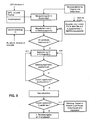
- the traffic check checks Data manager 6, whether a successful route change took place before the message was received and whether the rollback horizon, which is determined by the data manager 6, has already been exceeded. If this is not the case, the data manager 6 does not trigger a route check accordingly FIG. 2 out. If the folding back horizon has been crossed, a re-adaptation of the route is carried out and, for example, via the input and output unit 1 is output. Also in this review, the data manager 6 takes into account the traffic network which is stored in the stored map data of the georeference database 10, for example possible departure points and their distance to the current position.
- FIG. 3 is compared to FIG. 2 It can be seen that not every route after a recalculation is displayed to the user of the navigation device 9, but only when a new quality, such as an improvement in the travel time, has been achieved by the recalculation. If no improvement of the route properties is achieved, the user of the navigation device 9 is acoustically informed by the input and output unit 1 that there is a traffic obstruction on the route traveled and has changed the time to reach the destination.
- the route calculator 8 When the quality of the route calculated by the route calculator 8 improves in consideration of traffic reports, it is output to the user of the navigation apparatus 9 from the input and output unit 1.
- the data manager 6 In the background of the route calculation and adaptation to current traffic obstructions, the data manager 6, after determining the current traffic volume, controls the receiving means 4, such as the tuner.
- the data manager 6 provides control information for the receiving means 4, which, for example, in heavy traffic, with more than twenty received relevant traffic reports, the capacity of the receiving means 4 mainly on the receipt of traffic reports aligns. Accordingly, the priority to ensure reception of a tuned station and to provide maintenance of a list of receivable stations is downgraded.
- the reception means 4 would try to restore the reception of the tuned station. This is not the case with the present invention.
- means are provided which align the capacity of the receiving means 4 as a function of the current traffic volume to the reception of traffic reports.
Landscapes
- Engineering & Computer Science (AREA)
- Radar, Positioning & Navigation (AREA)
- Remote Sensing (AREA)
- Physics & Mathematics (AREA)
- General Physics & Mathematics (AREA)
- Automation & Control Theory (AREA)
- Mathematical Physics (AREA)
- Navigation (AREA)
Description
Die Erfindung betrifft ein satellitengestütztes Navigationsgerät und ein Verfahren zur Anpassung oder Revision einer berechneten Route an eine aktuelle Verkehrslage. Bei der vorliegenden Erfindung unterliegen der Zeitpunkt und die Häufigkeit der Routenanpassung durch Komponenten des satellitengestützten Navigationsgerätes sowie eine Ausgabe einer aktualisierten Route an den Führer eines Kraftfahrzeugs bestimmten Bedingungen.The invention relates to a satellite-based navigation device and a method for adapting or revising a calculated route to an actual traffic situation. In the present invention, the timing and frequency of the route adaptation by components of the satellite-based navigation device as well as an output of an updated route to the driver of a motor vehicle are subject to certain conditions.
Es sind verschiedenste Lösungen zur Navigation und Routenberechnung von Fahrzeugen bekannt, die anhand von Kriterien eine optimale Route von einem Startpunkt zu einem benutzerdefinierten Endpunkt berechnen und dem Nutzer zur Zielführung anbieten. Zu den Kriterien zählen beispielsweise vom Nutzer definierte Zwischenziele oder zu vermeidende Straßenarten. Zusätzlich ergeben sich Qualitätskriterien einer Route aus den Kosten der berechneten Route selbst und Verkehrshindernissen, die sich auf der berechneten Route befinden. Zu den Kosten der berechneten Route gehören solche, die sich aus der Fahrzeit und dem Kraftstoffverbrauch ergeben und die benötigt werden, um die berechnete Route zurückzulegen. Besteht auf einer Route von Routenabschnitten ein Verkehrshindernis, wie eine Straßensperrung, ein Stau oder stockender Verkehr, verändern sich die Kosten, da sie nicht nur von der Zeit zum Befahren der Route vom Startpunkt zum Zielpunkt, sondern zusätzlich von der Zeit zum Passieren des Verkehrshindernisses abhängig sind.Various solutions for navigation and route calculation of vehicles are known, which use criteria to calculate an optimal route from a starting point to a user-defined end point and offer it to the user for route guidance. The criteria include, for example, user-defined intermediate destinations or types of roads to avoid. In addition, quality criteria of a route will result from the cost of the calculated route itself and traffic obstructions that are on the calculated route. The cost of the calculated route includes those resulting from travel time and fuel consumption needed to cover the calculated route. If there is a traffic obstruction on a route of route sections, such as a road blockage, a traffic jam or stagnant traffic, the costs change, since they depend not only on the time to travel the route from the starting point to the destination point, but also on the time to pass the traffic obstruction are.
Aus der
Diese Art der Übertragung von Verkehrsmeldungen, bei der zwischen Verkehrszentrale und Fahrzeug ein ständiger Datenaustausch, wie zum Beispiel über ein Funktelefon, stattfindet, wird durch die zur Verfügung stehende Kapazität der Kommunikationskanäle begrenzt. Zusätzlicher Nachteil dieser Systeme sind die bei der Übermittlung der Verkehrsmeldungen entstehenden Kosten.This type of transmission of traffic reports, in which a constant exchange of data between the traffic control center and the vehicle, such as via a radiotelephone takes place, is limited by the available capacity of the communication channels. An additional disadvantage of these systems is the costs incurred in transmitting the traffic reports.
Aus der
Aus der
Die Offenlegungsschrift
Aus der japanischen Patentanmeldung
Aus der
Die bekannten Navigationssysteme nutzen für die Routenberechnung allgemein zugängliche Verkehrsinformation über ein Rundfunkübertragungssystem, wie den Verkehrsnachrichtenkanal, den sogenannten Traffic Message Channel auch TMC, TMC-Pro, Satelliten Radio auch als XM-Radio bekannt, HD-Verkehrsrundfunk oder Digital Rundfunk. Bei diesen Systemen wird Information hinsichtlich Verkehrsbeeinträchtigungen mit dem Audiosignal gesendet und von einem entsprechenden Empfänger, der mit dem Navigationssystem verbunden ist, empfangen. Die empfangene Verkehrsinformation wird bei der Berechnung einer Route von einer Startposition zu einer Zielposition und zur Aktualisierung der momentan befahrenen Route berücksichtigt. Der Nachteil dieser Systeme ist, dass sofort, wenn sich die Verkehrssituation auf der benutzten Fahrtroute oder einem Routenabschnitt ändert, eine Neuberechnung der Route durch das Navigationssystem ausgelöst wird und die Ausgabe einer neuen Fahrtroute erfolgt. Die Neuberechnung und Ausgabe von Alternativrouten kann in Zeiten mit hohem Verkehrsaufkommen, wie zu Urlaubsbeginn, besonders häufig auftreten. Der Führer eines Fahrzeugs kann durch die ständige Ausgabe von empfangenen Verkehrsmeldungen, dem wiederholten Vorschlagen von Routenänderungen, vom aktuellen Verkehrsgeschehen abgelenkt werden.The known navigation systems use for the calculation of the route generally accessible traffic information via a radio transmission system, such as the traffic news channel, the so-called Traffic Message Channel TMC, TMC-Pro, satellite radio also known as XM radio, HD traffic broadcasting or digital broadcasting. In these systems, information regarding traffic impairments is transmitted with the audio signal and received by a corresponding receiver connected to the navigation system. The received traffic information becomes when calculating a route from a start position to a destination position and updating the currently traveled route considered. The disadvantage of these systems is that immediately when the traffic situation on the used route or a route section changes, a recalculation of the route is triggered by the navigation system and the output of a new route takes place. Recalculating and outputting alternative routes can be particularly common in times of high traffic, such as at the beginning of the vacation. The leader of a vehicle can be distracted from the current traffic situation by the continuous output of received traffic reports, the repeated suggestion of route changes.
Die Routenänderungen können unter Umständen auch Empfehlungen für das Abfahren von der aktuellen Fahrtroute sowie für das spätere Zurückkehren auf diese beinhalten, was für den Fahrer besonders irritierend ist.The route changes may also include recommendations for departing from the current route and for later returning to this, which is particularly irritating for the driver.
Die Aufgabe der vorliegenden Erfindung besteht darin, eine Vorrichtung und ein Verfahren zur Zielführung mit einem satellitengestützten Navigationsgerät zur Verfügung zu stellen, das einem Nutzer ermöglicht, ein Reiseziel sicher, bequem, stressfrei und in ressourcenschonender Weise zu erreichen und Ablenkungen, beispielsweise beim Führen eines Kraftfahrzeugs, zu verringern sowie Mittel bereitzustellen, die es ermöglichen Rundfunkempfangsmittel, die mit dem Navigationsgerät verbunden sind, zu steuern.The object of the present invention is to provide a device and a method for navigation with a satellite-based navigation device that enables a user to reach a destination safely, comfortably, stress-free and in a resource-saving manner and distractions, for example when driving a motor vehicle and to provide means for controlling radio reception means connected to the navigation device.
Zur Lösung der benannten Aufgabe geht die vorliegende Erfindung von einem satellitengestützten Navigationsgerät zur dynamischen Zielführung aus, welches mithilfe von über Hörrundfunk empfangenen Verkehrsmeldungen eine Routenberechnung durchführt und eine berechnete Route entsprechend empfangener Information zu Verkehrsereignissen aktualisiert und anpasst. Ein wesentlicher Vorteil der vorliegenden Erfindung besteht darin, dass das Navigationsgerät zur Routenberechnung und Anpassung keine Verbindung oder Rückkopplung zu einer Verkehrszentrale benötigt. Bei dieser Art von Geräten, den sogenannten Onboard-Systemen, findet der Empfang von Verkehrsmeldungen mithilfe von Übertragungskanälen statt. Diese Übertragungskanäle unterliegen Störungen, es kann zur Störung der Übertragung selbst kommen, beispielsweise bei einer Durchfahrt durch einen Tunnel, oder bei der Übertragung kann Information verloren gehen.In order to achieve the stated object, the present invention is based on a satellite-based navigation device for dynamic route guidance, which performs a route calculation by means of traffic reports received via audio broadcasting and updates and adjusts a calculated route in accordance with received information on traffic events. An essential advantage of the present invention is that the navigation device for route calculation and adaptation requires no connection or feedback to a traffic center. In this type of device, the so-called on-board systems, traffic information is received using transmission channels. These transmission channels are subject to interference, it may interfere with the transmission itself, for example, when passing through a tunnel, or in the transmission information may be lost.
Das Onboard- System führt die Routenberechnung und die Routenanpassung an das aktuelle Verkehrsgeschehen selbstständig mit internen Komponenten durch. Zu internen Komponenten zählen beispielsweise ein GPS-basiertes Lage- und Positionsschätzmodul, Rundfunkempfangsmittel, eine Georeferenz-Datenbank als Speichermittel, die aktuelles Kartenmaterial gespeichert hat, ein Routenkalkulationsmodul, weitere Speichermittel zum Speichern von aktuellen Verkehrsmeldungen in einem Meldungspool.The onboard system independently carries out the route calculation and the route adaptation to the current traffic situation with internal components. Internal components include, for example, a GPS-based attitude and position estimation module, radio reception means, a georeference database as storage means which has stored current map material, a route calculation module, further storage means for storing current traffic reports in a message pool.
In der Georeferenz-Datenbank ist die Struktur des Verkehrsnetzes durch Daten zu Straßenabschnitten nachgebildet, wobei jeder Abschnitt von einem anderen aus erreichbar ist. Da sich Straßenabschnitte des Verkehrsnetzes, beispielsweise durch Erweiterungen ändern können, müssen die Daten zum Verkehrsnetz in der Georeferenz-Datenbank aktualisiert werden.In the georeference database, the structure of the traffic network is modeled by data on road sections, each section being reachable from another. Since road sections of the transport network can change, for example, through extensions, the data must be updated to the transport network in the georeference database.
Ein Straßenabschnitt verbindet zwei Punkte, die WGS-84 Koordinaten. Jeder Straßenabschnitt verursacht Kosten, die durch das Passieren des betroffenen Abschnittes entstehen, die Kosten werden in einer Zeiteinheit, beispielsweise in Sekunden, angegeben und sind ebenfalls in der Georeferenz-Datenbank hinterlegt.A road section connects two points, the WGS-84 coordinates. Each road section causes costs incurred by passing the affected section, the costs are given in unit time, for example in seconds, and are also stored in the georeference database.
Die Rundfunkempfangsmittel, auch als Tuner bekannt, besitzen Kapazität zum Empfangen von Hörfunksignalen und Verkehrsmeldungen, beispielsweise über RDS-TMC empfangen, sowie zum Bereitstellen und Aktualisieren einer Liste mit empfangbaren Sendern. Diese Verkehrsmeldungen umfassen Verkehrsprognosen sowie Information zu Verkehrsereignissen, wie eine eingeschränkte Verkehrsführung, beispielsweise das Befahren von Verkehrszonen zu bestimmten Zeiten oder durch bestimmte Fahrzeugtypen. Das Radio Data System, auch als RDS bekannt, ermöglicht die Übermittlung von Zusatzinformationen beim Hörfunk. Die Rundfunkempfangsmittel, im Weiteren kurz Empfangsmittel genannt, müssen ebenfalls die Qualität eines eingestellten Hörfunksenders sicherstellen, dazu wechseln sie automatisch die Frequenz und folgen somit einem einmal eingestellten Sender. Das erspart dem Nutzer das manuelle Suchen nach der neuen Frequenz, wenn das Fahrzeug auf seiner Route den Sendebereich des eingestellten Senders verlässt. Zusätzlich halten die Empfangsmittel die bereitgestellte Senderliste aktuell. Durch den Empfang von Verkehrsmeldungen ermöglichen die Empfangsmittel eine Routenberechnung und die Routenanpassung an die aktuelle Verkehrssituation. Die höchste Priorität der Empfangsmittel liegt im Normalfall darauf eine gleichbleibende Qualität des eingestellten Senders, somit eines empfangenen und ausgegebenen Hörfunkprogramms, sicher zu stellen. Zu diesem Zweck sind bestimmte Empfangskomponenten redundant ausgelegt. Wenn die Qualität eines eingestellten Programmes sinkt und gleichzeitig eine angespannte Verkehrslage herrscht, was sich im verstärkten Empfang von Verkehrsmeldungen niederschlägt, werden die Empfangsmittel zuerst die Qualität des eingestellten Programmes gewährleisten und danach empfangene Verkehrsinformation weiterleiten.The radio receiving means, also known as tuners, have capacity for receiving radio signals and traffic messages, for example via RDS-TMC, as well as for providing and updating a list of receivable stations. These traffic announcements include traffic forecasts as well as information on traffic events, such as limited traffic management, for example driving through traffic zones at specific times or by certain vehicle types. The Radio Data System, also known as RDS, allows the transmission of additional information in radio. The radio receiving means, hereinafter referred to as receiving means, must also ensure the quality of a set radio station, they automatically change the frequency and thus follow a once set station. This saves the user from manually searching for the new frequency when the vehicle leaves the transmission range of the set transmitter on its route. In addition, the receiving means keeps the provided station list up to date. By receiving traffic reports, the receiving means allow route calculation and route adaptation to the current traffic situation. The highest priority of the receiving means is normally a constant quality of the set station, thus a received and issued radio program to ensure. For this purpose, certain receiving components are designed redundantly. If the quality of a set program decreases and at the same time a tense traffic situation prevails, which is reflected in the increased reception of traffic reports, the receiving means will first ensure the quality of the set program and then forward received traffic information.
Ein Informationsverwaltungsmodul, das mit dem Navigationsgerät verbunden ist, verwaltet die empfangenen Meldungen mit Verkehrsinformation, die Verkehrsereignisse oder Verkehrshindernisse beinhaltet, und überträgt sie an den Meldungspool.An information management module connected to the navigation device manages the received messages with traffic information including traffic events or traffic obstructions, and transmits them to the message pool.
Die Gültigkeit von Verkehrsinformation und ihre Anwesenheit als Meldung im RDS-TMC Strom wird beispielsweise in der ISO14819, dem internationalen Standard über den Empfang von Verkehrsmeldungen, geregelt. Die empfangene Verkehrsmeldung, die als Datensatz vorliegt, wird durch ihre Struktur und den Inhalt des Datensatzes charakterisiert.The validity of traffic information and its presence as a message in the RDS-TMC stream is regulated, for example, in ISO14819, the international standard for the reception of traffic reports. The received traffic message, which is present as a data record, is characterized by its structure and the content of the data record.
Geht eine Verkehrsmeldung wegen schlechter Empfangsqualität, mangelnder Empfangsfeldstärke oder Mehrwegeempfang wiederholt verloren, muss die Verkehrsmeldung aus dem gültigen Meldungspool entfernt werden, beispielsweise bei Durchfahrt durch einen Tunnel hervorgerufen. Dieser Ablauf weicht von der tatsächlichen Verkehrssituation und den über RDS-TMC gemeldeten Verkehrshindernissen ab.If a traffic message is repeatedly lost due to poor reception quality, poor reception field strength or multipath reception, the traffic message must be removed from the valid message pool, for example, when passing through a tunnel. This process deviates from the actual traffic situation and the traffic obstructions reported via RDS-TMC.
Ändern sich diese Randbedingungen, beispielsweise, wenn das Fahrzeug den Tunnel verlässt, die Empfangsqualität des RDS-TMC Senders wieder besser wird, wie beim Verlassen eines Empfangsschattens, erscheint die betroffene TMC-Meldung oder die betroffenen TMC-Meldungen erneut im RDS-TMC Strom und müssen wieder in den Meldungspool aufgenommen werden.If these boundary conditions change, for example, when the vehicle leaves the tunnel, the reception quality of the RDS-TMC transmitter improves again, as when leaving a receiving shadow, the affected TMC message or the relevant TMC messages appear again in the RDS-TMC stream and must be included again in the message pool.
Dieser für Onboard-Systeme typische Vorgang führt in herkömmlichen Navigationssystemen meist zur akustischen und visuellen Ausgabe von Empfehlungen bezüglich Routenwechseln mit häufigen Zielführungsangaben, die auch widersprüchlich sein können, beispielsweise wie Aufforderungen die aktuell befahrene Autobahn zu verlassen oder wieder auf die Autobahn zurückzukehren.This process, which is typical of onboard systems, in conventional navigation systems usually results in the acoustic and visual output of recommendations for route changes with frequent route guidance information, which can also be contradictory, for example, such as requests to leave the currently used motorway or return to the motorway.
Der Empfang und die Anwesenheit einer Verkehrsmeldung im RDS-TMC-Strom ist eine Zufallsgröße, die einer unbekannten Wahrscheinlichkeitsverteilung folgt. Aus diesem Grund wird bei der vorliegenden Erfindung eine zeitliche und räumliche Filterung dieser Zufallsgröße vorgenommen.The receipt and presence of a traffic announcement in the RDS-TMC stream is a random quantity that follows an unknown probability distribution. For this reason, in the present invention, a temporal and spatial filtering of this random variable is made.
Die Nutzung von Meldungspool und einem Pufferpool bringt den Vorteil, dass auch bei Störung der Übertragungskanäle Verkehrsmeldungen zur Überprüfung und Anpassung oder Revision einer berechneten, aktuellen Route zur Verfügung stehen.The use of message pool and a buffer pool has the advantage that even if the transmission channels are disrupted, traffic messages are available for checking and adapting or revising a calculated, current route.
Ein wesentliches Merkmal gemäß der vorliegenden Erfindung besteht darin, dass zwischen Meldungspool und Pufferpool eine Datenverbindung besteht, welche mithilfe einer Datenmanagementeinrichtung, im weiteren Datenmanager genannt, eine besondere Datenübertragung zwischen Meldungspool und Pufferpool stattfindet.An essential feature according to the present invention is that there is a data connection between the message pool and the buffer pool, which takes place by means of a data management device, called data manager hereinafter, a special data transmission between message pool and buffer pool.
Ein weiteres Merkmal der Erfindung besteht darin, dass der Datenmanager in Abhängigkeit von der Anzahl der empfangenen Verkehrsmeldungen,
- das aktuelle Verkehrsaufkommen im Bereich um das Navigationsgerät analysiert und bestimmt,
- die empfangenen Verkehrsmeldungen gefiltert und bewertet vom Meldungspool in den Pufferpool überträgt,
- die Aktualisierungen des Pufferpools derart vornimmt, dass die zeitlichen Abstände zwischen den Aktualisierungen variieren und
- die Empfangsmittel zum Empfangen von Hörfunksignalen sowie Verkehrsmeldungen und den Routenkalkulator steuert.
- the current traffic volume in the area around the navigation device is analyzed and determined
- filters the received traffic reports and transfers them from the message pool to the buffer pool,
- makes the updates to the buffer pool such that the time intervals between the updates vary
- controls the receiving means for receiving radio signals as well as traffic announcements and the route calculator.
Im Rahmen der vorliegenden Erfindung wird unter dem aktuellen Verkehrsaufkommen dasjenige verstanden, welches vom Datenmanager mithilfe der Anzahl der vom Meldungspool in den Pufferpool übertragenen Verkehrsmeldungen bestimmt wird. Die Bestimmung des Verkehrsaufkommens wird vom Datenmanager während der Zielführung und Routenaktualisierung mehrfach, in geräteintern festgelegten zeitlichen Abständen, durchgeführt, da sich die Anzahl der gemeldeten Verkehrsmeldungen ändert.In the context of the present invention, the current traffic volume is understood to mean that which is determined by the data manager by means of the number of traffic messages transmitted from the message pool to the buffer pool. The determination of the traffic volume is carried out by the data manager during the route guidance and route update several times, at internally fixed time intervals, as the number of reported traffic reports changes.
Bei der Bestimmung des Verkehrsaufkommens betrachtet der Datenmanager die empfangenen Verkehrsmeldungen, die ein neues Verkehrsereignis, ein bereits empfangenes Verkehrsereignis, dessen Eigenschaften sich verändert haben, oder die den Wegfall eines bereits empfangenen Verkehrsereignisses betreffen, sofern diese durch ihre Position für die berechnete Route relevant sind. Die so ermittelte Anzahl der Verkehrsmeldungen wird vom Datenmanager als Indikator für das aktuelle Verkehrsaufkommen um das Navigationsgerät betrachtet. Änderungen, welche die Eigenschaften von einem Verkehrshindernis oder Verkehrsereignis betreffen, können beispielsweise die Länge eines Staus sein, zu dem bereits eine Meldung mit Verkehrsinformation empfangen wurde, aber dessen Länge sich verändert hat. Das aktuelle Verkehrsaufkommen wird vom Datenmanager als steigend betrachtet, je mehr relevante neue Verkehrsmeldungen und Änderungen von Verkehrsmeldungen empfangen oder Löschungen von Verkehrsmeldungen registriert werden. Entsprechend der vorliegenden Erfindung wird angenommen, dass die Anzahl der empfangenen, an den Pufferpool übertragenen und gespeicherten Verkehrsmeldungen das aktuelle Verkehrsaufkommen widerspiegelt.When determining the traffic volume, the data manager considers the received traffic reports that relate to a new traffic event, an already received traffic event whose properties have changed, or which relate to the elimination of an already received traffic event, provided that they are relevant by their position for the calculated route. The number of traffic reports thus determined is considered by the data manager as an indicator of the current traffic volume around the navigation device. Changes that affect the characteristics of a traffic obstruction or traffic event may be, for example, the length of a traffic jam to which a traffic information message has already been received but whose length has changed. The current traffic volume is considered by the data manager as increasing, the more relevant new traffic announcements and changes of traffic announcements received or deletions of traffic announcements are registered. According to the present invention, it is assumed that the number of received traffic messages transmitted and stored to the buffer pool reflects the current traffic volume.
Entsprechend der vorliegenden Erfindung nimmt der Datenmanager eine Filterung der empfangenen Verkehrsmeldungen derart vor, dass er die Entfernung des Verkehrshindernisses einer empfangenen Verkehrsmeldung zur aktuellen Position und unter Betrachtung des aktuellen Verkehrsnetzes des Navigationsgerätes räumlich bestimmt und anhand dieser Entfernung die Verkehrsmeldung bezüglich der Konsequenz zur Verkehrsdichte und Positionsnähe gewichtet in den Pufferpool überträgt.According to the present invention, the data manager filters the received traffic information to spatially determine the distance of the traffic obstruction of a received traffic message to the current location and the current traffic network of the navigation device, and based on this distance, the traffic message regarding the consequent traffic density and location weighted transfers to the buffer pool.
Der Datenmanager nimmt die Bewertung der empfangenen Verkehrsmeldungen, die Verkehrshindernisse betreffen, derart vor, dass er sie nach ihrer Art, ihren Eigenschaften unterscheidet und entsprechend ihrer Position zum aktuellen Standort des Navigationsgerätes unter Berücksichtigung des aktuellen Verkehrsnetzes betrachtet und im Pufferpool speichert. Verkehrshindernisse sind zum Beispiel zäh fließender oder stockender Verkehr, Staus und Sperrungen von Routenabschnitten. Der Datenmanager berücksichtigt zusätzlich zur Position des Verkehrshindernisses zur Verkehrsmeldung gehörende Information, die beispielsweise den Zeitpunkt eines Meldungseingangs betrifft und im Zusammenhang mit dem Verkehrshindernis entstehende Zusatzkosten. Ein Verkehrsereignis, wie beispielsweise eine Vollsperrung, verursacht höhere Zusatzkosten als ein Stau, die entsprechend der vorliegenden Erfindung in Zeiteinheiten ausgedrückt werden.The data manager undertakes the evaluation of the received traffic messages relating to traffic obstructions such that it distinguishes them according to their type and their characteristics and looks at their position relative to the current location of the navigation device taking into account the current traffic network and stores it in the buffer pool. Traffic barriers include, for example, slow-moving or slow traffic, traffic jams and blockages of route sections. The data manager shall take into account, in addition to the position of the traffic obstruction, traffic information relating to, for example, the time of receipt of an alert and any additional costs arising in connection with the traffic obstruction. A traffic event, such as a full closure, causes higher overheads than congestion, which are expressed in units of time according to the present invention.
Der zeitliche Abstand von Aktualisierungen des Pufferpools hängt in einer speziellen Ausführungsform der vorliegenden Erfindung vom aktuellen Verkehrsaufkommen und der Entfernung zu einem relevanten Verkehrshindernis ab und variiert. Ein Verkehrsereignis ist relevant, wenn es auf der gewählten Route liegt oder zu einem betrachteten Verkehrsbereich gehört. Das bedeutet, vom Datenmanager werden die Höhe des Verkehrsaufkommens und die Entfernung des Navigationsgerätes zu einem relevanten Verkehrsereignis zur Bestimmung des zeitlichen Abstandes zwischen Aktualisierungen des Pufferpools betrachtet. Der Datenmanager unterscheidet entsprechend der Anzahl empfangener relevanter Verkehrsmeldungen zwischen einem ruhigen, durchschnittlichen und hohen Verkehrsaufkommen. Der Datenmanager geht von einer Verkehrslage mit einem hohen Verkehrsaufkommen aus, wenn beispielsweise mehr als zwanzig relevante Verkehrsmeldungen von den Empfangsmitteln empfangen werden. Entsprechend dieser Anzahl von Verkehrsmeldungen setzt der Datenmanager die Zeit bis zur nächsten Aktualisierung des Pufferpools beispielsweise auf fünf Minuten. Ist die Anzahl der empfangenen relevanten Verkehrsmeldungen kleiner als zwanzig, wird der zeitliche Abstand bis zur nächsten Aktualisierung des Pufferpools zum Beispiel auf vier Minuten gesetzt. Somit wird bei sinkendem Verkehrsaufkommen der Pufferpool öfter aktualisiert als bei steigendem oder hohem Verkehrsaufkommen. Bei der vorliegenden Erfindung wird davon ausgegangen, dass sich Verkehrshindernisse, zu denen Informationen mit den Verkehrsmeldungen übertragen werden auflösen oder sich in ihren Eigenschaften ändern können. Somit realisiert der Datenmanager eine dynamische Steuerung der zeitlichen Aktualisierung des Pufferpools, da er eine Integration seines bewerteten Inhalts über die Zeit vornimmt. Dadurch, dass bei hohem Verkehrsaufkommen der Pufferpool seltener aktualisiert wird, kommt es zu einer scheinbaren Beruhigung der Verkehrssituation um das Navigationsgerät, daraus kann resultieren, dass weniger Routenaktualisierungen vom Datenmanager angestoßen werden.The timing of buffer pool updates in a particular embodiment of the present invention depends on and varies with current traffic and distance to a relevant traffic obstruction. A traffic event is relevant if it is on the chosen route or belongs to a considered traffic area. That is, the Data Manager will determine the amount of traffic and the distance of the navigation device to a relevant traffic event to determine the time interval between updates to the buffer pool. The data manager differentiates between a quiet, average and high traffic volume according to the number of relevant traffic reports received. The data manager assumes a traffic situation with a high volume of traffic, if, for example, more than twenty relevant traffic reports are received by the receiving means. For example, according to this number of traffic reports, the data manager sets the time to the next update of the buffer pool to five minutes. If the number of relevant traffic reports received is less than twenty, the time interval until the next update of the buffer pool is set to four minutes, for example. Thus, as the volume of traffic decreases, the buffer pool is updated more frequently than when there is a high or high traffic volume. In the present invention, it is assumed that traffic obstructions to which information is transmitted with the traffic reports can be resolved or changed in their characteristics. Thus, the data manager dynamically controls the buffer pool time-out because it integrates its weighted content over time. The fact that the buffer pool is updated less frequently in the event of a high traffic volume leads to an apparent calming of the traffic situation around the navigation device, as a result of which fewer route updates are initiated by the data manager.
In der Zeit zwischen den Aktualisierungen wird keine gefilterte, bewertete Verkehrsmeldung in den Pufferpool übertragen. Erst nach Ablauf der Zeit übergibt der Datenmanager Pakete von bewerteter, gewichteter Information entsprechend empfangener Verkehrsmeldungen an den Pufferpool. Diese Vorgehensweise dient dazu, eine scheinbare Beruhigung der aktuellen Verkehrssituation zu erreichen und die Anzahl der Routenaktualisierungen zu verringern, da sich im zeitlichen Abstand bis zur nächsten Aktualisierung des Pufferpools Verkehrsmeldungen kompensieren können.During the time between updates, no filtered, weighted traffic message is transferred to the buffer pool. Only after the time has elapsed does the data manager pass packets of weighted, weighted information according to received traffic messages to the buffer pool. This procedure serves to achieve an apparent calming of the current traffic situation and to reduce the number of route updates, since traffic messages can be compensated for at intervals until the next update of the buffer pool.
Ein anderes Merkmal der Erfindung besteht darin, dass der Datenmanager bei einer Festlegung der zeitlichen Abstände zwischen den Aktualisierungen des Pufferpools berücksichtigt, ob die berechnete Route durch einen Bereich des Verkehrsnetzes wie dem Ruhrgebiet führt, das generell durch eine hohe Anzahl von Verkehrsmeldungen charakterisiert ist. In diesem Fall kann der Datenmanager eine höhere Anzahl von gemeldeten Verkehrsmeldungen zulassen, bevor er die zeitlichen Abstände zwischen den Aktualisierungen des Pufferpools vergrößert.Another feature of the invention is that the data manager takes into account when determining the time intervals between the updates of the buffer pool whether the calculated route leads through an area of the traffic network such as the Ruhr area, which is generally characterized by a high number of traffic reports. In this case, the data manager may allow a higher number of reported traffic messages before increasing the intervals between updates to the buffer pool.
Ein weiteres Merkmal der vorliegenden Erfindung besteht darin, dass der Datenmanager nach Bestimmung der Höhe des aktuellen Verkehrsaufkommens die Empfangsmittel mit Kapazität zum Empfangen von Hörfunksignalen, Verkehrsmeldungen sowie zum Bereitstellen und Aktualisieren einer Liste mit empfangbaren Sendern derart steuert, dass bei steigendem oder hohem Verkehrsaufkommen die Empfangsmittel ihre Empfangskapazität vorwiegend zum Empfang der Verkehrsmeldungen nutzen.Another feature of the present invention is that the data manager, after determining the amount of current traffic, controls the receiving means with capacity to receive radio signals, traffic alerts, and to provide and update a list of receivable broadcasters such that as the traffic increases or decreases Traffic the receiving means use their capacity to receive primarily the traffic information.
Gemäß einem weiteren Merkmal der Erfindung wird zur Initiierung einer ersten Überprüfung und Anpassung der aktuellen Route an aktuelle Verkehrsmeldungen durch den Datenmanager das Verhältnis der Kosten eines Routenabschnittes der aktuellen Route ohne Verkehrshindernis zu den Gesamtkosten des Routenabschnittes betrachtet. Alle weiteren Überprüfungen hängen von der Änderung der Eigenschaften der Verkehrsmeldungen auf der aktualisierten Route und den Verkehrsmeldungen in der Umgebung des Navigationsgerätes ab, wobei bei den Letzteren nur die Meldungen betrachtet werden, die bei der Routensuche benutzt wurden. Diese gemeldeten Verkehrshindernisse müssen nicht zwingend auf der aktualisierten bzw. auf der ursprünglichen Route liegen bzw. gelegen haben.According to a further feature of the invention, for initiating a first check and adaptation of the current route to current traffic reports by the data manager, the ratio of the costs of a route section of the current route without traffic obstruction to the total cost of the route section is considered. All further checks depend on the change in the characteristics of the traffic reports on the updated route and the traffic reports in the environment of the navigation device, the latter only looking at the messages used in the route search. These reported traffic obstructions do not necessarily have to be on the updated or on the original route.
Unter Überprüfung im Sinne dieser Erfindung wird verstanden, dass durch den Datenmanager eine Bewertung der aktuellen Route und der Fahrzeugumgebung hinsichtlich einer gewichteten und bewerteten Verkehrsmeldung vorgenommen wird, der Routenkalkulator nach einer Alternativroute sucht und deren Kosten berechnet. Durch die Routenüberprüfung wird die laufende Zielführung nicht unterbrochen, sie läuft im Hintergrund ab. Nicht jede aktualisierte Route wird dem Nutzer angezeigt. Eine aktualisierte Route wird dem Nutzer des Navigationsgeräts nur dann ausgegeben, wenn diese eine signifikant geänderte Qualität besitzt. Die Qualität der aktualisierten Route ergibt sich beispielsweise aus einer Änderung der Fahrzeit und der damit verbundenen Kosten, oder aus dem Kraftstoffverbrauch. Die Gesamtkosten einer Route werden aus der Summe der Kosten des Routenabschnittes ohne Berücksichtigung von einem gemeldeten Verkehrsereignis und den Kosten des Routenabschnittes mit Verkehrsereignis ermittelt. Übersteigt das Verhältnis einen systemintern definierten Wert, erfolgt eine Neuberechnung der Route. Dadurch wird verhindert, dass der Routenkalkulator ständig nach Alternativrouten sucht. Die Systemleistung des Navigationsgerätes wird somit vorteilhaft verbessert. Für die Verkehrsmeldung, die ein Ereignis betrifft, das keinen wesentlichen Einfluss auf die Kosten hat, unterbleibt die Suche nach einer neu alternativen Route.Checking in the context of this invention means that the data manager performs an evaluation of the current route and the vehicle environment with regard to a weighted and weighted traffic message, searches the route calculator for an alternative route and calculates its costs. The route check does not interrupt the current route guidance; it runs in the background. Not every updated route is displayed to the user. An updated route is only output to the user of the navigation device if it has a significantly changed quality. The quality of the updated route results, for example, from a change in travel time and the associated costs, or from fuel consumption. The total cost of a route is determined from the sum of the costs of the route section without taking into account a reported traffic event and the cost of the route segment with traffic event. If the ratio exceeds a system-internally defined value, the route is recalculated. This prevents the route calculator from constantly searching for alternative routes. The system performance of the navigation device is thus advantageously improved. For the traffic message, which concerns an event that has no significant influence on the costs, the search for a new alternative route is omitted.
Wurde eine aktualisierte Route durch den Routenkalkulator berechnet, wird im Anschluss an die Berechnung anhand der Kostenänderung der revidierten Route gegenüber der ursprünglichen durch den Datenmanager entschieden, ob dem Nutzer ein Wechsel zur aktualisierten Route vorzuschlagen ist. Da nicht jede Routenalternative dem Nutzer des Navigationsgerätes angeboten wird, sinkt die Anzahl der Ablenkungen und der Fahrkomfort des Nutzers steigt.If an updated route has been calculated by the route calculator, following the calculation based on the cost change of the revised route from the original one, the data manager will decide whether to propose to the user to change to the updated route. Since not every route alternative is offered to the user of the navigation device, the number of distractions decreases and the driving comfort of the user increases.
Gemäß der vorliegenden Erfindung wird vom Datenmanager zur Verbesserung der Zielführungsqualität durch das Navigationsgerät zusätzlich zu den vorher genannten zeitlichen und räumlichen Filtermöglichkeiten ein Zurückklapphorizont betrachtet.According to the present invention, in addition to the aforesaid temporal and spatial filtering capabilities, the data manager, to improve the guidance quality of the navigation system, considers a roll-back horizon.
Der Zurückklapphorizont dient dazu, ein Pendeln zwischen zwei berechneten und dem Nutzer ausgegebenen Routenalternativen zu vermeiden oder zu minimieren, um den Nutzer des Navigationsgerätes durch wiederholte Routenwechsel nicht zu irritieren. Der Zurückklapphorizont kann beispielsweise eine Zeitspanne sein, bei einem Anwendungsszenario Stau oder eine berechnete Position speziell im Anwendungsszenario freier Verkehrsfluss bis zu deren Erreichen keine Routenneukalkulation durchgeführt wird. Eine Kombination aus beiden Ansätzen bei der Änderung der aktuellen Verkehrslage in der Umgebung des Fahrzeugs ist ebenfalls möglich.The folding back horizon is used to calculate a commute between two and the user route alternatives to be avoided or minimized in order not to irritate the user of the navigation device by repeated route changes. The roll-back horizon can be, for example, a period of time, in the case of an application scenario congestion or a calculated position, especially in the application scenario free traffic flow, until which no route re-calculation is performed. A combination of both approaches to changing the current traffic situation around the vehicle is also possible.
Abweichend von der vorher beschriebenen Vorgehensweise initialisiert der Datenmanager die Berechnung einer Alternativroute ohne Betrachtung des Zurückklapphorizontes, wenn
- die Meldung zu einem Verkehrshindernis empfangen wurde, welches hohe Kosten verursacht, wie ein Stau mit mehreren Kilometern Länge, noch nicht im Pufferpool gespeichert ist und das sich auf der aktuell befahrenen Route befindet,
- wenn sich die Eigenschaften eines Verkehrsereignisses auf der aktuellen Route entsprechend einer Verkehrsmeldung wesentlich geändert haben, beispielsweise aus stockendem Verkehr ein Stau mit mehreren Kilometern Länge geworden ist,
- wenn sich das Fahrzeug auf einer hindernisfreien Alternativroute bewegt, sich die Kosten des Verkehrshindernisses, die den Wechsel auf diese Route erzwungen haben verringern, kann eine weitere Alternativroute berechnet werden. Diese Alternativroute kann die ursprüngliche Route sein, auf die an einem, in Fahrtrichtung liegenden, vorausberechneten Abfahrpunkt zurückgekehrt wird,
- die Bewegung des Navigationsgerätes aufgrund von Pausenzeiten oder der Unterschätzung von tatsächlichen Kosten für das Befahren eines Routenabschnitts mit einem Verkehrshindernis das Erreichen des Zurückklapphorizonts, durch einen systemintern festgelegten Schwellwert festgelegt, verhindert.
- the message about a traffic obstruction has been received, which causes high costs, such as a congestion of several kilometers in length, is not yet stored in the buffer pool and that is on the currently traveled route,
- if the characteristics of a traffic event on the current route have changed significantly according to a traffic report, for example, traffic has become a traffic jam several kilometers in length,
- if the vehicle is traveling on an obstacle-free alternative route, the costs of the traffic obstruction that have forced the change to that route are reduced, another alternative route can be calculated. This alternative route may be the original route that is returned to a predicted departure point in the direction of travel,
- the movement of the navigation device due to pause times or the underestimation of actual costs for driving on a route section with a traffic obstruction prevents reaching the Rückklapphorizonts, set by a system-internally set threshold.
Diese Ausnahmen dienen dazu, dass Verkehrsmeldungen, welche die aktuelle Route betreffen, unverzüglich vom Navigationsgerät berücksichtigt werden.These exceptions serve to ensure that traffic messages concerning the current route are immediately taken into account by the navigation device.
Der Zurückklapphorizont wird auf der Basis des aktuellen Verkehrsnetzes berücksichtigt, wenn
- ein ehemals auf der Route liegendes Verkehrshindernis seine Kosten verringert oder entfällt,
- ein Verkehrsereignis seine Kosten verringert oder entfällt, das bei der letzten Routenüberprüfung und Routenaktualisierung berücksichtigt wurde,
- das Fahrzeug in einen von mehreren systemintern festgelegten geografischen Kreisen um ein Verkehrshindernis, das bei der letzten Routenüberprüfung verwendet wurde, einfährt.
- a traffic obstacle formerly on the route reduces or eliminates its costs,
- a traffic event reduces or eliminates its costs, which was taken into account in the last route check and route update,
- the vehicle enters one of several intrinsically defined geographic circles around a traffic obstruction used in the last route check.
Verkehrshindernisse, die bei der letzten Routenüberprüfung verwendet wurden, müssen nicht zwingend jemals auf der geführten Route gelegen haben. Eine Routenüberprüfung kann auch dadurch verursacht werden, wenn beispielsweise das Fahrzeug die vom Zielführungssystem angebotene Route verlässt.Traffic barriers used during the last route check do not necessarily have to be on the guided route. A route check can also be caused if, for example, the vehicle leaves the route offered by the destination guidance system.
Im Gegensatz zum technischen Hintergrund wird bei der vorliegenden Erfindung beim Befahren einer Route immer der nächstmögliche Abzweigpunkt, in Abhängigkeit vom aktuellen, in den Kartendaten gespeicherten Verkehrsnetz, der aktuellen Route voraus berechnet.In contrast to the technical background, in the present invention when driving a route always the next possible branch point, depending on the current, stored in the map data traffic network, the current route ahead calculated.
Die vorliegende Erfindung soll nachstehend anhand von Figuren beschrieben werden. Die Figuren zeigen im Einzelnen:
-
Figur 1 : eine schematische Darstellung des Aufbaus des Navigationsgerätes, -
Figur 2 : ein schematisches Funktionsdiagramm einer Routenüberprüfung nach Start des Navigationsgerätes ohne gespeicherte Verkehrsmeldungen und in -
Figur 3 : ein schematisches Funktionsdiagramm einer Routenüberprüfung nach Start des Navigationsgerätes ohne gespeicherte Verkehrsmeldungen bei Betrachtung der Kosten und Qualitätsänderung einer revidierten Route.
-
FIG. 1 : a schematic representation of the structure of the navigation device, -
FIG. 2 A schematic functional diagram of a route check after starting the navigation device without stored traffic reports and in -
FIG. 3 : A schematic functional diagram of a route check after the start of the navigation device without stored traffic reports considering the cost and quality change of a revised route.
Entsprechend
Parallel zur Bestimmung und Ausgabe der ersten Route empfängt eine Rundfunk-Antenne 2 des Navigationsgerätes 9, die in Verbindung mit den Empfangsmitteln 4 steht, einen Rundfunkdienst, der in seinem unhörbaren Bereich Verkehrsmeldungen beinhaltet. Diese Verkehrsmeldungen beziehen sich auf Verkehrshindernisse, die im Empfangsbereich der Empfangsmittel 4 liegen und somit im Zusammenhang mit der Position des Navigationsgerätes 9 stehen, sie sind jedoch keiner bestimmten Route zugeordnet. Ein Tunermodul 4a der Empfangsmittel 4 nimmt die Verkehrsmeldungen, beispielsweise über den Verkehrsnachrichtenkanal empfangen auf und das Informationsverwaltungsmodul 4b der Empfangsmittel 4 übergibt die empfangenen Verkehrsmeldungen entsprechend ISO 14819 an Speichermittel 5, hier an den Meldungspool 5a, der die Gesamtheit der empfangenen Verkehrsmeldungen speichert. Der Datenmanager 6 prüft, ob sich die Position eines aktuellen Verkehrshindernisses, zu dem eine Meldung empfangen wurde, in einem Bereich von beispielsweise 200 km um die aktuelle Position des Navigationsgerätes 9 befindet. Bezieht sich die Meldung zum Verkehrsereignis, auf eine Position größer 200 km, wird diese Meldung vom Datenmanager 6 nicht in den Pufferpool 5b übertragen, somit räumlich gefiltert und steht momentan nicht zur Routenkalkulation zur Verfügung. Der Pufferpool 5b entsprechend
Befindet sich im Pufferpool 5b eine Verkehrsmeldung, die ein Verkehrshindernis beschreibt, das sich auf die aktuell berechnete und befahrene Route bezieht, prüft und vergleicht der Datenmanager 6 die Höhe der durch das Ereignis verursachten Zusatzkosten mit den Kosten der aktuellen Route. Übersteigt das Ergebnis einen systemintern festgelegten Schwellwert der Kosten, wird eine Anpassung der aktuellen Route vom Datenmanager 6 initiiert. Danach sucht der Routenkalkulator 8 mithilfe der durch das Lage- und Positionsschätzmodul 7 ermittelten aktuellen Position des Navigationsgerätes 9 und den vorhandenen Kartendaten nach einer Alternativroute. Diese Alternativroute wird dem Nutzer über die Ein- und Ausgabeeinheit 1 des Navigationsgerätes 9 nur dann ausgegeben, wenn sie im Vergleich zur aktuell befahrenen Route eine neue Qualität, beispielsweise hinsichtlich der Fahrzeit, besitzt.If there is a traffic message in the
Während der aktuellen Zielführung und der Überprüfung der Route ermittelt der Datenmanager 6 anhand der Anzahl der vom Meldungspool 5a in den Pufferpool 5b zu übertragenden Verkehrsmeldungen die Höhe des aktuellen Verkehrsaufkommens um das Navigationsgerät 9. Aus der Anzahl von gemeldeter und empfangener Verkehrsinformation hinsichtlich Verkehrshindernissen passt der Datenmanager 6 den zeitlichen Abstand bis zur nächsten Aktualisierung des Pufferpools 5b an.During the current route guidance and the review of the route, the
Der Datenmanager 6 unterscheidet entsprechend der Anzahl empfangener relevanter Verkehrsmeldungen zwischen einem ruhigen, durchschnittlichen und hohen Verkehrsaufkommen. Der Datenmanager 6 betrachtet die Höhe des Verkehrsaufkommens auf der Basis der Anzahl der durch die Empfangsmittel 4 empfangenen relevanten Verkehrsmeldungen als normal, bei gleich oder weniger als zehn Verkehrsmeldungen.The
Liegt die Anzahl der Verkehrsmeldungen beispielsweise in einem Bereich zwischen zehn und zwanzig Verkehrsmeldungen, wird vom Datenmanager 6 das Verkehrsaufkommen als durchschnittlich betrachtet. Bei mehr als zwanzig Verkehrsmeldungen wird das Verkehrsaufkommen als stark eingestuft. Der Abstand zwischen den Aktualisierungen des Pufferpools 5b wird vom Datenmanager entsprechend des Verkehrsaufkommens angepasst, er variiert somit. Je höher das Verkehrsaufkommen, desto länger werden die zeitlichen Abstände zwischen den Aktualisierungen des Pufferpools 5b.If the number of traffic reports is in a range between ten and twenty traffic reports, for example, the
Haben die Empfangsmittel 4 beispielsweise mehr als zwanzig Meldungen mit Verkehrsinformation empfangen, welche relevant sind und die der Datenmanager 6 bei der Aktualisierung vom Meldungspool 5a an den Pufferpool 5b übertragen bzw. kopiert hat, beträgt der zeitliche Abstand bis zur nächsten Aktualisierung des Pufferpools beispielsweise fünf Minuten.For example, if the receiving means 4 have received more than twenty traffic information messages which are relevant and which the
In den zwanzig Meldungen kann Verkehrsinformation bezüglich Verkehrshindernissen enthalten sein, die
- noch nicht gemeldet wurden, somit neu aufgetreten sind,
- deren Eigenschaften sich verändert haben, oder
- die sich aufgelöst haben.
- have not yet been reported, thus new occurred,
- whose properties have changed, or
- which have dissolved.
Zusätzlich betrachtet der Datenmanager 6 die Annäherung des Navigationsgerätes 9 an ein Verkehrshindernis als Meldung, die bei der Bestimmung der Höhe des Verkehrsaufkommens berücksichtigt wird. Befindet sich in diesem Fall das Navigationsgerät 9 in einer Entfernung von mehr als fünfzig Kilometer zu einem Verkehrshindernis, beträgt die Zeitspanne bis zur nächsten Aktualisierung des Pufferpools 5b im vorliegenden Beispiel sieben Minuten.In addition, the
Der Datenmanager 6 berücksichtigt die Position der Verkehrshindernisse zum Navigationsgerät 9 und ordnet sie entsprechend dieser Position einem Nahbereich oder einem Fernbereich zu. Auch entsprechend dieser Bereiche passt der Datenmanager 6 den zeitlichen Abstand der Aktualisierungen des Pufferpools 5b an, im Nahbereich und Fernbereich ist er unterschiedlich, weil bei der vorliegenden Erfindung davon ausgegangen wird, dass sich Verkehrsmeldungen in einer größeren Entfernung zum Navigationsgerät 9 bis zur Annäherung an das entsprechende Verkehrshindernis aufheben können.The
Bei weniger als fünfzig Kilometer Abstand zu einem Verkehrshindernis und mehr als zwanzig relevanten Verkehrsmeldungen beträgt der Abstand bis zur nächsten Aktualisierung beispielsweise fünf Minuten.For example, less than fifty kilometers away from a traffic obstruction and more than twenty relevant traffic reports, the gap is five minutes before the next update.
Wird vom Datenmanager 6, bei einer Aktualisierung des Pufferpools 5b, eine Verkehrsmeldung vom Meldungspool 5a übertragen, die ein schwerwiegendes Verkehrshindernis betrifft, durch das sich die Kosten des Routenabschnittes erheblich vergrößern und das relevant ist, da es auf der aktuell befahrenen Route liegt, überprüft der Datenmanager 6, ob vor Meldungseingang ein erfolgreicher Routenwechsel stattgefunden hat und ob der Zurückklapphorizont, der durch den Datenmanager 6 bestimmt wird, bereits überschritten wurde. Ist das nicht der Fall, löst der Datenmanager 6 keine Routenüberprüfung entsprechend
Aus
Wenn sich die Qualität der, durch den Routenkalkulator 8 berechneten Route unter Berücksichtigung von Verkehrsmeldungen verbessert, wird diese dem Nutzer des Navigationsgerätes 9 von der Ein- und Ausgabeeinheit 1 ausgegeben.When the quality of the route calculated by the
Im Hintergrund der Routenberechnung und Anpassung an aktuelle Verkehrshindernisse steuert der Datenmanager 6, nach Bestimmung des aktuellen Verkehrsaufkommens, die Empfangsmittel 4, wie beispielsweise den Tuner.In the background of the route calculation and adaptation to current traffic obstructions, the
Besonders vorteilhaft stellt der Datenmanager 6 eine Steuerinformation für die Empfangsmittel 4 bereit, die beispielsweise bei starkem Verkehr, bei mehr als zwanzig empfangenen relevanten Verkehrsmeldungen, die Kapazität der Empfangsmittel 4 vornehmlich auf den Empfang von Verkehrsmeldungen ausrichtet. Dementsprechend wird die Priorität, den Empfang eines eingestellten Senders zu gewährleisten und die Pflege einer Liste mit empfangbaren Sendern bereitzustellen, zurückgestuft.Particularly advantageously, the
Das dient dazu, den Empfang der zahlreichen Verkehrsinformation, sowie eine zeitliche und inhaltliche Konsistenz relevanter Verkehrsmeldungen mit dem erfindungsgemäßen Navigationsgerät 9 zu gewährleisten.This serves to ensure the reception of the numerous traffic information as well as a temporal and content consistency of relevant traffic reports with the navigation device 9 according to the invention.
Im Normalfall würden bei Verlust der Sendefrequenz eines eingestellten Senders, wie bei Durchfahrt durch einen Tunnel, die Empfangsmittel 4 versuchen, den Empfang des eingestellten Senders wieder herzustellen. Das ist bei der vorliegenden Erfindung nicht der Fall. Es werden vorteilhaft Mittel bereitgestellt, welche die Kapazität der Empfangsmittel 4 in Abhängigkeit vom aktuellen Verkehrsaufkommen auf den Empfang von Verkehrsmeldungen ausrichten.Normally, if the transmission frequency of a tuned station is lost, as would be the case when passing through a tunnel, the reception means 4 would try to restore the reception of the tuned station. This is not the case with the present invention. Advantageously, means are provided which align the capacity of the receiving means 4 as a function of the current traffic volume to the reception of traffic reports.
Claims (15)
- Satellite-based navigation device (9) having an apparatus for adapting a calculated route to current traffic events, the navigation device (9) comprising a route calculator (8), a GPS antenna (3), a location and position estimation module (7) for determining the current position, reception means (4) configured for receiving radio signals and traffic messages as well as providing and updating a list of receivable broadcast stations, and storage means (5) which contain card data, a message pool (5a) for storing all traffic messages received via radio as well as a buffer pool (5b) for storing evaluated filtered traffic messages, characterized in that
the navigation device (9) additionally contains a data manager (6) which, dependent on a number of received traffic messages,• performes a determination of a current traffic volume,• transmits the filtered and evaluated received traffic messages from the message pool (5a) into the buffer pool (5b),• adapts the time lags between updates of the buffer pool (5b), and• controls the reception means (4) and the route calculator (8). - Satellite-based navigation device (9) according to claim 1
wherein during the adaptation of the calculated route to current traffic events the data manager (6) performs the determination of the current traffic volume several times, in time lags that were internally specified. - Satellite-based navigation device (9) according to claim 1
wherein on the determination of the current traffic volume the data manager (6) considers the received traffic messages for traffic events which are relevant for the calculated route due to their position and which• were not received so far and hence are new,• concern a traffic event that is already stored in the storage means (5), wherein however the properties of the traffic event have changed, or• concern the discontinuation of a traffic event which was already received. - Satellite-based navigation device (9) according to claim 1
wherein the data manager (6) filters the received traffic messages in such a way that at a rising number of received traffic messages the data manager (6) presumes a rising traffic volume and enlarges the time laps between the updates of the buffer pool (5b). - Satellite-based navigation device (9) according to claim 1
wherein the data manager (6) additionally evaluates the received traffic messages in such a way that the data manager (6) assignes the traffic messages which need to be transferred from the message pool (5a) into the buffer pool (5b) to a near range or to a far range from the navigation device (9) dependent on their position and their distance. - Satellite-based navigation device (9) according to claim 4
wherein on the update of the buffer pool (5b) the data manager (6) differentiates between the near range and the far range and adapts the time lags between the update of the buffer pool (5b) according to near range and far range. - Satellite-based navigation device (9) according to claim 5
wherein the time lag between updates of the buffer pool (5b) in the far range of the navigation device (9) is bigger than the time lag between updates of the buffer pool (5b) in the near range of the navigation device (9). - Satellite-based navigation device (9) according to claim 1
wherein the data manager (6) adapts the time lags between the updates of the buffer pool (5b) additionally in such a way that the data manager (6) considers if the calculated route passes through an area of the transport network that is characterized by a large number of traffic messages generally. - Satellite-based navigation device (9) according to claim 1
wherein the data manager (6) controls the route calculator (8) in such a way that on the adaptation of the route to current traffic events the data manager (6) precalculates a next possible exit point subject to the current position and the transport network stored in card data. - Satellite-based navigation device (9) according to claim 9
wherein the route calculator (8) calculates the adapted route according to a relevant traffic message, as well as a quality change which expresses itself by the needed driving time for the routes or the needed fuel consumption and considers based on the transport network the exit point from which both routes differ. - Satellite-based navigation device (9) according to claim 10
wherein the route calculator (8) outputs the adapted route only if the adapted route comprises a substantial change of the quality compared to the current route and the route calculator (8) has checked if a route change already took place. - Satellite-based navigation device (9) according to claim 1
wherein the data manager (6) on arrival of a message regarding a relevant traffic event triggers a route adaption only if the data manager (6) has checked if prior to arrival of a message a successful route change after preceding adaptation of the route was performed and an appropriate foldback horizon was stridden through. - Satellite-based navigation device (9) according to claim 1
wherein after determination of the level of the current traffic volume the data manager (6) controls the reception means (4) in such a way that at a rising traffic volume a capacity of the reception means (4) is mainly concentrated on the reception of traffic messages. - Method for adapting a calculated route to current traffic events using a satellite-based navigation device (9) which comprises a route calculator (8), a GPS antenna (3) as well as a location and position estimation module (7) for determining the current position, reception means (4) configured for receiving radio signals and traffic messages as well as providing and updating a list of receivable broadcast stations, and storage means (5) which contain card data, a message pool (5a) for storing all traffic messages received via radio and a buffer pool (5b) for storing evaluated as well as filtered traffic messages, characterized in that
the navigation device (9) additionally comprises a data manager (6) which, dependent on a number of received traffic messages,• performs a determination of a current traffic volume,• transmits the filtered and evaluated received traffic messages from the message pool (5a) into the buffer pool (5b),• adapts the time lags between updates of the buffer pool (5b), and• controls the reception means (4) and the route calculator. - Method for adapting a calculated route according to claim 14
wherein the data manager (6) performs the determination of the current traffic volume based on the number of traffic messages that are relevant for the calculated route and which are transmitted from the message pool (5a) into the buffer pool (5b).
Applications Claiming Priority (1)
| Application Number | Priority Date | Filing Date | Title |
|---|---|---|---|
| DE102010020898A DE102010020898A1 (en) | 2010-05-12 | 2010-05-12 | Satellite-based navigation device with a device and a method for adapting a calculated route to current traffic events |
Publications (3)
| Publication Number | Publication Date |
|---|---|
| EP2386830A2 EP2386830A2 (en) | 2011-11-16 |
| EP2386830A3 EP2386830A3 (en) | 2014-08-06 |
| EP2386830B1 true EP2386830B1 (en) | 2015-09-02 |
Family
ID=44117265
Family Applications (1)
| Application Number | Title | Priority Date | Filing Date |
|---|---|---|---|
| EP11156177.5A Active EP2386830B1 (en) | 2010-05-12 | 2011-02-28 | Satellite navigation system with a device and method for adjusting a calculated route on the basis of current traffic events |
Country Status (2)
| Country | Link |
|---|---|
| EP (1) | EP2386830B1 (en) |
| DE (1) | DE102010020898A1 (en) |
Families Citing this family (5)
| Publication number | Priority date | Publication date | Assignee | Title |
|---|---|---|---|---|
| KR101526386B1 (en) * | 2013-07-10 | 2015-06-08 | 현대자동차 주식회사 | Apparatus and method of processing road data |
| DE102014209788B4 (en) | 2014-05-22 | 2016-01-14 | Technisat Digital Gmbh | Method and arrangement for processing information in a vehicle assistance and information system |
| DE102014209850B4 (en) | 2014-05-23 | 2017-05-24 | Preh Car Connect Gmbh | Method and device for processing information in a vehicle assistance and information system |
| DE102015005174B4 (en) * | 2015-04-22 | 2017-07-27 | Audi Ag | Method for controlling a reproduction of traffic information |
| CN115664860B (en) * | 2022-12-26 | 2023-03-31 | 广东财经大学 | Network Security Threat Assessment Method and System |
Family Cites Families (6)
| Publication number | Priority date | Publication date | Assignee | Title |
|---|---|---|---|---|
| JP2867872B2 (en) | 1994-04-12 | 1999-03-10 | 松下電器産業株式会社 | Route guidance device |
| ES2179087T3 (en) | 1994-11-28 | 2003-01-16 | Vodafone Ag | PROCEDURE AND SYSTEM TO GUIDE A VEHICLE TO A DESTINATION. |
| DE19516477A1 (en) | 1995-05-05 | 1996-11-07 | Bosch Gmbh Robert | Device for preparing and outputting information for a driver |
| EP0958566B1 (en) | 1997-02-04 | 2004-06-16 | ATX Europe GmbH | Method for transmitting traffic information and devices for implementing said method |
| DE102004010510A1 (en) | 2004-03-04 | 2005-09-22 | Robert Bosch Gmbh | Navigation system with a traffic information receiver and method for transmitting traffic information |
| DE102007001857A1 (en) * | 2007-01-12 | 2008-07-17 | Siemens Ag | Method and device for navigating a vehicle |
-
2010
- 2010-05-12 DE DE102010020898A patent/DE102010020898A1/en not_active Withdrawn
-
2011
- 2011-02-28 EP EP11156177.5A patent/EP2386830B1/en active Active
Also Published As
| Publication number | Publication date |
|---|---|
| EP2386830A3 (en) | 2014-08-06 |
| DE102010020898A1 (en) | 2011-11-17 |
| EP2386830A2 (en) | 2011-11-16 |
Similar Documents
| Publication | Publication Date | Title |
|---|---|---|
| EP1033692B9 (en) | Method of transmitting traffic information in a vehicle | |
| DE10037827B4 (en) | Vehicle autonomous traffic information system | |
| EP3948464B1 (en) | Method and apparatus for controlling a vehicle by means of a remote operator | |
| EP0769180A1 (en) | Arrangement for preparing and providing information for a vehicle driver | |
| WO1998027527A1 (en) | Process for selecting the traffic information transmitted by a traffic information centre which concerns a route of a vehicle equipped with a terminal in a road network | |
| EP2386830B1 (en) | Satellite navigation system with a device and method for adjusting a calculated route on the basis of current traffic events | |
| EP0958565B1 (en) | Transmission of localized traffic information | |
| EP0861482A2 (en) | Process and guidance system for ensuring reliable guidance of a vehicle | |
| EP1533592B1 (en) | Method for selecting and processing traffic information | |
| EP1614996B1 (en) | Method of and system for dynamic route planning | |
| EP1466140A1 (en) | Method for determining a travel time | |
| DE102014100569A1 (en) | Navigation method and navigation system | |
| WO2023222276A1 (en) | Method for requesting predicted routes from a backend server by means of a vehicle, computer-readable medium, system, and vehicle | |
| DE102016010028B4 (en) | Technique for locally selecting a route in a traffic network by a vehicle navigation device | |
| EP2224408A2 (en) | Traffic detection system | |
| DE10110549B4 (en) | Traffic information system for vehicles on a traffic route network | |
| WO1998038617A1 (en) | Device and method for reporting traffic jams | |
| DE10252768B4 (en) | Method for creating and sending traffic-relevant data | |
| DE10230832B4 (en) | Method for determining the relevance of road sections | |
| DE19753050A1 (en) | Transmission of area-related traffic information | |
| DE102021006025A1 (en) | Method for performing vehicle navigation and system for determining a navigation route | |
| DE102018216867A1 (en) | Method for determining a location for a motor vehicle for improved reception quality and motor vehicle | |
| DE102004014051A1 (en) | Improved GPS system for road vehicles monitors vehicle progress on alternative routes around blockages and evaluates and stores these routes for future transmission to other vehicles | |
| DE10110550B4 (en) | Information system for mobile subscribers | |
| WO2023222273A1 (en) | Method for providing navigation data from a backend server to a vehicle during a driving process using the vehicle, computer-readable medium, system, and vehicle |
Legal Events
| Date | Code | Title | Description |
|---|---|---|---|
| AK | Designated contracting states |
Kind code of ref document: A2 Designated state(s): AL AT BE BG CH CY CZ DE DK EE ES FI FR GB GR HR HU IE IS IT LI LT LU LV MC MK MT NL NO PL PT RO RS SE SI SK SM TR |
|
| AX | Request for extension of the european patent |
Extension state: BA ME |
|
| PUAI | Public reference made under article 153(3) epc to a published international application that has entered the european phase |
Free format text: ORIGINAL CODE: 0009012 |
|
| PUAL | Search report despatched |
Free format text: ORIGINAL CODE: 0009013 |
|
| AK | Designated contracting states |
Kind code of ref document: A3 Designated state(s): AL AT BE BG CH CY CZ DE DK EE ES FI FR GB GR HR HU IE IS IT LI LT LU LV MC MK MT NL NO PL PT RO RS SE SI SK SM TR |
|
| AX | Request for extension of the european patent |
Extension state: BA ME |
|
| RIC1 | Information provided on ipc code assigned before grant |
Ipc: G08G 1/0968 20060101ALI20140629BHEP Ipc: G01C 21/34 20060101AFI20140629BHEP |
|
| 17P | Request for examination filed |
Effective date: 20140815 |
|
| RBV | Designated contracting states (corrected) |
Designated state(s): AL AT BE BG CH CY CZ DE DK EE ES FI FR GB GR HR HU IE IS IT LI LT LU LV MC MK MT NL NO PL PT RO RS SE SI SK SM TR |
|
| GRAP | Despatch of communication of intention to grant a patent |
Free format text: ORIGINAL CODE: EPIDOSNIGR1 |
|
| INTG | Intention to grant announced |
Effective date: 20150318 |
|
| GRAS | Grant fee paid |
Free format text: ORIGINAL CODE: EPIDOSNIGR3 |
|
| GRAA | (expected) grant |
Free format text: ORIGINAL CODE: 0009210 |
|
| AK | Designated contracting states |
Kind code of ref document: B1 Designated state(s): AL AT BE BG CH CY CZ DE DK EE ES FI FR GB GR HR HU IE IS IT LI LT LU LV MC MK MT NL NO PL PT RO RS SE SI SK SM TR |
|
| REG | Reference to a national code |
Ref country code: GB Ref legal event code: FG4D Free format text: NOT ENGLISH |
|
| REG | Reference to a national code |
Ref country code: AT Ref legal event code: REF Ref document number: 746897 Country of ref document: AT Kind code of ref document: T Effective date: 20150915 Ref country code: CH Ref legal event code: EP |
|
| REG | Reference to a national code |
Ref country code: IE Ref legal event code: FG4D Free format text: LANGUAGE OF EP DOCUMENT: GERMAN |
|
| REG | Reference to a national code |
Ref country code: DE Ref legal event code: R096 Ref document number: 502011007741 Country of ref document: DE |
|
| PG25 | Lapsed in a contracting state [announced via postgrant information from national office to epo] |
Ref country code: GR Free format text: LAPSE BECAUSE OF FAILURE TO SUBMIT A TRANSLATION OF THE DESCRIPTION OR TO PAY THE FEE WITHIN THE PRESCRIBED TIME-LIMIT Effective date: 20151203 Ref country code: NO Free format text: LAPSE BECAUSE OF FAILURE TO SUBMIT A TRANSLATION OF THE DESCRIPTION OR TO PAY THE FEE WITHIN THE PRESCRIBED TIME-LIMIT Effective date: 20151202 Ref country code: LT Free format text: LAPSE BECAUSE OF FAILURE TO SUBMIT A TRANSLATION OF THE DESCRIPTION OR TO PAY THE FEE WITHIN THE PRESCRIBED TIME-LIMIT Effective date: 20150902 Ref country code: LV Free format text: LAPSE BECAUSE OF FAILURE TO SUBMIT A TRANSLATION OF THE DESCRIPTION OR TO PAY THE FEE WITHIN THE PRESCRIBED TIME-LIMIT Effective date: 20150902 Ref country code: FI Free format text: LAPSE BECAUSE OF FAILURE TO SUBMIT A TRANSLATION OF THE DESCRIPTION OR TO PAY THE FEE WITHIN THE PRESCRIBED TIME-LIMIT Effective date: 20150902 |
|
| REG | Reference to a national code |
Ref country code: DE Ref legal event code: R081 Ref document number: 502011007741 Country of ref document: DE Owner name: JOYNEXT GMBH, DE Free format text: FORMER OWNER: TECHNISAT DIGITAL GMBH, 54550 DAUN, DE Ref country code: DE Ref legal event code: R081 Ref document number: 502011007741 Country of ref document: DE Owner name: TECHNISAT DIGITAL GMBH, DE Free format text: FORMER OWNER: TECHNISAT DIGITAL GMBH, 54550 DAUN, DE Ref country code: DE Ref legal event code: R081 Ref document number: 502011007741 Country of ref document: DE Owner name: PREH CAR CONNECT GMBH, DE Free format text: FORMER OWNER: TECHNISAT DIGITAL GMBH, 54550 DAUN, DE |
|
| REG | Reference to a national code |
Ref country code: LT Ref legal event code: MG4D Ref country code: NL Ref legal event code: MP Effective date: 20150902 |
|
| REG | Reference to a national code |
Ref country code: FR Ref legal event code: PLFP Year of fee payment: 6 |
|
| PG25 | Lapsed in a contracting state [announced via postgrant information from national office to epo] |
Ref country code: PL Free format text: LAPSE BECAUSE OF FAILURE TO SUBMIT A TRANSLATION OF THE DESCRIPTION OR TO PAY THE FEE WITHIN THE PRESCRIBED TIME-LIMIT Effective date: 20150902 Ref country code: ES Free format text: LAPSE BECAUSE OF FAILURE TO SUBMIT A TRANSLATION OF THE DESCRIPTION OR TO PAY THE FEE WITHIN THE PRESCRIBED TIME-LIMIT Effective date: 20150902 Ref country code: SE Free format text: LAPSE BECAUSE OF FAILURE TO SUBMIT A TRANSLATION OF THE DESCRIPTION OR TO PAY THE FEE WITHIN THE PRESCRIBED TIME-LIMIT Effective date: 20150902 Ref country code: RS Free format text: LAPSE BECAUSE OF FAILURE TO SUBMIT A TRANSLATION OF THE DESCRIPTION OR TO PAY THE FEE WITHIN THE PRESCRIBED TIME-LIMIT Effective date: 20150902 |
|
| PG25 | Lapsed in a contracting state [announced via postgrant information from national office to epo] |
Ref country code: SK Free format text: LAPSE BECAUSE OF FAILURE TO SUBMIT A TRANSLATION OF THE DESCRIPTION OR TO PAY THE FEE WITHIN THE PRESCRIBED TIME-LIMIT Effective date: 20150902 Ref country code: IT Free format text: LAPSE BECAUSE OF FAILURE TO SUBMIT A TRANSLATION OF THE DESCRIPTION OR TO PAY THE FEE WITHIN THE PRESCRIBED TIME-LIMIT Effective date: 20150902 Ref country code: IS Free format text: LAPSE BECAUSE OF FAILURE TO SUBMIT A TRANSLATION OF THE DESCRIPTION OR TO PAY THE FEE WITHIN THE PRESCRIBED TIME-LIMIT Effective date: 20160102 Ref country code: NL Free format text: LAPSE BECAUSE OF FAILURE TO SUBMIT A TRANSLATION OF THE DESCRIPTION OR TO PAY THE FEE WITHIN THE PRESCRIBED TIME-LIMIT Effective date: 20150902 Ref country code: EE Free format text: LAPSE BECAUSE OF FAILURE TO SUBMIT A TRANSLATION OF THE DESCRIPTION OR TO PAY THE FEE WITHIN THE PRESCRIBED TIME-LIMIT Effective date: 20150902 Ref country code: CZ Free format text: LAPSE BECAUSE OF FAILURE TO SUBMIT A TRANSLATION OF THE DESCRIPTION OR TO PAY THE FEE WITHIN THE PRESCRIBED TIME-LIMIT Effective date: 20150902 |
|
| PG25 | Lapsed in a contracting state [announced via postgrant information from national office to epo] |
Ref country code: BE Free format text: LAPSE BECAUSE OF NON-PAYMENT OF DUE FEES Effective date: 20160229 Ref country code: RO Free format text: LAPSE BECAUSE OF FAILURE TO SUBMIT A TRANSLATION OF THE DESCRIPTION OR TO PAY THE FEE WITHIN THE PRESCRIBED TIME-LIMIT Effective date: 20150902 Ref country code: PT Free format text: LAPSE BECAUSE OF FAILURE TO SUBMIT A TRANSLATION OF THE DESCRIPTION OR TO PAY THE FEE WITHIN THE PRESCRIBED TIME-LIMIT Effective date: 20160104 |
|
| REG | Reference to a national code |
Ref country code: DE Ref legal event code: R097 Ref document number: 502011007741 Country of ref document: DE |
|
| PLBE | No opposition filed within time limit |
Free format text: ORIGINAL CODE: 0009261 |
|
| STAA | Information on the status of an ep patent application or granted ep patent |
Free format text: STATUS: NO OPPOSITION FILED WITHIN TIME LIMIT |
|
| 26N | No opposition filed |
Effective date: 20160603 |
|
| PG25 | Lapsed in a contracting state [announced via postgrant information from national office to epo] |
Ref country code: DK Free format text: LAPSE BECAUSE OF FAILURE TO SUBMIT A TRANSLATION OF THE DESCRIPTION OR TO PAY THE FEE WITHIN THE PRESCRIBED TIME-LIMIT Effective date: 20150902 Ref country code: SI Free format text: LAPSE BECAUSE OF FAILURE TO SUBMIT A TRANSLATION OF THE DESCRIPTION OR TO PAY THE FEE WITHIN THE PRESCRIBED TIME-LIMIT Effective date: 20150902 |
|
| PG25 | Lapsed in a contracting state [announced via postgrant information from national office to epo] |
Ref country code: MC Free format text: LAPSE BECAUSE OF FAILURE TO SUBMIT A TRANSLATION OF THE DESCRIPTION OR TO PAY THE FEE WITHIN THE PRESCRIBED TIME-LIMIT Effective date: 20150902 Ref country code: LU Free format text: LAPSE BECAUSE OF FAILURE TO SUBMIT A TRANSLATION OF THE DESCRIPTION OR TO PAY THE FEE WITHIN THE PRESCRIBED TIME-LIMIT Effective date: 20160228 |
|
| REG | Reference to a national code |
Ref country code: CH Ref legal event code: PL |
|
| PG25 | Lapsed in a contracting state [announced via postgrant information from national office to epo] |
Ref country code: LI Free format text: LAPSE BECAUSE OF NON-PAYMENT OF DUE FEES Effective date: 20160229 Ref country code: CH Free format text: LAPSE BECAUSE OF NON-PAYMENT OF DUE FEES Effective date: 20160229 |
|
| REG | Reference to a national code |
Ref country code: DE Ref legal event code: R081 Ref document number: 502011007741 Country of ref document: DE Owner name: PREH CAR CONNECT GMBH, DE Free format text: FORMER OWNER: TECHNISAT DIGITAL GMBH, 01156 DRESDEN, DE Ref country code: DE Ref legal event code: R081 Ref document number: 502011007741 Country of ref document: DE Owner name: JOYNEXT GMBH, DE Free format text: FORMER OWNER: TECHNISAT DIGITAL GMBH, 01156 DRESDEN, DE |
|
| REG | Reference to a national code |
Ref country code: IE Ref legal event code: MM4A |
|
| PG25 | Lapsed in a contracting state [announced via postgrant information from national office to epo] |
Ref country code: IE Free format text: LAPSE BECAUSE OF NON-PAYMENT OF DUE FEES Effective date: 20160228 |
|
| REG | Reference to a national code |
Ref country code: FR Ref legal event code: PLFP Year of fee payment: 7 |
|
| PG25 | Lapsed in a contracting state [announced via postgrant information from national office to epo] |
Ref country code: MT Free format text: LAPSE BECAUSE OF FAILURE TO SUBMIT A TRANSLATION OF THE DESCRIPTION OR TO PAY THE FEE WITHIN THE PRESCRIBED TIME-LIMIT Effective date: 20150902 |
|
| REG | Reference to a national code |
Ref country code: AT Ref legal event code: PC Ref document number: 746897 Country of ref document: AT Kind code of ref document: T Owner name: PREH CAR CONNECT GMBH, DE Effective date: 20170811 |
|
| REG | Reference to a national code |
Ref country code: FR Ref legal event code: PLFP Year of fee payment: 8 |
|
| PG25 | Lapsed in a contracting state [announced via postgrant information from national office to epo] |
Ref country code: CY Free format text: LAPSE BECAUSE OF FAILURE TO SUBMIT A TRANSLATION OF THE DESCRIPTION OR TO PAY THE FEE WITHIN THE PRESCRIBED TIME-LIMIT Effective date: 20150902 Ref country code: HU Free format text: LAPSE BECAUSE OF FAILURE TO SUBMIT A TRANSLATION OF THE DESCRIPTION OR TO PAY THE FEE WITHIN THE PRESCRIBED TIME-LIMIT; INVALID AB INITIO Effective date: 20110228 Ref country code: SM Free format text: LAPSE BECAUSE OF FAILURE TO SUBMIT A TRANSLATION OF THE DESCRIPTION OR TO PAY THE FEE WITHIN THE PRESCRIBED TIME-LIMIT Effective date: 20150902 |
|
| PGFP | Annual fee paid to national office [announced via postgrant information from national office to epo] |
Ref country code: AT Payment date: 20180220 Year of fee payment: 8 |
|
| PG25 | Lapsed in a contracting state [announced via postgrant information from national office to epo] |
Ref country code: TR Free format text: LAPSE BECAUSE OF FAILURE TO SUBMIT A TRANSLATION OF THE DESCRIPTION OR TO PAY THE FEE WITHIN THE PRESCRIBED TIME-LIMIT Effective date: 20150902 Ref country code: HR Free format text: LAPSE BECAUSE OF FAILURE TO SUBMIT A TRANSLATION OF THE DESCRIPTION OR TO PAY THE FEE WITHIN THE PRESCRIBED TIME-LIMIT Effective date: 20150902 Ref country code: MK Free format text: LAPSE BECAUSE OF FAILURE TO SUBMIT A TRANSLATION OF THE DESCRIPTION OR TO PAY THE FEE WITHIN THE PRESCRIBED TIME-LIMIT Effective date: 20150902 |
|
| PG25 | Lapsed in a contracting state [announced via postgrant information from national office to epo] |
Ref country code: BG Free format text: LAPSE BECAUSE OF FAILURE TO SUBMIT A TRANSLATION OF THE DESCRIPTION OR TO PAY THE FEE WITHIN THE PRESCRIBED TIME-LIMIT Effective date: 20150902 |
|
| PG25 | Lapsed in a contracting state [announced via postgrant information from national office to epo] |
Ref country code: AL Free format text: LAPSE BECAUSE OF FAILURE TO SUBMIT A TRANSLATION OF THE DESCRIPTION OR TO PAY THE FEE WITHIN THE PRESCRIBED TIME-LIMIT Effective date: 20150902 |
|
| REG | Reference to a national code |
Ref country code: AT Ref legal event code: MM01 Ref document number: 746897 Country of ref document: AT Kind code of ref document: T Effective date: 20190228 |
|
| PG25 | Lapsed in a contracting state [announced via postgrant information from national office to epo] |
Ref country code: AT Free format text: LAPSE BECAUSE OF NON-PAYMENT OF DUE FEES Effective date: 20190228 |
|
| REG | Reference to a national code |
Ref country code: DE Ref legal event code: R081 Ref document number: 502011007741 Country of ref document: DE Owner name: JOYNEXT GMBH, DE Free format text: FORMER OWNER: PREH CAR CONNECT GMBH, 01156 DRESDEN, DE |
|
| PGFP | Annual fee paid to national office [announced via postgrant information from national office to epo] |
Ref country code: GB Payment date: 20250220 Year of fee payment: 15 |
|
| PGFP | Annual fee paid to national office [announced via postgrant information from national office to epo] |
Ref country code: DE Payment date: 20260217 Year of fee payment: 16 |
|
| PGFP | Annual fee paid to national office [announced via postgrant information from national office to epo] |
Ref country code: FR Payment date: 20260223 Year of fee payment: 16 |