DE102021209670A1 - Concept for monitoring a data fusion function of an infrastructure system - Google Patents
Concept for monitoring a data fusion function of an infrastructure system Download PDFInfo
- Publication number
- DE102021209670A1 DE102021209670A1 DE102021209670.0A DE102021209670A DE102021209670A1 DE 102021209670 A1 DE102021209670 A1 DE 102021209670A1 DE 102021209670 A DE102021209670 A DE 102021209670A DE 102021209670 A1 DE102021209670 A1 DE 102021209670A1
- Authority
- DE
- Germany
- Prior art keywords
- infrastructure
- result
- data
- input data
- checking
- Prior art date
- Legal status (The legal status is an assumption and is not a legal conclusion. Google has not performed a legal analysis and makes no representation as to the accuracy of the status listed.)
- Granted
Links
Images


Classifications
-
- G—PHYSICS
- G08—SIGNALLING
- G08G—TRAFFIC CONTROL SYSTEMS
- G08G1/00—Traffic control systems for road vehicles
- G08G1/09—Arrangements for giving variable traffic instructions
- G08G1/0962—Arrangements for giving variable traffic instructions having an indicator mounted inside the vehicle, e.g. giving voice messages
- G08G1/0967—Systems involving transmission of highway information, e.g. weather, speed limits
- G08G1/096766—Systems involving transmission of highway information, e.g. weather, speed limits where the system is characterised by the origin of the information transmission
- G08G1/096783—Systems involving transmission of highway information, e.g. weather, speed limits where the system is characterised by the origin of the information transmission where the origin of the information is a roadside individual element
-
- G—PHYSICS
- G01—MEASURING; TESTING
- G01S—RADIO DIRECTION-FINDING; RADIO NAVIGATION; DETERMINING DISTANCE OR VELOCITY BY USE OF RADIO WAVES; LOCATING OR PRESENCE-DETECTING BY USE OF THE REFLECTION OR RERADIATION OF RADIO WAVES; ANALOGOUS ARRANGEMENTS USING OTHER WAVES
- G01S13/00—Systems using the reflection or reradiation of radio waves, e.g. radar systems; Analogous systems using reflection or reradiation of waves whose nature or wavelength is irrelevant or unspecified
- G01S13/86—Combinations of radar systems with non-radar systems, e.g. sonar, direction finder
- G01S13/865—Combination of radar systems with lidar systems
-
- B—PERFORMING OPERATIONS; TRANSPORTING
- B60—VEHICLES IN GENERAL
- B60W—CONJOINT CONTROL OF VEHICLE SUB-UNITS OF DIFFERENT TYPE OR DIFFERENT FUNCTION; CONTROL SYSTEMS SPECIALLY ADAPTED FOR HYBRID VEHICLES; ROAD VEHICLE DRIVE CONTROL SYSTEMS FOR PURPOSES NOT RELATED TO THE CONTROL OF A PARTICULAR SUB-UNIT
- B60W50/00—Details of control systems for road vehicle drive control not related to the control of a particular sub-unit, e.g. process diagnostic or vehicle driver interfaces
- B60W50/0098—Details of control systems ensuring comfort, safety or stability not otherwise provided for
-
- G—PHYSICS
- G01—MEASURING; TESTING
- G01S—RADIO DIRECTION-FINDING; RADIO NAVIGATION; DETERMINING DISTANCE OR VELOCITY BY USE OF RADIO WAVES; LOCATING OR PRESENCE-DETECTING BY USE OF THE REFLECTION OR RERADIATION OF RADIO WAVES; ANALOGOUS ARRANGEMENTS USING OTHER WAVES
- G01S13/00—Systems using the reflection or reradiation of radio waves, e.g. radar systems; Analogous systems using reflection or reradiation of waves whose nature or wavelength is irrelevant or unspecified
- G01S13/66—Radar-tracking systems; Analogous systems
- G01S13/72—Radar-tracking systems; Analogous systems for two-dimensional [2D] tracking, e.g. combination of angle and range tracking, track-while-scan radar
- G01S13/723—Radar-tracking systems; Analogous systems for two-dimensional [2D] tracking, e.g. combination of angle and range tracking, track-while-scan radar by using numerical data
- G01S13/726—Multiple target tracking
-
- G—PHYSICS
- G01—MEASURING; TESTING
- G01S—RADIO DIRECTION-FINDING; RADIO NAVIGATION; DETERMINING DISTANCE OR VELOCITY BY USE OF RADIO WAVES; LOCATING OR PRESENCE-DETECTING BY USE OF THE REFLECTION OR RERADIATION OF RADIO WAVES; ANALOGOUS ARRANGEMENTS USING OTHER WAVES
- G01S13/00—Systems using the reflection or reradiation of radio waves, e.g. radar systems; Analogous systems using reflection or reradiation of waves whose nature or wavelength is irrelevant or unspecified
- G01S13/86—Combinations of radar systems with non-radar systems, e.g. sonar, direction finder
- G01S13/867—Combination of radar systems with cameras
-
- G—PHYSICS
- G01—MEASURING; TESTING
- G01S—RADIO DIRECTION-FINDING; RADIO NAVIGATION; DETERMINING DISTANCE OR VELOCITY BY USE OF RADIO WAVES; LOCATING OR PRESENCE-DETECTING BY USE OF THE REFLECTION OR RERADIATION OF RADIO WAVES; ANALOGOUS ARRANGEMENTS USING OTHER WAVES
- G01S13/00—Systems using the reflection or reradiation of radio waves, e.g. radar systems; Analogous systems using reflection or reradiation of waves whose nature or wavelength is irrelevant or unspecified
- G01S13/87—Combinations of radar systems, e.g. primary radar and secondary radar
-
- G—PHYSICS
- G01—MEASURING; TESTING
- G01S—RADIO DIRECTION-FINDING; RADIO NAVIGATION; DETERMINING DISTANCE OR VELOCITY BY USE OF RADIO WAVES; LOCATING OR PRESENCE-DETECTING BY USE OF THE REFLECTION OR RERADIATION OF RADIO WAVES; ANALOGOUS ARRANGEMENTS USING OTHER WAVES
- G01S13/00—Systems using the reflection or reradiation of radio waves, e.g. radar systems; Analogous systems using reflection or reradiation of waves whose nature or wavelength is irrelevant or unspecified
- G01S13/88—Radar or analogous systems specially adapted for specific applications
- G01S13/93—Radar or analogous systems specially adapted for specific applications for anti-collision purposes
- G01S13/931—Radar or analogous systems specially adapted for specific applications for anti-collision purposes of land vehicles
-
- G—PHYSICS
- G01—MEASURING; TESTING
- G01S—RADIO DIRECTION-FINDING; RADIO NAVIGATION; DETERMINING DISTANCE OR VELOCITY BY USE OF RADIO WAVES; LOCATING OR PRESENCE-DETECTING BY USE OF THE REFLECTION OR RERADIATION OF RADIO WAVES; ANALOGOUS ARRANGEMENTS USING OTHER WAVES
- G01S17/00—Systems using the reflection or reradiation of electromagnetic waves other than radio waves, e.g. lidar systems
- G01S17/88—Lidar systems specially adapted for specific applications
- G01S17/89—Lidar systems specially adapted for specific applications for mapping or imaging
-
- G—PHYSICS
- G01—MEASURING; TESTING
- G01S—RADIO DIRECTION-FINDING; RADIO NAVIGATION; DETERMINING DISTANCE OR VELOCITY BY USE OF RADIO WAVES; LOCATING OR PRESENCE-DETECTING BY USE OF THE REFLECTION OR RERADIATION OF RADIO WAVES; ANALOGOUS ARRANGEMENTS USING OTHER WAVES
- G01S17/00—Systems using the reflection or reradiation of electromagnetic waves other than radio waves, e.g. lidar systems
- G01S17/88—Lidar systems specially adapted for specific applications
- G01S17/93—Lidar systems specially adapted for specific applications for anti-collision purposes
- G01S17/931—Lidar systems specially adapted for specific applications for anti-collision purposes of land vehicles
-
- G—PHYSICS
- G01—MEASURING; TESTING
- G01S—RADIO DIRECTION-FINDING; RADIO NAVIGATION; DETERMINING DISTANCE OR VELOCITY BY USE OF RADIO WAVES; LOCATING OR PRESENCE-DETECTING BY USE OF THE REFLECTION OR RERADIATION OF RADIO WAVES; ANALOGOUS ARRANGEMENTS USING OTHER WAVES
- G01S7/00—Details of systems according to groups G01S13/00, G01S15/00, G01S17/00
- G01S7/003—Transmission of data between radar, sonar or lidar systems and remote stations
-
- G—PHYSICS
- G01—MEASURING; TESTING
- G01S—RADIO DIRECTION-FINDING; RADIO NAVIGATION; DETERMINING DISTANCE OR VELOCITY BY USE OF RADIO WAVES; LOCATING OR PRESENCE-DETECTING BY USE OF THE REFLECTION OR RERADIATION OF RADIO WAVES; ANALOGOUS ARRANGEMENTS USING OTHER WAVES
- G01S7/00—Details of systems according to groups G01S13/00, G01S15/00, G01S17/00
- G01S7/02—Details of systems according to groups G01S13/00, G01S15/00, G01S17/00 of systems according to group G01S13/00
- G01S7/40—Means for monitoring or calibrating
-
- G—PHYSICS
- G01—MEASURING; TESTING
- G01S—RADIO DIRECTION-FINDING; RADIO NAVIGATION; DETERMINING DISTANCE OR VELOCITY BY USE OF RADIO WAVES; LOCATING OR PRESENCE-DETECTING BY USE OF THE REFLECTION OR RERADIATION OF RADIO WAVES; ANALOGOUS ARRANGEMENTS USING OTHER WAVES
- G01S7/00—Details of systems according to groups G01S13/00, G01S15/00, G01S17/00
- G01S7/48—Details of systems according to groups G01S13/00, G01S15/00, G01S17/00 of systems according to group G01S17/00
- G01S7/4802—Details of systems according to groups G01S13/00, G01S15/00, G01S17/00 of systems according to group G01S17/00 using analysis of echo signal for target characterisation; Target signature; Target cross-section
-
- G—PHYSICS
- G01—MEASURING; TESTING
- G01S—RADIO DIRECTION-FINDING; RADIO NAVIGATION; DETERMINING DISTANCE OR VELOCITY BY USE OF RADIO WAVES; LOCATING OR PRESENCE-DETECTING BY USE OF THE REFLECTION OR RERADIATION OF RADIO WAVES; ANALOGOUS ARRANGEMENTS USING OTHER WAVES
- G01S7/00—Details of systems according to groups G01S13/00, G01S15/00, G01S17/00
- G01S7/48—Details of systems according to groups G01S13/00, G01S15/00, G01S17/00 of systems according to group G01S17/00
- G01S7/497—Means for monitoring or calibrating
-
- G—PHYSICS
- G08—SIGNALLING
- G08G—TRAFFIC CONTROL SYSTEMS
- G08G1/00—Traffic control systems for road vehicles
- G08G1/09—Arrangements for giving variable traffic instructions
- G08G1/0962—Arrangements for giving variable traffic instructions having an indicator mounted inside the vehicle, e.g. giving voice messages
- G08G1/0967—Systems involving transmission of highway information, e.g. weather, speed limits
- G08G1/096708—Systems involving transmission of highway information, e.g. weather, speed limits where the received information might be used to generate an automatic action on the vehicle control
-
- B—PERFORMING OPERATIONS; TRANSPORTING
- B60—VEHICLES IN GENERAL
- B60W—CONJOINT CONTROL OF VEHICLE SUB-UNITS OF DIFFERENT TYPE OR DIFFERENT FUNCTION; CONTROL SYSTEMS SPECIALLY ADAPTED FOR HYBRID VEHICLES; ROAD VEHICLE DRIVE CONTROL SYSTEMS FOR PURPOSES NOT RELATED TO THE CONTROL OF A PARTICULAR SUB-UNIT
- B60W2554/00—Input parameters relating to objects
- B60W2554/40—Dynamic objects, e.g. animals, windblown objects
- B60W2554/404—Characteristics
- B60W2554/4041—Position
-
- B—PERFORMING OPERATIONS; TRANSPORTING
- B60—VEHICLES IN GENERAL
- B60W—CONJOINT CONTROL OF VEHICLE SUB-UNITS OF DIFFERENT TYPE OR DIFFERENT FUNCTION; CONTROL SYSTEMS SPECIALLY ADAPTED FOR HYBRID VEHICLES; ROAD VEHICLE DRIVE CONTROL SYSTEMS FOR PURPOSES NOT RELATED TO THE CONTROL OF A PARTICULAR SUB-UNIT
- B60W2554/00—Input parameters relating to objects
- B60W2554/40—Dynamic objects, e.g. animals, windblown objects
- B60W2554/404—Characteristics
- B60W2554/4044—Direction of movement, e.g. backwards
-
- B—PERFORMING OPERATIONS; TRANSPORTING
- B60—VEHICLES IN GENERAL
- B60W—CONJOINT CONTROL OF VEHICLE SUB-UNITS OF DIFFERENT TYPE OR DIFFERENT FUNCTION; CONTROL SYSTEMS SPECIALLY ADAPTED FOR HYBRID VEHICLES; ROAD VEHICLE DRIVE CONTROL SYSTEMS FOR PURPOSES NOT RELATED TO THE CONTROL OF A PARTICULAR SUB-UNIT
- B60W2556/00—Input parameters relating to data
- B60W2556/35—Data fusion
-
- G—PHYSICS
- G01—MEASURING; TESTING
- G01S—RADIO DIRECTION-FINDING; RADIO NAVIGATION; DETERMINING DISTANCE OR VELOCITY BY USE OF RADIO WAVES; LOCATING OR PRESENCE-DETECTING BY USE OF THE REFLECTION OR RERADIATION OF RADIO WAVES; ANALOGOUS ARRANGEMENTS USING OTHER WAVES
- G01S13/00—Systems using the reflection or reradiation of radio waves, e.g. radar systems; Analogous systems using reflection or reradiation of waves whose nature or wavelength is irrelevant or unspecified
- G01S13/86—Combinations of radar systems with non-radar systems, e.g. sonar, direction finder
- G01S13/862—Combination of radar systems with sonar systems
-
- G—PHYSICS
- G01—MEASURING; TESTING
- G01S—RADIO DIRECTION-FINDING; RADIO NAVIGATION; DETERMINING DISTANCE OR VELOCITY BY USE OF RADIO WAVES; LOCATING OR PRESENCE-DETECTING BY USE OF THE REFLECTION OR RERADIATION OF RADIO WAVES; ANALOGOUS ARRANGEMENTS USING OTHER WAVES
- G01S13/00—Systems using the reflection or reradiation of radio waves, e.g. radar systems; Analogous systems using reflection or reradiation of waves whose nature or wavelength is irrelevant or unspecified
- G01S13/88—Radar or analogous systems specially adapted for specific applications
- G01S13/91—Radar or analogous systems specially adapted for specific applications for traffic control
-
- G—PHYSICS
- G01—MEASURING; TESTING
- G01S—RADIO DIRECTION-FINDING; RADIO NAVIGATION; DETERMINING DISTANCE OR VELOCITY BY USE OF RADIO WAVES; LOCATING OR PRESENCE-DETECTING BY USE OF THE REFLECTION OR RERADIATION OF RADIO WAVES; ANALOGOUS ARRANGEMENTS USING OTHER WAVES
- G01S13/00—Systems using the reflection or reradiation of radio waves, e.g. radar systems; Analogous systems using reflection or reradiation of waves whose nature or wavelength is irrelevant or unspecified
- G01S13/88—Radar or analogous systems specially adapted for specific applications
- G01S13/93—Radar or analogous systems specially adapted for specific applications for anti-collision purposes
- G01S13/931—Radar or analogous systems specially adapted for specific applications for anti-collision purposes of land vehicles
- G01S2013/9316—Radar or analogous systems specially adapted for specific applications for anti-collision purposes of land vehicles combined with communication equipment with other vehicles or with base stations
-
- G—PHYSICS
- G08—SIGNALLING
- G08G—TRAFFIC CONTROL SYSTEMS
- G08G1/00—Traffic control systems for road vehicles
- G08G1/01—Detecting movement of traffic to be counted or controlled
- G08G1/0104—Measuring and analyzing of parameters relative to traffic conditions
- G08G1/0108—Measuring and analyzing of parameters relative to traffic conditions based on the source of data
- G08G1/0116—Measuring and analyzing of parameters relative to traffic conditions based on the source of data from roadside infrastructure, e.g. beacons
-
- G—PHYSICS
- G08—SIGNALLING
- G08G—TRAFFIC CONTROL SYSTEMS
- G08G1/00—Traffic control systems for road vehicles
- G08G1/01—Detecting movement of traffic to be counted or controlled
- G08G1/0104—Measuring and analyzing of parameters relative to traffic conditions
- G08G1/0125—Traffic data processing
- G08G1/0133—Traffic data processing for classifying traffic situation
-
- G—PHYSICS
- G08—SIGNALLING
- G08G—TRAFFIC CONTROL SYSTEMS
- G08G1/00—Traffic control systems for road vehicles
- G08G1/01—Detecting movement of traffic to be counted or controlled
- G08G1/04—Detecting movement of traffic to be counted or controlled using optical or ultrasonic detectors
Landscapes
- Engineering & Computer Science (AREA)
- Remote Sensing (AREA)
- Radar, Positioning & Navigation (AREA)
- Physics & Mathematics (AREA)
- General Physics & Mathematics (AREA)
- Computer Networks & Wireless Communication (AREA)
- Electromagnetism (AREA)
- Life Sciences & Earth Sciences (AREA)
- Atmospheric Sciences (AREA)
- Automation & Control Theory (AREA)
- Human Computer Interaction (AREA)
- Transportation (AREA)
- Mechanical Engineering (AREA)
- Traffic Control Systems (AREA)
Abstract
Die Erfindung betrifft ein Verfahren zum Überwachen einer Datenfusionsfunktion eines Infrastruktursystems zum infrastrukturgestützten Assistieren von Kraftfahrzeugen bei einer zumindest teilautomatisierten Fahraufgabe innerhalb einer Infrastruktur, wobei das Infrastruktursystem mehrere Infrastrukturumfeldsensoren zum Erfassen eines Bereichs der Infrastruktur aufweist, umfassend die folgenden Schritte:
Empfangen von mehreren für die Datenfusionsfunktion bestimmte Eingangsdatensätze, welche jeweils auf der jeweiligen Erfassung des Bereichs basierende Umfelddaten umfassen, welche den erfassten Bereich repräsentieren,
Empfangen von von der Datenfusionsfunktion ausgegebenen auf einer Datenfusion der Eingangsdatensätze basierende Ausgangsdaten,
Prüfen der Eingangsdatensätze und/oder der Ausgangsdaten auf Konsistenz, Ausgeben eines Prüfergebnisses des Prüfens.
Die Erfindung betrifft eine Vorrichtung, ein Computerprogramm und ein maschinenlesbares Speichermedium.

Receiving multiple input data sets intended for the data fusion function, each of which includes environmental data that is based on the respective detection of the area and represents the detected area,
Receiving output data based on a data fusion of the input data sets output by the data fusion function,
Checking the input data records and/or the output data for consistency, outputting a test result of the test.
The invention relates to a device, a computer program and a machine-readable storage medium.
Description
Die Erfindung betrifft ein Verfahren zum Überwachen einer Datenfusionsfunktion eines Infrastruktursystems zum infrastrukturgestützten Assistieren von Kraftfahrzeugen bei einer zumindest teilautomatisierten Fahraufgabe innerhalb einer Infrastruktur, eine Vorrichtung, ein Computerprogramm und ein maschinenlesbares Speichermedium.The invention relates to a method for monitoring a data fusion function of an infrastructure system for infrastructure-supported assistance to motor vehicles in an at least partially automated driving task within an infrastructure, a device, a computer program and a machine-readable storage medium.
Stand der TechnikState of the art
Die Offenlegungsschrift
Die Offenlegungsschrift
Offenbarung der ErfindungDisclosure of Invention
Die der Erfindung zugrunde liegende Aufgabe ist darin zu sehen, ein Konzept zum effizienten Überwachen einer Datenfusionsfunktion eines Infrastruktursystems zum infrastrukturgestützten Assistieren von Kraftfahrzeugen bei einer zumindest teilautomatisierten Fahraufgabe innerhalb einer Infrastruktur bereitzustellen.The object on which the invention is based is to be seen as providing a concept for efficiently monitoring a data fusion function of an infrastructure system for infrastructure-supported assistance to motor vehicles during an at least partially automated driving task within an infrastructure.
Diese Aufgabe wird mittels des jeweiligen Gegenstands der unabhängigen Ansprüche gelöst. Vorteilhafte Ausgestaltungen der Erfindung sind Gegenstand von jeweils abhängigen Unteransprüchen.This object is solved by means of the respective subject matter of the independent claims. Advantageous configurations of the invention are the subject matter of the dependent subclaims.
Nach einem ersten Aspekt wird ein Verfahren zum Überwachen einer Datenfusionsfunktion eines Infrastruktursystems zum infrastrukturgestützten Assistieren von Kraftfahrzeugen bei einer zumindest teilautomatisierten Fahraufgabe innerhalb einer Infrastruktur, wobei das Infrastruktursystem mehrere Infrastrukturumfeldsensoren zum Erfassen eines Bereichs der Infrastruktur aufweist, bereitgestellt, umfassend die folgenden Schritte:
- Empfangen von mehreren für die Datenfusionsfunktion bestimmte Eingangsdatensätze, welche jeweils auf der jeweiligen Erfassung des Bereichs basierende Umfelddaten umfassen, welche den erfassten Bereich repräsentieren,
- Empfangen von von der Datenfusionsfunktion ausgegebenen auf einer Datenfusion der Eingangsdatensätze basierende Ausgangsdaten,
- Prüfen der Eingangsdatensätze und/oder der Ausgangsdaten auf Konsistenz, Ausgeben eines Prüfergebnisses des Prüfens.
- Receiving multiple input data sets intended for the data fusion function, each of which includes environmental data that is based on the respective detection of the area and represents the detected area,
- Receiving output data based on a data fusion of the input data sets output by the data fusion function,
- Checking the input data records and/or the output data for consistency, outputting a test result of the test.
Nach einem zweiten Aspekt wird eine Vorrichtung bereitgestellt, die eingerichtet ist, alle Schritte des Verfahrens nach dem ersten Aspekt auszuführen.According to a second aspect, a device is provided which is set up to carry out all the steps of the method according to the first aspect.
Nach einem dritten Aspekt wird ein Computerprogramm bereitgestellt, welches Befehle umfasst, die bei Ausführung des Computerprogramms durch einen Computer, beispielsweise durch die Vorrichtung nach dem zweiten Aspekt, diesen veranlassen, ein Verfahren gemäß dem ersten Aspekt auszuführen.According to a third aspect, a computer program is provided which comprises instructions which, when the computer program is executed by a computer, for example by the device according to the second aspect, cause it to carry out a method according to the first aspect.
Nach einem vierten Aspekt wird ein maschinenlesbares Speichermedium bereitgestellt, auf dem das Computerprogramm nach dem dritten Aspekt gespeichert ist.According to a fourth aspect, there is provided a machine-readable storage medium on which the computer program according to the third aspect is stored.
Die Erfindung basiert auf der Erkenntnis und schließt diese mit ein, dass die obige Aufgabe dadurch gelöst wird, indem die Eingangsdatensätze und/oder die Ausgangsdaten einer Datenfusionsfunktion auf Konsistenz geprüft werden. Dadurch wird zum Beispiel der technische Vorteil bewirkt, dass die Datenfusionsfunktion des Infrastruktursystems effizient überwacht werden kann. The invention is based on and includes the knowledge that the above object is achieved by checking the input data records and/or the output data of a data fusion function for consistency. This brings about the technical advantage, for example, that the data fusion function of the infrastructure system can be monitored efficiently.
Die Datenfusionsfunktion des Infrastruktursystems führt also Informationen von mehreren Infrastrukturumfeldsensoren zusammen, um basierend auf einem entsprechenden Datenfusionsergebnis Kraftfahrzeuge bei einer zumindest teilautomatisierten Fahraufgabe innerhalb der Infrastruktur zu unterstützen oder zu assistieren. Dadurch wird zum Beispiel der technische Vorteil bewirkt, dass die Kraftfahrzeuge effizient zumindest teilautomatisiert geführt innerhalb der Infrastruktur fahren können, da die Kraftfahrzeuge zum Beispiel Informationen über Bereiche der Infrastruktur durch die Unterstützung erhalten, welche durch kraftfahrzeugeigene Umfeldsensoren nur eingeschränkt oder gar nicht erfasst werden könnten.The data fusion function of the infrastructure system thus combines information from a number of infrastructure environment sensors in order to support or assist motor vehicles in an at least partially automated driving task within the infrastructure based on a corresponding data fusion result. This brings about the technical advantage, for example, that the motor vehicles can drive efficiently, at least partially automatically, within the infrastructure, since the motor vehicles, for example, receive information about areas of the infrastructure through the support, which the vehicle's own environment sensors could only detect to a limited extent or not at all.
Damit sich Kraftfahrzeuge bei ihrer zumindest teilautomatisiert geführten Fahrt innerhalb der Infrastruktur auf Informationen des Infrastruktursystems, also auf Informationen, welche basierend auf den Ausgangsdaten der Datenfusionsfunktion ermittelt wurden, verlassen können, ist es vorteilhaft, dass die Ausgangsdaten, welche insbesondere ein Fusionsergebnis der fusionierten Eingangsdatensätze angibt oder umfasst, sicher und vergleichbar gut oder besser als kraftfahrzeugeigene Kraftfahrzeugsensoren sein, ohne hierbei irgendwelche Nachteile oder Einschränkungen aufzuweisen.In order for motor vehicles to be able to rely on information from the infrastructure system, i.e. information that was determined based on the output data of the data fusion function, during their at least partially automated journey within the infrastructure, it is advantageous for the output data, which in particular indicates a fusion result of the fused input data records or includes, safe and comparably good or better than on-board motor vehicle sensors without having any disadvantages or limitations.
Indem nun die Eingangsdatensätze und/oder die Ausgangsdaten der Datenfusionsfunktion auf Konsistenz geprüft werden, kann in effizienter Weise dazu beigetragen werden, die vorstehend bezeichneten Anforderungen zu erfüllen. Als Folge kann das Kraftfahrzeug zum Beispiel in vorteilhafter Weise seine zumindest teilautomatisierte Fahraufgabe sicher ausführen oder durchführen.By now checking the input data records and/or the output data of the data fusion function for consistency, the above can be contributed to in an efficient manner meet specified requirements. As a result, the motor vehicle can, for example, advantageously carry out its at least partially automated driving task safely.
Somit wird weiter der technische Vorteil bewirkt, dass ein Kraftfahrzeug bei einer zumindest teilautomatisierten Fahraufgabe innerhalb einer Infrastruktur effizient infrastrukturgestützt unterstützt oder assistiert werden kann.This further brings about the technical advantage that a motor vehicle can be efficiently supported or assisted with an at least partially automated driving task within an infrastructure.
In der Datenfusionsfunktion werden die Eingangsdatensätze fusioniert, um ein oder mehrere Fusionsergebnisse zu ermitteln. Die Ausgangsdaten umfassen das oder die ermittelten Fusionsergebnisse.In the data fusion function, the input data sets are fused to determine one or more fusion results. The output data include the determined fusion result or results.
Die Formulierung, dass die Eingangsdatensätze für die Datenfusionsfunktion bestimmt sind, bedeutet, dass diese unmittelbar für die Datenfusionsfunktion bestimmt sind, sodass die Datenfusionsfunktion diese unmittelbar für eine Datenfusion verwendet.The wording that the input data sets are intended for the data fusion function means that they are directly intended for the data fusion function, so that the data fusion function uses them directly for data fusion.
Die Infrastrukturumfeldsensoren sind zum Beispiel räumlich verteilt innerhalb der Infrastruktur angeordnet.The infrastructure environment sensors are arranged spatially distributed within the infrastructure, for example.
Ein Infrastrukturumfeldsensor ist beispielsweise einer der folgenden Umfeldsensoren: Radarsensor, Lidarsensor, Videosensor, Ultraschallsensor, Magnetfeldsensor und Infrarotsensor.An example of an infrastructure environment sensor is one of the following environment sensors: radar sensor, lidar sensor, video sensor, ultrasonic sensor, magnetic field sensor, and infrared sensor.
Gemäß einer Ausführungsform ist vorgesehen, dass einige der Eingangsdatensätze jeweils ein Freiraumerkennungsergebnis umfassen, welches ein Ergebnis einer Freiraumerkennung des Bereichs angibt, wobei die Ausgangsdaten ein fusioniertes Freiraumerkennungsergebnis der jeweiligen Freiraumerkennungsergebnisse umfassen.According to one embodiment, it is provided that some of the input data records each include a free space detection result, which indicates a result of a free space detection of the area, with the output data including a merged free space detection result of the respective free space detection results.
Dadurch wird zum Beispiel der technische Vorteil bewirkt, dass die Freiraumerkennungsergebnisse und/oder das fusionierte Freiraumerkennungsergebnis effizient auf Konsistenz geprüft werden können.This brings about the technical advantage, for example, that the free space detection results and/or the merged free space detection result can be efficiently checked for consistency.
Gemäß einer Ausführungsform ist vorgesehen, dass einige der Eingangsdatensätze jeweils ein Objektdetektionsergebnis umfassen, welches ein Ergebnis einer Objektdetektion des Bereichs angibt, wobei die Ausgangsdaten ein fusioniertes Objektdetektionsergebnis der jeweiligen Objektdetektionsergebnisse umfassen.According to one embodiment, it is provided that some of the input data sets each include an object detection result that indicates a result of an object detection of the area, with the output data including a merged object detection result of the respective object detection results.
Dadurch wird zum Beispiel der technische Vorteil bewirkt, dass die Objektdetektionsergebnisse und/oder das fusionierte Objektdetektionsergebnis effizient auf Konsistenz geprüft werden kann.This brings about the technical advantage, for example, that the object detection results and/or the merged object detection result can be checked efficiently for consistency.
Gemäß einer Ausführungsform ist vorgesehen, dass das Prüfen ein Vergleichen des fusionierten Freiraumerkennungsergebnisses mit dem fusionierten Objektdetektionsergebnis umfasst, um Inkonsistenzen zu detektieren.According to one embodiment, it is provided that the checking includes a comparison of the merged free space detection result with the merged object detection result in order to detect inconsistencies.
Dadurch wird zum Beispiel der technische Vorteil bewirkt, dass das Prüfen effizient durchgeführt werden kann, sodass Inkonsistenzen effizient detektiert werden können. Sofern zum Beispiel das fusionierte Freiraumerkennungsergebnis an einer Stelle des Bereichs einen Freiraum angibt, wobei aber für genau diese Stelle das fusionierte Objektdetektionsergebnis ein detektiertes Objekt angibt, so liegt eine Inkonsistenz vor.This brings about the technical advantage, for example, that the checking can be carried out efficiently, so that inconsistencies can be detected efficiently. If, for example, the merged free space detection result indicates a free space at one point in the area, but the merged object detection result indicates a detected object for precisely this point, then there is an inconsistency.
In einer Ausführungsform ist vorgesehen, dass ein Objektdetektionsmehrheitsergebnis ermittelt wird, welches dem Objektdetektionsergebnis der Mehrheit von gleichen Objektdetektionsergebnissen entspricht, wobei das Prüfen ein Vergleichen des fusionierten Objektdetektionsergebnisses mit dem Objektdetektionsmehrheitsergebnis umfasst, um Inkonsistenzen zu detektieren.One embodiment provides that an object detection majority result is determined which corresponds to the object detection result of the majority of identical object detection results, the checking comprising comparing the merged object detection result with the object detection majority result in order to detect inconsistencies.
Dadurch wird zum Beispiel der technische Vorteil bewirkt, dass das Prüfen effizient durchgeführt werden kann, sodass das fusionierte Objektdetektionsergebnis effizient auf Inkonsistenzen geprüft werden kann.This brings about the technical advantage, for example, that the checking can be carried out efficiently, so that the merged object detection result can be checked efficiently for inconsistencies.
Gemäß einer Ausführungsform ist vorgesehen, dass einer der Eingangsdatensätze Trajektoriendaten umfasst, welche eine Trajektorie eines sich innerhalb des Bereichs befindlichen Objekts repräsentieren, wobei das Prüfen ein Prüfen der Trajektorie auf Plausibilität umfasst, um Inkonsistenzen zu detektieren.According to one specific embodiment, it is provided that one of the input data sets includes trajectory data that represents a trajectory of an object located within the area, with the checking including checking the trajectory for plausibility in order to detect inconsistencies.
Dadurch wird zum Beispiel der technische Vorteil bewirkt, dass das Prüfen effizient durchgeführt werden kann, sodass Inkonsistenzen effizient detektiert werden können. Eine Trajektorie eines sich innerhalb eines Bereichs befindlichen Objekts sollte zum Beispiel innerhalb Begrenzungsmarkierungen einer Straße verlaufen. Sofern dies nicht der Fall ist, ist dies zum Beispiel eine Inkonsistenz. Ein Objekt unterliegt physikalischen Gesetzen. Sollte die Trajektorie des Objekts physikalisch unmöglich sein, liegt eine Inkonsistenz vor.This brings about the technical advantage, for example, that the checking can be carried out efficiently, so that inconsistencies can be detected efficiently. For example, a trajectory of an object located within a region should pass within boundary markings of a road. If this is not the case, this is an inconsistency, for example. An object is subject to physical laws. If the trajectory of the object is physically impossible, there is an inconsistency.
Gemäß einer Ausführungsform ist vorgesehen, dass einer der Eingangsdatensätze Positionsdaten umfasst, welche eine Anfangsposition eines sich innerhalb des Bereichs befindlichen Objekts repräsentieren zu einem Zeitpunkt einer erstmaligen Erfassung durch den entsprechenden Infrastrukturumfeldsensor, wobei das Prüfen ein Vergleichen der Anfangsposition mit einer maximalen Erfassungsreichweite des entsprechenden Infrastrukturumfeldsensors umfasst, um Inkonsistenzen zwischen der Anfangsposition und der maximalen Erfassungsreichweite zu detektieren.According to one embodiment, it is provided that one of the input data sets includes position data that represents an initial position of an object located within the area at the time of initial detection by the corresponding infrastructure environment sensor, with the checking involving a comparison of the initial position with a maximum detection range of the corresponding infrastructure environment sensors to detect inconsistencies between the initial position and the maximum detection range.
Dadurch wird zum Beispiel der technische Vorteil bewirkt, dass das Prüfen effizient durchgeführt werden kann, sodass Inkonsistenzen zwischen der Anfangsposition und der maximalen Erfassungsreichweite effizient detektiert werden können. Diese Ausführungsform basiert auf dem Gedanken, dass unter optimalen Voraussetzungen ein Objekt erstmalig an der maximalen Erfassungsreichweite vom entsprechenden Infrastrukturumfeldsensor erfasst wird. Sofern eine erstmalige Erfassung des Objekts durch den entsprechenden Infrastrukturumfeldsensor erst innerhalb der maximalen Erfassungsreichweite stattfindet, so liegt eine Inkonsistenz vor, was zum Beispiel ein Hinweis darauf ist, dass verschlechterte Erfassungsbedingungen vorliegen, beispielsweise Nebel, Schnee, Regen und/oder einen verschmutzten Infrastrukturumfeldsensor.This brings about the technical advantage, for example, that checking can be carried out efficiently, so that inconsistencies between the initial position and the maximum detection range can be detected efficiently. This embodiment is based on the idea that, under optimal conditions, an object is first detected at the maximum detection range by the corresponding infrastructure environment sensor. If the object is only detected for the first time by the corresponding infrastructure environment sensor within the maximum detection range, then there is an inconsistency, which is an indication, for example, that deteriorated detection conditions are present, for example fog, snow, rain and/or a dirty infrastructure environment sensor.
Gemäß einer Ausführungsform ist vorgesehen, dass einer der Eingangsdatensätze Positionsdaten umfasst, welche eine Endposition eines sich innerhalb des Bereichs befindlichen Objekts repräsentieren zu einem Zeitpunkt einer letztmaligen Erfassung durch den entsprechenden Infrastrukturumfeldsensor, wobei das Prüfen ein Vergleichen der Endposition mit einer maximalen Erfassungsreichweite des entsprechenden Infrastrukturumfeldsensors umfasst, um Inkonsistenzen zwischen der Endposition und der maximalen Erfassungsreichweite zu detektieren.According to one embodiment, it is provided that one of the input data sets includes position data that represents an end position of an object located within the area at a time when it was last detected by the corresponding infrastructure environment sensor, with the checking comprising comparing the end position with a maximum detection range of the corresponding infrastructure environment sensor to detect inconsistencies between the end position and the maximum detection range.
Dadurch wird zum Beispiel der technische Vorteil bewirkt, dass das Prüfen effizient durchgeführt werden kann, sodass Inkonsistenzen zwischen der Endposition und der maximalen Erfassungsreichweite effizient detektiert werden können. Diese Ausführungsform ist das Pendant zu vorstehend bezeichneten Ausführungsformen hinsichtlich der Anfangsposition, nur dass hier die Endposition der letztmaligen Erfassung des Objekts durch den entsprechenden Infrastrukturumfeldsensor betrachtet wird. Sollte die entsprechende Endposition innerhalb der maximalen Erfassungsreichweite liegen, so liegt eine Inkonsistenz vor. Unter optimalen Voraussetzungen sollte das Objekt vom entsprechenden Infrastrukturumfeldsensor stets an der maximalen Erfassungsreichweite erfasst werden können. Die Gründe für ein davon abweichendes Verhalten sind die gleichen, wie sie vorstehend im Zusammenhang mit der Ausführungsform betreffend die Anfangsposition benannt wurden.This brings about the technical advantage, for example, that the checking can be carried out efficiently, so that inconsistencies between the end position and the maximum detection range can be detected efficiently. This embodiment is the counterpart to the above-described embodiments with regard to the starting position, except that the end position of the last time the object was detected by the corresponding infrastructure environment sensor is considered here. If the corresponding end position is within the maximum detection range, then there is an inconsistency. Under optimal conditions, the object should always be able to be detected by the corresponding infrastructure environment sensor at the maximum detection range. The reasons for a different behavior are the same as those mentioned above in connection with the embodiment relating to the initial position.
Gemäß einer Ausführungsform ist das Verfahren nach dem ersten Aspekt ein computerimplementiertes Verfahren.According to one embodiment, the method according to the first aspect is a computer-implemented method.
Technische Funktionalitäten des Verfahrens ergeben sich analog aus entsprechenden technischen Funktionalitäten der Vorrichtung und umgekehrt. Das heißt also, dass sich Vorrichtungsmerkmale aus entsprechenden Verfahrensmerkmalen und umgekehrt ergeben.Technical functionalities of the method result analogously from corresponding technical functionalities of the device and vice versa. This means that device features result from corresponding process features and vice versa.
Eine Fahrt eines Kraftfahrzeugs im Sinne der Beschreibung ist zum Beispiel eine zumindest teilautomatisiert geführte Fahrt, insbesondere eine infrastrukturgestützte, zumindest teilautomatisiert geführte Fahrt.A journey by a motor vehicle within the meaning of the description is, for example, an at least partially automated journey, in particular an infrastructure-supported, at least partially automated journey.
Eine zumindest teilautomatisierte Fahraufgabe umfasst zum Beispiel eine zumindest teilautomatisiert geführte Fahrt. Das Fahrzeug wird also zum Beispiel zumindest teilautomatisiert geführt. Eine zumindest teilautomatisierte Fahraufgabe umfasst also ein zumindest teilautomatisiertes Führen des Kraftfahrzeugs oder der Kraftfahrzeuge.An at least partially automated driving task includes, for example, an at least partially automated guided trip. The vehicle is therefore, for example, at least partially automated. An at least partially automated driving task thus includes at least partially automated driving of the motor vehicle or motor vehicles.
Die Formulierung „zumindest teilautomatisiertes Führen“ umfasst einen oder mehrere der folgenden Fälle: assistiertes Führen, teilautomatisiertes Führen, hochautomatisiertes Führen, vollautomatisiertes Führen. Die Formulierung „zumindest teilautomatisiert“ umfasst also einen oder mehrere der folgenden Formulierungen: assistiert, teilautomatisiert, hochautomatisiert, vollautomatisiert.The phrase "at least partially automated driving" includes one or more of the following cases: assisted driving, partially automated driving, highly automated driving, fully automated driving. The wording “at least partially automated” therefore includes one or more of the following wordings: assisted, partially automated, highly automated, fully automated.
Assistiertes Führen bedeutet, dass ein Fahrer des Kraftfahrzeugs dauerhaft entweder die Quer- oder die Längsführung des Kraftfahrzeugs ausführt. Die jeweils andere Fahraufgabe (also ein Steuern der Längs- oder der Querführung des Kraftfahrzeugs) wird automatisch durchgeführt. Das heißt also, dass bei einem assistierten Führen des Kraftfahrzeugs entweder die Quer- oder die Längsführung automatisch gesteuert wird.Assisted driving means that a driver of the motor vehicle continuously carries out either the lateral or the longitudinal guidance of the motor vehicle. The respective other driving task (that is, controlling the longitudinal or lateral guidance of the motor vehicle) is carried out automatically. This means that when driving the motor vehicle with assistance, either the lateral or the longitudinal guidance is controlled automatically.
Teilautomatisiertes Führen bedeutet, dass in einer spezifischen Situation (zum Beispiel: Fahren auf einer Autobahn, Fahren innerhalb eines Parkplatzes, Überholen eines Objekts, Fahren innerhalb einer Fahrspur, die durch Fahrspurmarkierungen festgelegt ist) und/oder für einen gewissen Zeitraum eine Längs- und eine Querführung des Kraftfahrzeugs automatisch gesteuert werden. Ein Fahrer des Kraftfahrzeugs muss selbst nicht manuell die Längs -und Querführung des Kraftfahrzeugs steuern. Der Fahrer muss aber das automatische Steuern der Längs- und Querführung dauerhaft überwachen, um bei Bedarf manuell eingreifen zu können. Der Fahrer muss jederzeit zur vollständigen Übernahme der Kraftfahrzeugführung bereit sein.Partly automated driving means that in a specific situation (for example: driving on a motorway, driving within a parking lot, overtaking an object, driving within a lane defined by lane markings) and/or for a certain period of time, a longitudinal and a Lateral guidance of the motor vehicle are controlled automatically. A driver of the motor vehicle does not have to manually control the longitudinal and lateral guidance of the motor vehicle. However, the driver must constantly monitor the automatic control of the longitudinal and lateral guidance in order to be able to intervene manually if necessary. The driver must be ready to take full control of the vehicle at any time.
Hochautomatisiertes Führen bedeutet, dass für einen gewissen Zeitraum in einer spezifischen Situation (zum Beispiel: Fahren auf einer Autobahn, Fahren innerhalb eines Parkplatzes, Überholen eines Objekts, Fahren innerhalb einer Fahrspur, die durch Fahrspurmarkierungen festgelegt ist) eine Längs- und eine Querführung des Kraftfahrzeugs automatisch gesteuert werden. Ein Fahrer des Kraftfahrzeugs muss selbst nicht manuell die Längs -und Querführung des Kraftfahrzeugs steuern. Der Fahrer muss das automatische Steuern der Längs- und Querführung nicht dauerhaft überwachen, um bei Bedarf manuell eingreifen zu können. Bei Bedarf wird automatisch eine Übernahmeaufforderung an den Fahrer zur Übernahme des Steuerns der Längs- und Querführung ausgegeben, insbesondere mit einer ausreichenden Zeitreserve ausgegeben. Der Fahrer muss also potenziell in der Lage sein, das Steuern der Längs- und Querführung zu übernehmen. Grenzen des automatischen Steuerns der Quer- und Längsführung werden automatisch erkannt. Bei einem hochautomatisierten Führen ist es nicht möglich, in jeder Ausgangssituation automatisch einen risikominimalen Zustand herbeizuführen.Highly automated driving means that for a certain period of time in a specific situation (for example: driving on a freeway, driving in a parking lot, overtaking an object, driving within a lane defined by lane markings), longitudinal and lateral guidance of the motor vehicle can be controlled automatically. A driver of the motor vehicle does not have to manually control the longitudinal and lateral guidance of the motor vehicle. The driver does not have to constantly monitor the automatic control of the longitudinal and lateral guidance in order to be able to intervene manually if necessary. If necessary, a takeover request is automatically issued to the driver to take over control of the longitudinal and lateral guidance, in particular with a sufficient time reserve. The driver must therefore potentially be able to take over control of the longitudinal and lateral guidance. Limits of the automatic control of the lateral and longitudinal guidance are recognized automatically. With highly automated guidance, it is not possible to automatically bring about a risk-minimum state in every initial situation.
Vollautomatisiertes Führen bedeutet, dass in einer spezifischen Situation (zum Beispiel: Fahren auf einer Autobahn, Fahren innerhalb eines Parkplatzes, Überholen eines Objekts, Fahren innerhalb einer Fahrspur, die durch Fahrspurmarkierungen festgelegt ist) eine Längs- und eine Querführung des Kraftfahrzeugs automatisch gesteuert werden. Ein Fahrer des Kraftfahrzeugs muss selbst nicht manuell die Längs -und Querführung des Kraftfahrzeugs steuern. Der Fahrer muss das automatische Steuern der Längs- und Querführung nicht überwachen, um bei Bedarf manuell eingreifen zu können. Vor einem Beenden des automatischen Steuerns der Quer- und Längsführung erfolgt automatisch eine Aufforderung an den Fahrer zur Übernahme der Fahraufgabe (Steuern der Quer- und Längsführung des Kraftfahrzeugs), insbesondere mit einer ausreichenden Zeitreserve. Sofern der Fahrer nicht die Fahraufgabe übernimmt, wird automatisch in einen risikominimalen Zustand zurückgeführt. Grenzen des automatischen Steuerns der Quer- und Längsführung werden automatisch erkannt. In allen Situationen ist es möglich, automatisch in einen risikominimalen Systemzustand zurückzuführen.Fully automated driving means that in a specific situation (for example: driving on a freeway, driving within a parking lot, overtaking an object, driving within a lane that is defined by lane markings), longitudinal and lateral guidance of the motor vehicle are controlled automatically. A driver of the motor vehicle does not have to manually control the longitudinal and lateral guidance of the motor vehicle. The driver does not have to monitor the automatic control of the longitudinal and lateral guidance in order to be able to intervene manually if necessary. Before the automatic control of the lateral and longitudinal guidance is ended, the driver is automatically prompted to take over the driving task (controlling the lateral and longitudinal guidance of the motor vehicle), in particular with a sufficient time reserve. If the driver does not take over the task of driving, the system automatically returns to a risk-minimum state. Limits of the automatic control of the lateral and longitudinal guidance are recognized automatically. In all situations it is possible to automatically return to a risk-minimum system state.
In einer Ausführungsform ist vorgesehen, dass das Verfahren nach dem ersten Aspekt mittels der Vorrichtung nach dem zweiten Aspekt durchgeführt wird.In one embodiment it is provided that the method according to the first aspect is carried out by means of the device according to the second aspect.
Die Begriffe „assistieren“ und „unterstützen“ können synonym verwendet werden.The terms "assist" and "support" can be used interchangeably.
Ausführungsbeispiele der Erfindung sind in den Zeichnungen dargestellt und in der nachfolgenden Beschreibung näher erläutert. Es zeigen:
-
1 ein Ablaufdiagramm eines Verfahrens nach dem ersten Aspekt, -
2 eine Vorrichtung nach dem zweiten Aspekt, -
3 ein maschinenlesbares Speichermedium nach dem vierten Aspekt, -
4 ein Blockdiagramm und -
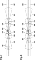
5 -8 jeweils ein Kraftfahrzeug, welches auf einer Straße fährt.
-
1 a flowchart of a method according to the first aspect, -
2 a device according to the second aspect, -
3 a machine-readable storage medium according to the fourth aspect, -
4 a block diagram and -
5 -8th each a motor vehicle driving on a road.
Im Folgenden können für gleiche Merkmale gleiche Bezugszeichen verwendet werden.The same reference symbols can be used below for the same features.
Empfangen 101 von mehreren für die Datenfusionsfunktion bestimmte Eingangsdatensätze, welche jeweils auf der jeweiligen Erfassung des Bereichs basierende Umfelddaten umfassen, welche den erfassten Bereich repräsentieren,Empfangen 103 von von der Datenfusionsfunktion ausgegebenen auf einer Datenfusion der Eingangsdatensätze basierende Ausgangsdaten,Prüfen 105 der Eingangsdatensätze und/oder der Ausgangsdaten auf Konsistenz,Ausgeben 107 eines Prüfergebnisses des Prüfens.
- Receiving 101 of a plurality of input data sets intended for the data fusion function, each of which includes environmental data based on the respective detection of the area and representing the detected area,
- Receiving 103 output data based on a data fusion of the input data sets output by the data fusion function,
- Checking 105 the input data records and/or the output data for consistency,
- Outputting 107 a test result of the testing.
Gemäß einer Ausführungsform wird basierend auf dem Prüfergebnis entschieden, ob das Infrastruktursystem abgeschaltet werden soll oder ob eine durch das Infrastruktursystem bereitgestellte Assistenzfunktion eingeschränkt werden soll.According to one embodiment, based on the test result, a decision is made as to whether the infrastructure system should be switched off or whether an assistance function provided by the infrastructure system should be restricted.
In einer Ausführungsform des Verfahrens umfasst dieses einen Schritt des Erfassens des Bereichs durch die mehreren Infrastrukturumfeldsensoren, um der Erfassung entsprechenden Umfeldsensordaten auszugeben. Die ausgegebenen Umfeldsensordaten werden zum Beispiel weiterverarbeitet, um jeweils auf der jeweiligen Erfassung des Bereichs basierende Umfelddaten zu ermitteln, welche den erfassten Bereich repräsentieren.In one embodiment of the method, this includes a step of detecting the area using the plurality of infrastructure environment sensors in order to output environment sensor data corresponding to the detection. The environment sensor data that are output are processed further, for example, in order to determine environment data that is based on the respective detection of the area and that represents the detected area.
In einer Ausführungsform des Verfahrens umfasst dieses ein Fusionieren der Eingangsdatensätze, um ein oder mehrere Fusionsergebnisse zu ermitteln, wobei die Ausgangsdaten das oder die ermittelten Fusionsergebnisse umfassen. Das heißt also insbesondere, dass das Verfahren zum Beispiel ein Ausführen der Datenfusionsfunktion umfasst.In one embodiment of the method, this includes a merging of the input data records in order to determine one or more fusion results, with the output data including the determined fusion result or results. That means ie in particular that the method includes, for example, executing the data fusion function.
Gemäß dem Blockdiagramm 401 sind mehrere Videokameras 403 umfassend jeweils einen Videosensor vorgesehen. Weiter sind mehrere Radarsensoren 405 vorgesehen. Weiter sind mehrere Lidarsensoren 407 vorgesehen. Diese Infrastrukturumfeldsensoren erfassen einen oder mehrere Bereiche einer Infrastruktur, durch welche Kraftfahrzeuge zumindest teilautomatisiert fahren können. Hierbei werden die Kraftfahrzeuge von einem Infrastruktursystem zum infrastrukturgestützten Assistieren von Kraftfahrzeugen bei einer zumindest teilautomatisierten Fahraufgabe unterstützt. Die Infrastrukturumfeldsensoren 403, 405, 407 sind von dem Infrastruktursystem umfasst.According to the block diagram 401, a plurality of
Gemäß einem Funktionsblock 409 wird eine Objekterkennung basierend auf den Videobildern der Videokameras 403 durchgeführt. Im Rahmen dieser Objekterkennung findet auch eine Spurdetektion statt.According to a
Gemäß einem Funktionsblock 411 wird eine Objekterkennung basierend auf den Radarbildern der Radarsensoren 405 durchgeführt.According to a
Gemäß einem Funktionsblock 413 wird eine Objekterkennung basierend auf den Lidarbildern der Lidarsensoren 407 durchgeführt.According to a
Ein Ergebnis der Objekterkennung gemäß dem Funktionsblock 409 wird einem Funktionsblock 415 zugeführt, gemäß welchem das Ergebnis geprüft wird. Dieses Prüfen umfasst zum Beispiel eine Plausibilitätsprüfung. Für das Prüfen wird eine digitale Karte 416 der Infrastruktur verwendet. Sollte zum Beispiel die digitale Karte 416 an einer Stelle ein Objekt zeigen, welches nicht in dem Ergebnis gemäß dem Funktionsblock 409 vorhanden ist, so wird zum Beispiel davon ausgegangen, dass ein Fehler aufgetreten ist, beispielsweise im Rahmen der Objekterkennung und/oder bereits in einer oder mehreren der Videokameras 403.A result of the object recognition according to function block 409 is supplied to a
Analog wird ein Ergebnis der Objekterkennung gemäß dem Funktionsblock 411 einem Funktionsblock 417 zugeführt, gemäß welchem analog zum Funktionsblock 415 das Ergebnis der Objekterkennung gemäß dem Funktionsblock 411 geprüft wird. Die entsprechenden Ausführungen gelten analog.Analogously, a result of the object recognition according to the
Analog wird ein Ergebnis der Objekterkennung gemäß dem Funktionsblock 413 einem Funktionsblock 419 zugeführt, gemäß welchem analog zu den Funktionsblöcken 415, 417 das Ergebnis der Objekterkennung gemäß dem Funktionsblock 413 geprüft wird. Die entsprechenden Ausführungen gelten analog.Analogously, a result of the object recognition according to the
Die Ergebnisse dieser Prüfungen werden einem Zustandsautomaten 421 übermittelt. Basierend auf diesen Ergebnissen kann der Zustandsautomat 421 beispielsweise einen Zustand der Funktionsfähigkeit des Infrastruktursystems im Hinblick auf ein infrastrukturgestütztes Assistieren von Kraftfahrzeugen ermitteln. Ein Zustand kann beispielsweise sein, dass das Infrastruktursystem vollumfänglich korrekt funktioniert. Ein Zustand kann beispielsweise sein, dass das Infrastruktursystem nur eingeschränkt funktioniert. Ein Zustand kann beispielsweise sein, dass das Infrastruktursystem vollständig fehlerhaft funktioniert.The results of these checks are communicated to a
Das geprüfte Ergebnis gemäß dem Funktionsblock 415 wird einem Funktionsblock 423 zugeführt. Das heißt also, dass dem Funktionsblock 423 ein geprüftes Ergebnis der Objekt- und Spurerkennung gemäß dem Funktionsblock 409 zugeführt wird. Gemäß dem Funktionsblock 423 werden detektierte Objekte über die Zeit verfolgt, also getrackt.The checked result according to function block 415 is fed to a
Analog wird das durch den Funktionsblock 417 geprüfte Ergebnis der Objekterkennung gemäß dem Funktionsblock 411 einem Funktionsblock 425 zugeführt. Der Funktionsblock 425 verfolgt über die Zeit die detektierten Objekte analog zum Funktionsblock 423.Analogously, the result of the object recognition checked by the
Analog wird das durch den Funktionsblock 419 geprüfte Ergebnis der Objektdetektion oder Objekterkennung gemäß dem Funktionsblock 413 an einen Funktionsblock 427 übergeben. Analog zu den Funktionsblöcken 423, 425 wird gemäß dem Funktionsblock 427 ein detektiertes Objekt oder werden mehrere detektierte Objekte über die Zeit verfolgt, also getrackt.Analogously, the result of the object detection or object recognition checked by the
Es werden also zum Beispiel jeweilige Trajektorien der detektierten Objekte in den Funktionsblöcken 423, 425, 427 ermittelt. Diese Trajektorien werden an eine Datenfusionsfunktion 429 übermittelt. Die Datenfusionsfunktion umfasst einen Funktionsblock 431, gemäß welchem die ermittelten Trajektorien, welche jeweils basierend auf Videobildern, Radarbildern und Lidarbildern ermittelt wurden, auf Konsistenz geprüft. Dieses Prüfen umfasst zum Beispiel eine Plausibilitätsprüfung der Trajektorien. Es wird hier zur weiteren Veranschaulichung auf die
Ein Ergebnis dieses Prüfens wird dem Zustandsautomaten 421 zur Verfügung gestellt, welcher basierend auf dem Ergebnis entscheiden kann, welchen Zustand das Infrastruktursystem aufweist.A result of this checking is made available to the
Die entsprechend geprüften Trajektorien werden einem Funktionsblock 433 zur Verfügung gestellt, gemäß welchem die einzelnen Trajektoriendaten fusioniert werden.The correspondingly checked trajectories are made available to a
Die Videobilder, Radarbilder und Lidarbilder werden einem Funktionsblock 435 zur Verfügung gestellt. Aus diesen Eingangsdaten erzeugt der Funktionsblock 435 für jeden Sensor die Information über die für den Sensor sichtbaren Bereiche. Mit dieser Information sind dem System Verdeckungen durch statische und dynamische Hindernisse für jeden Sensor bekannt. Die erzeugten Informationen sind die Ausgabe des Funktionsblocks 435.The video images, radar images and lidar images are provided to a
Die Ausgabe des Funktionsblocks 435 wird zum einen den Funktionsblöcken 423, 425, 427 zur Verfügung gestellt und zum anderen auch dem Funktionsblock 433 zwecks Durchführung der Fusion der Trajektorien.The output of the
Der Funktionsblock 433 gibt als Ausgangsdaten im Sinne der Beschreibung ein fusioniertes Objektdetektionsergebnis aus, welches in einem Funktionsblock 437 auf Konsistenz geprüft wird.The
Die Videobilder werden weiter einem Funktionsblock 439 zur Verfügung gestellt, gemäß welchem eine Freiraumerkennung durchgeführt wird. Die Radarbilder werden weiter einem Funktionsblock 441 zur Verfügung gestellt, gemäß welchem eine Freiraumerkennung basierend auf den Radarbildern durchgeführt wird. Die Lidarbilder werden weiter einem Funktionsblock 443 zur Verfügung gestellt, gemäß welchem eine Freiraumerkennung basierend auf den Lidarbildern durchgeführt wird.The video images are also made available to a
Entsprechende Freiraumerkennungsergebnisse der einzelnen Funktionsblöcke 439, 441, 443 werden einem Funktionsblock 445 der Datenfusionsfunktion 429 zur Verfügung gestellt, gemäß welchem die Freiraumerkennungsergebnisse zu einem fusionierten Freiraumerkennungsergebnis fusioniert werden. Der Funktionsblock 445 gibt als Ausgangsdaten im Sinne der Beschreibung das fusionierte Freiraumerkennungsergebnis an den Funktionsblock 437 aus, gemäß welchem das fusionierte Freiraumerkennungsergebnis geprüft wird.Corresponding free space detection results of the individual function blocks 439, 441, 443 are made available to a
Die Prüfschritte gemäß dem Funktionsblock 437 sind beispielsweise die vor- und/oder nachstehend beschriebenen Prüfschritte.The test steps according to the
Ein Ergebnis dieses Prüfens, also ein Prüfergebnis, wird an den Zustandsautomaten 421 ausgegeben, welcher basierend darauf entscheiden kann, welchen Zustand das Infrastruktursystem hat.A result of this check, ie a check result, is output to the
Entsprechend kann dann gemäß einem Funktionsblock 447 entschieden werden, was genau zum Beispiel an Kraftfahrzeuge, welche zumindest teilautomatisiert durch den oder die Bereiche der Infrastruktur fahren, gesendet werden soll. Accordingly, it can then be decided according to a
Sollte zum Beispiel festgestellt werden, dass gemäß dem Funktionsblock 437 eine Inkonsistenz zwischen Objektdetektionsergebnis und Freiraumerkennungsergebnis vorliegt, dann wird der entsprechende Bereich im Freiraumerkennungsergebnis als nicht frei, also als belegt, markiert und an Kraftfahrzeuge gesendet. In keinem Fall werden inkonsistente oder nicht sichtbare Bereiche als Frei gemeldet.If it is determined, for example, that according to function block 437 there is an inconsistency between the object detection result and the free space detection result, then the corresponding area in the free space detection result is marked as not free, ie as occupied, and is sent to motor vehicles. In no case are inconsistent or non-visible areas reported as free.
In einer nicht gezeigten Ausführungsform ist vorgesehen, dass analog zum Funktionsblock 431 ein entsprechender Funktionsblock vor dem Funktionsblock 445 vorgesehen ist, welcher analog zum Funktionsblock 431 die Freiraumerkennungsergebnisse prüft, beispielsweise auf Konsistenz und/oder Plausibilität prüft. Ein entsprechendes Ergebnis kann ebenfalls dem Zustandsautomaten 421 zur Verfügung gestellt werden.In an embodiment that is not shown, it is provided that, analogously to function
Die vier Erfassungsbereiche 513, 515, 517, 519 sind jeweils mittels unterschiedlich gestrichelten Linien dargestellt.The four
Der erste Infrastrukturumfeldsensor 505 und der dritte Infrastrukturumfeldsensor 509 erfassen („schauen“) entgegengesetzt der Fahrtrichtung des Kraftfahrzeugs 501, welche bezogen auf die Papierebene von links nach rechts verläuft.The first
Der zweite Infrastrukturumfeldsensor 507 und der vierte Infrastrukturumfeldsensor 511 erfassen („schauen“) in Fahrtrichtung des Kraftfahrzeugs 501.The second
Der zweite Infrastrukturumfeldsensor 507 und der dritte Infrastrukturumfeldsensor 509 erfassen beide zum in
Wie der Heatmap 523 gemäß
Sofern also die Kalibrierung erhalten bleibt und die Infrastrukturumfeldsensoren fehlerfrei funktionieren, sollte auch in Zukunft ein entsprechend ermittelter Heatmap darstellen, dass die entsprechenden Trajektorien innerhalb der Begrenzungsmarkierungen verlaufen.As long as the calibration is retained and the infrastructure environment sensors function correctly, a correspondingly determined heat map should also show in the future that the corresponding trajectories run within the boundary markings.
Bei einer Dekalibrierung und/oder einem Fehler in den Infrastrukturumfeldsensoren wird ein abweichender Heatmap erwartet. Dies ist beispielhaft in
Wann also zur Laufzeit des Infrastruktursystems, also während des Betriebs des Infrastruktursystems, ein entsprechender Heatmap ermittelt wird, so ist dies ein Zeichen dafür, dass zum Beispiel entsprechende Infrastrukturumfeldsensoren dekalibriert sind und/oder ein Fehler aufgetreten ist.So when a corresponding heat map is determined during the runtime of the infrastructure system, ie during operation of the infrastructure system, this is a sign that, for example, corresponding infrastructure environment sensors are decalibrated and/or an error has occurred.
Weiter kann beispielsweise vorgesehen sein, für das Kraftfahrzeug 501 eine Anfangsposition einer erstmaligen Erfassung durch beispielsweise den ersten Infrastrukturumfeldsensor 505 zu ermitteln. Wenn dies für mehrere Kraftfahrzeuge über die Zeit durchgeführt wird, kann ebenfalls ein Heatmap ermittelt werden, was beispielhaft in
Sofern aber die Umweltbedingungen schlechter werden, beispielsweise durch Regen oder Schnee, so kann der erste Infrastrukturumfeldsensor 505 nicht mehr Kraftfahrzeuge an seiner maximalen Erfassungsreichweite erfassen. Vielmehr sinkt eine aktuelle Erfassungsreichweite, sodass eine Anfangsposition einer erstmaligen Erfassung sich innerhalb des ersten Erfassungsbereichs 513 befindet und nicht mehr der maximalen Erfassungsreichweite entspricht. Wenn dies für mehrere Kraftfahrzeuge über die Zeit ermittelt wird, so kann wiederum ein entsprechender Heatmap ermittelt werden, was in
Wie
Zusammenfassend basiert das hier beschriebene Konzept insbesondere darauf, eine Datenfusionsfunktion mittels einer Datenfusionsüberwachungsfunktion zu überwachen und zum Beispiel ein Ergebnis der Überwachung einem Zustandsautomaten zu übermitteln. Die Datenfusionsüberwachungsfunktion hilft bei der Identifizierung von Inkonsistenzen in verschiedenen Phasen der Wahrnehmungspipeline. Auf der Grundlage der Überwachungsergebnisse entscheidet der Zustandsautomat zum Beispiel, ob Degradationsfunktionen aktiviert werden müssen. Der aktuelle Status der Degradation wird zum Beispiel am Systemausgang kommuniziert.In summary, the concept described here is based in particular on monitoring a data fusion function using a data fusion monitoring function and, for example, transmitting a result of the monitoring to a state machine. The data fusion monitor feature helps identify inconsistencies at different stages of the perception pipeline. Based on the monitoring results, the state machine decides, for example, whether degradation functions need to be activated. The current status of the degradation is communicated at the system output, for example.
Die Datenfusionsüberwachungsfunktion kann zum Beispiel eine oder mehrere der folgenden drei Möglichkeiten umfassen:
- Möglichkeit 1: Basierend auf dem Vergleich von fusionierten Freirauminformationen (fusioniertes Freiraumerkennungsergebnis) mit globalen fusionierten Objekten (fusioniertes Objektdetektionsergebnis).
- Possibility 1: Based on the comparison of fused free space information (fused free space detection result) with global fused objects (fused object detection result).
Freirauminformationen sind komplementär und schließen sich gegenseitig mit globalen fusionierten Objekten aus. Dies ist die Grundlage, auf der Inkonsistenzen zwischen zwei Informationsquellen identifiziert werden können. Beispiel: In einem bestimmten Gebiet meldet die globale Fusion ein Objekt mit 80 % Existenzwahrscheinlichkeit. Wenn die Freiflächenfusionsfunktion in demselben Gebiet mit hoher Sicherheit eine Freifläche meldet, handelt es sich um eine eindeutige Inkonsistenz, die erkannt werden kann.Free space information is complementary and mutually exclusive with global merged objects. This is the basis on which inconsistencies between two sources of information len can be identified. Example: In a certain area, the global fusion reports an object with 80% probability of existence. If the open space fusion function reports an open space in the same area with a high degree of certainty, it is a clear inconsistency that can be detected.
Bei Infrastrukturwahrnehmungssystemen können dynamische Verdeckungen aufgrund unterschiedlicher Montagepunkte und Blickwinkel der Infrastrukturumfeldsensoren auftreten. Solche Verdeckungen werden zum Beispiel in dieser Überwachungsfunktion berücksichtigt, indem die Informationen über das für jeden Sensor berechnete dynamische Sichtbarkeitsraster verwendet werden.In infrastructure perception systems, dynamic occlusions can occur due to different mounting points and viewing angles of the infrastructure environment sensors. Such occlusions are taken into account, for example, in this monitoring function by using the information about the dynamic visibility grid calculated for each sensor.
Darüber hinaus können die ermittelten Unstimmigkeiten zum Beispiel zur Anpassung der Freirauminformationen verwendet werden, um Fehlinterpretationen innerhalb des zumindest teilautomatisierten Kraftfahrzeugs zu vermeiden. Im obigen Beispiel, in dem ein Objekt mit hoher Wahrscheinlichkeit gemeldet wurde, kann die Unsicherheit des Freiraums in diesem Bereich zum Beispiel erhöht werden, um die Gesamtkonsistenz des vom System bereitgestellten Umgebungsmodells sicherzustellen.In addition, the discrepancies determined can be used, for example, to adapt the free space information in order to avoid misinterpretations within the at least partially automated motor vehicle. For example, in the example above where an object has been reported with high probability, the uncertainty of the clearance in that area can be increased to ensure the overall consistency of the environment model provided by the system.
Möglichkeit 2: Basierend auf dem Vergleich zwischen mehreren Infrastrukturumfeldsensoren.Possibility 2: Based on the comparison between several infrastructure environment sensors.
Unter Anwendung des 2-von-3-Prinzips kann die Wahrscheinlichkeit des Vorhandenseins jedes einzelnen Sensorobjekts zusammen mit der Wahrscheinlichkeit des Vorhandenseins des globalen Fusionsobjekts verwendet werden, um falsch-positive und falsch-negative Fälle zu identifizieren.Using the 2-out-of-3 principle, the probability of each sensor object's presence along with the global fusion object's probability of being present can be used to identify false-positive and false-negative cases.
Möglichkeit 3. Basierend auf den Trajektorien der erkannten Sensorobjekte.Possibility 3. Based on the trajectories of the detected sensor objects.
Ausgehend von der Tatsache, dass das Wahrnehmungssystem (Anordnung der mehreren Infrastrukturumfeldsensoren) statisch ist, kann von bestimmten Trajektorien der Objekte ausgegangen werden, die das Sichtfeld des Wahrnehmungssystems durchlaufen. Eine Ansammlung von unwahrscheinlichen Start- und Endpunkten oder Pfaden der Trajektorien kann erkannt werden. Wenn die Objektdaten in irgendeinem Stadium der Wahrnehmungspipeline unwahrscheinliche Trajektorien liefern, wird der Teil der Wahrnehmungspipeline, der diese unwahrscheinlichen Objektdaten liefert, an den Zustandsautomaten gemeldet.Based on the fact that the perception system (arrangement of the several infrastructure environment sensors) is static, certain trajectories of the objects that pass through the field of view of the perception system can be assumed. A collection of improbable start and end points or paths of the trajectories can be recognized. If the object data yields improbable trajectories at any stage in the perception pipeline, the portion of the perception pipeline that yields that unlikely object data is reported to the state machine.
Dies bietet somit den Vorteil einer Identifizierung von Inkonsistenzen, um eine geeignete Systemreaktion zu bestimmen. Zum Beispiel: wenn eine Systemdegradation erforderlich ist.This thus offers the advantage of identifying inconsistencies in order to determine an appropriate system response. For example: when system degradation is required.
Dadurch kann eine Verbesserung der Sicherheit und Leistung des Systems bewirkt werden.This can improve the security and performance of the system.
Die Wahrnehmungspipeline erhält ihre Eingangsdaten von den Infrastrukturumfeldsensoren zum Beispiel mit unterschiedlichen Messprinzipien, um das Risiko von Fehlern mit gemeinsamer Ursache zu minimieren. Von hier aus werden zum Beispiel zwei parallele Verarbeitungspfade ausgeführt:
- 1. Objektbasierte Wahrnehmung
- a) Basierend auf den empfangenen Sensordaten erzeugen sensorspezifische Objekterkennungsalgorithmen und sensorspezifische Verfolgungsalgorithmen für jeden Infrastrukturumfeldsensor Objektdaten (lokale Spuren) von verfolgten Objekten. Bereits in diesem Stadium sind Überwachungsfunktionen möglich, um die lokalen Spuren zu validieren.
- b)
Der Funktionsblock 431 überprüft den Inhalt der lokalen Spuren z.B. anhand ihrer Trajektorien. (Möglichkeit 3, oben beschrieben). - c) Die Objektfusion
gemäß dem Funktionsblock 433 kombiniert zum Beispiel: lokale Spuren, Wissen darüber, wo jeder Infrastrukturumfeldsensor in der Lage ist, Objekte zu erkennen (aus dem dynamischen Sichtbarkeitsraster), zu fusionierten Objektspuren (globale Spuren). - d)
Der Funktionsblock 437 verwendet zum Beispiel die globalen Spuren (aus dem Funktionsblock 433), die Informationen über die beitragenden Infrastrukturumfeldsensoren (aus dem Funktionsblock 433), das Wissen darüber, wo jeder Infrastrukturumfeldsensor in der Lage ist, Objekte zu erkennen (aus dem dynamischen Sichtbarkeitsraster), um falsch-positive und falsch-negative Fälle zu erkennen.
- 2. Freiraumbasierte Wahrnehmung
- a) Die sensorspezifischen Freiraumdetektoren generieren Freirauminformationen (lokaler Freiraum) auf der Grundlage der empfangenen Umfeldsensordaten.
- b) Die Freiraumfusion kombiniert die lokalen Freiräume zu einem globalen Freiraum.
- 1. Object-based perception
- a) Based on the received sensor data, sensor-specific object detection algorithms and sensor-specific tracking algorithms generate object data (local traces) of tracked objects for each infrastructure environment sensor. Monitoring functions are already possible at this stage in order to validate the local traces.
- b)
Function block 431 checks the content of the local tracks, for example using their trajectories. (Option 3, described above). - c) Object fusion according to function block 433 combines for example: local lanes, knowledge of where each infrastructure environment sensor is able to detect objects (from the dynamic visibility grid), into fused object lanes (global lanes).
- d) Function block 437 uses, for example, the global traces (from function block 433), the information about the contributing infrastructure environment sensors (from function block 433), the knowledge of where each infrastructure environment sensor is capable of detecting objects (from the dynamic visibility grid) to detect false positives and false negatives.
- 2. Free space-based perception
- a) The sensor-specific free space detectors generate free space information (local free space) based on the received environment sensor data.
- b) Free space fusion combines the local free spaces into a global free space.
Zusätzlich zur Erkennung von Falsch-Positiv und Falsch-Negativ vergleicht der Funktionsblock 437 zum Beispiel auch die globalen Spuren und den globalen Freiraum, um Inkonsistenzen zwischen ihnen zu finden (Möglichkeiten 1 und 2 oben beschrieben).For example, in addition to detecting false positives and false negatives,
Jeder Überwachungsblock entlang der Wahrnehmungspipeline meldet ein entsprechendes Überwachungsergebnis an den Zustandsautomaten 421, welcher zum Beispiel eine Ausgabe des Infrastruktursystems steuert, indem dieser über eine geeignete Systemreaktion entscheidet.Each monitoring block along the perception pipeline reports a corresponding one Monitoring result to the
Nachfolgend wird die Überwachungsfunktion, die auf den Trajektorien der Sensorobjekte basiert, näher erläutert.The monitoring function, which is based on the trajectories of the sensor objects, is explained in more detail below.
Dekalibrierte Infrastrukturumfeldsensoren können zu falschen Sensor-Objekt-Trajektorien führen (, insbesondere in Bereichen, die nur von einem einzigen Infrastrukturumfeldsensor abgedeckt werden). Diese Dekalibrierung eines einzelnen Sensors soll überwacht werden.Decalibrated infrastructure environment sensors can result in incorrect sensor-to-object trajectories (especially in areas covered by only a single infrastructure environment sensor). This decalibration of an individual sensor should be monitored.
Es wird erwartet, dass die Trajektorien der Kraftfahrzeuge im Wesentlichen den Grenzen der Fahrspuren folgen. Wenn die Fahrspuren auf der Karte und die durchschnittlichen Trajektorien nicht übereinstimmen, könnte ein dekalibrierter Sensor die Ursache dafür sein.It is expected that the trajectories of the motor vehicles essentially follow the boundaries of the lanes. If the lanes on the map and the average trajectories do not match, a decalibrated sensor could be the cause.
Außerdem ist die Leistung der Infrastrukturumfeldsensoren nicht immer gleich. Umwelteinflüsse (schlechtes Wetter, Blendung, schwaches Licht) oder eine schlechte Kalibrierung können die Erfassungsleistung der Infrastrukturumfeldsensoren beeinflussen. Diese Leistungsverschlechterung wird zum Beispiel überwacht.In addition, the performance of the infrastructure environment sensors is not always the same. Environmental influences (bad weather, glare, low light) or poor calibration can affect the detection performance of the infrastructure environment sensors. This performance degradation is monitored, for example.
Unter perfekten Bedingungen wird erwartet, dass die Trajektorien der Kraftfahrzeuge bei ähnlichen Entfernungen/Positionen erstellt werden, d. h., wenn sie in das Sichtfeld des Sensors eintreten. Das Gleiche gilt zum Beispiel für die Beendigung der Trajektorien von Kraftfahrzeugen, wenn sie das Sichtfeld des Infrastrukturumfeldsensors verlassen. Aufgrund von Umwelteinflüssen (z. B. Wetter oder Tageszeit) und/oder Dekalibrierung kann sich der Bereich der Trajektorienerstellung und/oder -beendigung im Vergleich zum normalen Verhalten ändern.Under perfect conditions, the trajectories of the motor vehicles are expected to be established at similar distances/positions, ie. that is, when they enter the sensor's field of view. The same applies, for example, to the termination of the trajectories of motor vehicles when they leave the field of view of the infrastructure environment sensor. Due to environmental influences (e.g. weather or time of day) and/or decalibration, the range of trajectory creation and/or termination may change compared to normal behavior.
Um die vergangenen Bereiche der Objekterstellung und -beendigung zu speichern, können Heatmaps verwendet werden. Der Heatmap 701 zeigt das nominale Verhalten bei der Objekterstellung. Die Objekte werden hauptsächlich an der Grenze des Sichtfeldes erzeugt. Gemäß dem Heatmap 801 wird die Objekterkennung durch die Umgebung stark beeinflusst und somit verringert sich auch der Objekterkennungsbereich. Die Objektspuren werden später an einer anderen Position als im Sollverhalten erzeugt, was durch die Verschiebung gemäß dem Heatmap 601 angezeigt wird. Ein analoger Heatmap (Wärmekarte) kann zum Beispiel für die Beendigung der Spur erstellt und überwacht werden.Heatmaps can be used to store the past ranges of object creation and termination.
ZITATE ENTHALTEN IN DER BESCHREIBUNGQUOTES INCLUDED IN DESCRIPTION
Diese Liste der vom Anmelder aufgeführten Dokumente wurde automatisiert erzeugt und ist ausschließlich zur besseren Information des Lesers aufgenommen. Die Liste ist nicht Bestandteil der deutschen Patent- bzw. Gebrauchsmusteranmeldung. Das DPMA übernimmt keinerlei Haftung für etwaige Fehler oder Auslassungen.This list of documents cited by the applicant was generated automatically and is included solely for the better information of the reader. The list is not part of the German patent or utility model application. The DPMA assumes no liability for any errors or omissions.
Zitierte PatentliteraturPatent Literature Cited
- DE 102016224074 A1 [0002]DE 102016224074 A1 [0002]
- DE 102015226116 A1 [0003]DE 102015226116 A1 [0003]
Claims (11)
Priority Applications (3)
| Application Number | Priority Date | Filing Date | Title |
|---|---|---|---|
| DE102021209670.0A DE102021209670B4 (en) | 2021-09-02 | 2021-09-02 | Concept for monitoring a data fusion function of an infrastructure system |
| US17/896,229 US20230061522A1 (en) | 2021-09-02 | 2022-08-26 | Concept for monitoring a data fusion function of an infrastructure system |
| CN202211073013.2A CN115762123A (en) | 2021-09-02 | 2022-09-02 | Solution, device and storage medium for monitoring data fusion function of infrastructure system |
Applications Claiming Priority (1)
| Application Number | Priority Date | Filing Date | Title |
|---|---|---|---|
| DE102021209670.0A DE102021209670B4 (en) | 2021-09-02 | 2021-09-02 | Concept for monitoring a data fusion function of an infrastructure system |
Publications (2)
| Publication Number | Publication Date |
|---|---|
| DE102021209670A1 true DE102021209670A1 (en) | 2023-03-02 |
| DE102021209670B4 DE102021209670B4 (en) | 2023-09-28 |
Family
ID=85175084
Family Applications (1)
| Application Number | Title | Priority Date | Filing Date |
|---|---|---|---|
| DE102021209670.0A Active DE102021209670B4 (en) | 2021-09-02 | 2021-09-02 | Concept for monitoring a data fusion function of an infrastructure system |
Country Status (3)
| Country | Link |
|---|---|
| US (1) | US20230061522A1 (en) |
| CN (1) | CN115762123A (en) |
| DE (1) | DE102021209670B4 (en) |
Cited By (1)
| Publication number | Priority date | Publication date | Assignee | Title |
|---|---|---|---|---|
| DE102024203221A1 (en) * | 2024-04-09 | 2025-10-09 | Robert Bosch Gesellschaft mit beschränkter Haftung | Method for verifying the plausibility of data from an external environmental sensor system by at least one networked road user, networked motor vehicle and infrastructure system |
Citations (3)
| Publication number | Priority date | Publication date | Assignee | Title |
|---|---|---|---|---|
| DE102015226116A1 (en) | 2015-12-18 | 2017-06-22 | Robert Bosch Gmbh | A method of assessing a hazard situation detected by at least one sensor of a vehicle, a method of controlling a replay of a hazard alert, and a method of displaying a hazard alert |
| DE102016224074A1 (en) | 2016-12-02 | 2018-06-07 | Robert Bosch Gmbh | Method and device for operating a vehicle |
| DE102020203058A1 (en) | 2020-03-10 | 2021-09-16 | Siemens Mobility GmbH | Automated reliability test of an infrastructure-side monitoring sensor system |
Family Cites Families (2)
| Publication number | Priority date | Publication date | Assignee | Title |
|---|---|---|---|---|
| WO2021118675A1 (en) * | 2019-12-12 | 2021-06-17 | Intel Corporation | Vulnerable road user safety technologies based on responsibility sensitive safety |
| CN115997244A (en) * | 2020-06-08 | 2023-04-21 | 英特尔公司 | Collective Sensing Service in Intelligent Transportation Systems |
-
2021
- 2021-09-02 DE DE102021209670.0A patent/DE102021209670B4/en active Active
-
2022
- 2022-08-26 US US17/896,229 patent/US20230061522A1/en not_active Abandoned
- 2022-09-02 CN CN202211073013.2A patent/CN115762123A/en active Pending
Patent Citations (3)
| Publication number | Priority date | Publication date | Assignee | Title |
|---|---|---|---|---|
| DE102015226116A1 (en) | 2015-12-18 | 2017-06-22 | Robert Bosch Gmbh | A method of assessing a hazard situation detected by at least one sensor of a vehicle, a method of controlling a replay of a hazard alert, and a method of displaying a hazard alert |
| DE102016224074A1 (en) | 2016-12-02 | 2018-06-07 | Robert Bosch Gmbh | Method and device for operating a vehicle |
| DE102020203058A1 (en) | 2020-03-10 | 2021-09-16 | Siemens Mobility GmbH | Automated reliability test of an infrastructure-side monitoring sensor system |
Cited By (1)
| Publication number | Priority date | Publication date | Assignee | Title |
|---|---|---|---|---|
| DE102024203221A1 (en) * | 2024-04-09 | 2025-10-09 | Robert Bosch Gesellschaft mit beschränkter Haftung | Method for verifying the plausibility of data from an external environmental sensor system by at least one networked road user, networked motor vehicle and infrastructure system |
Also Published As
| Publication number | Publication date |
|---|---|
| US20230061522A1 (en) | 2023-03-02 |
| CN115762123A (en) | 2023-03-07 |
| DE102021209670B4 (en) | 2023-09-28 |
Similar Documents
| Publication | Publication Date | Title |
|---|---|---|
| DE102019002487A1 (en) | Method for checking a surroundings detection sensor of a vehicle and method for operating a vehicle | |
| DE102016207463A1 (en) | Method and device for operating at least one vehicle with respect to at least one passable object in the vicinity of the at least one vehicle | |
| EP4007891B1 (en) | Method and device for locating a vehicle in a surrounding area | |
| EP4469943B1 (en) | Method for detecting ghost objects in sensor measurements | |
| DE102019008093A1 (en) | Method for merging sensor data from a large number of detection devices using a sparse occupancy grid, as well as a driver assistance system | |
| DE102022102782A1 (en) | Driver assistance system and method for operating a driver assistance system | |
| DE102016001955A1 (en) | Server device and method for determining correction data for a configuration of a driver assistance device of a motor vehicle | |
| DE102017206344A1 (en) | Driver assistance system for a vehicle | |
| DE102021201130A1 (en) | Method for infrastructure-supported assistance of several motor vehicles | |
| DE102021212493A1 (en) | Method for infrastructure-supported assistance in a motor vehicle | |
| DE102021209670B4 (en) | Concept for monitoring a data fusion function of an infrastructure system | |
| WO2023131603A1 (en) | Method for optimizing the environment sensing for a driving assistance system by means of an additional reference sensor system | |
| DE102019127322A1 (en) | Method for detecting objects in a vehicle environment, device for data processing, computer program product and computer-readable data carrier | |
| WO2022167232A1 (en) | Device for assisting a motor vehicle with support from an infrastructure | |
| DE102021209817A1 (en) | Process for the multi-stage fusion of measurement data | |
| DE102019215263A1 (en) | Method and device for driving a motor vehicle in a lane | |
| DE102022202717A1 (en) | Method for testing a chain of effects | |
| DE102021212492A1 (en) | Method for infrastructure-supported assistance in a motor vehicle | |
| DE102021005053A1 (en) | Method for merging a large number of sensor data by means of an electronic computing device, as well as a driver assistance system | |
| DE102021113767A1 (en) | Monitoring device and method for monitoring an overall system made up of several different subsystems for faults and motor vehicles | |
| DE102020213661A1 (en) | Method for analyzing the surroundings of a motor vehicle | |
| DE102019128947A1 (en) | Determination of a traffic light status | |
| DE102023206282A1 (en) | method for controlling a vehicle | |
| DE102022131849A1 (en) | Method for providing driving side information | |
| DE102021211515A1 (en) | Method and device for operating an automated vehicle |
Legal Events
| Date | Code | Title | Description |
|---|---|---|---|
| R012 | Request for examination validly filed | ||
| R016 | Response to examination communication | ||
| R018 | Grant decision by examination section/examining division | ||
| R020 | Patent grant now final |