DE102018220115A1 - Location-based radar, lidar, and GCP data - Google Patents
Location-based radar, lidar, and GCP data Download PDFInfo
- Publication number
- DE102018220115A1 DE102018220115A1 DE102018220115.3A DE102018220115A DE102018220115A1 DE 102018220115 A1 DE102018220115 A1 DE 102018220115A1 DE 102018220115 A DE102018220115 A DE 102018220115A DE 102018220115 A1 DE102018220115 A1 DE 102018220115A1
- Authority
- DE
- Germany
- Prior art keywords
- location
- data
- grid
- file
- mobile terminal
- Prior art date
- Legal status (The legal status is an assumption and is not a legal conclusion. Google has not performed a legal analysis and makes no representation as to the accuracy of the status listed.)
- Pending
Links
Images

Classifications
-
- G—PHYSICS
- G01—MEASURING; TESTING
- G01C—MEASURING DISTANCES, LEVELS OR BEARINGS; SURVEYING; NAVIGATION; GYROSCOPIC INSTRUMENTS; PHOTOGRAMMETRY OR VIDEOGRAMMETRY
- G01C21/00—Navigation; Navigational instruments not provided for in groups G01C1/00 - G01C19/00
- G01C21/38—Electronic maps specially adapted for navigation; Updating thereof
- G01C21/3863—Structures of map data
- G01C21/387—Organisation of map data, e.g. version management or database structures
- G01C21/3881—Tile-based structures
-
- G—PHYSICS
- G06—COMPUTING OR CALCULATING; COUNTING
- G06F—ELECTRIC DIGITAL DATA PROCESSING
- G06F16/00—Information retrieval; Database structures therefor; File system structures therefor
- G06F16/20—Information retrieval; Database structures therefor; File system structures therefor of structured data, e.g. relational data
- G06F16/29—Geographical information databases
Landscapes
- Engineering & Computer Science (AREA)
- Remote Sensing (AREA)
- Radar, Positioning & Navigation (AREA)
- Databases & Information Systems (AREA)
- Physics & Mathematics (AREA)
- General Physics & Mathematics (AREA)
- Automation & Control Theory (AREA)
- Theoretical Computer Science (AREA)
- Data Mining & Analysis (AREA)
- General Engineering & Computer Science (AREA)
- Traffic Control Systems (AREA)
- Mobile Radio Communication Systems (AREA)
Abstract
Die Erfindung betrifft ein Verfahren zum Generieren eines Datensatz-Gitters (2) mit ortsbezogenen Daten, mit den folgenden Schritten: Bereitstellen eines Datensatzes (1) mit ortsbezogenen Daten für eine Region (5), wobei die ortsbezogenen Daten zumindest ortsbezogene Radardaten, ortsbezogene Lidardaten und ortsbezogene GCP-Daten umfassen; Bereitstellen eines Gitters, welches die Region in Teilregionen unterteilt, mit einer Vielzahl von Gitterzellen (3, 3'); Zuordnen der ortsbezogenen Daten zu einer Gitterzelle (3, 3'); Gitterzellenweise Speichern der ortsbezogenen Daten in jeweils einer Datei (6), derart dass die Datei die ortsbezogenen Daten einer Gitterzelle (3, 3') aufweist. Die Erfindung betrifft ferner ein Übertragungsverfahren für ortsbezogene Daten zwischen einem Server und einem mobilen Endgerät mit den folgenden Schritten: Übermitteln (V1) eines Orts oder einer Region von dem mobilen Endgerät zu dem Server; Zuordnen (V2) des Orts zu einer ersten Gitterzelle (3) eines Gitters einer Region (5); Übertragen (V5) einer Datei (6) mit von ortsbezogenen Daten, welche zumindest ortsbezogene Radardaten, ortsbezogene Lidardaten und ortsbezogene GCP-Daten umfassen und welche der zugeordneten ersten Gitterzelle (3) zugehörig sind, von dem Server zu dem mobilen Endgerät.The invention relates to a method for generating a data record grid (2) with location - related data, comprising the following steps: providing a data record (1) with location - related data for a region (5), the location - based data at least location - related radar data, location - related lidar data and include location-based GCP data; Providing a grid which divides the region into subregions with a plurality of grid cells (3, 3 '); Assigning the location-related data to a grid cell (3, 3 '); Storage of the location-related data in grid cells in each case in a file (6), such that the file has the location-related data of a grid cell (3, 3 '). The invention further relates to a transmission method for location-related data between a server and a mobile terminal, comprising the following steps: transmitting (V1) a location or region from the mobile terminal to the server; Assigning (V2) the location to a first grid cell (3) of a grid of a region (5); Transmission (V5) of a file (6) with location-related data, which includes at least location-related radar data, location-related lidar data and location-related GCP data and which are associated with the assigned first grid cell (3), from the server to the mobile terminal.
Description
GEBIET DER ERFINDUNGFIELD OF THE INVENTION
Die vorliegende Erfindung betrifft ein Verfahren zum Generieren eines Datensatz-Gitters mit ortsbezogenen Daten sowie ein Übertragungsverfahren für ortsbezogene Daten zwischen einem Server und einem mobilen Endgerät.The present invention relates to a method for generating a data record grid with location-related data and a transmission method for location-related data between a server and a mobile terminal.
TECHNISCHER HINTERGRUNDTECHNICAL BACKGROUND
Webbasierte Navigationsanwendungen sind bekannt. Hierbei werden häufig Standortdaten eines mobilen Endgeräts an einen zentralen Server übertragen. Aufgrund des Standorts wählt der zentrale Server eine geeignete Datei mit einer Landkarte aus und überträgt die Datei an das mobile Endgerät, welches die Datei zu Navigationszwecken auswertet.Web-based navigation applications are known. Here, location data of a mobile device is often transmitted to a central server. Based on the location, the central server selects a suitable file with a map and transmits the file to the mobile terminal, which evaluates the file for navigation purposes.
Es ist davon auszugehen, dass künftig neben Landkartendaten auch Radar-, Lidar- und GCP-Daten im Rahmen webbasierter Navigationsanwendungen von einem zentralen Server auf ein mobiles Endgerät zu übertragen sind.It can be assumed that in the future, in addition to map data, radar, lidar and GCP data will also have to be transferred from a central server to a mobile device as part of web-based navigation applications.
ZUSAMMENFASSUNG DER ERFINDUNGSUMMARY OF THE INVENTION
Vor diesem Hintergrund liegt der Erfindung die Aufgabe zugrunde, ein Verfahren anzugeben, welches eine optimierte Übertragung von Radar-, Lidar- und GCP-Daten ermöglicht.Against this background, the invention is based on the object of specifying a method which enables an optimized transmission of radar, lidar and GCP data.
Erfindungsgemäß wird diese Aufgabe durch ein Verfahren zum Generieren eines Datensatz-Gitters mit ortsbezogenen Daten mit den Merkmalen des Patentanspruchs 1 und/oder durch ein Übertragungsverfahren für ortsbezogene Daten zwischen einem Server und einem mobilen Endgerät mit den Merkmalen des Patentanspruchs 7 gelöst.According to the invention, this object is achieved by a method for generating a data record grid with location-related data with the features of
Demgemäß ist vorgesehen:
- - ein Verfahren zum Generieren eines Datensatz-Gitters mit ortsbezogenen Daten, mit den folgenden Schritten: Bereitstellen eines Datensatzes mit ortsbezogenen Daten für eine Region, wobei die ortsbezogenen Daten zumindest ortsbezogene Radardaten, ortsbezogene Lidardaten und ortsbezogene GCP-Daten umfassen; Bereitstellen eines Gitters, welches die Region in Teilregionen unterteilt, mit einer Vielzahl von Gitterzellen; Zuordnen der ortsbezogenen Daten zu einer Gitterzelle; sowie gitterzellenweise Speichern der ortsbezogenen Daten in jeweils einer Datei, derart dass die Datei die ortsbezogenen Daten einer Gitterzelle aufweist, wobei die gitterzellenweise gespeicherten Dateien das Datensatz-Gitter bilden; sowie
- - ein Übertragungsverfahren für ortsbezogene Daten zwischen einem Server und einem mobilen Endgerät mit den folgenden Schritten: Übermitteln eines Orts oder einer Region von dem mobilen Endgerät zu dem Server; Zuordnen des Orts zu einer ersten Gitterzelle eines Gitters einer Region; Übertragen einer Datei mit von ortsbezogenen Daten, welche zumindest ortsbezogene Radardaten, ortsbezogene Lidardaten und ortsbezogene GCP-Daten umfassen und welche der zugeordneten ersten Gitterzelle zugehörig sind, von dem Server zu dem mobilen Endgerät.
- A method for generating a data record grid with location-related data, comprising the following steps: providing a data record with location-based data for a region, the location-based data comprising at least location-based radar data, location-related lidar data and location-related GCP data; Providing a grid that divides the region into sub-regions with a plurality of grid cells; Assigning the location-related data to a grid cell; as well as storage of the location-related data in grid cells in each case in a file, such that the file has the location-related data of a grid cell, the files stored in grid cell form the data record grid; such as
- a transmission method for location-based data between a server and a mobile terminal, comprising the following steps: transmitting a location or region from the mobile terminal to the server; Assigning the location to a first grid cell of a grid of a region; Transmission of a file with location-related data, which includes at least location-related radar data, location-related lidar data and location-related GCP data and which are associated with the assigned first grid cell, from the server to the mobile terminal.
Kraftfahrzeuge im Sinne dieser Patentanmeldung sind motorgetriebene Landfahrzeuge. Davon sind auch Schienenfahrzeuge umfasst.Motor vehicles in the sense of this patent application are motor-driven land vehicles. Rail vehicles are also included.
„Echtzeit“ bedeutet, dass das Verfahren simultan zur Realität abläuft.“Real time” means that the process runs simultaneously with reality.
Ein Datensatz umfasst eine Gruppe von Daten. In dieser Anmeldung umfasst ein Datensatz zumindest Radardaten, Lidardaten und GCP-Daten.A data set comprises a group of data. In this application, a data set comprises at least radar data, lidar data and GCP data.
Ein Gitter unterteilt Daten in Gitterzellen. Eckpunkte bzw. Randpunkte der Gitterzellen werden auch als Gitterpunkte bezeichnet. Der Abstand zwischen zwei Gitterpunkten wird als Schrittweite bezeichnet. Die Daten können dabei hinsichtlich beliebig vieler Parameter unterteilt werden. Ein Beispiel für ein Gitter der Erdoberfläche ist ein Gitter aus Längen- und Breitengraden. Es versteht sich, dass sich auch andere Gitter der Erdoberfläche, beispielsweise in einem anderen Koordinatensystem, erzeugen lassen. Gitterzellenweises Speichern bedeutet, dass Daten gitterzellenweise abgelegt werden und abrufbar sind.A grid divides data into grid cells. Corner points or edge points of the grid cells are also referred to as grid points. The distance between two grid points is called the step size. The data can be divided according to any number of parameters. An example of a grid of the earth's surface is a grid of degrees of longitude and latitude. It goes without saying that other grids of the earth's surface can also be generated, for example in a different coordinate system. Storage by grid cells means that data are stored and can be called up by grid cells.
In einem Gitter mit konstanter Schrittweite sind alle Gitterzellen in dem dem Gitter zugrundeliegenden Koordinatensystem des Gitters gleich groß. In einem Gitter mit verschiedenen Schrittweiten sind die Gitterzellen unterschiedlich groß. Dementsprechend lässt sich die Schrittweite lokal, beispielsweise anhand einer Auflösung der Daten in dem Gitter einstellen. Diesbezüglich spricht man auch von Schrittweitensteueru ng.In a grid with a constant step size, all grid cells in the coordinate system of the grid on which the grid is based are of the same size. In a grid with different step sizes, the grid cells are of different sizes. Accordingly, the step size can be set locally, for example on the basis of a resolution of the data in the grid. In this regard, one also speaks of step size control.
Dementsprechend ist ein Datensatz-Gitter ein Datensatz dessen Daten in Gitterzellen unterteilt wurden.Accordingly, a data set grid is a data set whose data has been divided into grid cells.
Ortsbezogene Daten sind Daten, die eine Ortsinformation enthalten. Beispielsweise sind spatio-temporäre Daten, die einen Zusammenhang zwischen einer Ortsangabe und der Zeit herstellen, ortsbezogene Daten.Location-related data is data that contains location information. For example, spatio-temporary data that establish a connection between a location and time is location-related data.
Radar (engl. für „radio detection and ranging) ist die Bezeichnung für verschiedene Erkennungs- und Ortungsverfahren und -geräte auf der Basis elektromagnetischer Wellen im Radiofrequenzbereich (Funkwellen). Ein Radargerät ist ein Gerät, das elektromagnetische Wellen gebündelt aussendet, die von Objekten reflektierten Echos empfängt und auswertet. So können Informationen über die Objekte gewonnen werden. Meist handelt es sich um eine Ortung (Bestimmung von Entfernung und Winkel). Aus den empfangenen, vom Objekt reflektierten Wellen können u. a. folgende Informationen gewonnen werden: der Winkel und die Entfernung zum Objekt, die Relativbewegung zwischen Sender und Objekt, die Wegstrecke und die Absolutgeschwindigkeit des Objektes, Konturen oder Bilder des Objektes.Radar (English for "radio detection and ranging) is the name for various detection and location methods and devices on the Basis of electromagnetic waves in the radio frequency range (radio waves). A radar device is a device that emits bundled electromagnetic waves, which receives and evaluates echoes reflected from objects. In this way, information about the objects can be obtained. It is usually a location (determination of distance and angle). The following information can be obtained from the waves received and reflected by the object: the angle and the distance to the object, the relative movement between the transmitter and the object, the distance and the absolute speed of the object, contours or images of the object.
Lidar (engl. light detection and ranging), auch Ladar (laser detection and ranging), ist eine dem Radar verwandte Methode zur optischen Abstands- und Geschwindigkeitsmessung sowie zur Fernmessung atmosphärischer Parameter. Statt der Radiowellen wie beim Radar werden Laserstrahlen verwendet.Lidar (English: light detection and ranging), also Ladar (laser detection and ranging), is a method related to radar for optical distance and speed measurement and for remote measurement of atmospheric parameters. Instead of the radio waves as with radar, laser beams are used.
GCP (engl. Ground Control Point)-Daten werden auch Passpunkte oder Referenzpunkte genannt. Sie werden als Orientierungspunkte in einem Messbild verwendet. Es handelt sich dabei um Punkte im Gelände, deren Lage in einem entsprechenden (Gelände-) Koordinatensystem bekannt ist und die in dem Messbild eindeutig zu erkennen sind. Es werden drei Arten von GCP-Daten unterschieden: Vollpasspunkte, bei denen die Raumkoordinaten X, Y und Z bekannt sind, Lagepasspunkte, bei denen die Lagekoordinaten X und Y bekannt sind und Höhenpasspunkte, bei denen die Höhenkoordinate Z bekannt ist.GCP (Ground Control Point) data is also called control points or reference points. They are used as landmarks in a measurement image. These are points in the terrain, the position of which is known in a corresponding (terrain) coordinate system and which can be clearly recognized in the measurement image. A distinction is made between three types of GCP data: full control points where the spatial coordinates X, Y and Z are known, position control points where the position coordinates X and Y are known and height control points where the height coordinate Z is known.
Eine Region ist/sind beispielsweise ein oder mehrere Kontinent/e, ein Staat oder ein Bundesland.A region is, for example, one or more continents, a state or a federal state.
Eine Navigationssoftware berechnet mit Hilfe von Positionsbestimmung (Satellit, Funk, GSM bzw. inertes oder autonomes System) und Geoinformationen (Topologie-, Straßen-, Luft- oder Seekarten) eine Zielführung zu einem gewählten Ort oder eine Route unter Beachtung gewünschter Kriterien.A navigation software uses route determination (satellite, radio, GSM or inert or autonomous system) and geographic information (topology, road, air or sea maps) to calculate a route to a selected location or a route, taking into account the desired criteria.
Mobile Endgeräte sind Geräte, die aufgrund ihrer Größe und ihres Gewichts tragbar oder in einem mobilen Objekt, z.B. einem Fahrzeug, montiert sind und somit mobil einsetzbar sind. Ein Beispiel für ein mobiles Endgerät ist ein Navigationsgerät, ein Smartphone oder ein PDA.Mobile devices are devices that, due to their size and weight, are portable or in a mobile object, e.g. a vehicle, are mounted and can therefore be used mobile. An example of a mobile device is a navigation device, a smartphone or a PDA.
Ein Server (engl. server) ist ein Computerprogramm oder ein Computer, der Computerfunktionalitäten wie Dienstprogramme, Daten oder andere Ressourcen bereitstellt, damit andere Computer oder Programme („Clients“) darauf zugreifen können, meist über ein Netzwerk.A server is a computer program or a computer that provides computer functionalities such as utilities, data or other resources so that other computers or programs (“clients”) can access them, usually via a network.
Ein Grenzbereich einer Gitterzelle ist ein Bereich in der Nähe vom Rand der Gitterzelle. Der Grenzbereich kann absolut vorgegeben sein, beispielsweise der Bereich, der einen Abstand von höchstens 500 m zum Rand der Gitterzelle aufweist, oder relativ zur Gitterzelle vorgegeben sein, beispielsweise der Bereich, der einen Abstand von höchstens 3 % der Länge der Gitterzelle zum Rand der Gitterzelle aufweist.A boundary area of a grid cell is an area near the edge of the grid cell. The limit area can be specified in absolute terms, for example the area that is at a distance of at most 500 m from the edge of the grid cell, or may be specified relative to the grid cell, for example the area that is at a distance of at most 3% of the length of the grid cell from the edge of the grid cell having.
Computerprogrammprodukte umfassen in der Regel eine Folge von Befehlen, durch die die Hardware bei geladenem Programm veranlasst wird, ein bestimmtes Verfahren durchzuführen, das zu einem bestimmten Ergebnis führt.Computer program products typically include a sequence of instructions that cause the hardware, when the program is loaded, to perform a specific procedure that leads to a specific result.
Ein Dateiformat definiert die Syntax und Semantik von Daten innerhalb einer Datei. Es stellt damit eine bidirektionale Abbildung von Information auf einen eindimensionalen binären Speicher dar.A file format defines the syntax and semantics of data within a file. It thus represents a bidirectional mapping of information onto a one-dimensional binary memory.
Ein Datenträger, Datenspeicher oder Speichermedium dient zur Speicherung von Daten.A data carrier, data memory or storage medium is used to store data.
Die grundlegende Idee der Erfindung ist es, einen Datensatz mit ortsbezogenen Radardaten, Liederdaten und GCP-Daten anwendungsspezifisch hinsichtlich einer von dem Datensatz abgedeckten Region anzupassen.The basic idea of the invention is to adapt a data record with location-specific radar data, song data and GCP data in an application-specific manner with regard to a region covered by the data record.
Aufgrund dessen lassen sich Datenpakete im Internet bereitstellen, welche ein Nutzer über ein mobiles Endgerät herunterladen kann. Somit ist gewährleistet, dass ein Nutzer über das Internet auch Zugang zu hoch aufgelösten Datensätzen hat bzw. das dessen Download durch eine angemessene Reduzierung der Datengröße beschleunigt werden kann.As a result, data packets can be made available on the Internet, which a user can download via a mobile device. This ensures that a user has access to high-resolution data records via the Internet, and that downloading can be accelerated by an appropriate reduction in data size.
Vorteilhafte Ausgestaltungen und Weiterbildungen ergeben sich aus den weiteren Unteransprüchen sowie aus der Beschreibung unter Bezugnahme auf die Figuren der Zeichnung.Advantageous refinements and developments result from the further subclaims and from the description with reference to the figures of the drawing.
Gemäß einer bevorzugten Weiterbildung der Erfindung weist das Gitter eine konstante Schrittweite auf. Somit lässt sich die Rechenkapazität des Verfahrens reduzieren, da die Schrittweite nicht gesondert per adaptiver Schrittweitensteuerung berechnet werden muss, sondern vorgegeben ist.According to a preferred development of the invention, the grating has a constant step size. The computing capacity of the method can thus be reduced since the step size does not have to be calculated separately by means of adaptive step size control, but is predefined.
Es kann vorgesehen sein, dass für eine Region mehrere Datensatz-Gitter mit einer jeweils konstanten Schrittweite, wobei sich die Schrittweite der Datensatz-Gitter voneinander unterscheiden, bereitgestellt werden.It can be provided that a plurality of data record grids are provided for a region, each with a constant step size, the step size of the data record grids differing from one another.
Alternativ kann es vorteilhaft sein, wenn das Gitter verschiedene Schrittweiten aufweist. In diesem Fall lässt sich die Schrittweite während des Erzeugen des Gitters einstellen. Beispielsweise kann vorgesehen sein, dass das Gitter in einem städtischen Gebiet eine kleinere Schrittweite aufweist als in einem außerörtlichen Gebiet.Alternatively, it can be advantageous if the grating has different step sizes. In this case, the step size can be set while the grid is being generated. For example, it can be provided that the grid in an urban Area is smaller than in an extra-urban area.
Sowohl für Gitter mit konstanter Schrittweite als auch für Gitter mit verschiedenen Schrittweiten ist es dabei zweckmäßig, wenn ein Gitter hinsichtlich einer Größe der Gitterzellen und/oder hinsichtlich einer Anzahl der Gitterzellen ausgewählt wird.For grids with constant step size as well as for grids with different step sizes, it is expedient if a grid is selected with regard to the size of the grid cells and / or with regard to the number of grid cells.
Dementsprechend lässt sich bei einer konstanten Schrittweite beispielsweise bestimmen, dass die Region in eine bestimmte Anzahl an Gitterzellen unterteilt wird.Accordingly, with a constant step size, it can be determined, for example, that the region is divided into a certain number of grid cells.
Dementsprechend lässt sich bei einer variablen Schrittweite beispielsweise bestimmen, dass eine Teilregion der Region in eine bestimmte Anzahl an Gitterzellen unterteilt wird, bzw. dass eine Gitterzelle in weitere untergeordnete Gitterzellen unterteilt wird oder dass mehrere Gitterzellen zu einer Gitterzelle zusammengefasst werden.Accordingly, with a variable step size, it can be determined, for example, that a partial region of the region is divided into a certain number of grid cells, or that a grid cell is divided into further subordinate grid cells or that a plurality of grid cells are combined to form a grid cell.
Dies ist besonders vorteilhaft, wenn der Ort einer Gitterzelle Vorhersagen über einen denkbaren Geschwindigkeitsbereich, mit dem sich ein mobiles Endgerät in der Gitterzelle bewegen könnte, ermöglicht. Beispielsweise ist es sinnvoll, die Größe der Gitterzelle zu erhöhen, wenn zu erwarten ist, dass mobile Endgeräte sich in der Gitterzelle mit hoher Geschwindigkeit bewegen. Gegebenenfalls kann in diesem Fall auch die Datenauflösung reduziert werden, um Einbußen bei der Übertragungszeit zu kompensieren.This is particularly advantageous if the location of a grid cell enables predictions about a conceivable speed range with which a mobile terminal device could move in the grid cell. For example, it makes sense to increase the size of the grid cell if it can be expected that mobile terminals will move at high speed in the grid cell. If necessary, the data resolution can also be reduced in this case in order to compensate for losses in the transmission time.
Gemäß einer bevorzugten Weiterbildung der Erfindung ist die Datei eingerichtet, von einer Navigationssoftware eines mobilen Endgeräts ausgewertet zu werden. Somit lässt sich gewährleisten, dass die Navigationssoftware online Zugriff auf das Datensatzgitter hat.According to a preferred development of the invention, the file is set up to be evaluated by navigation software of a mobile terminal. This ensures that the navigation software has online access to the data record grid.
Gemäß einer bevorzugten Weiterbildung des Übertragungsverfahrens entspricht der übermittelte Ort dem Standort des mobilen Endgeräts. Somit lässt sich ein Übertragungsverfahren für Echtzeit-Anwendungen bereitstellen. Das bedeutet, dass das Übertragungsverfahren nicht im Vorfeld einer Anwendung durchgeführt werden muss.According to a preferred development of the transmission method, the transmitted location corresponds to the location of the mobile terminal. A transmission method for real-time applications can thus be provided. This means that the transmission process does not have to be carried out in advance of an application.
Dabei ist es ferner zweckmäßig, wenn serverseitig ermittelt wird, wenn sich das mobile Endgerät in einem Grenzbereich einer ersten Gitterzelle befindet. Somit lässt sich Rechenleistung von dem mobilen Endgerät auf den Server auslagern. Insbesondere ist es nicht erforderlich, dass die Position eines mobilen Endgeräts innerhalb einer Gitterzelle von dem mobilen Endgerät überwacht wird.It is also expedient if it is determined on the server side when the mobile terminal is in a border area of a first grid cell. This means that computing power can be transferred from the mobile device to the server. In particular, it is not necessary that the position of a mobile terminal within a grid cell is monitored by the mobile terminal.
Dabei ist es auch zweckmäßig, wenn serverseitig wenigstens eine zu der ersten Gitterzelle benachbarte nächste Gitterzelle, innerhalb welcher ein zukünftiger Standort des mobilen Endgerät liegen könnte, ermittelt wird und die ortsbezogenen Daten der wenigstens einen nächsten Gitterzelle von dem Server zu dem mobilen Endgerät übertragen werden. Somit lässt sich gewährleisten, dass der Download einer nächsten Gitterzelle automatisch gestartet wird. Somit lässt sich verhindern, dass dem mobilen Endgerät nach dem Verlassen einer Gitterzelle keine relevanten ortsbezogenen Daten zur Verfügung stehen.It is also expedient here if at least one next grid cell adjacent to the first grid cell, within which a future location of the mobile terminal device could be located, is determined on the server side and the location-related data of the at least one next grid cell are transmitted from the server to the mobile terminal device. This ensures that the next grid cell download starts automatically. This prevents the mobile terminal device from having any relevant location-related data available after leaving a grid cell.
Gemäß einer bevorzugten Weiterbildung der Erfindung wird ferner eine Geschwindigkeit des mobilen Endgeräts ermittelt. Somit lässt sich beispielsweise die verbleibende Zeit in einer Gitterzelle abschätzen. Dies ist vorteilhaft, um beispielsweise eine Übertragungsgeschwindigkeit oder Übertragunsstartzeitpunkt zum Übertragen der Datei einzustellen.According to a preferred development of the invention, a speed of the mobile terminal is also determined. This means, for example, that the remaining time in a grid cell can be estimated. This is advantageous, for example, in order to set a transfer speed or transfer start time for transferring the file.
Gemäß einer bevorzugten Weiterbildung der Erfindung wird ferner eine Größe und/oder eine Datenauflösung einer zu übertragenden Gitterzelle ausgewählt. Beispielsweise kann vorgesehen sein, dass eine Datenauflösung verringert wird, wenn eine hohe Geschwindigkeit des mobilen Endgeräts ermittelt wird.According to a preferred development of the invention, a size and / or a data resolution of a grid cell to be transmitted is also selected. For example, it can be provided that data resolution is reduced when a high speed of the mobile terminal is determined.
Gemäß einer bevorzugten Weiterbildung der Erfindung wird vor dem Übertragen der Datei ein geeignetes Dateiformat ausgewählt und die Datei wird gegebenenfalls in das Dateiformat konvertiert. Somit lässt sich das Übertragungsverfahren auch von Endgeräten abrufen, die verschiedene Dateiformate verwenden bzw. ist es nicht erforderlich, eine Datei mit ortsbezogenen Daten einer Region in mehreren Dateiformaten bereitzustellen. Stattdessen ist es denkbar, die Datei in einem komprimierten Dateiformat zu speichern und serverseitig oder endgeräteseitig in ein lesbares Dateiformat zu konvertieren.According to a preferred development of the invention, a suitable file format is selected before the file is transmitted, and the file is optionally converted into the file format. The transmission method can thus also be called up from end devices which use different file formats, or it is not necessary to provide a file with location-related data of a region in several file formats. Instead, it is conceivable to save the file in a compressed file format and to convert it into a readable file format on the server side or on the terminal device side.
Gemäß einer bevorzugten Weiterbildung der Erfindung wird eine Übertragungsgeschwindigkeit der Datei mit ortsbezogenen Daten geschätzt oder ermittelt und die Datenauflösung der Datei und/oder eine Größe der Gitterzelle wird aufgrund der Übertragungsgeschwindigkeit angepasst. Somit lässt sich verhindern, dass aufgrund von beispielsweise spärlicher Netzabdeckung die Übertragung der Datei soweit verzögert wird, dass das mobile Endgerät eine Gitterzelle verlassen hat, bevor der Download der nächsten Gitterzelle abgeschlossen ist.According to a preferred development of the invention, a transmission speed of the file with location-related data is estimated or determined, and the data resolution of the file and / or a size of the grid cell is adapted on the basis of the transmission speed. This prevents the transmission of the file being delayed to such an extent, for example due to sparse network coverage, that the mobile terminal has left a grid cell before the download of the next grid cell has been completed.
Es versteht sich, dass vorteilhafte Schritte eines Verfahrens zum Generieren eines Datensatz-Gitters alternativ auch im Rahmen des Übertragungsverfahrens durchgeführt werden können. Beispielsweise ist es auch denkbar, dass das Übertragungsverfahren eine Schrittweite einer Gitterzelle steuert, wenn ein Datensatz-Gitter mit einer konstanten Schrittweite generiert wurde. Dementsprechend können vorteilhafte Schritte eines Übertragungsverfahrens unter Umständen auch bereits im Rahmen eines Verfahrens zum Generieren eines Datensatz-Gitters durchgeführt werden. Beispielsweise kann vorgesehen sein, dass ein Datensatz-Gitter Informationen über eine bekannte Netzabdeckung enthält, woraufhin sich eine mögliche Übertragungsgeschwindigkeit abschätzen lässt. In diesem Fall ist es denkbar, die Größe oder die Datenauflösung von Gitterzellen in Abhängigkeit der Netzabdeckung anzupassen.It goes without saying that advantageous steps of a method for generating a data record grid can alternatively also be carried out as part of the transmission method. For example, it is also conceivable that the transmission method controls a step size of a grid cell if a data record grid has a constant one Increment was generated. Accordingly, advantageous steps of a transmission method can possibly already be carried out as part of a method for generating a data record grid. For example, it can be provided that a data record grid contains information about a known network coverage, whereupon a possible transmission speed can be estimated. In this case, it is conceivable to adapt the size or the data resolution of grid cells depending on the network coverage.
Sofern die Netzabdeckung eines Gebiets in einem Datensatz-Gitter gespeichert ist, lässt sich auch der Startzeitpunkt eines Übertragungsverfahrens aufgrund der Netzabdeckung anpassen.If the network coverage of an area is stored in a data record grid, the start time of a transmission process can also be adjusted based on the network coverage.
Es versteht sich, dass Datenträger, auf welchem ein Datensatzgitter, welches mit einem Verfahren wie es vorstehend beschrieben wurde, gespeichert ist, vorteilhaft sind.It goes without saying that data carriers on which a data record grid which has been stored using a method as described above are advantageous.
FigurenlisteFigure list
Die vorliegende Erfindung wird nachfolgend anhand der in den schematischen Figuren der Zeichnungen angegebenen Ausführungsbeispiele näher erläutert. Es zeigen dabei:
-
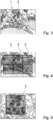
1 ein schematisches Blockschaltbild einer Ausführungsform der Erfindung; -
2 ein schematisches Blockschaltbild einer Ausführungsform der Erfindung; -
3 eine schematische Darstellung von Daten gemäß einer Ausführungsform der Erfindung; -
4 eine schematische Darstellung von Daten gemäß einer Ausführungsform der Erfindung; -
5 eine schematische Darstellung von Daten gemäß einer Ausführungsform der Erfindung;
-
1 a schematic block diagram of an embodiment of the invention; -
2nd a schematic block diagram of an embodiment of the invention; -
3rd a schematic representation of data according to an embodiment of the invention; -
4th a schematic representation of data according to an embodiment of the invention; -
5 a schematic representation of data according to an embodiment of the invention;
Die beiliegenden Zeichnungen sollen ein weiteres Verständnis der Ausführungsformen der Erfindung vermitteln. Sie veranschaulichen Ausführungsformen und dienen im Zusammenhang mit der Beschreibung der Erklärung von Prinzipien und Konzepten der Erfindung. Andere Ausführungsformen und viele der genannten Vorteile ergeben sich im Hinblick auf die Zeichnungen. Die Elemente der Zeichnungen sind nicht notwendigerweise maßstabsgetreu zueinander gezeigt.The accompanying drawings are intended to provide further understanding of the embodiments of the invention. They illustrate embodiments and, in connection with the description, serve to explain principles and concepts of the invention. Other embodiments and many of the advantages mentioned result from the drawings. The elements of the drawings are not necessarily shown to scale with respect to one another.
In den Figuren der Zeichnungen sind gleiche, funktionsgleiche und gleichwirkende Elemente, Merkmale und Komponenten - sofern nicht anders ausgeführt ist - jeweils mit denselben Bezugszeichen versehen.In the figures of the drawings, elements, features and components that are the same, have the same function and have the same function — unless stated otherwise — are each provided with the same reference symbols.
BESCHREIBUNG VON AUSFÜHRUNGSBEISPIELENDESCRIPTION OF EMBODIMENTS
In dem Schritt
In dem Schritt
In dem Schritt
In dem Schritt
In dem Schritt
In dem Schritt
In dem Schritt
In dem Schritt
In dem Schritt
In
In
In
BezugszeichenlisteReference symbol list
- 11
- Datensatzrecord
- 22nd
- Datensatz-GitterRecord grid
- 33rd
- GitterzelleGrid cell
- 3'3 '
- GitterzelleGrid cell
- 44th
- SpeicherStorage
- 55
- Regionregion
- 66
- Dateifile
Claims (14)
Priority Applications (4)
| Application Number | Priority Date | Filing Date | Title |
|---|---|---|---|
| DE102018220115.3A DE102018220115A1 (en) | 2018-11-23 | 2018-11-23 | Location-based radar, lidar, and GCP data |
| PCT/EP2019/081120 WO2020104264A1 (en) | 2018-11-23 | 2019-11-13 | Location-based radar, lidar and gcp data |
| US17/295,940 US12181308B2 (en) | 2018-11-23 | 2019-11-13 | Location-based radar, LIDAR and GCP data |
| CN201980076643.5A CN113167591B (en) | 2018-11-23 | 2019-11-13 | Location-related radar data, lidar data, and GCP data |
Applications Claiming Priority (1)
| Application Number | Priority Date | Filing Date | Title |
|---|---|---|---|
| DE102018220115.3A DE102018220115A1 (en) | 2018-11-23 | 2018-11-23 | Location-based radar, lidar, and GCP data |
Publications (1)
| Publication Number | Publication Date |
|---|---|
| DE102018220115A1 true DE102018220115A1 (en) | 2020-05-28 |
Family
ID=68621239
Family Applications (1)
| Application Number | Title | Priority Date | Filing Date |
|---|---|---|---|
| DE102018220115.3A Pending DE102018220115A1 (en) | 2018-11-23 | 2018-11-23 | Location-based radar, lidar, and GCP data |
Country Status (4)
| Country | Link |
|---|---|
| US (1) | US12181308B2 (en) |
| CN (1) | CN113167591B (en) |
| DE (1) | DE102018220115A1 (en) |
| WO (1) | WO2020104264A1 (en) |
Families Citing this family (1)
| Publication number | Priority date | Publication date | Assignee | Title |
|---|---|---|---|---|
| KR102308234B1 (en) * | 2021-04-29 | 2021-10-05 | 주식회사 메이사 | A method for positioning GCP and a device using the same |
Citations (5)
| Publication number | Priority date | Publication date | Assignee | Title |
|---|---|---|---|---|
| US20040151388A1 (en) * | 2003-01-22 | 2004-08-05 | Increment P Corporation | Recording medium storing map information, map information processing device, map information processing system, map information processing method, map information processing program and recording medium storing the map information processing program |
| DE102005063013A1 (en) * | 2005-12-30 | 2007-07-05 | Robert Bosch Gmbh | Earth`s surface section representing method for vehicle navigation system, involves assigning set of points of region on surface to lattice with triangulation with its data sets, where set of points is selected in region of model of surface |
| DE102008031081A1 (en) * | 2008-07-01 | 2010-01-28 | Aloqa Gmbh | Data processing module in a radio network with location-based services |
| WO2010068185A1 (en) * | 2008-12-09 | 2010-06-17 | Tele Atlas B.V. | Method of generating a geodetic reference database product |
| DE112008002657B4 (en) * | 2007-11-27 | 2014-09-18 | Mitsubishi Electric Corp. | Card information processor and data structure of card information |
Family Cites Families (15)
| Publication number | Priority date | Publication date | Assignee | Title |
|---|---|---|---|---|
| US5652717A (en) * | 1994-08-04 | 1997-07-29 | City Of Scottsdale | Apparatus and method for collecting, analyzing and presenting geographical information |
| US8803970B2 (en) | 2009-12-31 | 2014-08-12 | Honeywell International Inc. | Combined real-time data and live video system |
| PL2418510T3 (en) * | 2010-07-30 | 2014-07-31 | Eads Deutschland Gmbh | Method for evaluating the suitability of a piece of land for a landing zone or taxi surface for airplanes |
| US8803920B2 (en) | 2011-12-12 | 2014-08-12 | Google Inc. | Pre-fetching map tile data along a route |
| KR101232292B1 (en) * | 2012-09-25 | 2013-02-12 | 건국대학교 산학협력단 | Calculating system for open area ratio of the sky using aerial lidar data |
| KR101556618B1 (en) * | 2013-10-16 | 2015-10-01 | 팅크웨어(주) | Apparatus and method for providing map data and system thereof |
| EP3077985B1 (en) * | 2013-12-04 | 2020-05-27 | Urthecast Corp. | Systems and methods for processing distributing earth observation images |
| CN106403925B (en) * | 2016-08-31 | 2019-10-29 | 河南理工大学 | The spatial network construction and paths planning method to navigate in faced chamber with the underground space |
| US11704344B2 (en) * | 2016-10-25 | 2023-07-18 | Here Global B.V. | Method and apparatus for determining weather-related information on a tile basis |
| US11010614B2 (en) * | 2017-01-26 | 2021-05-18 | Matias Klein | Total property intelligence system |
| CN108734780B (en) * | 2017-04-17 | 2021-12-10 | 百度在线网络技术(北京)有限公司 | Method, device and equipment for generating map |
| CN107300703B (en) * | 2017-07-27 | 2020-05-19 | 华云信息技术工程有限公司 | Radar data networking processing system |
| US10219111B1 (en) * | 2018-04-18 | 2019-02-26 | Snap Inc. | Visitation tracking system |
| US10382890B1 (en) * | 2018-07-26 | 2019-08-13 | Bluedot Innovation Pty Ltd | Cacheable geographic pages |
| US11215462B2 (en) * | 2018-10-26 | 2022-01-04 | Here Global B.V. | Method, apparatus, and system for location correction based on feature point correspondence |
-
2018
- 2018-11-23 DE DE102018220115.3A patent/DE102018220115A1/en active Pending
-
2019
- 2019-11-13 WO PCT/EP2019/081120 patent/WO2020104264A1/en not_active Ceased
- 2019-11-13 CN CN201980076643.5A patent/CN113167591B/en active Active
- 2019-11-13 US US17/295,940 patent/US12181308B2/en active Active
Patent Citations (5)
| Publication number | Priority date | Publication date | Assignee | Title |
|---|---|---|---|---|
| US20040151388A1 (en) * | 2003-01-22 | 2004-08-05 | Increment P Corporation | Recording medium storing map information, map information processing device, map information processing system, map information processing method, map information processing program and recording medium storing the map information processing program |
| DE102005063013A1 (en) * | 2005-12-30 | 2007-07-05 | Robert Bosch Gmbh | Earth`s surface section representing method for vehicle navigation system, involves assigning set of points of region on surface to lattice with triangulation with its data sets, where set of points is selected in region of model of surface |
| DE112008002657B4 (en) * | 2007-11-27 | 2014-09-18 | Mitsubishi Electric Corp. | Card information processor and data structure of card information |
| DE102008031081A1 (en) * | 2008-07-01 | 2010-01-28 | Aloqa Gmbh | Data processing module in a radio network with location-based services |
| WO2010068185A1 (en) * | 2008-12-09 | 2010-06-17 | Tele Atlas B.V. | Method of generating a geodetic reference database product |
Also Published As
| Publication number | Publication date |
|---|---|
| US20220011121A1 (en) | 2022-01-13 |
| US12181308B2 (en) | 2024-12-31 |
| WO2020104264A1 (en) | 2020-05-28 |
| CN113167591B (en) | 2024-07-19 |
| CN113167591A (en) | 2021-07-23 |
Similar Documents
| Publication | Publication Date | Title |
|---|---|---|
| EP3207538B1 (en) | Communication system for a vehicle and method for communicating | |
| DE102018105293A1 (en) | METHOD AND DEVICE FOR A NETWORKED SCENE REPRESENTATION AND EXPANSION IN VEHICLE ENVIRONMENTS IN AUTONOMOUS DRIVING SYSTEMS | |
| DE102018115265A1 (en) | METHOD AND DEVICE FOR OBJECT SURFACE ESTIMATION BY REFLECTION DELAYING | |
| DE102018109441A1 (en) | Method and apparatus for pulse repetition sequence with high processing gain | |
| DE102018118528A1 (en) | Method and device for cross-segment acquisition in a lidar system | |
| DE112017008137T5 (en) | MAPPING A GRID ASSIGNMENT USING A DEFECTIVE AREA DISTRIBUTION | |
| EP1631938B1 (en) | Method for generating a three-dimensional terrain model | |
| DE102017128194A1 (en) | Accurate self-locating using a synthetic aperture automotive radar | |
| DE102019112649A1 (en) | DEVICE AND METHOD FOR IMPROVING RADAR BEAM FORMING | |
| DE102010040730A1 (en) | System and method for multiply resolved route planning | |
| WO2007144071A1 (en) | Calculation method for network-specific factors in a network of reference stations for a satellite-based positioning system | |
| DE112012005261B4 (en) | Clearance information in an occupancy grid as a basis for determining maneuvering space for a vehicle | |
| EP3304126A1 (en) | Method for the transformation of position information into a local coordinates system | |
| EP3999806B1 (en) | Method and communication system for supporting an at least partially automatic vehicle control | |
| WO2017028994A1 (en) | Method for locating an automated motor vehicle | |
| DE102019127062A1 (en) | TRANSPORT INFRASTRUCTURE COMMUNICATION AND CONTROL | |
| DE102018115372A1 (en) | METHOD AND DEVICE FOR PARALLEL LIGHTING BY A VCSEL ARRAY | |
| DE102021104896A1 (en) | ON-DEMAND VEHICLE IMAGE RECORDING SYSTEMS AND METHODS | |
| EP3491338B1 (en) | Method for transmitting data from a vehicle to a server, and method for updating a map | |
| EP3465650B1 (en) | Method and system for determining risk areas in road traffic | |
| AT517443B1 (en) | Method for displaying relevant information in an aircraft | |
| DE102018220115A1 (en) | Location-based radar, lidar, and GCP data | |
| DE60037425T2 (en) | LOCAL DETECTION FOR A MOBILE STATION OF A TELECOMMUNICATIONS SYSTEM | |
| EP3317612A1 (en) | Method and device for uploading data of a motor vehicle | |
| DE102017203151A1 (en) | Method for the precise location of a motor vehicle |
Legal Events
| Date | Code | Title | Description |
|---|---|---|---|
| R012 | Request for examination validly filed | ||
| R016 | Response to examination communication |