DE102012210344A1 - Vehicle cooperative control unit for vehicle, has passive landmark comprising dividing strip between two lanes of roads, and control unit sending vehicle cooperative message to receiver outside of vehicle - Google Patents
Vehicle cooperative control unit for vehicle, has passive landmark comprising dividing strip between two lanes of roads, and control unit sending vehicle cooperative message to receiver outside of vehicle Download PDFInfo
- Publication number
- DE102012210344A1 DE102012210344A1 DE201210210344 DE102012210344A DE102012210344A1 DE 102012210344 A1 DE102012210344 A1 DE 102012210344A1 DE 201210210344 DE201210210344 DE 201210210344 DE 102012210344 A DE102012210344 A DE 102012210344A DE 102012210344 A1 DE102012210344 A1 DE 102012210344A1
- Authority
- DE
- Germany
- Prior art keywords
- vehicle
- lane
- data
- message
- control unit
- Prior art date
- Legal status (The legal status is an assumption and is not a legal conclusion. Google has not performed a legal analysis and makes no representation as to the accuracy of the status listed.)
- Ceased
Links
Images


Classifications
-
- G—PHYSICS
- G08—SIGNALLING
- G08G—TRAFFIC CONTROL SYSTEMS
- G08G1/00—Traffic control systems for road vehicles
- G08G1/16—Anti-collision systems
- G08G1/161—Decentralised systems, e.g. inter-vehicle communication
- G08G1/162—Decentralised systems, e.g. inter-vehicle communication event-triggered
-
- B—PERFORMING OPERATIONS; TRANSPORTING
- B60—VEHICLES IN GENERAL
- B60W—CONJOINT CONTROL OF VEHICLE SUB-UNITS OF DIFFERENT TYPE OR DIFFERENT FUNCTION; CONTROL SYSTEMS SPECIALLY ADAPTED FOR HYBRID VEHICLES; ROAD VEHICLE DRIVE CONTROL SYSTEMS FOR PURPOSES NOT RELATED TO THE CONTROL OF A PARTICULAR SUB-UNIT
- B60W30/00—Purposes of road vehicle drive control systems not related to the control of a particular sub-unit, e.g. of systems using conjoint control of vehicle sub-units
- B60W30/08—Active safety systems predicting or avoiding probable or impending collision or attempting to minimise its consequences
- B60W30/09—Taking automatic action to avoid collision, e.g. braking and steering
-
- G—PHYSICS
- G08—SIGNALLING
- G08G—TRAFFIC CONTROL SYSTEMS
- G08G1/00—Traffic control systems for road vehicles
- G08G1/09—Arrangements for giving variable traffic instructions
- G08G1/091—Traffic information broadcasting
- G08G1/092—Coding or decoding of the information
-
- G—PHYSICS
- G08—SIGNALLING
- G08G—TRAFFIC CONTROL SYSTEMS
- G08G1/00—Traffic control systems for road vehicles
- G08G1/16—Anti-collision systems
- G08G1/161—Decentralised systems, e.g. inter-vehicle communication
- G08G1/163—Decentralised systems, e.g. inter-vehicle communication involving continuous checking
-
- G—PHYSICS
- G08—SIGNALLING
- G08G—TRAFFIC CONTROL SYSTEMS
- G08G1/00—Traffic control systems for road vehicles
- G08G1/16—Anti-collision systems
- G08G1/167—Driving aids for lane monitoring, lane changing, e.g. blind spot detection
-
- B—PERFORMING OPERATIONS; TRANSPORTING
- B60—VEHICLES IN GENERAL
- B60W—CONJOINT CONTROL OF VEHICLE SUB-UNITS OF DIFFERENT TYPE OR DIFFERENT FUNCTION; CONTROL SYSTEMS SPECIALLY ADAPTED FOR HYBRID VEHICLES; ROAD VEHICLE DRIVE CONTROL SYSTEMS FOR PURPOSES NOT RELATED TO THE CONTROL OF A PARTICULAR SUB-UNIT
- B60W2556/00—Input parameters relating to data
- B60W2556/45—External transmission of data to or from the vehicle
- B60W2556/65—Data transmitted between vehicles
Landscapes
- Physics & Mathematics (AREA)
- General Physics & Mathematics (AREA)
- Engineering & Computer Science (AREA)
- Automation & Control Theory (AREA)
- Transportation (AREA)
- Mechanical Engineering (AREA)
- Multimedia (AREA)
- Traffic Control Systems (AREA)
Abstract
Description
Die Erfindung betrifft das technische Gebiet der „Intelligent Transportation Systems” (ITS), d. h. das technische Gebiet intelligenter Transportsysteme. Insbesondere betrifft die Erfindung das Erkennen von Kollisionsgefahren sowie die Verringerung bzw. die Vermeidung von Kollisionen (Collision Mitigation bzw. Collision Avoidance) im Straßenverkehr anhand von Informationen, welche zwischen Fahrzeugen im Straßenverkehr ausgetauscht werden.The invention relates to the technical field of "Intelligent Transportation Systems" (ITS), d. H. the technical field of intelligent transport systems. In particular, the invention relates to the detection of collision hazards and the reduction or avoidance of collisions (collision mitigation or Collision Avoidance) in road traffic based on information that is exchanged between vehicles in traffic.
Derzeit werden im Rahmen diverser Initiativen zum Thema ”Intelligent Transportation Systems” (ITS) u. a. bei den Europäischen Standardisierungsbehörden ETSI und CEN, sowie in den USA bei ISO, SAE und IEEE Kommunikationsprotokolle und kooperative Sicherheitsanwendungen standardisiert, die zukünftig ein Fahrzeughersteller-übergreifendes, kooperatives, und nach Möglichkeit unfallfreies Fahren ermöglichen sollen. Die kooperativen Sicherheitsanwendungen beinhalten unter anderem auch Kollisionsvermeidungs-Anwendungen (Collision Avoidance) und Kollisionsfolgeverminderungs-Anwendungen (Collision Mitigation) für Auffahrunfälle. Die adressierten Sicherheitsanwendungen, sowie die zugehörigen Übertragungsprotokolle und Datenformate sind u. a. in dem
Auf Basis der derzeit entwickelten Kommunikationsstandards (d. h. insbesondere anhand der derzeit entwickelten Protokolle und Datenformate und der darin übertragenen Informationen) ist es jedoch nicht möglich eine Frontalkollision zweier ITS Stationen (z. B. zweier Fahrzeuge) zu erkennen und/oder zu vermeiden (frontal collision mitigation and avoidance). Ein Grund dafür ist insbesondere die begrenzte Genauigkeit der im Fahrzeug verfügbaren und der ausgetauschten Positionsinformationen (z. B. auf Basis von GPS). Außerdem können seitliche Kollisionen zweiter ITS Stationen bei spontan durchgeführten Spurwechseln nicht erkannt bzw. vermieden werden. Schließlich sind auch seitliche Kollisionen zweiter ITS Stationen, insbesondere bei Engstellen auf der Fahrbahn, ohne dedizierte Sensoren an den Seiten der ITS Stationen nicht zu detektieren bzw. zu vermeiden.However, based on the currently developed communication standards (ie in particular based on the currently developed protocols and data formats and the information transmitted therein), it is not possible to detect and / or avoid a frontal collision between two ITS stations (eg two vehicles) (frontal collision mitigation and avoidance). One reason for this is in particular the limited accuracy of the position information available in the vehicle and the position information exchanged (eg based on GPS). In addition, lateral collisions of second ITS stations can not be detected or avoided in spontaneously performed lane changes. Finally, side collisions of second ITS stations, especially at bottlenecks on the road, can not be detected or avoided without dedicated sensors on the sides of the ITS stations.
Das vorliegende Dokument adressiert die oben angesprochenen ITS Anwendungen, d. h. das frühzeitige Erkennen und/oder das Vermeiden von Frontalkollisionen oder von seitlichen Kollisionen bei Spurwechseln bzw. Verengungen. Insbesondere beschreibt das vorliegende Dokument Verfahren und Vorrichtungen, welche es ermöglichen, Frontalkollisionen oder Seitliche Kollisionen frühzeitig zu erkennen und ggf. zu vermeiden.The present document addresses the above-mentioned ITS applications, i. H. Early detection and / or avoidance of frontal collisions or lateral collisions in lane changes or constrictions. In particular, the present document describes methods and devices which make it possible to detect frontal collisions or lateral collisions at an early stage and possibly avoid them.
Gemäß einem Aspekt wird eine Fahrzeug-Kooperations-Steuereinheit für ein Fahrzeug (z. B. für ein Automobil, einen Lastkraftwagen und/oder für ein Motorrad) beschrieben. Die Fahrzeug-Kooperations-Steuereinheit kann eingerichtet sein, V2X (Vehicle-to-X) Anwendungen (auch als Fahrzeug Kooperations-Anwendungen bezeichnet) zu ermöglichen, wobei das X z. B. für ein anderes Fahrzeug (Vehicle) oder für Straßen-Infrastruktur (Infrastructure) steht. V2X Anwendungen können auch als Fahrzeug-zu-X Anwendungen bezeichnet werden. Insbesondere kann die Fahrzeug-Kooperations-Steuereinheit eingerichtet sein, Daten von einer Spurerkennungs-Vorrichtung des Fahrzeugs zu empfangen. Die Spurerkennungs-Vorrichtung kann z. B. eine Kamera umfassen, welche ein Bild einer Straße erfasst, auf der das Fahrzeug fährt. So kann es sich bei den Daten von einer Spurerkennungs-Vorrichtung um ein von der Kamera der Spurerkennungs-Vorrichtung aufgezeichnetes Bild der Straße handeln.In one aspect, a vehicle cooperative control unit for a vehicle (eg, for an automobile, a truck, and / or a motorcycle) is described. The vehicle cooperation control unit may be configured to enable V2X (vehicle-to-X) applications (also referred to as vehicle cooperation applications), where the X z. B. stands for another vehicle (Vehicle) or for road infrastructure (Infrastructure). V2X applications can also be referred to as vehicle-to-X applications. In particular, the vehicle cooperation control unit may be configured to receive data from a lane recognition device of the vehicle. The lane detection device may, for. B. include a camera that detects an image of a road on which the vehicle is traveling. Thus, the data from a track-recognition device may be an image of the road recorded by the camera of the track-recognition device.
Die Fahrzeug-Kooperation-Steuereinheit kann eingerichtet sein, Fahrspur-Daten aus den empfangenen Daten der Spurerkennungs-Vorrichtung zu ermitteln. Dabei können die Fahrspur-Daten insbesondere auf der Analyse einer von der Spurerkennungs-Vorrichtung erfassten passiven Landmarke basieren. Bei der passiven Landmarke kann es sich z. B. um ein oder mehrere der Folgenden handeln: einen Trennstreifen zwischen zwei Fahrspuren einer Straße auf der das Fahrzeug fährt; einen Seitenstreifen der Straße auf der das Fahrzeug fährt; ein Objekt an oder auf der Straße auf der das Fahrzeug fährt (z. B. ein Hindernis auf einer der Fahrspuren auf der das Fahrzeug fährt); und/oder ein oder mehrere Reflektoren an oder auf der Straße auf der das Fahrzeug fährt. Bei den passiven Landmarken kann es sich um Landmarken ohne eigene Energiequelle handeln. Alternativ oder ergänzend kann es sich bei der Landmarke, auf dessen Analyse die Fahrspur-Daten basieren, um eine Landmarke handeln, welche mit einer Kamera aufgezeichnet werden kann, wobei die Kamera eingerichtet ist optische Signale im sichtbaren Frequenzspektrum aufzuzeichnen. So kann z. B. eine Kamera der Spurerkennungs-Vorrichtung eingerichtet sein, ein Bild der Landmarke aufzunehmen und dieses Bild als Daten der Spurerkennungs-Vorrichtung an die Fahrzeug-Kooperations-Steuereinheit zu übermitteln.The vehicle cooperation control unit may be configured to determine lane data from the received data of the lane recognition device. In particular, the lane data may be based on the analysis of a passive landmark captured by the lane detection device. The passive landmark can be z. One or more of the following: a parting line between two lanes of a road on which the vehicle is traveling; a shoulder of the road on which the vehicle is traveling; an object on or on the road on which the vehicle is traveling (eg an obstacle on one of the lanes on which the vehicle is traveling); and / or one or more reflectors on or on the road on which the vehicle is traveling. The passive landmarks can be landmarks without their own energy source. Alternatively or additionally, the landmark on whose analysis the traffic lane data is based may be a landmark that can be recorded with a camera, the camera being set up to record optical signals in the visible frequency spectrum. So z. For example, a camera of the lane detection apparatus may be configured to take a picture of the landmark and to transmit this image as data of the lane detection device to the vehicle cooperation control unit.
Die aus den empfangenen Daten der Spurerkennungs-Vorrichtung ermittelten Fahrspur-Daten können z. B. ein oder mehrere der folgenden Informationen umfassen: einen Indikator dafür, dass das Fahrzeug seitlich mit einer benachbarten Fahrspur überlappt; Daten bzgl. eines Grades der Überlappung (z. B. eine seitliche Breite der Überlappung); Daten bzgl. einer aktuellen Breite einer eigenen Fahrspur; Daten bzgl. einer prädizierten Breite der eigenen Fahrspur in Abhängigkeit von einer Entfernung vom Fahrzeug in Fahrrichtung; und/oder Daten bzgl. einer zukünftigen Entwicklung des Grades der Überlappung in Abhängigkeit von einer Entfernung vom Fahrzeug in Fahrrichtung.The lane data determined from the received data of the lane recognition device can e.g. For example, one or more of the following information may include: an indicator that the vehicle overlaps laterally with an adjacent lane; Data on a degree of overlap (eg, a lateral width of the overlap); Data regarding a current latitude of an own lane; Data regarding a predicted width of the own lane as a function of a distance from the vehicle in the direction of travel; and / or data relating to a future evolution of the degree of overlap as a function of distance from the vehicle in the direction of travel.
Wie bereits oben dargelegt, kann die Spurerkennungs-Vorrichtung ein oder mehrere Kameras umfassen, um ein oder mehrere Bilder der Landmarke zu erfassen. Folglich können die Daten der Spurerkennungs-Vorrichtung das oder die Bilder der Landmarke umfassen. Die Fahrzeug-Kooperations-Steuereinheit kann dann eingerichtet sein, das oder die Bilder der Landmarke zu analysieren, um die Fahrspur-Daten zu ermitteln. Dazu kann die Fahrzeug-Kooperations-Steuereinheit Bildanalyse-Verfahren (z. B. zur Konturenerkennung) verwenden. Alternativ oder ergänzend kann bereits die Spurerkennungs-Vorrichtung eingerichtet sein, das oder die erfassten Bilder der Landmarke zu analysieren und so einen Teil oder alle der Fahrspur-Daten zu ermitteln. In diesem Fall können die Daten der Spurerkennungs-Vorrichtung bereits einen Teil oder alle der Fahrspur-Daten umfassen, so dass das Ermitteln der Fahrspur-Daten aus den Daten der Spurerkennungs-Vorrichtung ein Auswählen der relevanten Fahrspur-Daten umfasst.As stated above, the lane recognition device may include one or more cameras to capture one or more images of the landmark. Thus, the data of the lane recognition device may include the landmark image (s). The vehicle collaboration controller may then be configured to analyze the landmark image (s) to determine the lane data. For this purpose, the vehicle cooperation control unit can use image analysis methods (eg for contour recognition). Alternatively or additionally, the lane recognition device can already be set up to analyze the captured image (s) of the landmark and thus to determine a part or all of the lane data. In this case, the data of the lane recognition device may already include a part or all of the lane data, such that the determination of the lane data from the data of the lane recognition device comprises selecting the relevant lane data.
Die Fahrzeug-Kooperations-Steuereinheit kann eingerichtet sein, die Fahrspur-Daten in eine Fahrzeug-Kooperations-Nachricht aufzunehmen. Die Fahrzeug-Kooperations-Nachricht ist dazu vorgesehen, an ein anderes Fahrzeug übermittelt zu werden. D. h. die Fahrzeug-Kooperations-Nachricht kann dazu verwendet werden, ein anderes Fahrzeug über die Fahrspur-Daten des Fahrzeugs, welches die Fahrzeug-Kooperations-Steuereinheit umfasst, zu informieren. Damit wird das andere Fahrzeug befähigt ein Kollisionsrisiko zu ermitteln und ggf. Gegenmaßnahmen einzuleiten. Zur Übermittlung der Fahrspur-Daten kann die Fahrzeug-Kooperations-Steuereinheit eingerichtet sein, die Fahrzeug-Kooperations-Nachricht (z. B. über eine Kommunikationseinheit des Fahrzeugs) an einen Empfänger (z. B. an ein anderes Fahrzeug) außerhalb des Fahrzeugs der Fahrzeug-Kooperations-Steuereinheit zu senden.The vehicle cooperation control unit may be configured to include the lane data in a vehicle cooperation message. The vehicle cooperation message is intended to be transmitted to another vehicle. Ie. the vehicle cooperation message may be used to inform another vehicle of the lane data of the vehicle including the vehicle cooperation control unit. This will enable the other vehicle to detect a collision risk and, if necessary, initiate countermeasures. For communicating the lane data, the vehicle cooperation control unit may be configured to send the vehicle cooperation message (eg, via a communication unit of the vehicle) to a receiver (eg, another vehicle) outside the vehicle Vehicle Collaboration Control Unit to send.
Die Fahrzeug-Kooperations-Nachricht kann ein vordefiniertes, mglw. standardisiertes, Format haben. Dadurch kann erreicht werden, dass die Fahrzeug-Kooperations-Nachricht von dem Empfänger der Nachricht verstanden werden kann. Insbesondere wird dadurch der Empfänger befähigt, die Fahrspur-Daten aus der Fahrzeug-Kooperations-Nachricht zu entnehmen. Beispielsweise kann es sich bei der Fahrzeug-Kooperations-Nachricht um eine „Cooperative Awareness Message”(CAM)-Nachricht eines Vehicle-to-X Netzwerks (auch Fahrzeug-zu-X Netzwerk genannt); oder um eine „Decentralized Environmental Notification Message”(DENM)-Nachricht des Vehicle-to-X Netzwerks; oder um eine „Basic Safety Message”(BSM)-Nachricht handeln. Die o. g. standardisierten Nachrichtenformate können angepasst werden, um ein oder mehrere Datenfelder für die Fahrspur-Daten bereitzustellen. Bei den Datenfeldern kann es sich um permanente Datenfelder handeln, welche standardmäßig in der Fahrzeug-Kooperations-Nachricht übertragen werden, oder um à-la-carte Datenfelder, welche nur bei Vorliegen einer vorbestimmten Bedingung übertragen werden.The vehicle cooperation message can be a predefined, mglw. standardized format. As a result, it can be achieved that the vehicle cooperation message can be understood by the recipient of the message. In particular, this enables the receiver to extract the lane data from the vehicle cooperation message. For example, the vehicle cooperation message may be a Cooperative Awareness Message (CAM) message of a Vehicle-to-X network (also called a vehicle-to-X network); or a Decentralized Environmental Notification Message (DENM) message from the Vehicle-to-X network; or to act as a "Basic Safety Message" (BSM) message. The o. G. Standardized message formats may be adapted to provide one or more data fields for the lane data. The data fields may be permanent data fields, which are transmitted by default in the vehicle cooperation message, or a-la-carte data fields, which are transmitted only if a predetermined condition exists.
Die Fahrzeug-Kooperations-Nachricht kann neben den Fahrspur-Daten noch ein oder mehrere der folgenden weiteren Informationen umfassen. Diese weiteren Informationen können in Kombination mit den Fahrspur-Daten von einem empfangenden Fahrzeug dazu verwendet werden, ein Kollisionsrisiko zu detektieren und ggf. Gegenmaßnahmen einzuleiten. Die weiteren Informationen können u. a. umfassen: Satelliten-basierte Positionsdaten (z. B. GPS Daten) des Fahrzeugs; (ggf. Satelliten-basierte) Richtungsdaten des Fahrzeugs; Geschwindigkeitsdaten des Fahrzeugs; und/oder beschreibende Attribute des Fahrzeugs (z. B. die Breite des Fahrzeugs, der Fahrzeugtyp, etc.).The vehicle cooperation message may include one or more of the following additional information in addition to the lane data. This further information can be used in combination with the lane data from a receiving vehicle to detect a collision risk and initiate countermeasures if necessary. The further information can u. a. comprise: satellite-based position data (eg GPS data) of the vehicle; (possibly satellite-based) directional data of the vehicle; Speed data of the vehicle; and / or descriptive attributes of the vehicle (eg, the width of the vehicle, the vehicle type, etc.).
Um die Menge der übertragenen Daten zu reduzieren, kann es von Vorteil sein, der Fahrzeug-Kooperations-Nachricht die Fahrspur-Daten nur selektiv hinzuzufügen. Zu diesem Zweck kann die Fahrzeug-Kooperations-Steuereinheit eingerichtet sein, anhand der Daten von der Spurerkennungs-Vorrichtung, einen seitlichen Abstand des Fahrzeugs von einer benachbarten Fahrspur zu ermitteln. Das Aufnehmen der Fahrspur-Daten in die Fahrzeug-Kooperations-Nachricht kann dann von dem ermittelten seitlichen Abstand abhängig gemacht werden. Insbesondere kann die Fahrzeug-Kooperations-Steuereinheit eingerichtet sein, nur dann die Fahrspur-Daten zu versenden, wenn der ermittelte Abstand unterhalb eines vordefinierten Schwellwertes (z. B. von 0 cm) liegt.To reduce the amount of data transmitted, it may be advantageous to selectively add the lane data to the vehicle cooperation message only. For this purpose, the vehicle cooperation control unit may be configured to use the data from the lane recognition device to determine a lateral distance of the vehicle from an adjacent lane. The inclusion of the lane data in the vehicle cooperation message may then be made dependent on the determined lateral distance. In particular, the vehicle cooperation control unit may be set up to send the lane data only if the determined distance is below a predefined threshold value (eg of 0 cm).
Gemäß einem weiteren Aspekt wird eine Fahrzeug-Kooperations-Steuereinheit für ein erstes Fahrzeug beschrieben. Insbesondere kann die Fahrzeug-Kooperations-Steuereinheit für das erste Fahrzeug eingerichtet sein, eine Fahrzeug-Kooperations-Nachricht von einem sendenden zweiten Fahrzeug zu empfangen. Dabei umfasst die Fahrzeug-Kooperations-Nachricht Fahrspur-Daten des zweiten Fahrzeugs, wobei die Fahrspur-Daten auf der Analyse einer Landmarke an dem zweiten Fahrzeug basieren können. Die Fahrspur-Daten des zweiten Fahrzeugs werden z. B. von einer Spurerkennungs-Vorrichtung des zweiten Fahrzeugs erfasst und von der Fahrzeug-Kooperations-Steuereinheit des zweiten Fahrzeugs in die Fahrzeug-Kooperations-Nachricht eingefügt. Außerdem kann die Fahrzeug-Kooperations-Steuereinheit des zweiten Fahrzeugs eingerichtet sein, die Versendung der Fahrzeug-Kooperations-Nachricht an das erste Fahrzeug zu veranlassen.In another aspect, a vehicle cooperation control unit for a first vehicle is described. In particular, the vehicle cooperation control unit may be for the first Vehicle configured to receive a vehicle cooperation message from a sending second vehicle. In this case, the vehicle cooperation message comprises lane data of the second vehicle, wherein the lane data may be based on the analysis of a landmark on the second vehicle. The lane data of the second vehicle are z. B. detected by a lane detection device of the second vehicle and inserted by the vehicle cooperation control unit of the second vehicle in the vehicle cooperation message. In addition, the vehicle cooperation control unit of the second vehicle may be configured to cause the vehicle cooperation message to be sent to the first vehicle.
Des Weiteren kann die Fahrzeug-Kooperations-Steuereinheit für das erste Fahrzeug eingerichtet sein, anhand der Fahrspur-Daten, ein Kollisionsrisiko zwischen dem ersten Fahrzeug und dem zweiten Fahrzeug zu ermitteln. Beispielsweise kann die Fahrzeug-Kooperations-Steuereinheit für das erste Fahrzeug den Fahrspur-Daten entnehmen, dass das zweite Fahrzeug seitlich mit einer bestimmten Breite in die Fahrspur des ersten Fahrzeugs eingreift. Dadurch weiß die Fahrzeug-Kooperations-Steuereinheit für das erste Fahrzeug, dass der seitliche Abstand des ersten Fahrzeugs zum Rand der eigenen Fahrspur mindestens die bestimmte Breite umfassen muss, um eine Kollision zu vermeiden.Furthermore, the vehicle cooperation control unit for the first vehicle may be configured to determine, based on the traffic lane data, a collision risk between the first vehicle and the second vehicle. For example, the vehicle cooperation control unit for the first vehicle may infer from the lane data that the second vehicle engages laterally with a certain width in the lane of the first vehicle. As a result, the vehicle cooperation control unit for the first vehicle knows that the lateral distance of the first vehicle from the edge of the own lane must be at least the predetermined width in order to avoid a collision.
Dieser seitliche Abstand des ersten Fahrzeugs kann z. B. anhand einer Spurerkennungs-Vorrichtung des ersten Fahrzeugs ermittelt werden.This lateral distance of the first vehicle may, for. B. be determined based on a lane detection device of the first vehicle.
Die Fahrzeug-Kooperations-Steuereinheit kann weiter eingerichtet sein, eine Maßnahme im ersten Fahrzeug in Bezug auf das ermittelte Kollisionsrisiko einzuleiten. Bei der Maßnahme im ersten Fahrzeug kann es sich z. B. um Warnhinweise für den Fahrer des ersten Fahrzeugs handeln und/oder um automatische Eingriffe in das Fahrverhalten des ersten Fahrzeugs. Alternativ oder ergänzend kann die Fahrzeug-Kooperations-Steuereinheit eingerichtet sein, eine rückwärtige Fahrzeug-Kooperations-Nachricht an das zweite Fahrzeug in Bezug auf das ermittelte Kollisionsrisiko zu generieren und zu senden. In der rückwärtigen Fahrzeug-Kooperations-Nachricht können Empfehlungen oder Anweisungen enthalten sein, wie sich das zweite Fahrzeug verhalten sollte, um eine Kollision zu vermeiden bzw. deren Folgen zu reduzieren. Durch eine rückwärtige Fahrzeug-Kooperations-Nachricht können die Maßnahmen im ersten und zweiten Fahrzeug koordiniert werden, um so die Wahrscheinlichkeit einer Kollisionsvermeidung bzw. einer Kollisionsfolgenminderung zu erhöhen.The vehicle cooperation control unit may be further configured to initiate a measure in the first vehicle with respect to the determined collision risk. When the measure in the first vehicle may be z. B. be warnings for the driver of the first vehicle and / or automatic intervention in the handling of the first vehicle. Alternatively or additionally, the vehicle cooperation control unit may be configured to generate and send a rearward vehicle cooperation message to the second vehicle with respect to the determined collision risk. The rearward vehicle cooperation message may include recommendations or instructions on how the second vehicle should behave in order to avoid or reduce the consequences of a collision. By means of a rearward vehicle cooperation message, the measures in the first and second vehicles can be coordinated so as to increase the probability of a collision avoidance or a collision consequences reduction.
Gemäß einem weiteren Aspekt wird ein Fahrzeug (z. B. ein Automobil oder ein Motorrad) beschrieben. Das Fahrzeug umfasst eine Fahrzeug-Kooperations-Steuereinheit mit einem oder mehrerer der in diesem Dokument beschriebenen Merkmale. Die Fahrzeug-Kooperations-Steuereinheit kann eingerichtet sein, eine Fahrzeug-Kooperations-Nachricht zu generieren und/oder auszuwerten. Desweiteren kann das Fahrzeug eine Kommunikationseinheit umfassen, welche eingerichtet ist, die Fahrzeug-Kooperations-Nachricht über einen drahtlosen Übertragungsweg zu senden und/oder zu empfangen.In another aspect, a vehicle (eg, an automobile or a motorcycle) is described. The vehicle includes a vehicle cooperative control unit having one or more of the features described in this document. The vehicle cooperation control unit may be configured to generate and / or evaluate a vehicle cooperation message. Furthermore, the vehicle may include a communication unit configured to transmit and / or receive the vehicle cooperation message over a wireless transmission path.
Gemäß einem weiteren Aspekt wird ein System fair eine kooperative Fahrzeug-Anwendung beschrieben. Das System umfasst eine erste Fahrzeug-Kooperations-Steuereinheit für ein erstes Fahrzeug, wobei die erste Fahrzeug-Kooperations-Steuereinheit eingerichtet ist, eine Fahrzeug-Kooperations-Nachricht zu empfangen. Desweiteren umfasst das System eine zweite Fahrzeug-Kooperations-Steuereinheit für ein zweites Fahrzeug, wobei die zweite Fahrzeug-Kooperations-Steuereinheit eingerichtet ist, die Fahrzeug-Kooperations-Nachricht zu erzeugen und zu senden. Die Fahrzeug-Kooperations-Nachricht umfasst Fahrspur-Daten des zweiten Fahrzeugs, die z. B. auf einer am zweiten Fahrzeug erfassten Landmarke basieren.In another aspect, a system is fairly described as a cooperative vehicle application. The system includes a first vehicle cooperation control unit for a first vehicle, wherein the first vehicle cooperation control unit is configured to receive a vehicle cooperation message. The system further comprises a second vehicle cooperation control unit for a second vehicle, wherein the second vehicle cooperation control unit is configured to generate and send the vehicle cooperation message. The vehicle cooperation message includes lane data of the second vehicle, e.g. B. based on a detected at the second vehicle landmark.
Die erste und zweite Fahrzeug-Kooperations-Steuereinheit sind eingerichtet, anhand der Fahrzeug-Kooperations-Nachricht (und ggf. anhand weiterer Informationen wie z. B. weiterer Fahrzeug-Kooperations-Nachrichten) eine kooperative Fahrzeug-Anwendung bereitzustellen. Beispielsweise kann es sich bei der kooperativen Fahrzeug-Anwendung um das Erkennen eines Risikos einer Frontalkollision zwischen dem ersten und dem entgegenkommenden zweiten Fahrzeug handeln. Durch die in der Fahrzeug-Kooperations-Nachricht enthaltenen Fahrspur-Daten des zweiten Fahrzeugs kann die erste Fahrzeug-Kooperations-Steuereinheit ermitteln, ob ein frontales Kollisionsrisiko zwischen dem ersten und dem zweiten Fahrzeug besteht. Eine weitere kooperative Fahrzeug-Anwendung ist das Erkennen eines Risikos einer seitlichen Kollision zwischen dem ersten Fahrzeug und dem, in gleicher Richtung fahrenden, zweiten Fahrzeug, aufgrund von Fahrspurverengung und/oder aufgrund von Fahrspurwechsel. Auch in diesem Fall kann die erste Fahrzeug-Kooperations-Steuereinheit anhand der Fahrspur-Daten des zweiten Fahrzeugs ein seitliches Kollisionsrisiko detektieren.The first and second vehicle cooperation control units are set up to provide a cooperative vehicle application based on the vehicle cooperation message (and possibly on the basis of further information, such as, for example, further vehicle cooperation messages). For example, the co-operative vehicle application may be the detection of a risk of frontal collision between the first and oncoming second vehicles. By means of the lane data of the second vehicle included in the vehicle cooperation message, the first vehicle cooperation control unit can determine whether a frontal collision risk exists between the first and the second vehicle. Another cooperative vehicle application is to detect a risk of side collision between the first vehicle and the second vehicle traveling in the same direction due to lane constriction and / or lane change. In this case too, the first vehicle cooperation control unit can detect a lateral collision risk on the basis of the lane data of the second vehicle.
Gemäß einem weiteren Aspekt wird ein Verfahren zum Erkennen eines Kollisionsrisikos zwischen einem ersten und einem zweiten Fahrzeug beschrieben. Das Verfahren umfasst das Erfassen einer Landmarke am zweiten Fahrzeug (z. B. anhand einer Spurerkennungs-Vorrichtung). Desweiteren umfasst das Verfahren das Ermitteln von Fahrspur-Daten des zweiten Fahrzeugs anhand der erfassten Landmarke. Anschließend wird eine Fahrzeug-Kooperations-Nachricht erzeugt, welche die Fahrspur-Daten umfasst. Die Fahrzeug-Kooperations-Nachricht wird an das erste Fahrzeug gesendet, um so das erste Fahrzeug zu befähigen, das Kollisionsrisiko zu erkennen.In another aspect, a method for detecting a collision risk between a first and a second vehicle is described. The method includes detecting a landmark on the second vehicle (eg, using a lane recognition device). Furthermore includes the method determining lane data of the second vehicle based on the detected landmark. Subsequently, a vehicle cooperation message is generated which includes the lane data. The vehicle cooperation message is sent to the first vehicle so as to enable the first vehicle to detect the risk of collision.
Gemäß einem weiteren Aspekt wird ein korrespondierendes Verfahren zum Erkennen eines Kollisionsrisikos zwischen einem ersten und einem zweiten Fahrzeug beschrieben. Das Verfahren umfasst das Empfangen einer von dem zweiten Fahrzeug gesendeten Fahrzeug-Kooperations-Nachricht an dem ersten Fahrzeug. Die Fahrzeug-Kooperations-Nachricht umfasst Fahrspur-Daten des zweiten Fahrzeugs, wobei die Fahrspur-Daten auf der Analyse einer Landmarke an dem zweiten Fahrzeug basieren. Das Verfahren umfasst weiter, das Erkennen eines Kollisionsrisikos zwischen dem ersten Fahrzeug und dem zweiten Fahrzeug, anhand der Fahrspur-Daten. Die Fahrspur-Daten werden vorzugsweise anhand einer Spurerkennungs-Vorrichtung des zweiten Fahrzeugs ermittelt (z. B. anhand von einer Landmarke, welche durch die Spurerkennungs-Vorrichtung des zweiten Fahrzeugs erfasst wurde).In accordance with another aspect, a corresponding method for detecting a collision risk between a first and a second vehicle is described. The method includes receiving a vehicle cooperation message sent from the second vehicle on the first vehicle. The vehicle cooperation message includes lane data of the second vehicle, wherein the lane data is based on the analysis of a landmark on the second vehicle. The method further comprises detecting a collision risk between the first vehicle and the second vehicle based on the lane data. The lane data is preferably determined from a lane detection device of the second vehicle (eg, based on a landmark detected by the lane detection device of the second vehicle).
Gemäß einem weiteren Aspekt wird ein Software (SW) Programm beschrieben. Das SW Programm kann eingerichtet werden, um auf einem Prozessor ausgeführt zu werden, und um dadurch das in diesem Dokument beschriebene Verfahren auszuführen.In another aspect, a software (SW) program is described. The SW program can be set up to run on a processor and thereby perform the method described in this document.
Gemäß einem weiteren Aspekt wird ein Speichermedium beschrieben. Das Speichermedium kann ein SW Programm umfassen, welches eingerichtet ist, um auf einem Prozessor ausgeführt zu werden, und um dadurch das in diesem Dokument beschriebene Verfahren auszuführen.In another aspect, a storage medium is described. The storage medium may include a SW program that is set up to run on a processor and thereby perform the method described in this document.
Es ist zu beachten, dass die in diesem Dokument beschriebenen Verfahren, Vorrichtungen und Systeme sowohl alleine, als auch in Kombination mit anderen in diesem Dokument beschriebenen Verfahren, Vorrichtungen und Systemen verwendet werden können. Desweiteren können jegliche Aspekte der in diesem Dokument beschriebenen Verfahren, Vorrichtung und Systemen in vielfältiger Weise miteinander kombiniert werden. Insbesondere können die Merkmale der Ansprüche in vielfältiger Weise miteinander kombiniert werden.It should be understood that the methods, devices and systems described herein may be used alone as well as in combination with other methods, devices and systems described in this document. Furthermore, any aspects of the methods, apparatus, and systems described herein may be combined in a variety of ways. In particular, the features of the claims can be combined in a variety of ways.
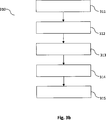
Im Weiteren wird die Erfindung anhand von Ausführungsbeispielen näher beschrieben. Dabei zeigtFurthermore, the invention will be described in more detail with reference to exemplary embodiments. It shows
Wie bereits eingangs dargelegt, befasst sich das vorliegende Dokument insbesondere mit den ITS Anwendungen „Collision Mitigation” (d. h. die Verminderung von Kollisionsfolgen) und/oder „Collision Avoidance” (d. h. die Verhinderung von Kollisionen). Diese Anwendungen sollen anhand von Informationen, welche zwischen Fahrzeugen im Straßenverkehr ausgetauscht werden, ermöglicht werden. Zum Austausch dieser Informationen, werden im Rahmen verschiedener Standardisierungsgremien (z. B. ETSI in Europa oder SAE in USA) Kommunikationsprotokolle spezifiziert, wie z. B. der
Eine ITS-Station kann eine CAM-Nachricht versenden und damit andere ITS-Stationen über seine Position, über seine Bewegung (z. B. Richtung, Geschwindigkeit), über grundlegende beschreibende Attribute (z. B. Größe der ITS-Station, Typ des Fahrzeugs) und über ausgewählte Sensordaten (z. B. Außentemperatur, Status einer Sirene) informieren. Mit dieser Information können verschiedenste ITS Anwendungen ermöglicht werden, wie z. B. „Forward Collision Avoidance (FCA)” oder „Red Light (Stop Sign) Violation Warning (RLV)”.An ITS station can send a CAM message and thus other ITS stations about its position, about its movement (eg direction, speed), about basic descriptive Information on attributes (eg size of the ITS station, type of vehicle) and on selected sensor data (eg outside temperature, status of a siren). With this information, a variety of ITS applications can be enabled, such. "Forward Collision Avoidance (FCA)" or "Red Light (Stop Sign) Violation Warning (RLV)".
Wie bereits oben dargelegt, befasst sich das vorliegende Dokument mit der Erkennung bzw. Vermeidung von frontalen Zusammenstößen zweier Fahrzeuge (frontal collision mitigation/avoidance). Desweiteren befasst sich das vorliegende Dokument mit seitlichen Zusammenstößen von Fahrzeugen, welche z. B. durch Spurwechsel bzw. durch Fahrbahnverengungen verursacht werden können. Diese Anwendungsfälle sind in den
Die in den o. g. Anwendungsfällen
Es wird in diesem Dokument vorgeschlagen, die in einem Fahrzeug (z. B. in einem Automobil) vorhandenen Mittel zur Spurerkennung bzw. zur Spureinhaltung („lane keep assist”) zu verwenden, und durch die Mittel zur Spurerkennung bzw. zur Spureinhaltung ermittelte Daten anderen Fahrzeugen in einem V2X-Netzwerk bereitzustellen. Mit anderen Worten, es wird die Realisierung einer Frontalkollisions- oder Seitenkollisionsassistenz auf Basis einer mglw. direkten Kommunikation zwischen beteiligten Fahrzeugen vorgeschlagen. Dabei kann die Kommunikation im Rahmen der aktuell in der Standardisierung beschriebenen Protokolle erfolgen. Um Defizite in der Positionsbestimmung der Fahrzeuge auszugleichen wird vorgeschlagen, dass die Fahrzeuge anhand von Spurerkennungs-Vorrichtungen ein Überschreiten der eigenen Fahrspur detektieren und daraufhin die Fahrzeuge in ihrer Umgebung über das Überschreiten und mglw. über das Ausmaß des Überschreitens informieren.It is proposed in this document to use the means for lane keep assist present in a vehicle (eg in an automobile) and data determined by the means for tracking or tracking to provide other vehicles in a V2X network. In other words, it is the realization of a front collision or side collision assistance based on a mglw. proposed direct communication between participating vehicles. In this case, the communication can take place within the framework of the protocols currently described in the standardization. In order to compensate for deficits in determining the position of the vehicles, it is proposed that the vehicles detect an exceeding of their own traffic lane on the basis of lane recognition devices, and then the vehicles in their vicinity are informed of the exceeding and mglw. to inform about the extent of the crossing.
Beispielsweise kann ein Fahrzeug
Ein entgegenkommendes Fahrzeug
Beispielhafte Gegenmaßnahmen umfassen u. a. das Generieren von Warnhinweisen an den Fahrer des ersten (empfangenden) Fahrzeugs
- • Force-Feedback am Lenkrad, als Lenkinitiative: Dabei kann ein Fahrer über einen Kraft-Impuls am Lenkrad dazu angeleitet werden, das Lenkrad in die Richtung des Kraft-Impulses einzuschlagen, um so das Kollisionsrisiko abzuwenden.
- • Aufmerksamkeitssteuerung des Fahrers, z. B. durch einen Warnton (aus einer dedizierten Richtung, welche mit der Richtung des jeweils anderen Fahrzeugs korreliert), und/oder durch Einblendung von Warnmeldungen, und/oder durch Generierung eines relativ lauten Motorengeräusches (aus der dedizierten Richtung, welche mit der Richtung des jeweils anderen Fahrzeugs korreliert).
- • Automatischer Lenkeinschlag: Dabei führt das Fahrzeug selbständig eine Richtungsänderung des Fahrzeugs durch.
- • Stabilitätskontrolle, Einzelsteuerung der Raddrehzahlen, um z. B. das Schleuderrisiko bei einem kurzfristigen Ausweichmanöver zu reduzieren.
- • Lichthupe, um z. B. den Fahrer des entgegenkommenden Fahrzeugs zu warnen.
- • Seitenspiegel einklappen, um so das Kollisionsrisiko zu reduzieren.
- • Reduzierung Fahrerablenkung, z. B. durch die Reduzierung kognitiver Lärmpegel.
- • Durchführen von Precrash-Safety Maßnahmen, wie z. B. die Vorkonditionierung des Fahrzeugs für Notbremsungen, und/oder die Aktivierung von Front-/Seiten-Sensorik, bspw. die Aktivierung von PDC (Peripheral CMA Controller) Sensoren, Radar, Kameras.
- • Weitere Eingriffsverfahren zur Vermeidung einer Kollision bzw. zur Reduzierung der Folgen einer Kollision.
- • Force feedback on the steering wheel, as a steering initiative: Here, a driver can be instructed via a force pulse on the steering wheel to steer the steering wheel in the direction of the force impulse in order to avert the risk of collision.
- Attention control of the driver, e.g. By a warning sound (from a dedicated direction which correlates with the direction of the other vehicle) and / or by displaying warning messages, and / or by generating a relatively loud engine noise (from the dedicated direction coinciding with the direction of the vehicle each other vehicle correlated).
- • Automatic steering lock: The vehicle autonomously changes the direction of the vehicle.
- • Stability control, individual control of the wheel speeds, for. B. to reduce the risk of skidding in a short-term evasive maneuver.
- • flasher to z. B. warn the driver of the oncoming vehicle.
- • Fold in side mirrors to reduce the risk of collision.
- • Reduction of driver distraction, eg By reducing cognitive noise levels.
- • Carrying out precrash safety measures, such as B. the pre-conditioning of the vehicle for emergency braking, and / or the activation of front / side sensors, eg. The activation of PDC (Peripheral CMA Controller) sensors, radar, cameras.
- • Further intervention procedures to avoid a collision or to reduce the consequences of a collision.
- • ob ein Teil des
Fahrzeugs 200 ineine andere Fahrspur 105 als dieFahrspur 105 desFahrzeugs 200 eingreift; und/oder - • mit welcher Länge (oder Breite)
231 (gemessen z. B. gemäß dem metrischen Einheitensystem oder gemäß dem angloamerikanischen Einheitensystem; mit unterschiedlichen Genauigkeiten und/oder Diskretisierungen)das Fahrzeug 200 indie andere Fahrspur 105 eingreift; diese Längen- bzw. Breiten-Angabe kann für verschiedene Komponenten und/oder für verschiedene Konfigurationen desFahrzeugs 200 ermittelt werden (z. B. eingreifende Breite des ausgeklappten Außenspiegel, eingreifende Breite des eingeklappten Außenspiegel, eingreifende Breite der Frontstoßstange, etc.); und/oder - • die
aktuelle Breite 232 der Fahrspur und/oder eine – durch die Spurerkennungs-Vorrichtung 201 ,202 erkennbare zukünftige (verringerte)Breite 233 der Fahrspur; und/oder - • ob sich die eingreifende Breite vergrößert bzw. verkleinert, und ggf.
den Gradienten 234 der Vergrößerung/Verkleinerung.
- • whether part of the
vehicle 200 in adifferent lane 105 as thelane 105 of thevehicle 200 engages; and or - • with which length (or width)
231 (measured, for example, according to the metric unit system or according to the Anglo-American unit system, with different accuracies and / or discretizations) thevehicle 200 in theother lane 105 engages; This length or width indication can be used for different components and / or for different configurations of thevehicle 200 determined (eg engaging width of the unfolded exterior mirror, engaging width of the folded-in exterior mirror, engaging width of the front bumper, etc.); and or - • the
current width 232 the lane and / or one - by thelane detection device 201 .202 recognizable future (reduced)width 233 the lane; and or - • whether the intervening width increases or decreases, and possibly the
gradient 234 enlargement / reduction.
Alternativ kann die Steuereinheit
Die V2X-Steuereinheit
Bei der Fahrzeug-Kooperations-Nachricht kann es sich z. B. um eine CAM-Nachricht handeln, welche mit einer vordefinierten Frequenz (z. B. 1 Mal pro Sekunde bis 10 Mal pro Sekunde) von dem Fahrzeug
Zur Aufnahme der Fahrspur-Daten kann die Fahrzeug-Kooperations-Nachricht mit ein oder mehreren Datenfeldern versehen werden, die für die Übertragung der jeweiligen Fahrspur-Daten geeignet sind, und von einem Empfänger der Fahrzeug-Kooperations-Nachricht entsprechend interpretiert werden können. Es ist zu beachten, dass es sich bei den Fahrspur-Daten nicht um Satelliten-basierte Positionsdaten (z. B. GPS oder Galileo Daten) des Fahrzeugs
Das Fahrzeug
Im Folgenden wird, ebenfalls anhand der
- • die empfangenen Fahrspur-Daten (siehe dazu z. B. die Ausführungen zu
-
2b ) des sendenden zweiten Fahrzeugs102 ,200 ; - • durch eine Spurerkennungs-
Vorrichtung 201 ,202 des erstenFahrzeugs 101 ,200 ermittelte Fahrspur-Daten des erstenFahrzeugs 101 ,200 ; - • Satelliten-basierte Positionsdaten, Geschwindigkeit, Richtung, Dimensionen des sendenden zweiten Fahrzeugs
102 ,200 (typischerweise in der Fahrzeug-Kooperations-Nachricht enthalten) und/oder des empfangenden ersten Fahrzeugs101 ,200 (typischerweise lokalim ersten Fahrzeug 101 ,200 , z. B. durch einen GPS/Galileo Empfänger, ermittelbar).
- • the received lane data (see, for example, the comments on
-
2 B ) of the sendingsecond vehicle 102 .200 ; - • by a
track recognition device 201 .202 of thefirst vehicle 101 .200 ascertained lane data of thefirst vehicle 101 .200 ; - • Satellite-based position data, speed, direction, dimensions of the sending
second vehicle 102 .200 (typically included in the vehicle cooperation message) and / or the receivingfirst vehicle 101 .200 (typically locally in thefirst vehicle 101 .200 , z. B. by a GPS / Galileo receiver, detectable).
Anhand der o. g. Informationen kann die V2X-Steuereinheit
Folglich können Fahrzeug-Kooperations-Anwendungen (welche u. a. den Zeitpunkt und die Art der Fahrerwarnung bzw. den Zeitpunkt und die Art eines autonomen Eingriffs in ein Fahrzeug
- • Relative Entfernung der Fahrzeuge, und/oder relative Geschwindigkeit der Fahrzeuge, und/oder relative Position in der Fahrspur der Fahrzeuge;
- • Abgleich der o. g. Informationen mit verfügbaren Karten-Daten hinsichtlich dem tatsächlichen Vorliegen eines Kollisionsrisikos; so kann u. a. eine bauliche Trennung der
Fahrbahnen 105 einen Einfluss auf das tatsächliche Vorliegen eines Kollisionsrisikos haben; - • Rechts/Links-Verkehr (bspw. bei einer Überfahrt von/nach England), und/oder Anzahl der Fahrspuren, und/oder Nummer der eigenen Fahrspur relativ zu einer Anzahl von Fahrspuren;
- • Gezielte Aktivierung und Auswertung von PDC Sensoren im Frontbereich des Fahrzeugs;
- • Gezielter Abgleich mit Radar-Sensorik/Kamera-Sensorik im Frontbereich des Fahrzeugs;
- • Geometrie der Straße aus verfügbaren Karten-Daten;
- • Geometrie der Straße auf Basis von Trace-Chains (path history); derartige historische Geometrieinformationen können aus den periodisch übermittelten Fahrzeug-Kooperations-Nachrichten der Fahrzeuge auf der gleichen Straße ermittelt werden.
- Relative distance of the vehicles, and / or relative speed of the vehicles, and / or relative position in the lane of the vehicles;
- • matching the above information with available map data regarding the actual existence of a collision risk; so can, inter alia, a structural separation of the
lanes 105 have an influence on the actual existence of a collision risk; - • right / left traffic (eg when crossing from / to England), and / or number of lanes, and / or number of own lane relative to a number of lanes;
- • Targeted activation and evaluation of PDC sensors in the front of the vehicle;
- • Targeted comparison with radar sensors / camera sensors in the front of the vehicle;
- • Geometry of the road from available map data;
- • Geometry of the road based on trace chains (path history); Such historical geometry information may be obtained from the periodically transmitted vehicle cooperation messages of the vehicles on the same road.
In einer weiteren Ausgestaltung kann durch die Fahrzeuge kooperativ ermittelt werden, ob in Kürze die Gesamtbreite der Fahrbahnen/Fahrspuren für zwei oder mehr Fahrzeuge nicht mehr ausreichen wird (und somit ein seitliches Kollisionsrisiko besteht). Auch in diesem Fall können Gegenmaßnahmen (z. B. Warn- und Informationshinweise, sowie automatische Fahrzeugaktionen) ausgelöst werden. Zu diesem Zweck ermitteln die beiden Fahrzeuge
Wie bereits oben dargelegt, kann eine Koordination beider (im oben geschilderten Szenario) beteiligten Fahrzeuge
Wie bereits oben dargelegt, können die Fahrspur-Daten in standardisierten Fahrzeug-Kooperations-Nachrichten übertragen werden. Bei der standardisierten Fahrzeug-Kooperations-Nachricht kann es sich z. B. um eine CAM Nachricht handeln. Die Fahrzeug-Kooperations-Nachricht kann ein oder mehrere Datenfelder umfassen, welche in jeder Fahrzeug-Kooperations-Nachricht übertragen werden (sogenannte permanente Datenfelder). Alternativ oder ergänzend kann die Fahrzeug-Kooperations-Nachricht ein oder mehrere Datenfelder umfassen, welche nur bei Vorliegen bestimmter Bedingungen eingefügt werden (sogenannte à-la-carte Datenfelder oder à-la-carte Container).As stated above, the lane data may be transmitted in standardized vehicle cooperation messages. The standardized vehicle cooperation message can be z. B. to act a CAM message. The vehicle cooperation message may include one or more data fields transmitted in each vehicle cooperation message (so-called persistent data fields). Alternatively or additionally, the vehicle cooperation message may comprise one or more data fields which are inserted only when certain conditions are met (so-called à la carte data fields or à la carte containers).
Zur Übermittlung der Fahrspur-Daten kann z. B. ein „LaneOverlap”-Datenfeld (als permanentes oder als à-la-carte Datenfeld) in die Fahrzeug-Kooperations-Nachricht aufgenommen werden. Das „LaneOverlap”-Datenfeld kann Informationen darüber enthalten, in welche Richtung und in welchem Maße das sendende Fahrzeug mit einer benachbarten Fahrspur überlappt.To transmit the lane data z. For example, a "LaneOverlap" data field (as a permanent or as an a la carte data field) may be included in the vehicle cooperation message. The "LaneOverlap" data field may contain information about which direction and to what extent the transmitting vehicle overlaps with an adjacent traffic lane.
In einem Ausführungsbeispiel umfasst das „LaneOverlap”-Datenfeld einen Wertebereich von 1 Byte als Ganzzahl (integer) im Wertebereich –127 bis 128. Das „LaneOverlap”-Datenfeld kann dann z. B. folgendermaßen interpretiert werden: Der Wert des Datenfeldes entspricht den Zentimetern der Überdeckung (z. B. breiteste Stelle, Außenspiegel) mit der Nachbarfahrbahn. Ein negativer Wert indiziert eine Überdeckung mit der Nachbarfahrbahn links, und ein positiver Wert indiziert eine Überdeckung mit der Nachbarfahrbahn rechts (oder umgekehrt). Der Grenzwert –127 zeigt somit an, dass eine Überdeckung des sendenden Fahrzeugs von 127 cm oder mehr mit der links liegenden Fahrspur besteht, und der Grenzwert von +128 zeigt an, dass eine Überdeckung des sendenden Fahrzeugs von 128 cm oder mehr mit der rechts liegenden Fahrspur besteht (oder umgekehrt).In one embodiment, the "LaneOverlap" data field comprises a value range of 1 byte integer in the value range -127 to 128. The "LaneOverlap" data field may then be e.g. This value can be interpreted as follows: The value of the data field corresponds to the centimeters of the overlap (eg widest point, outside mirror) with the neighboring lane. One negative value indicates overlap with the neighboring lane to the left and one positive value indicates coverage with the neighboring lane to the right (or vice versa). The limit value -127 thus indicates that the transmitting vehicle has an overlap of 127 cm or more with the left lane, and the limit of +128 indicates that the transmitting vehicle has a coverage of 128 cm or more with the rightmost one Lane exists (or vice versa).
Zu dem o. g. Datenfeld ist eine Vielzahl von Varianten denkbar. So kann z. B. durch eine Verkleinerung der Auflösung (bspw. auf 2 cm oder 5 cm pro ganzzahligen Wert des Datenfeldes) erreicht werden, dass größere Überdeckungen mit der Nachbarfahrbahn signalisiert werden können. Des Weiteren können weniger Bits für das „LaneOverlap”-Datenfeld vorgesehen werden, um die erforderlichen Übertragungskapazitäten zu reduzieren. Z. B. kann die Anzahl der Bits und die Auflösung reduziert werden (z. B. auf 6 Bits und z. B. auf 5 cm, oder z. B. auf 4 Bits und z. B. auf 10 cm), mit entsprechender Anpassung der „Randfalle” an den negativen/positiven Grenzen des Wertebereichs. Außerdem kann eine nicht-lineare Kodierung der Überlappung vorgenommen werden, bspw. auf Basis einer definierten Tabelle oder auf Basis einer vordefinierten nicht-linearen Funktion. Die nicht-lineare Kodierung des Wertebereichs kann z. B. bei kleiner Überlappung eine hohe Auflösung (von z. B. 1 cm) bereitstellen, wobei die Auflösung mit steigender Überlappung sinkt, da es dann nicht mehr so entscheidend ist, wie weit genau das sendende Fahrzeug mit der benachbarten Fahrbahn überlappt.To the o. G. Data field is a variety of variants conceivable. So z. B. by reducing the resolution (eg. To 2 cm or 5 cm per integer value of the data field) can be achieved that larger overlaps can be signaled with the neighboring lane. Furthermore, fewer bits may be provided for the "LaneOverlap" data field to reduce the required transmission capacities. For example, the number of bits and the resolution can be reduced (eg to 6 bits and eg to 5 cm, or eg to 4 bits and eg to 10 cm), with appropriate adaptation of the "Randfalle" at the negative / positive limits of the value range. In addition, a non-linear coding of the overlap can be made, for example on the basis of a defined table or on the basis of a predefined non-linear function. The non-linear coding of the value range can, for. For example, in the case of a small overlap, a high resolution (of, for example, 1 cm) can be provided, with the resolution decreasing as the overlap increases, since then it is no longer so important how far the transmitting vehicle overlaps the adjacent roadway.
Es können verschiedene Szenarien berücksichtigt werden, z. B. ein erstes Szenario bei einem (beabsichtigten) Spurwechsel oder ein zweites Szenario bei einer Überlappung mit einer Gegenfahrbahn (d. h. mit einer Fahrspur mit entgegengesetzter Fahrtrichtung). Bei dem ersten Szenario kann ein weiteres Datenfeld („LaneCount”) der Fahrzeug-Kooperations-Nachricht berücksichtigt werden, welches darlegt, auf welcher von mglw. mehreren Fahrspuren (mit gleicher Fahrtrichtung) das Fahrzeug derzeit fährt. Ein (beabsichtigter) Spurwechsel wird in einem Ausführungsbeispiel erst dann angenommen, wenn eine vollständige Überschreitung der gesamten Fahrzeugbreite vorliegt. Dies führt dann zu einer Änderung des „LaneCount”-Datenfeldes in der Fahrzeug-Kooperations-Nachricht und zu einem Zurücksetzen des „LaneOverlap”-Datenfeldes. In einem Beispiel überschreitet ein Fahrzeug mit einer Breite von 2 m die Fahrspur nach links, was zu einem Abfall des „LaneOverlap”-Datenfeldes von 0 zu –127 führt. Das „LaneOverlap”-Datenfeld bleibt bei dem Wert –127 bis das Fahrzeug mit seiner vollständigen Breite in die benachbarte Fahrspur hineinreicht, was zu einem Sprung (d. h. einem Zurücksetzen) des „LaneOverlap”-Datenfeldes auf 0 führt (und ggf. zu einer Änderung des „LaneCount”-Datenfeldes). In dem zweiten Szenario, d. h. wenn z. B. anhand der Karteninformationen und/oder dem „LaneCount”-Datenfeld ermittelt wird, dass es sich bei der benachbarten Fahrspur um eine Gegenfahrbahn handelt, erfolgt kein Sprung des „LaneOverlap”-Datenfeldes auf 0, wenn das Fahrzeug mit seiner vollständigen Breite in die benachbarte Fahrspur hineinreicht. Das „LaneOverlap”-Datenfeld zeigt somit weiterhin das Bestehen einer Gefahrensituation an.Different scenarios can be considered, eg. Example, a first scenario in an (intended) lane change or a second scenario in an overlap with an oncoming lane (ie with a lane in the opposite direction). In the first scenario, another data field ("LaneCount") of the vehicle cooperation message can be taken into account, which sets out which of mglw. several lanes (with the same direction of travel) the vehicle is currently driving. An (intended) lane change is assumed in one embodiment only when there is a complete overrun of the entire vehicle width. This leads to a Change the "LaneCount" data field in the vehicle cooperation message and reset the "LaneOverlap" data field. In one example, a 2m wide vehicle will drive the lane to the left, resulting in a "LaneOverlap" drop from 0 to -127. The "LaneOverlap" data field remains at the value -127 until the vehicle reaches its full latitude into the adjacent lane, resulting in a jump (ie, reset) of the "LaneOverlap" data field to 0 (and possibly a change of the "LaneCount" data field). In the second scenario, ie when z. B. based on the map information and / or the "LaneCount" data field is determined that it is the adjacent lane to an opposite lane, there is no jump of the "LaneOverlap" data field to 0 when the vehicle with its full width in the extends adjacent lane. The "LaneOverlap" data field thus continues to indicate the existence of a dangerous situation.
Wie bereits oben dargelegt, können die Datenfelder als à-la-carte Datenfelder implementiert werden, die nur bei Vorliegen einer Bedingung gesendet werden. Das sendende Fahrzeug kennt beispielsweise seine Breite b, die von der Spurerkennungs-Vorrichtung ermittelte Überlappung o_s mit der Nachbarfahrspur und die Richtung der Überlappung o_d (z. B. links/rechts). Daraus kann als Fahrspur-Daten der zu kommunizierende Wert der Überlappung o_c ermittelt werden. Das „LaneOverlap”-Datenfeld (welches den Wert o_c umfasst) kann z. B. als à-la-carte Datenfeld in Abhängigkeit von der Bedingung übermittelt werden, dass o_c von dem Wert 0 abweicht.As already explained above, the data fields can be implemented as à la carte data fields, which are sent only if a condition exists. The sending vehicle knows, for example, its width b, the overlap o_s determined by the lane recognition device with the neighboring lane and the direction of the overlap o_d (eg left / right). From this, the value of the overlap o_c to be communicated can be determined as lane data. The "LaneOverlap" data field (which includes the value o_c) may e.g. B. as an à-la-carte data field depending on the condition that o_c deviates from the
Wie oben beschrieben, kann ein (beabsichtigter) Spurwechsel dadurch festgestellt werden, dass die Überlappung mit der Nachbarfahrspur mindestens der Fahrzeugbreite entspricht. Diese Bedingung kann ungenau sein, wie in
Mit anderen Worten, ein „Rücksetzen” des „LaneOverlap”-Datenfeld erfolgt nicht auf Basis der Fahrzeugbreite allein, sondern auf Basis der ermittelten Überlappung und in Abhängigkeit der Lage des Fahrzeugs
In einer alternativen oder ergänzenden Variante werden (z. B. in dem „LaneCount”-Datenfeld) diejenigen Spuren übermittelt, die insgesamt belegt werden und/oder in die hineingeragt wird. In dem in
In dem vorliegenden Dokument wurden Verfahren, Vorrichtungen und Systeme zur Detektion und ggf. zur Vermeidung von Frontal/Seiten-Kollisionen von Fahrzeugen beschrieben. Insbesondere wurde beschrieben, wie lokal in einem Fahrzeug ermittelte Fahrspur-Daten zwischen mehreren Fahrzeugen ausgetaucht werden können, und anhand dieser Fahrspur-Daten Frontal/Seiten-Kollisionen detektiert werden können, sowie geeignete Gegenmaßnahmen eingeleitet werden können. Durch den Austausch der Fahrspur-Daten können kooperative Frontalkollisionsassistenten (in Automobilen und/oder Motorrädern), kooperative vorausschauende Engstellenassistenten und/oder Spurwechselassistenten (ohne dedizierte Seitensensorik) bereitgestellt werden. Die in diesem Dokument beschriebenen Verfahren, Vorrichtungen und Systeme benötigen keine hochgenauen digitalen Karten, um den genauen Verlauf einer Straße und der Fahrspuren zu kennen. Die beschriebenen Verfahren, Vorrichtungen und Systeme beruhen dahingegen auf einer relativen Distanz zweier Fahrzeuge zueinander. Aufgrund der Tatsache, dass keine hochgenauen (und kostenintensiven) digitalen Karten erforderlich sind, wird eine kostengünstige Implementierung von „Collision Avoidance” Anwendungen ermöglicht.The present document has described methods, devices and systems for detecting and possibly avoiding frontal / side collisions of vehicles. In particular, it has been described how lane data determined locally in a vehicle can be exchanged between several vehicles, and on the basis of this lane data, frontal / side collisions can be detected and suitable countermeasures can be initiated. By exchanging the lane data, cooperative front collision assistants (in automobiles and / or motorcycles), cooperative look-ahead bottleneck assistants, and / or lane change assistants (without dedicated side sensors) may be provided. The methods, devices and systems described in this document do not require highly accurate digital maps to know the exact course of a road and lanes. The described methods, By contrast, devices and systems are based on a relative distance between two vehicles. Due to the fact that no high-precision (and expensive) digital maps are required, a cost-effective implementation of collision avoidance applications is made possible.
Die vorliegende Erfindung ist nicht auf die gezeigten Ausführungsbeispiele beschränkt. Insbesondere ist zu beachten, dass die Beschreibung und die Figuren nur das Prinzip der vorgeschlagenen Verfahren, Vorrichtungen und Systeme veranschaulichen sollen.The present invention is not limited to the embodiments shown. In particular, it should be noted that the description and figures are intended to illustrate only the principle of the proposed methods, apparatus and systems.
ZITATE ENTHALTEN IN DER BESCHREIBUNG QUOTES INCLUDE IN THE DESCRIPTION
Diese Liste der vom Anmelder aufgeführten Dokumente wurde automatisiert erzeugt und ist ausschließlich zur besseren Information des Lesers aufgenommen. Die Liste ist nicht Bestandteil der deutschen Patent- bzw. Gebrauchsmusteranmeldung. Das DPMA übernimmt keinerlei Haftung für etwaige Fehler oder Auslassungen.This list of the documents listed by the applicant has been generated automatically and is included solely for the better information of the reader. The list is not part of the German patent or utility model application. The DPMA assumes no liability for any errors or omissions.
Zitierte Nicht-PatentliteraturCited non-patent literature
-
ETSI Standard TS 102 637 [0002]
ETSI Standard TS 102 637 [0002] - SAE Standard SAEJ2735 [0002] SAE Standard SAEJ2735 [0002]
-
Standard TS 102 637-2 [0002]
Standard TS 102 637-2 [0002] -
ETSI Standard TS 102 637 [0031]
ETSI Standard TS 102 637 [0031] - Standard SAE J2735 [0031] Standard SAE J2735 [0031]
- ETSI TS102 637-2 [0031] ETSI TS102 637-2 [0031]
-
ETSI TS 102 637-3 [0031]
ETSI TS 102 637-3 [0031] - IEEE 802.11p Standard [0045] IEEE 802.11p standard [0045]
Claims (14)
Priority Applications (1)
| Application Number | Priority Date | Filing Date | Title |
|---|---|---|---|
| DE201210210344 DE102012210344A1 (en) | 2012-06-19 | 2012-06-19 | Vehicle cooperative control unit for vehicle, has passive landmark comprising dividing strip between two lanes of roads, and control unit sending vehicle cooperative message to receiver outside of vehicle |
Applications Claiming Priority (1)
| Application Number | Priority Date | Filing Date | Title |
|---|---|---|---|
| DE201210210344 DE102012210344A1 (en) | 2012-06-19 | 2012-06-19 | Vehicle cooperative control unit for vehicle, has passive landmark comprising dividing strip between two lanes of roads, and control unit sending vehicle cooperative message to receiver outside of vehicle |
Publications (1)
| Publication Number | Publication Date |
|---|---|
| DE102012210344A1 true DE102012210344A1 (en) | 2013-12-19 |
Family
ID=49668058
Family Applications (1)
| Application Number | Title | Priority Date | Filing Date |
|---|---|---|---|
| DE201210210344 Ceased DE102012210344A1 (en) | 2012-06-19 | 2012-06-19 | Vehicle cooperative control unit for vehicle, has passive landmark comprising dividing strip between two lanes of roads, and control unit sending vehicle cooperative message to receiver outside of vehicle |
Country Status (1)
| Country | Link |
|---|---|
| DE (1) | DE102012210344A1 (en) |
Cited By (17)
| Publication number | Priority date | Publication date | Assignee | Title |
|---|---|---|---|---|
| DE102014201648A1 (en) * | 2014-01-30 | 2015-07-30 | Siemens Aktiengesellschaft | Method for communication within an ad-hoc cooperating, in particular wireless, motor vehicle communication system, installation of the traffic infrastructure and traffic participant device |
| DE102014207054A1 (en) * | 2014-04-11 | 2015-10-15 | Robert Bosch Gmbh | Method for operating a driver information system for traffic bottlenecks and driver information system |
| US9721471B2 (en) | 2014-12-16 | 2017-08-01 | Here Global B.V. | Learning lanes from radar data |
| EP3182394A3 (en) * | 2015-12-18 | 2017-08-09 | SWARCO Traffic Systems GmbH | Control device and control method for monitoring and controlling a traffic section |
| DE102016216513A1 (en) | 2016-09-01 | 2018-03-01 | Continental Teves Ag & Co. Ohg | Driver assistance device and method for a vehicle to avoid a lateral collision |
| DE102016216738A1 (en) | 2016-09-05 | 2018-03-08 | Robert Bosch Gmbh | Method and device for controlling a vehicle |
| DE102016218109A1 (en) | 2016-09-21 | 2018-03-22 | Honda Motor Co., Ltd. | Vehicle travel support device |
| DE102017202565A1 (en) | 2017-02-17 | 2018-08-23 | Bayerische Motoren Werke Aktiengesellschaft | System and method for assisting the driver of a vehicle in the navigation of the vehicle |
| US10262213B2 (en) | 2014-12-16 | 2019-04-16 | Here Global B.V. | Learning lanes from vehicle probes |
| DE102017218680A1 (en) | 2017-10-19 | 2019-04-25 | Volkswagen Aktiengesellschaft | Apparatus, means of locomotion and method for supporting guidance of a first means of locomotion through a bottleneck by means of externally determined environment information |
| WO2020139455A1 (en) * | 2018-12-28 | 2020-07-02 | Qualcomm Incorporated | Method and apparatus related to intra-lane position data indicative of a lateral distance to a lane reference point |
| US10762778B2 (en) | 2016-06-08 | 2020-09-01 | Volkswagen Aktiengesellschaft | Device, method, and computer program for capturing and transferring data |
| US10796168B2 (en) | 2015-09-29 | 2020-10-06 | Volkswagen Aktiengesellschaft | Device and method for the characterization of objects |
| CN113170295A (en) * | 2018-10-17 | 2021-07-23 | 诺基亚技术有限公司 | Virtual representation of unconnected vehicles in all-on-vehicle (V2X) system |
| US11189176B2 (en) | 2016-03-29 | 2021-11-30 | Volkswagen Aktiengesellschaft | Method, devices and computer program for initiating or carrying out a cooperative driving maneuver |
| DE102023211488B3 (en) | 2023-11-20 | 2024-11-14 | Volkswagen Aktiengesellschaft | Method for automatically folding an exterior mirror of a motor vehicle and control device for operating the motor vehicle |
| DE102023120743A1 (en) * | 2023-08-04 | 2025-02-06 | Valeo Schalter Und Sensoren Gmbh | PREVENTING A COLLISION BETWEEN ONE VEHICLE AND A SECOND VEHICLE |
Citations (6)
| Publication number | Priority date | Publication date | Assignee | Title |
|---|---|---|---|---|
| DE10356500A1 (en) * | 2002-12-04 | 2004-07-08 | Toyota Jidosha K.K., Toyota | communication device |
| WO2007131801A1 (en) * | 2006-05-17 | 2007-11-22 | Continental Teves Hungary Kft. | Method and device for avoiding vehicle collisions |
| DE102007027494A1 (en) * | 2007-06-14 | 2009-01-08 | Daimler Ag | Method for assistance of driver of vehicle during vehicle guidance, involves providing reference-time interval as period for left and right vehicle sides and reference-time interval varies from driver individually |
| DE102009020647A1 (en) * | 2009-05-08 | 2010-11-18 | Daimler Ag | Method for collision control of load vehicle, involves detecting two objects in surrounding of vehicle, where objects travel on traffic lane and counter lane, respectively and speed of first object is greater than that of second object |
| DE102010002067A1 (en) * | 2010-02-18 | 2011-08-18 | ZF Lenksysteme GmbH, 73527 | Driver assistance method for a motor vehicle with a guidance assistance function |
| DE102011120497A1 (en) * | 2010-12-13 | 2012-06-14 | Gm Global Technology Operations Llc, ( N.D. Ges. D. Staates Delaware) | Systems and methods for accurate vehicle positioning within a traffic lane |
-
2012
- 2012-06-19 DE DE201210210344 patent/DE102012210344A1/en not_active Ceased
Patent Citations (6)
| Publication number | Priority date | Publication date | Assignee | Title |
|---|---|---|---|---|
| DE10356500A1 (en) * | 2002-12-04 | 2004-07-08 | Toyota Jidosha K.K., Toyota | communication device |
| WO2007131801A1 (en) * | 2006-05-17 | 2007-11-22 | Continental Teves Hungary Kft. | Method and device for avoiding vehicle collisions |
| DE102007027494A1 (en) * | 2007-06-14 | 2009-01-08 | Daimler Ag | Method for assistance of driver of vehicle during vehicle guidance, involves providing reference-time interval as period for left and right vehicle sides and reference-time interval varies from driver individually |
| DE102009020647A1 (en) * | 2009-05-08 | 2010-11-18 | Daimler Ag | Method for collision control of load vehicle, involves detecting two objects in surrounding of vehicle, where objects travel on traffic lane and counter lane, respectively and speed of first object is greater than that of second object |
| DE102010002067A1 (en) * | 2010-02-18 | 2011-08-18 | ZF Lenksysteme GmbH, 73527 | Driver assistance method for a motor vehicle with a guidance assistance function |
| DE102011120497A1 (en) * | 2010-12-13 | 2012-06-14 | Gm Global Technology Operations Llc, ( N.D. Ges. D. Staates Delaware) | Systems and methods for accurate vehicle positioning within a traffic lane |
Non-Patent Citations (7)
| Title |
|---|
| ETSI Standard TS 102 637 |
| ETSI TS 102 637-3 |
| ETSI TS102 637-2 |
| IEEE 802.11p Standard |
| SAE Standard SAEJ2735 |
| Standard SAE J2735 |
| Standard TS 102 637-2 |
Cited By (24)
| Publication number | Priority date | Publication date | Assignee | Title |
|---|---|---|---|---|
| DE102014201648A1 (en) * | 2014-01-30 | 2015-07-30 | Siemens Aktiengesellschaft | Method for communication within an ad-hoc cooperating, in particular wireless, motor vehicle communication system, installation of the traffic infrastructure and traffic participant device |
| DE102014207054A1 (en) * | 2014-04-11 | 2015-10-15 | Robert Bosch Gmbh | Method for operating a driver information system for traffic bottlenecks and driver information system |
| DE102014207054B4 (en) | 2014-04-11 | 2023-02-23 | Robert Bosch Gmbh | Method for operating a driver information system for bottlenecks in road traffic and driver information system |
| US9721471B2 (en) | 2014-12-16 | 2017-08-01 | Here Global B.V. | Learning lanes from radar data |
| US10002537B2 (en) | 2014-12-16 | 2018-06-19 | HERE Global B. V. | Learning lanes from radar sensors |
| US10262213B2 (en) | 2014-12-16 | 2019-04-16 | Here Global B.V. | Learning lanes from vehicle probes |
| US10796168B2 (en) | 2015-09-29 | 2020-10-06 | Volkswagen Aktiengesellschaft | Device and method for the characterization of objects |
| EP3182394A3 (en) * | 2015-12-18 | 2017-08-09 | SWARCO Traffic Systems GmbH | Control device and control method for monitoring and controlling a traffic section |
| US11189176B2 (en) | 2016-03-29 | 2021-11-30 | Volkswagen Aktiengesellschaft | Method, devices and computer program for initiating or carrying out a cooperative driving maneuver |
| US10762778B2 (en) | 2016-06-08 | 2020-09-01 | Volkswagen Aktiengesellschaft | Device, method, and computer program for capturing and transferring data |
| DE102016216513A1 (en) | 2016-09-01 | 2018-03-01 | Continental Teves Ag & Co. Ohg | Driver assistance device and method for a vehicle to avoid a lateral collision |
| US10562527B2 (en) | 2016-09-05 | 2020-02-18 | Robert Bosch Gmbh | Method and device for controlling a vehicle |
| DE102016216738A1 (en) | 2016-09-05 | 2018-03-08 | Robert Bosch Gmbh | Method and device for controlling a vehicle |
| DE102016218109A1 (en) | 2016-09-21 | 2018-03-22 | Honda Motor Co., Ltd. | Vehicle travel support device |
| DE102017202565A1 (en) | 2017-02-17 | 2018-08-23 | Bayerische Motoren Werke Aktiengesellschaft | System and method for assisting the driver of a vehicle in the navigation of the vehicle |
| DE102017218680A1 (en) | 2017-10-19 | 2019-04-25 | Volkswagen Aktiengesellschaft | Apparatus, means of locomotion and method for supporting guidance of a first means of locomotion through a bottleneck by means of externally determined environment information |
| DE102017218680B4 (en) | 2017-10-19 | 2024-11-14 | Volkswagen Aktiengesellschaft | Device, means of transport and method for supporting guidance of a first means of transport through a narrow passage by means of externally determined environmental information |
| CN113170295A (en) * | 2018-10-17 | 2021-07-23 | 诺基亚技术有限公司 | Virtual representation of unconnected vehicles in all-on-vehicle (V2X) system |
| WO2020139455A1 (en) * | 2018-12-28 | 2020-07-02 | Qualcomm Incorporated | Method and apparatus related to intra-lane position data indicative of a lateral distance to a lane reference point |
| US11472405B2 (en) * | 2018-12-28 | 2022-10-18 | Qualcomm Incorporated | Method and apparatus related to intra-lane position data indicative of a lateral distance to a lane reference point |
| CN113195325B (en) * | 2018-12-28 | 2024-05-07 | 高通股份有限公司 | Method and apparatus associated with in-lane position data indicating lateral distance from a lane reference point |
| CN113195325A (en) * | 2018-12-28 | 2021-07-30 | 高通股份有限公司 | Method and apparatus relating to in-lane position data indicating a lateral distance from a lane reference point |
| DE102023120743A1 (en) * | 2023-08-04 | 2025-02-06 | Valeo Schalter Und Sensoren Gmbh | PREVENTING A COLLISION BETWEEN ONE VEHICLE AND A SECOND VEHICLE |
| DE102023211488B3 (en) | 2023-11-20 | 2024-11-14 | Volkswagen Aktiengesellschaft | Method for automatically folding an exterior mirror of a motor vehicle and control device for operating the motor vehicle |
Similar Documents
| Publication | Publication Date | Title |
|---|---|---|
| DE102012210344A1 (en) | Vehicle cooperative control unit for vehicle, has passive landmark comprising dividing strip between two lanes of roads, and control unit sending vehicle cooperative message to receiver outside of vehicle | |
| EP3830523B1 (en) | Method for updating an map of the surrounding area, device for executing method steps of said method on the vehicle, vehicle, device for executing method steps of the method on a central computer, and computer-readable storage medium | |
| EP3338252B1 (en) | Devices, method and computer program for providing information about an expected driving intention | |
| EP3350792B1 (en) | Device, method and computer program for making available information about an end of a traffic jam via a vehicle-to-vehicle interface | |
| DE102008036131B4 (en) | Method and device for detecting the traffic situation in a vehicle environment | |
| DE102013019112B4 (en) | Motor vehicle with lane tracking for driver assistance | |
| DE102017122084A1 (en) | METHOD AND DEVICE FOR PREVENTING ACCIDENTS WITH UNPROTECTED TRANSPORT PARTICIPANTS | |
| DE102016006687B4 (en) | Assistance system and method for transmitting data relating to an accident or breakdown of a vehicle | |
| DE102013222586A1 (en) | Method for avoiding a collision of a motor vehicle with a wrong-moving vehicle and control and detection device for a motor vehicle to avoid a collision of the motor vehicle with a wrong-driving vehicle | |
| EP2188798A1 (en) | Traffic guidance system | |
| DE102018120517A1 (en) | Detecting Track Conditions in Adaptive Cruise Control Systems | |
| WO2017054956A1 (en) | Method and system for determining road users with potential for interaction | |
| DE102013021835A1 (en) | Procedure for warning of a danger point | |
| DE202014003224U1 (en) | Driver assistance system for warning a driver of a collision with another road user | |
| WO2019233777A1 (en) | Driving assistance system | |
| DE102019218028B4 (en) | Control unit for a vehicle, vehicle, network server and intelligent infrastructure unit | |
| DE102013105103A1 (en) | Method for operating a self-vehicle | |
| WO2017125332A2 (en) | Detection of a dangerous situation in road traffic | |
| DE102005029662A1 (en) | Land vehicle surrounding detecting method, involves determining information about surroundings of land vehicles based on raw data of vehicles and forming trajectories of movement of vehicles during generation of information | |
| DE102015015920B4 (en) | Server device and method for identifying a road section with an increased accident probability | |
| DE102012102693A1 (en) | Method for providing traffic information in vehicle, involves receiving transmitted traffic information of secondary vehicle through primary communication device and outputting through optical output unit and acoustic output unit | |
| DE102021125730A1 (en) | SYSTEMS AND METHODS FOR DETECTING WRONG-DIRECTIONAL TRAVEL OF A VEHICLE | |
| DE102016202088B4 (en) | Procedures for influencing road traffic | |
| DE102013007171A1 (en) | Traffic information system for providing traffic information indicating traffic state in road traffic network, comprises motor vehicle with sensor unit and communication unit for exchanging data with server and with another motor vehicle | |
| EP4014062A1 (en) | Method for providing a current local environment status map for a motor vehicle, and motor vehicle for carrying out a method of this kind |
Legal Events
| Date | Code | Title | Description |
|---|---|---|---|
| R163 | Identified publications notified | ||
| R012 | Request for examination validly filed | ||
| R016 | Response to examination communication | ||
| R002 | Refusal decision in examination/registration proceedings | ||
| R003 | Refusal decision now final |