CN113822944A - External parameter calibration method and device, electronic equipment and storage medium - Google Patents
External parameter calibration method and device, electronic equipment and storage medium Download PDFInfo
- Publication number
- CN113822944A CN113822944A CN202111132245.6A CN202111132245A CN113822944A CN 113822944 A CN113822944 A CN 113822944A CN 202111132245 A CN202111132245 A CN 202111132245A CN 113822944 A CN113822944 A CN 113822944A
- Authority
- CN
- China
- Prior art keywords
- coordinate
- conversion matrix
- key point
- determining
- coordinate system
- Prior art date
- Legal status (The legal status is an assumption and is not a legal conclusion. Google has not performed a legal analysis and makes no representation as to the accuracy of the status listed.)
- Granted
Links
Images



Classifications
-
- G—PHYSICS
- G06—COMPUTING OR CALCULATING; COUNTING
- G06T—IMAGE DATA PROCESSING OR GENERATION, IN GENERAL
- G06T7/00—Image analysis
- G06T7/80—Analysis of captured images to determine intrinsic or extrinsic camera parameters, i.e. camera calibration
- G06T7/85—Stereo camera calibration
-
- G—PHYSICS
- G06—COMPUTING OR CALCULATING; COUNTING
- G06T—IMAGE DATA PROCESSING OR GENERATION, IN GENERAL
- G06T2207/00—Indexing scheme for image analysis or image enhancement
- G06T2207/30—Subject of image; Context of image processing
- G06T2207/30244—Camera pose
-
- Y—GENERAL TAGGING OF NEW TECHNOLOGICAL DEVELOPMENTS; GENERAL TAGGING OF CROSS-SECTIONAL TECHNOLOGIES SPANNING OVER SEVERAL SECTIONS OF THE IPC; TECHNICAL SUBJECTS COVERED BY FORMER USPC CROSS-REFERENCE ART COLLECTIONS [XRACs] AND DIGESTS
- Y02—TECHNOLOGIES OR APPLICATIONS FOR MITIGATION OR ADAPTATION AGAINST CLIMATE CHANGE
- Y02T—CLIMATE CHANGE MITIGATION TECHNOLOGIES RELATED TO TRANSPORTATION
- Y02T10/00—Road transport of goods or passengers
- Y02T10/10—Internal combustion engine [ICE] based vehicles
- Y02T10/40—Engine management systems
Landscapes
- Engineering & Computer Science (AREA)
- Computer Vision & Pattern Recognition (AREA)
- Physics & Mathematics (AREA)
- General Physics & Mathematics (AREA)
- Theoretical Computer Science (AREA)
- Navigation (AREA)
Abstract
The application relates to an external reference calibration method, an external reference calibration device, electronic equipment and a storage medium, and the external reference calibration method comprises the steps of converting coordinates corresponding to a plurality of pieces of environment data acquired by one vehicle-mounted sensor into a coordinate system where coordinates corresponding to the pieces of environment data acquired by the other vehicle-mounted sensor are located to obtain a conversion matrix with unknown parameters, and calculating error values of the coordinates in the same coordinate system corresponding to the pieces of environment data of different sensors; updating unknown parameters in the conversion matrix based on the error value to obtain a current conversion matrix; and repeating the steps, calculating an error value according to the current conversion matrix obtained by continuous updating until the error value or the updating times meet a preset condition, and determining the current conversion matrix as a target conversion matrix, namely the result of external reference calibration. According to the embodiment of the application, the external reference calibration between a plurality of different vehicle-mounted sensors in the automatic driving system can be realized in real time and with high precision and more accuracy.
Description
Technical Field
The invention relates to the technical field of automatic driving, in particular to an external parameter calibration method and device, electronic equipment and a storage medium.
Background
The automatic driving system is used as a fusion product of technologies such as automobile electronics, intelligent control, internet and the like, obtains information of the automobile and information of surrounding driving environment through the sensing system, and transmits the information back to the processor for analysis, calculation and processing, so that a decision is made to control the execution system to realize driving of the automobile. Environmental awareness during autonomous vehicle travel requires multi-target detection, tracking, and discrimination, including target identity, dynamic events, and activities. The perceived target objects and activities may be lane lines on the road, traffic signs, traffic gestures, moving pedestrians, pedestrian movement, static obstacles ahead, and co-directional or opposing vehicles, etc. in order to determine whether the vehicles are traveling normally. Various sensors have advantages and disadvantages due to different principle characteristics, and in order to better realize environment sensing, data of various sensors are generally required to be fused for use, and the sensors are required to be fused under a unified coordinate system.
Vehicle-mounted laser radars are commonly used sensors, and the working principle of the sensors is to emit laser beams to a target, compare received signals reflected from the target with the emitted signals, and obtain relevant information of the target after proper processing, such as distance, direction, height, speed, attitude, even shape and other parameters of the target relative to the laser radars. A vehicle-mounted Global Positioning System (GPS) is a relatively accurate Positioning sensor, but the update frequency is low, and cannot meet the requirement of real-time calculation; an Inertial Measurement Unit (IMU) is a sensor that can detect acceleration and rotational motion during driving, and the basic IMU includes an accelerometer and an angular velocity meter, and is characterized by high update frequency and capability of providing real-time position information, but has the disadvantage that its error increases with the advance of time, so that it can only rely on the Inertial sensor for positioning in a very short time, and thus combining the advantages of the two sensors, each of which takes a longer time, and can obtain more real-time and accurate positioning. The high-precision map of the automatic driving system is a vehicle-mounted electronic map with higher precision and more data dimensions, the absolute position precision of the high-precision map is close to one meter, the relative position precision is in the centimeter level, the road characteristics can be represented accurately and comprehensively, and the high-precision map has higher real-time performance.
At present, the automatic driving vehicle uses multi-sensor fusion for sensing and positioning, and the problem of unified coordinate system of sensor data is solved. The laser radar and the Global Navigation Satellite System (GNSS) are two sensors which are core in the automatic driving technology, and in order to realize data fusion between the two sensors, a high-precision and accurate real-time online calibration algorithm is not available for external reference calibration of the two sensors at present.
Disclosure of Invention
The embodiment of the application provides an external parameter calibration method, an external parameter calibration device, electronic equipment and a storage medium, errors among data acquired by a plurality of vehicle-mounted sensors can be optimized by unifying coordinate systems of the data acquired by the plurality of vehicle-mounted sensors, and the most appropriate external parameter is correspondingly obtained according to the obtained minimum value of the errors, so that the external parameter calibration of an automatic driving vehicle can be realized in real time and accurately.
The embodiment of the application provides an external reference calibration method, which comprises the following steps:
acquiring a plurality of first key points of a target object; each first key point in the plurality of first key points carries a first coordinate corresponding to the first coordinate system;
determining a plurality of second key points of the target object in the high-precision map according to the vehicle position information; the plurality of first key points and the plurality of second key points are in one-to-one correspondence; each second key point in the plurality of second key points carries a second coordinate corresponding to the second coordinate system; the vehicle position information is coordinates in a second coordinate system;
acquiring a conversion matrix with unknown parameters; the transformation matrix is a transformation matrix between a first coordinate system and a second coordinate system;
setting an initial value for an unknown parameter in a conversion matrix to obtain a current conversion matrix;
determining a first coordinate of each second key point according to the current conversion matrix and the second coordinate of each second key point;
determining an error value according to the first coordinate of each second key point and the first coordinate of the corresponding first key point;
updating unknown parameters in the conversion matrix based on the error value to obtain a current conversion matrix; repeating the steps: determining a first coordinate of each second key point according to the current conversion matrix and the second coordinate of each second key point; determining an error value according to the first coordinate of each second key point and the first coordinate of the corresponding first key point;
and determining the current conversion matrix as the target conversion matrix until the error value or the updating times meet the preset condition.
Further, acquiring a plurality of first key points of the target object includes:
acquiring vehicle environment information through a first acquisition device; the vehicle environment information comprises a plurality of environment data and a reflection intensity and a first coordinate corresponding to each environment data;
classifying the plurality of environment data based on the reflection intensity corresponding to each environment data of the data classification device to obtain the environment data of the target object and the environment data of the non-target object;
determining a plurality of first key points from the environment data of the target object;
a first acquisition device and a data classification device belong to a first acquisition device.
Further, before determining a plurality of second key points of the target object in the high-precision map according to the vehicle position information, the method further comprises the following steps:
determining original position information of the vehicle through a second collector; the original position information is a coordinate corresponding to the first coordinate system;
the original position information is converted into vehicle position information.
Further, converting the original position information into vehicle position information includes:
the raw position information is converted into vehicle position information according to an inertial measurement unit.
Further, the first coordinate system is a three-dimensional coordinate system including a longitude component, a latitude component, and an altitude component.
Correspondingly, the embodiment of the application also provides an external reference calibration device, which comprises:
the first key point acquisition module is used for acquiring a plurality of first key points of the target object; each first key point in the plurality of first key points carries a first coordinate corresponding to the first coordinate system;
the second key point acquisition module is used for determining a plurality of second key points of the target object in the high-precision map according to the vehicle position information; the plurality of first key points and the plurality of second key points are in one-to-one correspondence; each second key point in the plurality of second key points carries a second coordinate corresponding to the second coordinate system; the vehicle position information is coordinates in a second coordinate system;
the matrix acquisition module is used for acquiring a conversion matrix with unknown parameters; the transformation matrix is a transformation matrix between a first coordinate system and a second coordinate system;
the conversion matrix determining module is used for setting an initial value for an unknown parameter in the conversion matrix to obtain a current conversion matrix;
the coordinate conversion module is used for determining a first coordinate of each second key point according to the current conversion matrix and the second coordinate of each second key point;
the error value determining module is used for determining an error value according to the first coordinate of each second key point and the first coordinate of the corresponding first key point;
the parameter updating module is used for updating unknown parameters in the conversion matrix based on the error value to obtain a current conversion matrix; repeating the steps: determining a first coordinate of each second key point according to the current conversion matrix and the second coordinate of each second key point; determining an error value according to the first coordinate of each second key point and the first coordinate of the corresponding first key point;
and the target conversion matrix determining module is used for determining the current conversion matrix as the target conversion matrix until the error value or the updating times meet the preset condition.
Further, the first key point obtaining module is configured to:
acquiring vehicle environment information through a first acquisition device; the vehicle environment information comprises a plurality of environment data and a reflection intensity and a first coordinate corresponding to each environment data;
classifying the plurality of environment data based on the reflection intensity corresponding to each environment data of the data classification device to obtain the environment data of the target object and the environment data of the non-target object;
determining a plurality of first key points from the environment data of the target object;
a first acquisition device and a data classification device belong to a first acquisition device.
Further, the apparatus also includes a vehicle location information determination module to:
determining original position information of the vehicle through a second collector; the original position information is a coordinate corresponding to the first coordinate system;
the original position information is converted into vehicle position information.
Accordingly, an embodiment of the present application further provides an electronic device, which includes a processor and a memory, where the memory stores at least one instruction, at least one program, a code set, or a set of instructions, and the at least one instruction, the at least one program, the code set, or the set of instructions is loaded and executed by the processor to implement the above-mentioned external reference calibration method.
Accordingly, an embodiment of the present application further provides a computer-readable storage medium, in which at least one instruction, at least one program, a code set, or a set of instructions is stored, and the at least one instruction, the at least one program, the code set, or the set of instructions is loaded and executed by a processor to implement the above-mentioned extrinsic calibration method.
The embodiment of the application has the following beneficial effects:
the embodiment of the application discloses an external reference calibration method, an external reference calibration device, electronic equipment and a storage medium, wherein the method comprises the steps of obtaining a plurality of first key points of a target object, wherein each first key point in the plurality of first key points carries a first coordinate corresponding to a first coordinate system; determining a plurality of second key points of the target object in the high-precision map according to the vehicle position information; the plurality of first key points and the plurality of second key points are in one-to-one correspondence; each second key point in the plurality of second key points carries a second coordinate corresponding to the second coordinate system; the vehicle position information is coordinates in a second coordinate system; acquiring a conversion matrix with unknown parameters, wherein the conversion matrix is a conversion matrix between a first coordinate system and a second coordinate system, setting initial values for the unknown parameters in the conversion matrix to obtain a current conversion matrix, determining a first coordinate of each second key point according to the current conversion matrix and a second coordinate of each second key point, determining an error value according to the first coordinate of each second key point and the first coordinate of the corresponding first key point, and updating the unknown parameters in the conversion matrix based on the error value to obtain the current conversion matrix; repeating the steps: determining a first coordinate of each second key point according to the current conversion matrix and the second coordinate of each second key point; determining an error value according to the first coordinate of each second key point and the first coordinate of the corresponding first key point; and determining the current conversion matrix as the target conversion matrix until the error value or the updating times meet the preset condition.
Based on the embodiment of the application, a plurality of first key points of the target object are obtained, a plurality of second key points of the target object in the high-precision map are determined according to the vehicle position information, the first coordinate of each second key point is determined according to the current conversion matrix and the second coordinate of each second key point, the error value is determined according to the first coordinate of each second key point and the corresponding first coordinate of the first key point, the error value can be calculated by using the plurality of first key points and the plurality of second key points, the running environment information is enriched, the accuracy of the running environment information is improved, and the accuracy of the calculated error value is improved. By setting an initial value for an unknown parameter in the conversion matrix, the updating times of the conversion matrix can be effectively reduced, and the efficiency of calculating the error values of the first coordinates of the plurality of first key points and the first coordinates of the plurality of second key points by the external reference calibration method is improved. The conversion matrix is continuously updated through repeating the steps, and then the error value is updated, so that the error value as small as possible can be obtained, the perception fusion effect is better, and a proper external reference calibration result is found. By presetting the judgment condition of the error value or the updating frequency, the situation that the conversion matrix is updated all the time can be avoided, the determined error value can be output, and the response time of the automatic driving external reference calibration method can be effectively shortened. The external parameter calibration method can realize real-time optimization of external parameters and has the characteristics of real-time performance and high precision.
Drawings
In order to more clearly illustrate the technical solutions and advantages of the embodiments of the present application or the prior art, the drawings used in the description of the embodiments or the prior art will be briefly described below, it is obvious that the drawings in the following description are only some embodiments of the present application, and other drawings can be obtained by those skilled in the art without creative efforts.
FIG. 1 is a schematic diagram of an application environment provided by an embodiment of the present application;
FIG. 2 is a schematic flow chart of an external reference calibration method according to an embodiment of the present disclosure;
fig. 3 is a schematic flowchart of acquiring a first key point according to an embodiment of the present disclosure;
FIG. 4 is a schematic diagram of a process for determining vehicle location information according to an embodiment of the present disclosure;
FIG. 5 is a schematic structural diagram of an external reference calibration apparatus provided in an embodiment of the present application;
fig. 6 is a block diagram of a hardware structure of a server of an external reference calibration method according to an embodiment of the present application.
Detailed Description
To make the objects, technical solutions and advantages of the present application more clear, embodiments of the present application will be described in further detail below with reference to the accompanying drawings. It should be apparent that the described embodiment is only one embodiment of the present application and not all embodiments. All other embodiments, which can be derived by a person skilled in the art from the embodiments given herein without making any creative effort, shall fall within the protection scope of the present application.
An "embodiment" as referred to herein relates to a particular feature, structure, or characteristic that may be included in at least one implementation of the present application. In the description of the embodiments of the present application, it should be understood that the terms "upper", "lower", and the like refer to orientations or positional relationships based on those shown in the drawings, and are used for convenience in describing the present application and simplifying the description, but do not indicate or imply that the referred device/system or element must have a specific orientation, be constructed in a specific orientation, and be operated, and thus should not be construed as limiting the present application. The terms "first", "second", "third", "fourth" and "fifth" are used for descriptive purposes only and are not to be construed as indicating or implying relative importance or implicitly indicating the number of technical features indicated. Thus, features defined as "first," "second," "third," "fourth," and "fifth" may explicitly or implicitly include one or more of the features. Moreover, the terms "first," "second," "third," "fourth," and "fifth," etc. are used for distinguishing between similar elements and not necessarily for describing a particular sequential or chronological order. It is to be understood that the data so used is interchangeable under appropriate circumstances such that the embodiments of the application described herein are capable of operation in other sequences than described or illustrated herein. Furthermore, the terms "comprising," "having," and "being," as well as any variations thereof, are intended to cover non-exclusive inclusions.
Referring to fig. 1, fig. 1 is a schematic view of an application environment provided by an embodiment of the present application, where the schematic view includes a vehicle 101 and a server 102, where in an alternative implementation, the server 102 may be an on-board server disposed in the vehicle 101, the on-board server includes an external reference calibration model, and can obtain desired data in real time, so that a result of the external reference calibration can be obtained later. In another alternative embodiment, the vehicle 101 may be provided with its own vehicle-mounted server, and the vehicle-mounted server is not the same as the server 102 shown in fig. 1, and after the vehicle-mounted server transmits the obtained data to the server 102, the server may complete the subsequent steps to finally obtain the result of external reference calibration. The in-vehicle server relating to the first case and the server relating to the second case will be collectively referred to as a server hereinafter. In another alternative embodiment, the server may be an external server, such as one provided by the vehicle manufacturer.
Optionally, the server may include an independent physical server, a server cluster or a distributed system formed by a plurality of physical servers, or a cloud server providing basic cloud computing services such as a cloud service, a cloud database, cloud computing, a cloud function, cloud storage, a web service, cloud communication, a middleware service, a domain name service, a security service, a CDN (Content Delivery Network), a big data and artificial intelligence platform, and the like.
Specifically, the server 102 obtains a plurality of first key points of the target object, each of the first key points carries a first coordinate corresponding to a first coordinate system, determines a plurality of second key points of the target object in the high-precision map according to the position information of the vehicle 101, the first key points and the second key points are in one-to-one correspondence, each of the second key points carries a second coordinate corresponding to a second coordinate system, the position information of the vehicle 101 is a coordinate in the second coordinate system, obtains a transformation matrix with unknown parameters, the transformation matrix is a transformation matrix between the first coordinate system and the second coordinate system, sets an initial value of the unknown parameters in the transformation matrix to obtain a current transformation matrix, determines the first coordinate of each second key point according to the current transformation matrix and the second coordinate of each second key point, determining an error value according to the first coordinate of each second key point and the first coordinate of the corresponding first key point, updating unknown parameters in the conversion matrix based on the error value to obtain a current conversion matrix, and repeating the steps: determining a first coordinate of each second key point according to the current transformation matrix and a second coordinate of each second key point, determining an error value according to the first coordinate of each second key point and the corresponding first coordinate of the first key point, and determining the current transformation matrix as a target transformation matrix by the server 102 until the error value or the number of updating times meets a preset condition.
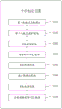
While specific embodiments of an external reference calibration method of the present application are described below, the present specification provides method steps as shown in the examples or flowcharts, but may include more or fewer steps based on routine or non-inventive efforts. The order of steps recited in the embodiments is only one of many possible orders of execution and does not represent the only order of execution, and in actual execution, the steps may be performed sequentially or in parallel as in the embodiments or methods shown in the figures (e.g., in the context of parallel processors or multi-threaded processing). Fig. 2 is a schematic flow chart of an external reference calibration method provided in an embodiment of the present application, and as shown in fig. 2, the method may include:
s201: acquiring a plurality of first key points of a target object; each first key point in the plurality of first key points carries a first coordinate corresponding to the first coordinate system.
In the embodiment of the application, when the vehicle runs on the road, the target object can select a lane line on the road, and the lane line can be a lane line on one side of the real-time position of the vehicle body or lane lines on two sides of the vehicle body. The first coordinate system may be a geodetic coordinate system. The plurality of first key points are all corresponding points on the lane line, and the first coordinate corresponding to the first coordinate system carried by the first key points on the lane line can be obtained by using xlidar,ylidar,zlidarAnd (4) showing.
In an embodiment of the present application, a plurality of first key points of a target object are obtained, and fig. 3 is a schematic flowchart of a process for obtaining the first key points provided in the embodiment of the present application, and is specifically shown in fig. 3:
s2011: acquiring vehicle environment information through a first acquisition device; the vehicle environment information includes a plurality of environment data and a reflection intensity and a first coordinate corresponding to each environment data.
S2013: and classifying the plurality of environment data based on the reflection intensity corresponding to each environment data of the data classification device to obtain the environment data of the target object and the environment data of the non-target object.
S2015: a plurality of first keypoints is determined from the environmental data of the target object.
In an optional implementation manner, the first acquisition device may adopt a vehicle-mounted laser radar, and may acquire environment data of environment information where the vehicle is located through the laser radar, where the environment data may be point cloud data, and the point cloud data records attributes of a target point, including parameters of a scanned point relative to the laser radar, such as distance, orientation, height, speed, posture, even shape, and may directly acquire information of the scanned point, such as distance, three-dimensional coordinates, angle, reflection intensity, speed, and the like, so as to generate a target multi-dimensional image.
In an alternative embodiment, the first coordinates may be three-dimensional coordinates located in a geodetic coordinate system. The first acquisition device and the data classification device belong to a first acquisition device, optionally, the data classification device may adopt a target detector corresponding to a laser radar, and the first acquisition device is an integrated laser radar and a target detector corresponding to the laser radar. The target detector can extract features according to a preset dynamic threshold method based on three-dimensional coordinates and reflection intensity corresponding to environment data acquired by the laser radar, classify the environment data acquired by the laser radar, and distinguish the environment data of a target object and non-target objects in the environment. Non-target objects may be road surfaces, few obstacles, road boundaries, signs, traffic lights, etc. The target object may be a one-sided lane line where the vehicle is located when driving on the road, and the plurality of first key points are determined in the environment data of the lane line.
S202: determining a plurality of second key points of the target object in the high-precision map according to the vehicle position information; the plurality of first key points and the plurality of second key points are in one-to-one correspondence; each second key point in the plurality of second key points carries a second coordinate corresponding to the second coordinate system; the vehicle position information is coordinates in the second coordinate system.
In the embodiment of the present application, the plurality of second keypoints are points on the lane line corresponding to the plurality of first keypoints one to one.
In an optional implementation mode, the second coordinate system can be a station center coordinate system, the high-precision map can use the station center coordinate system, the vehicle position information is expressed by coordinates of the station center coordinate system, and lane lines of the real-time position of the vehicle in the high-precision map can be acquired more accurately according to the vehicle position information. The second coordinate corresponding to the second coordinate system carried by the second key point of the lane line can be obtained by ximu,yimu,zimuAnd (4) showing.
In the embodiment of the present application, vehicle position information is determined, and fig. 4 is a schematic flowchart of a process for determining vehicle position information provided in the embodiment of the present application, specifically shown in fig. 4:
s2021: determining original position information of the vehicle through a second collector; the original position information is the coordinate corresponding to the first coordinate system.
S2023: the original position information is converted into vehicle position information.
In an alternative embodiment, the second collector may employ a GNSS sensor, such as GPS. The original position information of the vehicle acquired by the GPS is a coordinate corresponding to the first coordinate system, and may be a three-dimensional coordinate corresponding to a geodetic coordinate system.
In an alternative embodiment, the IMU may convert coordinates corresponding to the first coordinate system acquired by the GPS into vehicle location information of the second coordinate system. Optionally, the IMU converts the three-dimensional coordinates corresponding to the geodetic coordinate system acquired by the GPS into vehicle position information corresponding to the station center coordinate system, so as to query coordinates of a plurality of second key points on a lane line when the vehicle is running in real time in a high-precision map that also employs the station center coordinate system according to the vehicle position information corresponding to the station center coordinate system. The vehicle position information and the high-precision map belong to the same coordinate system, so that the high-precision map can inquire the lane line environment data more accurately when the vehicle runs, and the external reference calibration method is more accurate.
S203: acquiring a conversion matrix with unknown parameters; the transformation matrix is a transformation matrix between a first coordinate system and a second coordinate system.
In the embodiment of the present application, the transformation matrix between the first coordinate system and the second coordinate system may be represented by a rotation matrix and a translation matrix, where the rotation matrix is a 3 × 3R matrix and includes unknown parameters, namely a pitch angle pitch, a yaw angle yaw, and a roll angle roll; the translation matrix is a 3 × 1T matrix, i.e., a translation vector, and includes three unknown parameters of relative three-dimensional displacement information.
In an alternative embodiment, the transformation of the point or the set of points of the second coordinate system into the first coordinate system can result in a transformation matrix with six unknown parameters.
S204: setting an initial value for an unknown parameter in a conversion matrix to obtain a current conversion matrix;
in the embodiment of the application, the current conversion matrix is obtained by setting the initial value of the unknown parameter in the conversion matrix, the updating times of the conversion matrix can be effectively reduced, and the number of the output error values is further reduced, so that the time for reaching the most appropriate error value and the corresponding target conversion matrix is shorter, that is, the response time of the calibration process is effectively shortened, and the external reference calibration method is more efficient.
S205: determining a first coordinate of each second key point according to the current conversion matrix and the second coordinate of each second key point;
in the embodiment of the application, the current transformation matrix includes a rotation matrix and a translation matrix of which initial values are preset for unknown parameters, and the second coordinate of each second key point may pass through the rotation matrix and then pass through the translation matrix to realize target transformation, so as to obtain the first coordinate of each second key point.
Specifically, the first coordinate of each second keypoint second coordinate after being transformed by the current transformation matrix may be represented as:

s206: determining an error value according to the first coordinate of each second key point and the first coordinate of the corresponding first key point;
in the embodiment of the application, the error value is obtained by summing the squares of the differences between the first coordinates of the plurality of second keypoints and the first coordinates of the corresponding first keypoints. The number of the second key points is determined by the number of the unknown parameters of the conversion matrix, when the number of the selected second key points exceeds the number of the unknown parameters of the conversion matrix, the number of the selected second key points is more, and the precision and the accuracy of the target conversion matrix obtained by the calibration method are higher.
Specifically, the number of the selected second keypoints may be at least eight, and the number of the corresponding first keypoints is the same as the number of the selected second keypoints.
Specifically, the error value is calculated by using a mean square error function, and the error value L is calculated by using the mean square error function1Can be expressed as:

s207: updating unknown parameters in the conversion matrix based on the error value to obtain a current conversion matrix; repeating the steps: determining a first coordinate of each second key point according to the current conversion matrix and the second coordinate of each second key point; determining an error value according to the first coordinate of each second key point and the first coordinate of the corresponding first key point;
in the embodiment of the application, the conversion matrix is calculated by adopting a preset algorithm, the conversion matrix is continuously changed after the calculation of the preset algorithm, and different current conversion matrices are obtained by updating every time.
In an alternative embodiment, the preset algorithm may be a gradient descent method. The gradient descent method is a method of finding the minimum of the objective function, and the direction of gradient descent is the direction in which the function decreases the fastest, and the minimum of the objective function is solved, starting from an initial point, i.e. corresponding to the step of setting the initial value of the unknown parameter in S104. And (3) iteratively calculating a conversion matrix by a gradient descent method, wherein the current conversion matrix is changed constantly, the continuously updated conversion matrix is substituted into a calculation formula of an error value, the step of calculating the error value is repeated, and one error value is correspondingly output every time the step is repeated.
S208: and determining the current conversion matrix as the target conversion matrix until the error value or the updating times meet the preset condition.
In the embodiment of the application, by setting a preset condition of the error value, a determined error value and a corresponding target conversion matrix which are output when the error value is smaller than a set value or the updating times just reach the preset times can be selected from all the output error values; when the calculated error value is not less than the set value all the time, the conversion matrix can be stopped to be updated after the preset times are reached, so that the calculation amount of the conversion matrix and the error value is reduced, and the response time is shortened.
In an optional implementation manner, when the calculated error value is smaller than the preset error value, the conversion matrix stops iteration, the error value smaller than the preset error value is used as an optimal solution, and the corresponding current conversion matrix is output as a target conversion matrix corresponding to the optimal solution, which is the external reference calibration result of the external reference calibration method.
In an optional implementation manner, when the number of updates reaches a preset number, the conversion matrix stops iteration, and a minimum value is selected from the output error values as an optimal solution of the external reference calibration method, where a current conversion matrix corresponding to the minimum value is a target conversion matrix, that is, an external reference calibration result of the external reference calibration method.
In an alternative embodiment, the first coordinate system is a three-dimensional coordinate system comprising a longitude component, a latitude component and an altitude component, i.e. the first coordinate system may be a geodetic coordinate system.
By adopting the external reference calibration method provided by the embodiment of the application, the error value is calculated by utilizing the plurality of first key points and the plurality of second key points, so that the running environment information can be enriched, the precision of the calculated error value is improved, and the accuracy of the running environment information is improved. By setting an initial value for an unknown parameter in the conversion matrix, the iteration times of the conversion matrix using a preset gradient descent algorithm can be effectively reduced, and the efficiency of calculating the error values of the first coordinates of the first key points and the first coordinates of the second key points by the external reference calibration device is improved; updating unknown parameters in the conversion matrix based on the error value to obtain a current conversion matrix; repeating the steps: determining a first coordinate of each second key point according to the current conversion matrix and the second coordinate of each second key point; and determining an error value according to the first coordinate of each second key point and the first coordinate of the corresponding first key point, obtaining error values corresponding to different conversion matrixes, selecting the conversion matrix corresponding to the minimum value of the error value to realize external reference calibration between different vehicle-mounted sensors, and obtaining a corresponding conversion matrix as a target conversion matrix, namely an external reference calibration result. By presetting the judgment condition of the error value or the updating frequency, the external reference calibration device can be prevented from being always in the state of calculating the error value, and the determined error value can be output, so that the response time of the automatic driving external reference calibration device can be effectively shortened.
Fig. 5 is a schematic structural diagram of an external reference calibration apparatus provided in an embodiment of the present application. As shown in fig. 5, the apparatus may include:
a first key point obtaining module 501, configured to obtain a plurality of first key points of a target object; each first key point in the plurality of first key points carries a first coordinate corresponding to the first coordinate system;
a second key point obtaining module 502, configured to determine, according to the vehicle position information, a plurality of second key points of the target object in the high-precision map; the plurality of first key points and the plurality of second key points are in one-to-one correspondence; each second key point in the plurality of second key points carries a second coordinate corresponding to the second coordinate system; the vehicle position information is coordinates in a second coordinate system;
a matrix obtaining module 503, configured to obtain a transformation matrix with unknown parameters; the transformation matrix is a transformation matrix between a first coordinate system and a second coordinate system;
a conversion matrix determining module 504, configured to set an initial value for an unknown parameter in a conversion matrix, so as to obtain a current conversion matrix;
a coordinate transformation module 505, configured to determine a first coordinate of each second keypoint according to the current transformation matrix and the second coordinate of each second keypoint;
an error value determining module 506, configured to determine an error value according to the first coordinate of each second keypoint and the first coordinate of the corresponding first keypoint;
a parameter updating module 507, configured to update an unknown parameter in the conversion matrix based on the error value to obtain a current conversion matrix; repeating the steps: determining a first coordinate of each second key point according to the current conversion matrix and the second coordinate of each second key point; determining an error value according to the first coordinate of each second key point and the first coordinate of the corresponding first key point;
and a target transformation matrix determining module 508, configured to determine the current transformation matrix as the target transformation matrix until the error value or the update frequency satisfies a preset condition.
In the embodiment of the present application, the first key point obtaining module 501 is configured to obtain vehicle environment information through a first collecting device; the vehicle environment information comprises a plurality of environment data and a reflection intensity and a first coordinate corresponding to each environment data;
classifying the plurality of environment data based on the reflection intensity corresponding to each environment data of the data classification device to obtain the environment data of the target object and the environment data of the non-target object;
determining a plurality of first key points from the environment data of the target object;
a first acquisition device and a data classification device belong to a first acquisition device.
In the embodiment of the application, the device further comprises a vehicle position information determining module, which is used for determining the original position information of the vehicle through the second collector; the original position information is a coordinate corresponding to the first coordinate system; the original position information is converted into vehicle position information.
The device and method embodiments in the embodiments of the present application are based on the same application concept.
The method provided by the embodiment of the application can be executed in a computer terminal, a server or a similar operation device. Taking the operation on a server as an example, fig. 6 is a hardware structure block diagram of the server of the external reference calibration method provided in the embodiment of the present application. As shown in fig. 6, the server 600 may have a relatively large difference due to different configurations or performances, and may include one or more Central Processing Units (CPUs) 610 (the processor 610 may include but is not limited to a Processing device such as a microprocessor MCU or a programmable logic device FPGA), a memory 630 for storing data, and one or more storage media 620 (e.g., one or more mass storage devices) for storing applications 623 or data 622. Memory 630 and storage medium 620 may be, among other things, transient or persistent storage. The program stored on the storage medium 620 may include one or more modules, each of which may include a series of instruction operations for the server. Still further, the central processor 610 may be configured to communicate with the storage medium 620 to execute a series of instruction operations in the storage medium 620 on the server 600. The server 600 may also include one or more power supplies 660, one or more wired or wireless network interfaces 650, one or more input-output interfaces 640, and/or one or more operating systems 621, such as Windows Server, Mac OS XTM, UnixTM, LinuxTM, FreeBSDTM, and so forth.
The input/output interface 640 may be used to receive or transmit data via a network. Specific examples of the network described above may include a wireless network provided by a communication provider of the server 600. In one example, i/o Interface 640 includes a Network adapter (NIC) that may be coupled to other Network devices via a base station to communicate with the internet. In one example, the input/output interface 640 may be a Radio Frequency (RF) module, which is used for communicating with the internet in a wireless manner.
It will be understood by those skilled in the art that the structure shown in fig. 6 is only an illustration and is not intended to limit the structure of the electronic device. For example, server 600 may also include more or fewer components than shown in FIG. 6, or have a different configuration than shown in FIG. 6.
Embodiments of the present application further provide a storage medium, which may be disposed in a server to store at least one instruction, at least one program, a code set, or a set of instructions related to implementing an external reference calibration method in the method embodiments, where the at least one instruction, the at least one program, the code set, or the set of instructions are loaded and executed by the processor to implement the external reference calibration method.
Alternatively, in this embodiment, the storage medium may be located in at least one network server of a plurality of network servers of a computer network. Optionally, in this embodiment, the storage medium may include, but is not limited to: a U-disk, a Read-Only Memory (ROM), a Random Access Memory (RAM), a removable hard disk, a magnetic or optical disk, and other various media capable of storing program codes.
As can be seen from the above embodiments of the external reference calibration method, the external reference calibration device, or the storage medium provided by the present application, in the present application, a plurality of first keypoints of a target object are obtained, each of the plurality of first keypoints carries a first coordinate corresponding to a first coordinate system, a plurality of second keypoints of the target object in a high-precision map are determined according to vehicle position information, the plurality of first keypoints and the plurality of second keypoints correspond one-to-one, each of the plurality of second keypoints carries a second coordinate corresponding to a second coordinate system, the vehicle position information is a coordinate in the second coordinate system, a transformation matrix with unknown parameters is obtained, the transformation matrix is a transformation matrix between the first coordinate system and the second coordinate system, an initial value is set for the unknown parameters in the transformation matrix, a current transformation matrix is obtained, and a first coordinate of each second keypoint is determined according to the current transformation matrix and the second coordinate of each second keypoint, and determining an error value according to the first coordinate of each second key point and the first coordinate of the corresponding first key point, and updating unknown parameters in the conversion matrix based on the error value to obtain the current conversion matrix. Repeating the steps: determining a first coordinate of each second key point according to the current conversion matrix and a second coordinate of each second key point, determining an error value according to the first coordinate of each second key point and the corresponding first coordinate of the first key point, and determining the current conversion matrix as a target conversion matrix until the error value or the updating times meet a preset condition. Therefore, real-time, high-precision and more accurate external parameter calibration among a plurality of vehicle-mounted sensors in the automatic driving system can be realized.
It should be noted that: the sequence of the embodiments of the present application is only for description, and does not represent the advantages and disadvantages of the embodiments. And specific embodiments thereof have been described above. Other embodiments are within the scope of the following claims. In some cases, the actions or steps recited in the claims may be performed in a different order than in the embodiments and still achieve desirable results. In addition, the processes depicted in the accompanying figures do not necessarily require the particular order shown, or sequential order, to achieve desirable results. In some embodiments, multitasking and parallel processing may also be possible or may be advantageous.
The embodiments in the present specification are described in a progressive manner, and the same and similar parts among the embodiments are referred to each other, and each embodiment focuses on the differences from the other embodiments. In particular, for the apparatus embodiment, since it is substantially similar to the method embodiment, the description is relatively simple, and for the relevant points, reference may be made to the partial description of the method embodiment.
It will be understood by those skilled in the art that all or part of the steps for implementing the above embodiments may be implemented by hardware, or may be implemented by a program instructing relevant hardware, where the program may be stored in a computer-readable storage medium, and the above-mentioned storage medium may be a read-only memory, a magnetic disk or an optical disk, etc.
The above description is only exemplary of the present application and should not be taken as limiting the present application, as any modification, equivalent replacement, or improvement made within the spirit and principle of the present application should be included in the protection scope of the present application.
Claims (10)
1. An external reference calibration method is characterized by comprising the following steps:
acquiring a plurality of first key points of a target object; each first key point in the plurality of first key points carries a first coordinate corresponding to the first coordinate system;
determining a plurality of second key points of the target object in the high-precision map according to the vehicle position information; the plurality of first key points and the plurality of second key points are in one-to-one correspondence; each second key point in the plurality of second key points carries a second coordinate corresponding to a second coordinate system; the vehicle position information is coordinates in a second coordinate system;
acquiring a conversion matrix with unknown parameters; the transformation matrix is a transformation matrix between the first coordinate system and the second coordinate system;
setting an initial value for an unknown parameter in the conversion matrix to obtain a current conversion matrix;
determining a first coordinate of each second key point according to the current conversion matrix and the second coordinate of each second key point;
determining an error value according to the first coordinate of each second key point and the first coordinate of the corresponding first key point;
updating unknown parameters in the conversion matrix based on the error values to obtain a current conversion matrix; repeating the steps: determining a first coordinate of each second key point according to the current conversion matrix and the second coordinate of each second key point; determining an error value according to the first coordinate of each second key point and the first coordinate of the corresponding first key point;
and determining the current conversion matrix as a target conversion matrix until the error value or the updating times meet a preset condition.
2. The external reference calibration method according to claim 1, wherein the obtaining a plurality of first key points of the target object comprises:
acquiring the vehicle environment information through a first acquisition device; the vehicle environment information comprises a plurality of environment data and a reflection intensity and a first coordinate corresponding to each environment data;
classifying the plurality of environment data based on the reflection intensity corresponding to each environment data of the data classification device to obtain the environment data of the target object and the environment data of the non-target object;
determining a plurality of first key points from the environment data of the target object;
the first acquisition device and the data classification device belong to a first acquisition device.
3. The external reference calibration method according to claim 1, wherein before determining a plurality of second key points of the target object in the high-precision map according to the vehicle position information, the method further comprises:
determining original position information of the vehicle through a second collector; the original position information is a coordinate corresponding to the first coordinate system;
converting the original location information into the vehicle location information.
4. The external reference calibration method according to claim 3, wherein the converting the original position information into the vehicle position information comprises:
converting the raw position information into the vehicle position information according to an inertial measurement unit.
5. The extrinsic reference calibration method according to any one of claims 1 to 4, characterized in that said first coordinate system is a three-dimensional coordinate system comprising a longitude component, a latitude component and an altitude component.
6. An external reference calibration device, comprising:
the first key point acquisition module is used for acquiring a plurality of first key points of the target object; each first key point in the plurality of first key points carries a first coordinate corresponding to the first coordinate system;
the second key point acquisition module is used for determining a plurality of second key points of the target object in the high-precision map according to the vehicle position information; the plurality of first key points and the plurality of second key points are in one-to-one correspondence; each second key point in the plurality of second key points carries a second coordinate corresponding to a second coordinate system; the vehicle position information is coordinates in a second coordinate system;
the matrix acquisition module is used for acquiring a conversion matrix with unknown parameters; the transformation matrix is a transformation matrix between the first coordinate system and the second coordinate system;
the conversion matrix determining module is used for setting an initial value for the unknown parameter in the conversion matrix to obtain a current conversion matrix;
the coordinate conversion module is used for determining a first coordinate of each second key point according to the current conversion matrix and the second coordinate of each second key point;
an error value determining module, configured to determine an error value according to the first coordinate of each second keypoint and the first coordinate of the corresponding first keypoint;
the parameter updating module is used for updating unknown parameters in the conversion matrix based on the error values to obtain a current conversion matrix; repeating the steps: determining a first coordinate of each second key point according to the current conversion matrix and the second coordinate of each second key point; determining an error value according to the first coordinate of each second key point and the first coordinate of the corresponding first key point;
and the target conversion matrix determining module is used for determining the current conversion matrix as the target conversion matrix until the error value or the updating times meet the preset condition.
7. The external reference calibration device according to claim 6, wherein the first key point obtaining module is configured to:
acquiring the vehicle environment information through a first acquisition device; the vehicle environment information comprises a plurality of environment data and a reflection intensity and a first coordinate corresponding to each environment data;
classifying the plurality of environment data based on the reflection intensity corresponding to each environment data of the data classification device to obtain the environment data of the target object and the environment data of the non-target object;
determining a plurality of first key points from the environment data of the target object;
the first acquisition device and the data classification device belong to a first acquisition device.
8. The external reference calibration apparatus according to claim 6, further comprising a vehicle position information determination module configured to:
determining original position information of the vehicle through a second collector; the original position information is a coordinate corresponding to the first coordinate system;
converting the original location information into the vehicle location information.
9. An electronic device comprising a memory and a processor, the electronic device comprising a processor and a memory, the memory having stored therein at least one instruction, at least one program, a set of codes, or a set of instructions, the at least one instruction, the at least one program, the set of codes, or the set of instructions, which is loaded and executed by the processor to implement the extrinsic calibration method of any one of claims 1 to 5.
10. A computer readable storage medium having stored therein at least one instruction, at least one program, a set of codes, or a set of instructions, which is loaded and executed by a processor to implement the extrinsic calibration method as claimed in any one of claims 1 to 5.
Priority Applications (1)
| Application Number | Priority Date | Filing Date | Title |
|---|---|---|---|
| CN202111132245.6A CN113822944B (en) | 2021-09-26 | 2021-09-26 | External parameter calibration method and device, electronic equipment and storage medium |
Applications Claiming Priority (1)
| Application Number | Priority Date | Filing Date | Title |
|---|---|---|---|
| CN202111132245.6A CN113822944B (en) | 2021-09-26 | 2021-09-26 | External parameter calibration method and device, electronic equipment and storage medium |
Publications (2)
| Publication Number | Publication Date |
|---|---|
| CN113822944A true CN113822944A (en) | 2021-12-21 |
| CN113822944B CN113822944B (en) | 2023-10-31 |
Family
ID=78915578
Family Applications (1)
| Application Number | Title | Priority Date | Filing Date |
|---|---|---|---|
| CN202111132245.6A Active CN113822944B (en) | 2021-09-26 | 2021-09-26 | External parameter calibration method and device, electronic equipment and storage medium |
Country Status (1)
| Country | Link |
|---|---|
| CN (1) | CN113822944B (en) |
Cited By (11)
| Publication number | Priority date | Publication date | Assignee | Title |
|---|---|---|---|---|
| CN114460550A (en) * | 2022-01-06 | 2022-05-10 | 北京三快在线科技有限公司 | Monitoring method and device for sensor external parameter calibration |
| CN114705222A (en) * | 2022-03-31 | 2022-07-05 | 重庆长安汽车股份有限公司 | Vehicle-mounted multi-view ranging equipment calibration method and system based on perception data |
| CN115194770A (en) * | 2022-07-25 | 2022-10-18 | Oppo广东移动通信有限公司 | Conversion parameter acquisition method and device, mechanical arm and storage medium |
| CN115218943A (en) * | 2022-06-06 | 2022-10-21 | 北京主线科技有限公司 | Sensor external parameter calibration method, device, vehicle, equipment and medium |
| CN115343730A (en) * | 2022-10-18 | 2022-11-15 | 苏州挚途科技有限公司 | GNSS antenna external parameter determination method, device and computer readable storage medium |
| CN115950474A (en) * | 2023-02-02 | 2023-04-11 | 广州沃芽科技有限公司 | External parameter calibration method, device, equipment, medium and program product for sensor |
| CN115963459A (en) * | 2022-12-30 | 2023-04-14 | 苏州万集车联网技术有限公司 | Registration method of radar apparatus, and computer-readable storage medium |
| CN116309830A (en) * | 2023-02-28 | 2023-06-23 | 中汽创智科技有限公司 | A data processing method, device and storage medium |
| CN116664638A (en) * | 2022-11-28 | 2023-08-29 | 浙江宇视科技有限公司 | Method, device, electronic equipment and storage medium for determining perspective matrix |
| CN119399289A (en) * | 2024-09-03 | 2025-02-07 | 北京卓视智通科技有限责任公司 | Method and system for calibrating a conversion relationship between two roadside sensors |
| WO2026067445A1 (en) * | 2024-09-24 | 2026-04-02 | 北京石头创新科技有限公司 | Extrinsic parameter calibration method for sensors, and cleaning robot, cleaning system and medium |
Citations (5)
| Publication number | Priority date | Publication date | Assignee | Title |
|---|---|---|---|---|
| CN109215083A (en) * | 2017-07-06 | 2019-01-15 | 华为技术有限公司 | Method and device for calibrating external parameters of vehicle-mounted sensors |
| CN109920011A (en) * | 2019-05-16 | 2019-06-21 | 长沙智能驾驶研究院有限公司 | Outer ginseng scaling method, device and the equipment of laser radar and binocular camera |
| WO2019233330A1 (en) * | 2018-06-05 | 2019-12-12 | 上海商汤智能科技有限公司 | Vehicle-mounted camera self-calibration method and apparatus, and vehicle driving method and apparatus |
| CN110689585A (en) * | 2019-10-09 | 2020-01-14 | 北京百度网讯科技有限公司 | Joint calibration method, device, equipment and medium for multi-camera external parameters |
| CN112017251A (en) * | 2020-10-19 | 2020-12-01 | 杭州飞步科技有限公司 | Calibration method and device, road side equipment and computer readable storage medium |
-
2021
- 2021-09-26 CN CN202111132245.6A patent/CN113822944B/en active Active
Patent Citations (5)
| Publication number | Priority date | Publication date | Assignee | Title |
|---|---|---|---|---|
| CN109215083A (en) * | 2017-07-06 | 2019-01-15 | 华为技术有限公司 | Method and device for calibrating external parameters of vehicle-mounted sensors |
| WO2019233330A1 (en) * | 2018-06-05 | 2019-12-12 | 上海商汤智能科技有限公司 | Vehicle-mounted camera self-calibration method and apparatus, and vehicle driving method and apparatus |
| CN109920011A (en) * | 2019-05-16 | 2019-06-21 | 长沙智能驾驶研究院有限公司 | Outer ginseng scaling method, device and the equipment of laser radar and binocular camera |
| CN110689585A (en) * | 2019-10-09 | 2020-01-14 | 北京百度网讯科技有限公司 | Joint calibration method, device, equipment and medium for multi-camera external parameters |
| CN112017251A (en) * | 2020-10-19 | 2020-12-01 | 杭州飞步科技有限公司 | Calibration method and device, road side equipment and computer readable storage medium |
Cited By (14)
| Publication number | Priority date | Publication date | Assignee | Title |
|---|---|---|---|---|
| CN114460550A (en) * | 2022-01-06 | 2022-05-10 | 北京三快在线科技有限公司 | Monitoring method and device for sensor external parameter calibration |
| CN114705222A (en) * | 2022-03-31 | 2022-07-05 | 重庆长安汽车股份有限公司 | Vehicle-mounted multi-view ranging equipment calibration method and system based on perception data |
| CN115218943A (en) * | 2022-06-06 | 2022-10-21 | 北京主线科技有限公司 | Sensor external parameter calibration method, device, vehicle, equipment and medium |
| CN115194770A (en) * | 2022-07-25 | 2022-10-18 | Oppo广东移动通信有限公司 | Conversion parameter acquisition method and device, mechanical arm and storage medium |
| CN115343730A (en) * | 2022-10-18 | 2022-11-15 | 苏州挚途科技有限公司 | GNSS antenna external parameter determination method, device and computer readable storage medium |
| CN115343730B (en) * | 2022-10-18 | 2023-02-17 | 苏州挚途科技有限公司 | GNSS antenna external parameter determination method, device and computer readable storage medium |
| CN116664638A (en) * | 2022-11-28 | 2023-08-29 | 浙江宇视科技有限公司 | Method, device, electronic equipment and storage medium for determining perspective matrix |
| CN116664638B (en) * | 2022-11-28 | 2026-02-24 | 浙江宇视科技有限公司 | Determination method and device of perspective matrix, electronic equipment and storage medium |
| CN115963459A (en) * | 2022-12-30 | 2023-04-14 | 苏州万集车联网技术有限公司 | Registration method of radar apparatus, and computer-readable storage medium |
| CN115950474A (en) * | 2023-02-02 | 2023-04-11 | 广州沃芽科技有限公司 | External parameter calibration method, device, equipment, medium and program product for sensor |
| CN115950474B (en) * | 2023-02-02 | 2023-12-29 | 广州沃芽科技有限公司 | Sensor external parameter calibration method, device, equipment, medium and program product |
| CN116309830A (en) * | 2023-02-28 | 2023-06-23 | 中汽创智科技有限公司 | A data processing method, device and storage medium |
| CN119399289A (en) * | 2024-09-03 | 2025-02-07 | 北京卓视智通科技有限责任公司 | Method and system for calibrating a conversion relationship between two roadside sensors |
| WO2026067445A1 (en) * | 2024-09-24 | 2026-04-02 | 北京石头创新科技有限公司 | Extrinsic parameter calibration method for sensors, and cleaning robot, cleaning system and medium |
Also Published As
| Publication number | Publication date |
|---|---|
| CN113822944B (en) | 2023-10-31 |
Similar Documents
| Publication | Publication Date | Title |
|---|---|---|
| CN113822944B (en) | External parameter calibration method and device, electronic equipment and storage medium | |
| Suhr et al. | Sensor fusion-based low-cost vehicle localization system for complex urban environments | |
| CN113899375B (en) | Vehicle positioning method and device, storage medium and electronic equipment | |
| EP3674662B1 (en) | Automatic detection and positioning of pole-like objects in 3d | |
| CN110146909B (en) | Positioning data processing method | |
| CN109341706B (en) | Method for manufacturing multi-feature fusion map for unmanned vehicle | |
| CN111551186B (en) | Real-time vehicle positioning method and system and vehicle | |
| EP3671278B1 (en) | Road surface detection | |
| US10970542B2 (en) | Scalable three dimensional object segmentation | |
| CN111161353B (en) | Vehicle positioning method, device, readable storage medium and computer equipment | |
| CN109270545B (en) | Positioning true value verification method, device, equipment and storage medium | |
| CN112703368B (en) | Vehicle positioning method and device and positioning layer generation method and device | |
| CN109435955B (en) | Performance evaluation method, device and equipment for automatic driving system and storage medium | |
| US11493624B2 (en) | Method and system for mapping and locating a vehicle based on radar measurements | |
| CN114111774B (en) | Vehicle positioning method, system, device and computer readable storage medium | |
| JP5162849B2 (en) | Fixed point position recorder | |
| KR102130687B1 (en) | System for information fusion among multiple sensor platforms | |
| CN114419573A (en) | Dynamic occupancy grid estimation method and device | |
| CN112596089B (en) | Fusion positioning method and device, electronic equipment and storage medium | |
| CN116929377A (en) | Laser radar and inertial navigation fusion positioning method and related equipment | |
| CN116678424B (en) | High-precision vehicle positioning, vectorized map construction and positioning model training method | |
| CN112965076B (en) | Multi-radar positioning system and method for robot | |
| CN114660589A (en) | Method, system and device for positioning underground tunnel | |
| Farag | Self-driving vehicle localization using probabilistic maps and unscented-kalman filters | |
| CN115856911A (en) | A positioning method and device |
Legal Events
| Date | Code | Title | Description |
|---|---|---|---|
| PB01 | Publication | ||
| PB01 | Publication | ||
| SE01 | Entry into force of request for substantive examination | ||
| SE01 | Entry into force of request for substantive examination | ||
| GR01 | Patent grant | ||
| GR01 | Patent grant |