CN113723531A - Mining area ground surface deformation real-time/quasi-real-time monitoring method for full operation period - Google Patents

Mining area ground surface deformation real-time/quasi-real-time monitoring method for full operation period Download PDF

Info

Publication number
CN113723531A
CN113723531A CN202111024648.9A CN202111024648A CN113723531A CN 113723531 A CN113723531 A CN 113723531A CN 202111024648 A CN202111024648 A CN 202111024648A CN 113723531 A CN113723531 A CN 113723531A
Authority
CN
China
Prior art keywords
monitoring
model
time
real
deformation
Prior art date
Legal status (The legal status is an assumption and is not a legal conclusion. Google has not performed a legal analysis and makes no representation as to the accuracy of the status listed.)
Granted
Application number
CN202111024648.9A
Other languages
Chinese (zh)
Other versions
CN113723531B (en
Inventor
陶叶青
杨娟
严琰
Current Assignee (The listed assignees may be inaccurate. Google has not performed a legal analysis and makes no representation or warranty as to the accuracy of the list.)
Beijing Dixin Interactive Technology Co ltd
Original Assignee
Huaiyin Normal University
Priority date (The priority date is an assumption and is not a legal conclusion. Google has not performed a legal analysis and makes no representation as to the accuracy of the date listed.)
Filing date
Publication date
Application filed by Huaiyin Normal University filed Critical Huaiyin Normal University
Priority to CN202111024648.9A priority Critical patent/CN113723531B/en
Publication of CN113723531A publication Critical patent/CN113723531A/en
Application granted granted Critical
Publication of CN113723531B publication Critical patent/CN113723531B/en
Active legal-status Critical Current
Anticipated expiration legal-status Critical

Links

Images

Classifications

    • GPHYSICS
    • G06COMPUTING OR CALCULATING; COUNTING
    • G06FELECTRIC DIGITAL DATA PROCESSING
    • G06F18/00Pattern recognition
    • G06F18/20Analysing
    • G06F18/25Fusion techniques
    • G06F18/251Fusion techniques of input or preprocessed data
    • GPHYSICS
    • G01MEASURING; TESTING
    • G01BMEASURING LENGTH, THICKNESS OR SIMILAR LINEAR DIMENSIONS; MEASURING ANGLES; MEASURING AREAS; MEASURING IRREGULARITIES OF SURFACES OR CONTOURS
    • G01B21/00Measuring arrangements or details thereof, where the measuring technique is not covered by the other groups of this subclass, unspecified or not relevant
    • G01B21/32Measuring arrangements or details thereof, where the measuring technique is not covered by the other groups of this subclass, unspecified or not relevant for measuring the deformation in a solid
    • GPHYSICS
    • G01MEASURING; TESTING
    • G01CMEASURING DISTANCES, LEVELS OR BEARINGS; SURVEYING; NAVIGATION; GYROSCOPIC INSTRUMENTS; PHOTOGRAMMETRY OR VIDEOGRAMMETRY
    • G01C15/00Surveying instruments or accessories not provided for in groups G01C1/00 - G01C13/00

Landscapes

  • Engineering & Computer Science (AREA)
  • General Physics & Mathematics (AREA)
  • Physics & Mathematics (AREA)
  • Data Mining & Analysis (AREA)
  • Theoretical Computer Science (AREA)
  • Bioinformatics & Cheminformatics (AREA)
  • Life Sciences & Earth Sciences (AREA)
  • Artificial Intelligence (AREA)
  • Remote Sensing (AREA)
  • Bioinformatics & Computational Biology (AREA)
  • Computer Vision & Pattern Recognition (AREA)
  • Evolutionary Biology (AREA)
  • Evolutionary Computation (AREA)
  • General Engineering & Computer Science (AREA)
  • Radar, Positioning & Navigation (AREA)
  • Testing Or Calibration Of Command Recording Devices (AREA)
  • Management, Administration, Business Operations System, And Electronic Commerce (AREA)

Abstract

本发明公开了一种面向全运行周期的矿区地表形变实时/准实时监测方法,根据方差分量估计理论,定义几何空间尺度,建立时/空序列模型途径,构建面向多源观测数据融合的矿区地表形变监测数据程序化处理方法。本发明应用信息化对地观测技术实现矿区的基建‑开采‑闭坑全运行周期地表形变监测建立完善的解决方案,多种观测技术融合实现矿区地表形变实时/准实时监测数据的一致性评价,解决不同观测技术融合引起数据异质、异构与尺度差异而无法对监测精度做出准确评价的技术瓶颈。

Figure 202111024648

The invention discloses a real-time/quasi-real-time monitoring method for mining surface deformation oriented to a full operation cycle. According to the variance component estimation theory, a geometrical space scale is defined, a time/space sequence model approach is established, and a mining surface surface oriented to multi-source observation data fusion is constructed. Deformation monitoring data program processing method. The invention applies the information-based earth observation technology to realize the establishment of a complete solution for the monitoring of the surface deformation of the mining area's infrastructure-mining-pit closure in the full operation cycle, and the integration of multiple observation technologies realizes the consistency evaluation of the real-time/quasi-real-time monitoring data of the surface deformation of the mining area. Solve the technical bottleneck that the data heterogeneity, heterogeneity and scale difference caused by the fusion of different observation technologies cannot accurately evaluate the monitoring accuracy.

Figure 202111024648

Description

Mining area ground surface deformation real-time/quasi-real-time monitoring method for full operation period
Technical Field
The invention belongs to a mining area ground surface deformation monitoring method related to the industries of mining engineering, surveying and mapping engineering, safety engineering and the like, and particularly relates to a ground surface deformation monitoring data consistency evaluation scheme of a mining area capital construction-mining-closed pit full operation period, which integrates multiple observation technologies, and implements real-time/quasi-real-time monitoring of the ground surface deformation of a mining area.
Background
The monitoring of the deformation of the earth surface is a necessary measure for guaranteeing the safety production of the mining area, and is an effective way for guaranteeing the safety of life and property of the earth surface and the safety of underground operation. Meanwhile, the deformation of the ground surface of the mining area is effectively monitored, and the method is a precondition for mining area treatment such as mining area land reclamation, mining area ecological restoration and the like. In recent years, with the development of information-based earth observation technology, geospatial data acquisition presents a situation that a plurality of modes including a space base, a space base and a foundation are used together. Particularly, the construction and the perfection of software and hardware facilities of space information engineering such as a Beidou satellite navigation positioning system, a high-resolution earth observation satellite system and the like in China are realized, and the conditions of real-time/quasi-real-time monitoring of the deformation of the earth surface of the mining area covering the whole life cycle of infrastructure construction, mining and pit closure of the mining area are provided. However, the integration of multiple observation techniques to monitor the deformation of the earth surface in the mining area lacks a perfect technical implementation scheme and data processing method, and even the phenomena of 'true observation and false integration' occur.
Disclosure of Invention
The purpose of the invention is as follows: aiming at the current application situation of the mining area ground surface deformation monitoring technology and around the technical problem faced by heterogeneous/heterogeneous data processing generated by fusion of various ground observation technologies, a mining area ground surface deformation real-time/quasi-real-time monitoring method oriented to a full operation period is provided, a programmed solution is provided for breaking through the technical bottleneck existing in ground surface deformation real-time/quasi-real-time dynamic autonomous monitoring of the mining area full operation period, and the following problems are solved: 1. extracting and matching the characteristics of three types of heterogeneous data fusion of surface shape/linear shape/point shape; 2. the spatial scale problem of heterogeneous data fusion of different observation accuracies; 3. the problem of different temporal/spatial resolution data fusion for multiple observation means.
The principle of the invention is as follows: aiming at the extraction of the feature points of the planar data obtained by radar interferometry and three-dimensional laser scanning and the consistency matching of the feature points with the point data obtained by GNSS and leveling measurement, an M estimation theory is applied to establish a consistency evaluation method for the matching of the adjustment model of the feature point extraction and the feature points; defining precision scales of mapping data and a data processing model according to a spatial scale theory, establishing a block error model of heterogeneous data fusion by applying a variance component estimation theory, and analyzing the influence of the inconsistency of the geometric scales on the heterogeneous data fusion by combining the geometric meanings of a G-M linear model and a G-H nonlinear model; according to the basic law of subsidence-unbalance-collapse of the deformation of the ground surface of the mining area, a time/space grid is formed in a discrete monitoring area, and monitoring data of different time domains and different airspaces are fused by applying a typical sequence model, so that the full-period and autonomous monitoring of the deformation of the ground surface of the mining area is realized.
The technical solution of the invention is as follows: the mining area ground surface deformation real-time/quasi real-time monitoring method oriented to the full operation period comprises the following steps: aiming at the surface-shaped, linear and point-shaped heterogeneous data fusion acquired by the space-based/ground-based earth observation technology, a regional ellipsoid theory is applied to construct a system framework and a conversion model for monitoring the ground surface deformation of a mining area; unifying heterogeneous data precision scales according to a spatial scale theory, analyzing the influence of different geometric scales on model robustness and geometric scale inconsistency on heterogeneous data fusion by combining the geometric meanings of two typical adjustment models, and establishing a data processing model consistency evaluation means; establishing a block error model of heterogeneous data fusion by applying a variance component estimation theory; according to the basic law of subsidence-unbalance-collapse of the ground surface deformation of the mining area, a time/space grid is formed in a discrete monitoring area, interpolation is carried out on a missing monitoring area/monitoring time period by combining time/space resolution complementarity of data obtained by different observation technologies, and monitoring data of different time domains and different air domains are fused by applying a sequence model, so that real-time/quasi-real-time autonomous monitoring of the ground surface deformation covering the whole operation period of infrastructure construction-mining-closed pit of the mining area is realized.
The method comprises the following specific steps:
step1, constructing a mining area reference frame for acquiring heterogeneous data fusion by multiple earth observation technologies;
Step2.Msplitthe consistency of the estimation theory and the S conversion model on heterogeneous monitoring data based on various observation technologies is detected;
step3, defining the geometric space scale of the function model by using a space scale theory to detect the reliability of the model;
step4, establishing a heterogeneous data fusion model based on a variance component estimation theory, and detecting the consistency of monitoring data based on a surface deformation state domain;
step5, respectively carrying out time/space grid discretization on the monitoring area, and interpolating the grid units lacking the monitoring points;
and step6, smoothing grids in the monitoring area, and performing four-dimensional modeling on the earth surface deformation of the mining area to realize real-time/quasi-real-time dynamic autonomous monitoring on the earth surface deformation of the mining area.
In Step1, determining a reference ellipsoid of the monitoring area according to the average elevation surface of the mining area, selecting ellipsoid geometric parameters of a national coordinate system or an ellipsoid reference of a local coordinate system, taking a meridian passing through the central position of the monitoring area as a central meridian of coordinate projection, determining the projection band number according to the mining area, and at least covering the deformation monitoring area by the span of the projection band number; establishing a coordinate system conversion model by using a burst model with a large rotation angle, and establishing a monitoring area unified reference frame; the coordinate observation value in the conversion model is subjected to barycenter processing and pathologically detection; selecting remote sensing images or radar interference image interference points acquired by space-based/space-based and measuring stations scanned by foundation three-dimensional laser, preferentially selecting monitoring points distributed on the earth surface, and if the monitoring points are lacked, selecting characteristic points of important structures needing deformation monitoring in a mine area without limitation to a shaft to perform ground three-dimensional control measurement; the plane precision of the control measurement is not lower than the precision requirement of B-level GPS measurement in the Global positioning System measurement Specification (GB/T18314-2009), and the elevation precision is not lower than the precision requirement of second-level leveling in the national first-level and second-level leveling Specification (GB/T12897-2006).
In Step2, heterogeneous data consistency detection is mainly performed on monitoring data acquired by different observation technologies, including monitoring data acquired by common monitoring means for mine area ground surface deformation and emerging monitoring means; defining gross error as the index of consistency detection by combining the basic rule of monitoring the deformation of the earth surface of the mining area, and dividing the gross error into two types of conditions (1) that the same monitoring point has two or more than two types of monitoring data and M is appliedsplitThe estimation theory and the S conversion model carry out gross error detection, identification and adjustment on the monitoring data; wherein the target function of the gross error detection is represented by MsplitConstructing a statistical model by t distribution for identifying gross errors, and constructing a model by an IGG weight function for adjusting the gross errors; (2) the same monitoring point only has one type of first-stage monitoring data, and the average difference mode is surroundedThe internal reliability of the model is that a statistical model is constructed by using t distribution according to the unit weight variance obtained by the adjustment model to detect the gross error of the monitoring data; the deformation monitoring of the earth surface of the mining area reveals the deformation process and the deformation rule of the multi-period monitoring data through comparative analysis of the multi-period monitoring data, so that gross error detection of first-period monitoring data is primary check on the quality of original observation data, and the data needs to be brought into first-type condition processing along with accumulation of monitoring data quantity.
Furthermore, common monitoring means are not limited to GNSS, wire measurements, leveling measurements; emerging monitoring means are not limited to radar interferometry and three-dimensional laser scanning; the identification of the gross errors is not limited to a statistical model constructed by t distribution, and the adjustment of the gross errors is not limited to a model constructed by an IGG weight function.
In Step3, judging and selecting a proper data fusion model aiming at deformation characteristics of a mining area, and at least comparing a linear model with a nonlinear model; according to the geometric meaning of the model, defining the geometric spatial scale of the model, and measuring the influence of different scale standards on the reliability of the model and the identification of the reliability model; based on the assumption that the observation error obeys normal distribution, a statistical model is constructed by applying F distribution to detect the influence of different scale standards on the reliability of the model; and measuring the reliability of the model by taking the geometric space scale defined according to the geometric meaning of the model as an index, and selecting a data processing model suitable for the monitored mining area.
Further, the linear model is not limited to the G-M model, and the non-linear model is not limited to the G-H model; and (3) applying a statistical model which is not limited to F distribution construction to detect the influence of different scale standards on the reliability of the model.
In Step4, acquiring heteroscedasticity of heterogeneous data according to different observation technologies, and fusing monitoring data with heteroscedasticity by using a variance component estimation theory; meanwhile, the adjustment model constructed by the estimation of the variance component needs to be pathologically analyzed: (1) when the observed data is more than two, namely the number of error factors in the unit weight is more than two, applying the quantized condition number index to carry out ill-condition detection on the variance component estimation model, and when the variance component estimation model is ill-condition, applying a Tikhonov function to carry out regularization on the ill-condition model; (2) when the variance component estimation model contains two types of observation data, the model is not subjected to ill-condition detection; constructing a mine ground surface deformation time sequence model by using the monitoring data, predicting a deformation value according to the sequence model, and carrying out consistency detection on the monitoring data to be fused; the method specifically comprises the steps of constructing statistic by using the difference value of the predicted value and the monitored value, constructing a statistical function by using t distribution, and detecting the consistency of the fusion data.
In Step5, grid processing is carried out on a deformation monitoring area of the mining area according to the time and space resolution of monitoring carried out on the mining area, the space resolution of the grid is divided according to the landform characteristics of the ground surface of the mining area, and the general principle is that the more complex the landform is, the finer the grid is, and the resolution is not less than 5 mmy 5 m; the time resolution is divided according to the operation cycle of the infrastructure construction, mining and pit closure of the mining area, and the execution standards are national standards of coal mine measurement regulations and engineering measurement standards; the space shape of the grid is triangular net/four-sided net, but each grid unit is at least ensured to have a monitoring point; if the grid lacks monitoring point deformation data, a deformation model is constructed through the existing monitoring data in the adjacent area, interpolation processing is carried out on the deformation model by applying a Krigin interpolation algorithm, and the monitoring point deformation data is estimated.
In Step6, a single grid is used as a unit, and a multi-face function is applied to construct a four-dimensional model of the earth surface deformation of the mining area; in the construction of the deformation model, the weight of the unit grid is determined by using the consistency detection result of the monitoring points in the grid as prior information; the parameters of the deformation model are four-dimensional independent variables formed by space and time, and the surface deformation value is a dependent variable; according to the basic characteristics of the deformation of the ground surface of the mining area, the time dimension (t) in the independent variable takes day as a measurement unit; the spatial dimension adopts a spatial three-dimensional rectangular coordinate (X Y Z) or a plane coordinate plus an elevation (X Y H), meters are taken as a measurement unit, and the plane coordinate of the monitoring point is obtained by regional ellipsoid projection transformation of a mining area defined by the spatial three-dimensional rectangular coordinate; the surface deformation values are measured in millimeters.
The invention has the following advantages:
1. the real-time/quasi-real-time autonomous monitoring of the deformation of the earth surface of the mining area based on the combination of various observation technologies of the empty foundation/the sky foundation/the foundation is realized, and the defects that the time resolution/space resolution is low, the reliability is poor, the deformation of the earth surface needs to be judged by manual intervention and the like in a single observation technology are overcome.
2. A consistency evaluation scheme and a method for heterogeneous/heterogeneous data fusion based on combination of various observation technologies are established, and observation data reliability fusion considering factors such as observation technologies and mathematical models is achieved.
3. And the geometric spatial scale of the mining observation data processing model is defined from the perspective of the spatial scale, so that the autonomous selection of the optimal data processing model in different mining areas is realized.
Drawings
FIG. 1 is a monitoring diagram of the deformation of the earth's surface of a certain coal mine production operation surface;
FIG. 2 is a plot of average elevation surface versus projection distortion;
FIG. 3 is a flow chart of a monitoring method of the present invention.
Detailed Description
The following description will be given, with reference to the accompanying drawings, to illustrate a technical implementation of the present invention, taking monitoring of surface deformation of an underground working surface of a coal mine in the same city as Shanxi province in China as an example, and should not be construed as limiting the technical scheme of the present invention. The ground surface deformation monitoring time span of the underground operation surface is twenty-seven months, and a coordinate reference frame of a mining area is a national reference center coordinate system.
The observation means related to the surface deformation monitoring comprises:
(1) leveling along the underground working surface, wherein the working accuracy is second-grade elevation control measurement, and twenty-first-grade observation is carried out altogether;
(2) GNSS control measurement, wherein a control point is a CORS site distributed by an enterprise, the operation precision is a B-level GPS control network, and nine-stage observation is carried out;
(3) space-based SAR interference images with twelve scenes;
(4) a space-based SAR interference image with forty scenes;
(5) and (3) three-dimensional laser scanning data of five landslide body deformations, wherein the total period is six.
As shown in figure 1, a monitoring chart, a legend, of the surface deformation of a certain coal mine production working face:
Figure BDA0003242780630000052
Distributing measured horizontal points along the underground operation surface;
Figure DEST_PATH_IMAGE001
GNSS control points are distributed in the area adjacent to the underground working face;
Figure BDA0003242780630000054
the overlapping degree of the unit grids and the grids is 15%.
The coordinate reference frame used in the mining area is a national center-of-reference coordinate system, and the coordinates of part of the control points are listed in the following table 1.
TABLE 1 mine area part control point coordinates
Figure BDA0003242780630000051
And analyzing the relation between the average elevation surface and the projection deformation according to the topographic features of the area where the mining area is located, as shown in fig. 2, and establishing a mining area regional reference ellipsoid according to the relation.
Applying the burst model (without limitation to this model) to achieve national coordinate system coordinates (X) with large rotation angles0 Y0Z0) Coordinate (X) of coordinate system of mining area1 Y1 Z1) Conversion:
Figure BDA0003242780630000061
as shown in fig. 3, which is a flow chart of the monitoring method of the present invention, the deformation of the ground surface of the underground working surface of a coal mine in the same city as Datongyu of Shanxi province is monitored according to the flow chart, and the accumulated settlement amounts of some monitoring points are listed in table 2.
TABLE 2 cumulative settling volume for some monitoring points
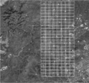
Figure BDA0003242780630000062

Claims (10)

1.面向全运行周期的矿区地表形变实时/准实时监测方法,其特征是该方法的步骤如下:针对空基/天基/地基对地观测技术获取的面状、线状、点状异构数据融合,应用区域性椭球理论构建矿区地表形变监测的系统框架与转换模型;根据空间尺度理论统一异质数据精度尺度,结合两种典型平差模型的几何意义分析不同几何尺度对模型稳健性、几何尺度不一致对异质数据融合的影响,建立数据处理模型一致性评价手段;应用方差分量估计理论,建立异质数据融合的平差模型;根据矿区地表形变的沉降-失衡-塌陷的基本规律,离散监测区域形成时/空格网,结合不同观测技术获取数据的时/空分辨率互补性对缺失监测区域/监测时段进行插值,应用序列模型对不同时域、不同空域的监测数据进行融合,实现覆盖矿区基建-开采-闭坑全运行周期的地表形变实时/准实时自主化监测。1. A real-time/quasi-real-time monitoring method for mining surface deformation oriented to a full operation cycle, characterized in that the method has the following steps: for the surface, linear, and point-like isomerism obtained by space-based/space-based/ground-based earth observation technology Data fusion, applying regional ellipsoid theory to construct a system framework and transformation model for surface deformation monitoring in mining areas; unifying the accuracy scale of heterogeneous data according to spatial scale theory, and combining the geometric significance of two typical adjustment models to analyze the robustness of different geometric scales to the model The impact of inconsistency of geometric scales on heterogeneous data fusion, establish a data processing model consistency evaluation method; apply the variance component estimation theory to establish an adjustment model for heterogeneous data fusion; , discrete monitoring areas form a time/space network, interpolate missing monitoring areas/monitoring periods by combining the temporal/spatial resolution complementarity of data obtained by different observation techniques, and use sequence models to fuse monitoring data in different time domains and different airspaces. Real-time/quasi-real-time autonomous monitoring of surface deformation covering the entire operation cycle of mining area infrastructure-mining-pit closure. 2.根据权利要求1所述的面向全运行周期的矿区地表形变实时/准实时监测方法,其特征是该方法的具体步骤如下:2. the real-time/quasi-real-time monitoring method of mining area surface deformation oriented to full operation cycle according to claim 1, it is characterized in that the concrete steps of this method are as follows: Step1.构建面向多种对地观测技术获取异构数据融合的矿区参考框架;Step1. Construct a mining area reference frame for the fusion of heterogeneous data obtained by various earth observation technologies; Step2.Msplit估计理论与S转换模型对基于多种观测技术的异质监测数据一致性检测;Step2. M split estimation theory and S transformation model to detect the consistency of heterogeneous monitoring data based on multiple observation techniques; Step3.空间尺度理论定义函数模型几何空间尺度进行模型可靠性检测;Step3. The spatial scale theory defines the geometrical spatial scale of the function model to test the reliability of the model; Step4.方差分量估计理论建立异质数据融合模型,基于地表形变状态域的监测数据一致性检测;Step4. Variance component estimation theory to establish a heterogeneous data fusion model, and to detect the consistency of monitoring data based on the surface deformation state domain; Step5.监测区域分别进行时/空格网离散化处理,对缺失监测点的格网单元进行插值;Step5. The monitoring area is processed by time/space grid discretization, and the grid cells with missing monitoring points are interpolated; Step6.监测区格网平滑,矿区地表形变四维建模,实现矿区地表形变实时/准实时动态自主监测。Step6. The grid of the monitoring area is smooth, and the surface deformation of the mining area is modeled in four dimensions to realize real-time/quasi-real-time dynamic autonomous monitoring of the surface deformation of the mining area. 3.根据权利要求2所述的面向全运行周期的矿区地表形变实时/准实时监测方法,其特征是:Step1中,根据矿区的平均高程面确定监测区域的参考椭球,椭球几何参数选择国家坐标系统椭球参数或者地方坐标系统椭球参考,以经过监测区域中心位置的子午线为坐标投影的中央子午线,投影带度数根据矿区区域确定,其跨度至少覆盖形变监测区域;应用具有大旋转角的Bursa模型建立坐标系统转换模型,构建监测区域统一参考框架;转换模型中的坐标观测值应进行重心化处理,并进行病态性检测;天基/空基获取的遥感影像或者雷达干涉影像干涉点,以及地基三维激光扫描的测站点选择,应优先选用地表已经布设的监测点,若监测点缺乏,则选用矿区不局限于井筒的需要进行形变监测的重要构筑物的特征点,进行地面三维控制测量;控制测量的平面精度不低于《全球定位系统测量规范》(GB/T18314-2009)中B级GPS测量的精度要求,高程精度不低于《国家一、二等水准测量规范》(GB/T12897-2006)中二等水准测量的精度要求。3. the real-time/quasi-real-time monitoring method for the surface deformation of the mining area oriented to the full operation cycle according to claim 2, is characterized in that: in Step 1, the reference ellipsoid of the monitoring area is determined according to the average elevation surface of the mining area, and the ellipsoid geometric parameters are selected National coordinate system ellipsoid parameters or local coordinate system ellipsoid reference, take the meridian passing through the center of the monitoring area as the central meridian of the coordinate projection, the degree of the projection zone is determined according to the mining area, and its span at least covers the deformation monitoring area; the application has a large rotation angle The Bursa model is used to establish a coordinate system transformation model and a unified reference frame for the monitoring area; the coordinate observations in the transformation model should be subjected to gravity center processing and ill-conditioned detection; remote sensing images or radar interference images obtained by space/space , as well as the selection of the measuring points for the three-dimensional laser scanning of the ground, the monitoring points that have been laid on the surface should be preferentially selected. If the monitoring points are lacking, the feature points of the important structures in the mining area that are not limited to the wellbore and need to be monitored for deformation should be selected for the three-dimensional control measurement on the ground. ; The plane accuracy of the control measurement is not lower than the accuracy requirements of the B-level GPS measurement in the "Global Positioning System Measurement Specification" (GB/T18314-2009), and the elevation accuracy is not lower than the "National First- and Second-Class Leveling Measurement Specifications" (GB/T18314-2009). T12897-2006), the accuracy requirements for second-class leveling. 4.根据权利要求2所述的面向全运行周期的矿区地表形变实时/准实时监测方法,其特征是:Step2中,异质数据一致性检测主要针对不同观测技术获取的监测数据,包括矿区地表形变常用监测手段获取的监测数据,也包括新兴监测手段;结合矿区地表形变监测的基本规律,定义粗差为一致性检测的指标,将其分为两类情况:(1)同一监测点有两类或两期及以上监测数据,应用Msplit估计理论与S转换模型对监测数据进行粗差的检测-识别-调整;其中,粗差检测的目标函数由Msplit构建,粗差的识别由t分布构建统计模型,粗差的调整由IGG权函数构建模型;(2)同一监测点仅有一类一期监测数据,围绕平差模型的内部可靠性,根据平差模型得到的单位权方差,应用t分布构建统计模型对监测数据的粗差进行检测;矿区地表形变监测是通过多期监测数据的对比分析,揭示其形变过程与形变规律,因此,一类一期监测数据的粗差检测是对原始观测数据质量的初步检核,随着监测数据量的积累,这类数据须纳入到第一类情况处理。4. The real-time/quasi-real-time monitoring method for mining surface deformation oriented to a full operation cycle according to claim 2, characterized in that: in Step 2, the heterogeneous data consistency detection is mainly aimed at monitoring data obtained by different observation techniques, including mining surface The monitoring data obtained by commonly used monitoring methods for deformation also include emerging monitoring methods; combined with the basic laws of surface deformation monitoring in mining areas, gross error is defined as an index for consistency detection, and it is divided into two types: (1) There are two situations at the same monitoring point. For monitoring data of two or more phases, M split estimation theory and S-transformation model are used to detect, identify and adjust the gross errors of the monitoring data; the objective function of gross error detection is constructed by M split , and the identification of gross errors is determined by t A statistical model is constructed for the distribution, and the adjustment of the gross error is constructed by the IGG weight function; (2) There is only one type of first-phase monitoring data at the same monitoring point. Focusing on the internal reliability of the adjustment model, the unit weight variance obtained by the adjustment model is applied. t distribution builds a statistical model to detect gross errors in monitoring data; monitoring of surface deformation in mining areas reveals its deformation process and deformation laws through the comparative analysis of multi-phase monitoring data. Preliminary inspection of the quality of raw observation data, with the accumulation of monitoring data, such data must be included in the first category of processing. 5.根据权利要求4所述的面向全运行周期的矿区地表形变实时/准实时监测方法,其特征是:常用监测手段不局限于GNSS、导线测量、水准测量;新兴监测手段不局限于雷达干涉测量、三维激光扫描;粗差的识别不局限于t分布构建的统计模型,粗差的调整不局限于IGG权函数构建的模型。5. The real-time/quasi-real-time monitoring method for surface deformation in a mining area oriented to a full operating cycle according to claim 4, characterized in that: the commonly used monitoring means are not limited to GNSS, traverse surveying, and leveling; the emerging monitoring means are not limited to radar interference Measurement, 3D laser scanning; the identification of gross errors is not limited to the statistical model constructed by the t distribution, and the adjustment of gross errors is not limited to the model constructed by the IGG weight function. 6.根据权利要求2所述的面向全运行周期的矿区地表形变实时/准实时监测方法,其特征是:Step3中,针对矿区形变特征,判别、选择合适的数据融合模型,至少对线性与非线性这两类模型进行比较;根据模型的几何意义,定义模型的几何空间尺度,度量不同尺度标准对模型可靠性的影响与可靠性模型的识别;基于观测误差服从正态分布的假设,应用F分布构建统计模型检测不同尺度标准对模型可靠性影响;根据模型几何意义定义的几何空间尺度为指标,度量模型的可靠性,选择适用于所监测矿区的数据处理模型。6. The real-time/quasi-real-time monitoring method for surface deformation in a mining area oriented to a full operation cycle according to claim 2, characterized in that: in Step 3, for the deformation characteristics of the mining area, a suitable data fusion model is discriminated and selected, at least for linear and nonlinear data fusion models. Compare the two types of linear models; define the geometric spatial scale of the model according to the geometric meaning of the model, measure the influence of different scale standards on the reliability of the model and identify the reliability model; based on the assumption that the observation error obeys a normal distribution, the application of F The distribution builds a statistical model to detect the influence of different scale standards on the reliability of the model; according to the geometric spatial scale defined by the geometric meaning of the model as an indicator, the reliability of the model is measured, and a data processing model suitable for the monitored mining area is selected. 7.根据权利要求6所述的面向全运行周期的矿区地表形变实时/准实时监测方法,其特征是:线性模型不局限于G-M模型,非线性模型不局限于G-H模型;应用不局限于F分布构建的统计模型检测不同尺度标准对模型可靠性影响。7. The real-time/quasi-real-time monitoring method for the surface deformation of mining areas facing full operation cycle according to claim 6 is characterized in that: the linear model is not limited to the G-M model, and the nonlinear model is not limited to the G-H model; the application is not limited to the F The statistical model constructed by the distribution detects the influence of different scale criteria on the reliability of the model. 8.根据权利要求2所述的面向全运行周期的矿区地表形变实时/准实时监测方法,其特征是:Step4中,针对不同观测技术获取异质数据具有的异方差性,应用方差分量估计理论对具有异方差的监测数据进行融合;同时,须对方差分量估计构建的平差模型进行病态性分析:(1)当观测数据多于两种,即单位权中误差因子数量大于二时,应用量化的条件数指标对方差分量估计模型进行病态性检测,当方差分量估计模型病态,应用Tikhonov函数对病态模型进行正则化;(2)当方差分量估计模型含有两类观测数据时,不对模型进行病态性检测;应用监测数据构建矿区地表形变时间序列模型,根据序列模型预测形变值,对需要融合的监测数据进行一致性检测;具体方法为,应用预测值与监测值的差值构建统计量,应用t分布构建统计函数,进行融合数据的一致性检测。8. The real-time/quasi-real-time monitoring method for mining surface deformation oriented to a full operating cycle according to claim 2, characterized in that: in Step 4, for the heteroscedasticity of heterogeneous data obtained by different observation techniques, the variance component estimation theory is applied Fusion of monitoring data with heteroscedasticity; at the same time, ill-conditioned analysis of the adjustment model constructed by variance component estimation is required: (1) When there are more than two kinds of observed data, that is, when the number of error factors in the unit weight is greater than two, apply The quantified condition number index performs ill-conditioned detection of the variance component estimation model. When the variance component estimation model is ill-conditioned, the Tikhonov function is used to regularize the ill-conditioned model; (2) When the variance component estimation model contains two types of observation data, the model is not checked. Sickness detection; use monitoring data to build a time series model of surface deformation in the mining area, predict the deformation value according to the sequence model, and perform consistency detection on the monitoring data that needs to be fused; the specific method is to use the difference between the predicted value and the monitored value to construct a statistic, The t-distribution is used to construct a statistical function for consistency detection of fused data. 9.根据权利要求2所述的面向全运行周期的矿区地表形变实时/准实时监测方法,其特征是:Step5中,依据矿区已实施监测的时间与空间分辨率,对矿区形变监测区域进行格网处理,格网的空间分辨率根据矿区地表的地貌特征进行划分,总体原则是地貌越复杂格网越精细,并且其分辨率不得小于5m╳5m;时间分辨率根据矿区基建-开采-闭坑的运行周期进行划分,执行标准为《煤矿测量规程》、《工程测量规范》国家规范;格网的空间形状采用三角网/四边网,但至少应确保每个网格单元有一个监测点;若网格缺失监测点形变数据,则通过邻近区域已有监测数据构建形变模型,对形变模型应用克里金插值算法进行插值处理,推估监测点形变数据。9. The real-time/quasi-real-time monitoring method for surface deformation in a mining area oriented to a full operation cycle according to claim 2, wherein in Step 5, according to the time and spatial resolution of the monitoring implemented in the mining area, the deformation monitoring area of the mining area is checked. Grid processing, the spatial resolution of the grid is divided according to the geomorphological characteristics of the mining area. The general principle is that the more complex the landform, the finer the grid, and the resolution should not be less than 5m╳5m; the time resolution is based on the mining area infrastructure-mining-pit closure The operating cycle of the grid is divided according to the national standard of "Coal Mine Surveying Regulations" and "Engineering Surveying Specifications"; the spatial shape of the grid adopts triangular mesh/quad mesh, but at least one monitoring point should be ensured for each grid unit; If the grid lacks the deformation data of the monitoring point, the deformation model is constructed by the existing monitoring data in the adjacent area, and the Kriging interpolation algorithm is applied to the deformation model to perform interpolation processing to estimate the deformation data of the monitoring point. 10.根据权利要求2所述的面向全运行周期的矿区地表形变实时/准实时监测方法,其特征是:Step6中,以单个格网为单元,应用多面函数构建矿区地表形变四维模型;在形变模型的构建中,单元格网的权值由格网内的监测点一致性检测结果作为先验信息确定;形变模型的参数是空间与时间构成的四维自变量,地表形变值为应变量;根据矿区地表形变的基本特征,自变量中的时间维度(t)以日为计量单位;空间维度采用空间三维直角坐标(X YZ)或者平面坐标加高程(x y H),以米为计量单位,监测点平面坐标由其空间三维直角坐标经定义的矿区区域性椭球投影变换得到;地表形变值以毫米为计量单位。10. The real-time/quasi-real-time monitoring method for mining surface deformation oriented to a full operating cycle according to claim 2, characterized in that: in Step 6, a single grid is used as a unit, and a multi-faceted function is used to construct a four-dimensional model of mining surface deformation; In the construction of the model, the weight of the cell grid is determined by the consistency detection results of the monitoring points in the grid as a priori information; the parameters of the deformation model are the four-dimensional independent variables composed of space and time, and the surface deformation value is the dependent variable; The basic characteristics of the surface deformation of the mining area, the time dimension (t) in the independent variable is measured in days; the spatial dimension adopts three-dimensional rectangular coordinates (X YZ) or plane coordinates plus elevation (x y H), and the unit of measurement is meters. The plane coordinates of the point are obtained from the three-dimensional rectangular coordinates of the space through the defined regional ellipsoid projection transformation of the mining area; the surface deformation value is measured in millimeters.
CN202111024648.9A 2021-09-02 2021-09-02 Real-time/quasi-real-time monitoring method for surface deformation in mining areas during the entire operation cycle Active CN113723531B (en)

Priority Applications (1)

Application Number Priority Date Filing Date Title
CN202111024648.9A CN113723531B (en) 2021-09-02 2021-09-02 Real-time/quasi-real-time monitoring method for surface deformation in mining areas during the entire operation cycle

Applications Claiming Priority (1)

Application Number Priority Date Filing Date Title
CN202111024648.9A CN113723531B (en) 2021-09-02 2021-09-02 Real-time/quasi-real-time monitoring method for surface deformation in mining areas during the entire operation cycle

Publications (2)

Publication Number Publication Date
CN113723531A true CN113723531A (en) 2021-11-30
CN113723531B CN113723531B (en) 2024-06-14

Family

ID=78680824

Family Applications (1)

Application Number Title Priority Date Filing Date
CN202111024648.9A Active CN113723531B (en) 2021-09-02 2021-09-02 Real-time/quasi-real-time monitoring method for surface deformation in mining areas during the entire operation cycle

Country Status (1)

Country Link
CN (1) CN113723531B (en)

Cited By (3)

* Cited by examiner, † Cited by third party
Publication number Priority date Publication date Assignee Title
CN116336977A (en) * 2023-03-02 2023-06-27 中铁第四勘察设计院集团有限公司 Space-based bridge deformation monitoring method, device, equipment and storage medium
CN117664074A (en) * 2023-11-28 2024-03-08 山东省地质矿产勘查开发局第一地质大队(山东省第一地质矿产勘查院) Multi-source data acquisition method for subsidence monitoring of coal mining subsidence land
CN121582253A (en) * 2026-01-26 2026-02-27 武汉大学 A refined projection distortion calculation method and program based on 3D traversal grid.

Citations (2)

* Cited by examiner, † Cited by third party
Publication number Priority date Publication date Assignee Title
US20210011149A1 (en) * 2019-05-21 2021-01-14 Central South University InSAR and GNSS weighting method for three-dimensional surface deformation estimation
CN112667970A (en) * 2021-02-04 2021-04-16 淮阴师范学院 Deformation monitoring method for super-huge structure combined by multi-source observation technology

Patent Citations (2)

* Cited by examiner, † Cited by third party
Publication number Priority date Publication date Assignee Title
US20210011149A1 (en) * 2019-05-21 2021-01-14 Central South University InSAR and GNSS weighting method for three-dimensional surface deformation estimation
CN112667970A (en) * 2021-02-04 2021-04-16 淮阴师范学院 Deformation monitoring method for super-huge structure combined by multi-source observation technology

Non-Patent Citations (1)

* Cited by examiner, † Cited by third party
Title
陶叶青: "总体最小二乘模型及其在矿区测量数据处理中的应用研究", 《中国博士学位论文全文数据库(工程科技Ⅰ辑)》, no. 6, 15 June 2016 (2016-06-15), pages 021 - 2 *

Cited By (4)

* Cited by examiner, † Cited by third party
Publication number Priority date Publication date Assignee Title
CN116336977A (en) * 2023-03-02 2023-06-27 中铁第四勘察设计院集团有限公司 Space-based bridge deformation monitoring method, device, equipment and storage medium
CN117664074A (en) * 2023-11-28 2024-03-08 山东省地质矿产勘查开发局第一地质大队(山东省第一地质矿产勘查院) Multi-source data acquisition method for subsidence monitoring of coal mining subsidence land
CN117664074B (en) * 2023-11-28 2024-06-04 山东省地质矿产勘查开发局第一地质大队(山东省第一地质矿产勘查院) Multi-source data acquisition method for subsidence monitoring of coal mining subsidence land
CN121582253A (en) * 2026-01-26 2026-02-27 武汉大学 A refined projection distortion calculation method and program based on 3D traversal grid.

Also Published As

Publication number Publication date
CN113723531B (en) 2024-06-14

Similar Documents

Publication Publication Date Title
Matasci et al. Assessing rockfall susceptibility in steep and overhanging slopes using three-dimensional analysis of failure mechanisms
Oskouie et al. Automated measurement of highway retaining wall displacements using terrestrial laser scanners
CN107103153B (en) A mineral resource consumption assessment method based on three-dimensional laser scanning technology
Wang et al. Applications of terrestrial laser scanning for tunnels: a review
CN114997003B (en) Multi-model fusion tunnel construction risk prediction method, system, device and medium
CN107393006B (en) Method for measuring integral deformation of tunnel
CN113723531A (en) Mining area ground surface deformation real-time/quasi-real-time monitoring method for full operation period
Soni et al. Structural monitoring for the rail industry using conventional survey, laser scanning and photogrammetry
Chen et al. A critical review of automated extraction of rock mass parameters using 3D point cloud data
CN119559532B (en) Dynamic terrain monitoring method and system based on image recognition
Cui et al. Deformation measurement of tunnel shotcrete liner using the multiepoch LiDAR point clouds
Qiu et al. Flatness assessment for NATM tunnel shotcrete lining quality monitoring based on point cloud and 2D discrete wavelet transform
WO2023223281A1 (en) Automated monitoring of constructional sites
Kowalska et al. Determining the trend of geometrical changes of a hydrotechnical object based on data in the form of LiDAR point clouds
CN112859073B (en) Road damage assessment method based on PSInSAR technology
Zakaria et al. Utilizing Terrestrial Laser Scanning Dataset for Cadastral Surveying
CN120257649A (en) A method and system for calculating three-dimensional slope stability based on potential sliding direction
CN120445021A (en) A method for monitoring deformation of complex deformable bodies using time series at the same scale
Jian et al. Accurate estimation of concrete consumption in tunnel lining using terrestrial laser scanning
Barazzetti et al. Integrated modeling and monitoring of the medieval bridge azzone visconti
CN121346714B (en) High-precision concrete dam deformation monitoring method and system integrating GNSS and external environment parameters
Klapa et al. Inventory of various stages of construction using TLS technology
Wang Application of Long Distance Microscope and Three-Dimensional Laser Scanner in Tunnel Section Detection.
CN120651200B (en) A rapid simplification method for measuring points in river cross-sections based on the conservation of water flow area.
CN121458073B (en) Method and system for quantitatively evaluating risk of slag landslide by considering spatial variability of slag soil

Legal Events

Date Code Title Description
PB01 Publication
PB01 Publication
SE01 Entry into force of request for substantive examination
GR01 Patent grant
GR01 Patent grant
TR01 Transfer of patent right

Effective date of registration: 20241204

Address after: Room 2280, 2nd Floor, Building 4, No. 7 Linhe South Street, Renhe Town, Shunyi District, Beijing 101300

Patentee after: Beijing Dixin Interactive Technology Co.,Ltd.

Country or region after: China

Address before: No. 111, Changjiang West Road, Huaian, Jiangsu, Jiangsu

Patentee before: HUAIYIN NORMAL University

Country or region before: China

TR01 Transfer of patent right
