CN109459032B - Mobile robot positioning method, navigation method and grid map establishing method - Google Patents
Mobile robot positioning method, navigation method and grid map establishing method Download PDFInfo
- Publication number
- CN109459032B CN109459032B CN201811478230.3A CN201811478230A CN109459032B CN 109459032 B CN109459032 B CN 109459032B CN 201811478230 A CN201811478230 A CN 201811478230A CN 109459032 B CN109459032 B CN 109459032B
- Authority
- CN
- China
- Prior art keywords
- positioning
- distance
- positioning mark
- length
- identifier
- Prior art date
- Legal status (The legal status is an assumption and is not a legal conclusion. Google has not performed a legal analysis and makes no representation as to the accuracy of the status listed.)
- Active
Links
Images


Classifications
-
- G—PHYSICS
- G01—MEASURING; TESTING
- G01C—MEASURING DISTANCES, LEVELS OR BEARINGS; SURVEYING; NAVIGATION; GYROSCOPIC INSTRUMENTS; PHOTOGRAMMETRY OR VIDEOGRAMMETRY
- G01C21/00—Navigation; Navigational instruments not provided for in groups G01C1/00 - G01C19/00
- G01C21/20—Instruments for performing navigational calculations
-
- G—PHYSICS
- G05—CONTROLLING; REGULATING
- G05D—SYSTEMS FOR CONTROLLING OR REGULATING NON-ELECTRIC VARIABLES
- G05D1/00—Control of position, course, altitude or attitude of land, water, air or space vehicles, e.g. using automatic pilots
- G05D1/02—Control of position or course in two dimensions
- G05D1/021—Control of position or course in two dimensions specially adapted to land vehicles
- G05D1/0231—Control of position or course in two dimensions specially adapted to land vehicles using optical position detecting means
- G05D1/0234—Control of position or course in two dimensions specially adapted to land vehicles using optical position detecting means using optical markers or beacons
Landscapes
- Engineering & Computer Science (AREA)
- Radar, Positioning & Navigation (AREA)
- Remote Sensing (AREA)
- Physics & Mathematics (AREA)
- Automation & Control Theory (AREA)
- General Physics & Mathematics (AREA)
- Electromagnetism (AREA)
- Aviation & Aerospace Engineering (AREA)
- Control Of Position, Course, Altitude, Or Attitude Of Moving Bodies (AREA)
- Manipulator (AREA)
Abstract
本发明提供了一种移动机器人定位方法、导航方法和网格地图建立方法,涉及移动机器人技术领域。在本发明实施例中,移动机器人扫描当前定位标识,然后从网格地图中获取当前定位标识的坐标信息,确定移动机器人在工作场地中的位置。其中,网格地图中除记录有定长定位标识的坐标信息之外,还记录有变长定位标识的坐标信息。变长定位标识的坐标信息中包括变长定位标识的横纵坐标和变长距离。由于网格地图中记录了变长定位标识的变长距离,因此工作场地中的定位标识不需要全部等长间隔粘贴,可以根据需要设置。如果在定位标识铺设过程中遇到障碍物,可以只调整单个定位标识的粘贴位置,极大地节省了人力和时间。

The invention provides a mobile robot positioning method, a navigation method and a grid map establishment method, and relates to the technical field of mobile robots. In the embodiment of the present invention, the mobile robot scans the current positioning mark, and then obtains the coordinate information of the current positioning mark from the grid map to determine the position of the mobile robot in the work site. Wherein, in addition to the coordinate information of the fixed-length positioning mark recorded in the grid map, the coordinate information of the variable-length positioning mark is also recorded. The coordinate information of the variable-length positioning mark includes the horizontal and vertical coordinates and the variable-length distance of the variable-length positioning mark. Since the variable-length distance of the variable-length positioning marks is recorded in the grid map, the positioning marks in the work site do not need to be pasted at equal intervals, and can be set as required. If obstacles are encountered during the laying of positioning marks, only the sticking position of a single positioning mark can be adjusted, which greatly saves manpower and time.
Description
技术领域technical field
本发明涉及移动机器人技术领域,尤其是涉及一种移动机器人定位方法、导航方法和网格地图建立方法。The invention relates to the technical field of mobile robots, in particular to a mobile robot positioning method, a navigation method and a grid map establishment method.
背景技术Background technique
在工业物流和仓储行业中,常常会用移动机器人将货物按照规划的路径自动运送到指定地点,移动机器人也被称为AGV(Automated Guided Vehicle,自动引导运输车),是一种可以负载货物按规划的路径自动行驶至指定地点,然后通过自动或人工方式装卸货物的工业车辆。In the industrial logistics and warehousing industry, mobile robots are often used to automatically transport goods to designated locations according to the planned path. Mobile robots are also called AGV (Automated Guided Vehicle, automatic guided vehicle), which can load goods according to The planned route automatically drives to the designated place, and then the industrial vehicle that loads and unloads the goods automatically or manually.
移动机器人在工作场地中按照规划的路径行进,需要实现在行进过程中的定位,即移动机器人在工作场地中的实时位置。现有的移动机器人定位系统通常在工作场地中铺设二维码作为定位标识,每个定位标识在工作场地对应的全局坐标系中具有唯一对应的位置坐标。如图1所示,在现有技术中,定位标识一般按照笛卡尔坐标系等长间隔粘贴,形成等长网格。即在东西方向上,任意两个相邻的定位标识之间的距离相等,在南北方向上,任意两个相邻的定位标识之间的距离相等。在机器人管理服务器中,存储有移动机器人的工作场地对应的网格地图,网格地图中记录了每个定位标识在的位置坐标。移动机器人根据扫描到的定位标识在网格地图中的位置坐标和定位标识之间的距离,可以确定当前在在工作场地中所处的位置。The mobile robot travels in the workplace according to the planned path, and needs to realize the positioning during the travel process, that is, the real-time position of the mobile robot in the workplace. Existing mobile robot positioning systems usually lay two-dimensional codes in the work site as positioning marks, and each positioning mark has a unique corresponding position coordinate in the global coordinate system corresponding to the work site. As shown in FIG. 1 , in the prior art, positioning marks are generally pasted at equal intervals in a Cartesian coordinate system to form an equal-length grid. That is, in the east-west direction, the distance between any two adjacent positioning marks is equal, and in the north-south direction, the distance between any two adjacent positioning marks is equal. In the robot management server, a grid map corresponding to the work site of the mobile robot is stored, and the position coordinates of each positioning mark are recorded in the grid map. The mobile robot can determine the current position in the work site according to the scanned position coordinates of the positioning marks in the grid map and the distance between the positioning marks.
由于现有的定位标识均采用等长间隔粘贴,在一些地形复杂的工作场地中,很难规划出合理的网格,规划每个定位标识的粘贴位置需要耗费大量时间。并且,如果在定位标识铺设过程中遇到障碍物,需要调整个别定位标识的粘贴位置时,整个工作场地中的定位标识都需要重新规划位置并重新粘贴,不仅浪费了很多时间,也浪费了大量人力。Since the existing positioning marks are pasted at equal intervals, it is difficult to plan a reasonable grid in some work sites with complex terrain, and it takes a lot of time to plan the pasting position of each positioning mark. Moreover, if obstacles are encountered during the laying of positioning signs and the pasting position of individual positioning signs needs to be adjusted, the positioning signs in the entire work site need to be re-planned and re-pasted, which not only wastes a lot of time, but also wastes a lot of time. manpower.
发明内容Contents of the invention
有鉴于此,本发明的目的在于提供一种移动机器人定位方法、导航方法和网格地图建立方法,有助于灵活改变单个定位标识的粘贴位置,可以提高网格规划的效率,节约时间。In view of this, the object of the present invention is to provide a mobile robot positioning method, a navigation method and a grid map establishment method, which help to flexibly change the sticking position of a single positioning mark, can improve the efficiency of grid planning, and save time.
为了实现上述目的,本发明实施例采用的技术方案如下:In order to achieve the above object, the technical solution adopted in the embodiment of the present invention is as follows:
第一方面,本发明实施例提供了一种移动机器人定位方法,所述移动机器人的工作场地中设置有定位标识;所述方法包括:In the first aspect, an embodiment of the present invention provides a mobile robot positioning method, where a positioning mark is set in the work site of the mobile robot; the method includes:
扫描当前定位标识;Scan the current location identification;
从网格地图中获取所述当前定位标识的坐标信息;所述网格地图中记录有定长定位标识的坐标信息和变长定位标识的坐标信息,所述定长定位标识的坐标信息包括定长定位标识的横坐标和纵坐标,所述变长定位标识的坐标信息包括变长定位标识的横坐标、纵坐标和变长距离;Obtain the coordinate information of the current positioning mark from the grid map; the coordinate information of the fixed-length positioning mark and the coordinate information of the variable-length positioning mark are recorded in the grid map, and the coordinate information of the fixed-length positioning mark includes a fixed-length positioning mark. The abscissa and ordinate of the long positioning mark, the coordinate information of the variable-length positioning mark includes the abscissa, ordinate and variable-length distance of the variable-length positioning mark;
根据所述当前定位标识的坐标信息,确定所述移动机器人在所述工作场地中的位置。The position of the mobile robot in the work site is determined according to the coordinate information of the current positioning mark.
结合第一方面,本发明实施例提供了第一方面的第一种可能的实施方式,其中,根据所述当前定位标识的坐标信息,确定所述移动机器人在所述工作场地中的位置的步骤,包括:In combination with the first aspect, the embodiment of the present invention provides a first possible implementation manner of the first aspect, wherein, according to the coordinate information of the current positioning mark, the step of determining the position of the mobile robot in the work site ,include:
根据所述当前定位标识的坐标信息,确定所述当前定位标识在所述工作场地中的位置;determining the position of the current positioning mark in the work site according to the coordinate information of the current positioning mark;
确定所述定位标识相对于所述移动机器人的位置;determining the position of the positioning marker relative to the mobile robot;
根据所述当前定位标识在所述工作场地中的位置和所述定位标识相对于所述移动机器人的位置,确定所述移动机器人在所述工作场地中的位置。The position of the mobile robot in the work site is determined according to the position of the current positioning mark in the work site and the position of the position mark relative to the mobile robot.
结合第一方面的第一种可能的实施方式,本发明实施例提供了第一方面的第二种可能的实施方式,其中,所述网络地图中还记录有基准间隔距离;根据所述当前定位标识的坐标信息,确定所述当前定位标识在所述工作场地中的位置的步骤,包括:With reference to the first possible implementation of the first aspect, this embodiment of the present invention provides a second possible implementation of the first aspect, wherein the network map also records a reference interval distance; according to the current location The coordinate information of the sign, the step of determining the position of the current positioning sign in the work site includes:
如果所述当前定位标识的坐标信息包括横坐标和纵坐标,根据所述当前定位标识的横坐标、纵坐标和所述基准间隔距离,确定所述当前定位标识在所述工作场地中的位置;If the coordinate information of the current positioning mark includes abscissa and ordinate, determine the position of the current positioning mark in the work site according to the abscissa, ordinate and the reference interval distance of the current positioning mark;
如果所述当前定位标识的坐标信息包括横坐标、纵坐标和变长距离,根据所述当前定位标识的横坐标、纵坐标、所述基准间隔距离和变长距离,确定所述当前定位标识在所述工作场地中的位置。If the coordinate information of the current positioning mark includes an abscissa, a ordinate, and a variable length distance, according to the abscissa, the ordinate, the reference interval distance, and the variable length distance of the current positioning mark, it is determined that the current positioning mark is at The location in the workplace.
结合第一方面的第二种可能的实施方式,本发明实施例提供了第一方面的第三种可能的实施方式,其中,所述基准间隔距离包括横向基准间隔距离和纵向基准间隔距离;所述变长距离包括横向变长距离和纵向变长距离;根据所述当前定位标识的横坐标、纵坐标、所述基准间隔距离和变长距离,确定所述当前定位标识在所述工作场地中的位置的步骤,包括:With reference to the second possible implementation manner of the first aspect, the embodiment of the present invention provides a third possible implementation manner of the first aspect, wherein the reference separation distance includes a horizontal reference separation distance and a longitudinal reference separation distance; The variable length distance includes a horizontal variable length distance and a vertical variable length distance; according to the abscissa, ordinate, the reference interval distance and the variable length distance of the current positioning mark, it is determined that the current positioning mark is in the work site The location steps include:
计算所述当前定位标识的横坐标与所述横向基准间隔距离的乘积,作为横向预估位置;Calculating the product of the abscissa of the current positioning mark and the horizontal reference distance, as the estimated lateral position;
根据所述横向预估位置与所述横向变长距离之和,确定所述当前定位标识的横向位置;determining the lateral position of the current positioning mark according to the sum of the lateral estimated position and the lateral lengthening distance;
计算所述当前定位标识的纵坐标与所述纵向基准间隔距离的乘积,作为纵向预估位置;Calculating the product of the ordinate of the current positioning mark and the longitudinal reference distance as the estimated longitudinal position;
根据所述纵向预估位置与所述纵向变长距离之和,确定所述当前定位标识的纵向位置;Determine the longitudinal position of the current positioning mark according to the sum of the estimated longitudinal position and the longitudinal lengthening distance;
结合所述横向位置和所述纵向位置,确定所述当前定位标识在所述工作场地中的位置。Combining the horizontal position and the longitudinal position, determine the position of the current positioning mark in the work site.
第二方面,本发明实施例还提供一种移动机器人导航方法,所述移动机器人的工作场地中设置有定位标识;所述方法包括:In the second aspect, the embodiment of the present invention also provides a mobile robot navigation method, where a positioning mark is set in the work site of the mobile robot; the method includes:
扫描当前定位标识;Scan the current location identification;
从网格地图中获取所述当前定位标识的坐标信息和目标定位标识的坐标信息;所述目标定位标识为预设的导航路径中所述当前定位标识对应的下一定位标识;所述网格地图中记录有定长定位标识的坐标信息和变长定位标识的坐标信息,所述定长定位标识的坐标信息包括定长定位标识的横坐标和纵坐标,所述变长定位标识的坐标信息包括变长定位标识的横坐标、纵坐标和变长距离;Obtain the coordinate information of the current positioning mark and the coordinate information of the target positioning mark from the grid map; the target positioning mark is the next positioning mark corresponding to the current positioning mark in the preset navigation path; the grid The coordinate information of the fixed-length positioning mark and the coordinate information of the variable-length positioning mark are recorded in the map, the coordinate information of the fixed-length positioning mark includes the abscissa and ordinate of the fixed-length positioning mark, and the coordinate information of the variable-length positioning mark Including the abscissa, ordinate and variable-length distance of the variable-length positioning mark;
根据所述当前定位标识的坐标信息和所述目标定位标识的坐标信息,确定所述移动机器人从当前定位标识移动至目标定位标识的移动方向和移动距离;Determine the moving direction and moving distance of the mobile robot from the current positioning mark to the target positioning mark according to the coordinate information of the current positioning mark and the coordinate information of the target positioning mark;
根据所述移动方向和移动距离,引导所述移动机器人向所述目标定位标识行进。According to the moving direction and the moving distance, the mobile robot is guided to travel to the target positioning mark.
第三方面,本发明实施例还提供一种网格地图建立方法,其中,所述网格地图中记录有定位标识的坐标信息,所述定位标识设置在所述移动机器人的工作场地中;所述方法包括:In the third aspect, the embodiment of the present invention also provides a method for establishing a grid map, wherein coordinate information of a positioning mark is recorded in the grid map, and the positioning mark is set in the work site of the mobile robot; The methods described include:
设置所述网格地图的横向坐标轴和纵向坐标轴;Setting the horizontal coordinate axis and the vertical coordinate axis of the grid map;
如果当前定位标识与所述横向坐标轴之间存在中间定位标识,判断所述当前定位标识和所述中间定位标识中是否包括变长定位标识;If there is an intermediate positioning mark between the current positioning mark and the horizontal coordinate axis, it is judged whether the current positioning mark and the intermediate positioning mark include a variable-length positioning mark;
如果是,根据所述变长定位标识的纵向变长距离确定当前定位标识的纵向变长距离,将所述当前定位标识的纵向变长距离添加至所述当前定位标识的坐标信息中;If so, determine the longitudinal lengthening distance of the current positioning mark according to the longitudinal lengthening distance of the variable length positioning mark, and add the longitudinal lengthening distance of the current positioning mark to the coordinate information of the current positioning mark;
如果当前定位标识与所述纵向坐标轴之间存在中间定位标识,判断所述当前定位标识和所述中间定位标识中是否包括变长定位标识;If there is an intermediate positioning mark between the current positioning mark and the longitudinal coordinate axis, it is judged whether the current positioning mark and the intermediate positioning mark include a variable-length positioning mark;
如果是,根据所述变长定位标识的横向变长距离确定当前定位标识的横向变长距离,将所述当前定位标识的横向变长距离添加至所述当前定位标识的坐标信息中。If yes, determine the horizontal variable length distance of the current positioning mark according to the horizontal variable length distance of the variable length positioning mark, and add the horizontal variable length distance of the current positioning mark to the coordinate information of the current positioning mark.
结合第三方面,本发明实施例提供了第三方面的第一种可能的实施方式,其中,所述网格地图中还记录有第一目标对象的坐标信息;所述方法还包括:In conjunction with the third aspect, the embodiment of the present invention provides a first possible implementation manner of the third aspect, wherein the grid map also records coordinate information of the first target object; the method further includes:
确定最接近所述第一目标对象的定位标识与所述第一目标对象之间的第一距离是否等于预设的基准间隔距离;determining whether a first distance between the positioning mark closest to the first target object and the first target object is equal to a preset reference separation distance;
如果否,将所述第一距离与所述基准间隔距离之差作为所述目标对象的变长距离添加至所述目标对象的坐标信息中。If not, adding the difference between the first distance and the reference interval distance as the variable length distance of the target object to the coordinate information of the target object.
第四方面,本发明实施例还提供一种移动机器人定位装置,所述移动机器人的工作场地中设置有定位标识;所述装置包括:In the fourth aspect, the embodiment of the present invention also provides a mobile robot positioning device, where a positioning mark is set in the work site of the mobile robot; the device includes:
第一扫描模块,用于扫描当前定位标识;The first scanning module is used to scan the current positioning mark;
信息获取模块,用于从网格地图中获取所述当前定位标识的坐标信息;所述网格地图中记录有定长定位标识和变长定位标识的坐标信息,所述定长定位标识的坐标信息包括定长定位标识的横坐标和纵坐标,所述变长定位标识的坐标信息包括变长定位标识的横坐标、纵坐标和变长距离;An information acquisition module, configured to obtain the coordinate information of the current positioning mark from the grid map; the coordinate information of the fixed-length positioning mark and the variable-length positioning mark are recorded in the grid map, and the coordinate information of the fixed-length positioning mark The information includes the abscissa and ordinate of the fixed-length positioning mark, and the coordinate information of the variable-length positioning mark includes the abscissa, ordinate and variable-length distance of the variable-length positioning mark;
定位模块,用于根据所述当前定位标识的坐标信息,确定所述移动机器人在所述工作场地中的位置。A positioning module, configured to determine the position of the mobile robot in the work site according to the coordinate information of the current positioning mark.
第五方面,本发明实施例还提供一种移动机器人导航装置,所述移动机器人的工作场地中设置有定位标识;所述装置包括:In the fifth aspect, the embodiment of the present invention also provides a navigation device for a mobile robot, where a positioning mark is set in the work site of the mobile robot; the device includes:
第二扫描模块,用于扫描当前定位标识;The second scanning module is used to scan the current positioning mark;
坐标获取模块,用于从网格地图中获取所述当前定位标识的坐标信息和目标定位标识的坐标信息;所述目标定位标识为预设的导航路径中所述当前定位标识对应的下一定位标识;所述网格地图中记录有定长定位标识的坐标信息和变长定位标识的坐标信息,所述定长定位标识的坐标信息包括定长定位标识的横坐标和纵坐标,所述变长定位标识的坐标信息包括变长定位标识的横坐标、纵坐标和变长距离;A coordinate acquiring module, configured to acquire the coordinate information of the current positioning mark and the coordinate information of the target positioning mark from the grid map; the target positioning mark is the next position corresponding to the current positioning mark in the preset navigation route logo; the coordinate information of the fixed-length positioning logo and the coordinate information of the variable-length positioning logo are recorded in the grid map, and the coordinate information of the fixed-length positioning logo includes the abscissa and ordinate of the fixed-length positioning logo. The coordinate information of the long positioning mark includes the abscissa, vertical coordinate and variable length distance of the variable length positioning mark;
导航模块,用于根据所述当前定位标识的坐标信息和所述目标定位标识的坐标信息,确定所述移动机器人从当前定位标识移动至目标定位标识的移动方向和移动距离;根据所述移动方向和移动距离,引导所述移动机器人向所述目标定位标识行进。a navigation module, configured to determine the moving direction and moving distance of the mobile robot from the current positioning mark to the target positioning mark according to the coordinate information of the current positioning mark and the coordinate information of the target positioning mark; according to the moving direction and the moving distance, guiding the mobile robot to move toward the target location mark.
第六方面,本发明实施例还提供一种网格地图建立装置,其中,所述网格地图中记录有定位标识的坐标信息,所述定位标识用于设置在所述移动机器人的工作场地中;所述装置包括:In the sixth aspect, the embodiment of the present invention also provides a grid map establishment device, wherein coordinate information of a positioning mark is recorded in the grid map, and the positioning mark is used to be set in the work site of the mobile robot ; the device comprises:
坐标系设置模块,用于设置所述网格地图的横向坐标轴和纵向坐标轴;A coordinate system setting module, configured to set the horizontal coordinate axis and the vertical coordinate axis of the grid map;
第一判断模块,用于如果当前定位标识与所述横向坐标轴之间存在中间定位标识,判断所述当前定位标识和所述中间定位标识中是否包括变长定位标识;The first judging module is used to determine whether the current positioning mark and the intermediate positioning mark include a variable-length positioning mark if there is an intermediate positioning mark between the current positioning mark and the horizontal coordinate axis;
第一添加模块,用于如果所述当前定位标识和所述中间定位标识中是否包括变长定位标识,根据所述变长定位标识的纵向变长距离确定当前定位标识的纵向变长距离,将所述当前定位标识的纵向变长距离添加至所述当前定位标识的坐标信息中;The first adding module is used to determine the longitudinal lengthening distance of the current positioning mark according to the longitudinal lengthening distance of the variable length positioning mark if the current positioning mark and the intermediate positioning mark include whether the variable length positioning mark is included, and The longitudinal lengthening distance of the current positioning mark is added to the coordinate information of the current positioning mark;
第二判断模块,用于如果当前定位标识与所述纵向坐标轴之间存在中间定位标识,判断所述当前定位标识和所述中间定位标识中是否包括变长定位标识;The second judging module is used for judging whether the current positioning mark and the intermediate positioning mark include a variable-length positioning mark if there is an intermediate positioning mark between the current positioning mark and the longitudinal coordinate axis;
第二添加模块,用于如果所述当前定位标识和所述中间定位标识中是否包括变长定位标识,根据所述变长定位标识的横向变长距离确定当前定位标识的横向变长距离,将所述当前定位标识的横向变长距离添加至所述当前定位标识的坐标信息中。The second adding module is used to determine the lateral lengthening distance of the current positioning mark according to the horizontal lengthening distance of the variable length positioning mark if the current positioning mark and the intermediate positioning mark include variable length positioning marks, and The horizontal lengthening distance of the current positioning mark is added to the coordinate information of the current positioning mark.
第七方面,本发明实施例还提供一种移动机器人定位系统,其中,包括移动机器人和布设在所述移动机器人的工作场地中的定位标识;In the seventh aspect, the embodiment of the present invention also provides a mobile robot positioning system, which includes a mobile robot and a positioning mark arranged in the work site of the mobile robot;
所述定位标识包括定长定位标识和变长定位标识;所述定长定位标识为与相邻的定位标识之间的间隔等于预设的基准间隔距离的定位标识;所述变长定位标识为与相邻的定位标识之间的间隔大于或小于预设的基准间隔距离的定位标识;The locating mark includes a fixed-length locating mark and a variable-length locating mark; the fixed-length locating mark is a locating mark whose interval with an adjacent locating mark is equal to a preset reference interval distance; the variable-length locating mark is Positioning marks whose distance from adjacent positioning marks is larger or smaller than the preset reference distance;
所述移动机器人的读码器通过执行第一方面任一项所述的移动机器人定位方法进行定位。The code reader of the mobile robot is positioned by executing the mobile robot positioning method described in any one of the first aspect.
结合第七方面,本发明实施例提供了第七方面的第一种可能的实施方式,其中,如果所述工作场地包括至少两个工作区域,在所述工作区域的交界区内设置有变长定位标识。In combination with the seventh aspect, the embodiment of the present invention provides a first possible implementation manner of the seventh aspect, wherein, if the work site includes at least two work areas, a variable-length Locator ID.
结合第七方面,本发明实施例提供了第七方面的第二种可能的实施方式,其中,如果所述工作场地中规划道路需要避开障碍物,临近所述障碍物设置有至少一个变长定位标识。In combination with the seventh aspect, the embodiment of the present invention provides a second possible implementation manner of the seventh aspect, wherein, if the planned road in the work site needs to avoid obstacles, at least one variable length is provided adjacent to the obstacle. Locator ID.
结合第七方面,本发明实施例提供了第五方面的第三种可能的实施方式,其中,在所述工作场地中与第二目标对象平齐的位置设置有至少一个变长定位标识。With reference to the seventh aspect, the embodiment of the present invention provides a third possible implementation manner of the fifth aspect, wherein at least one variable-length positioning mark is set at a position in the work site that is flush with the second target object.
结合第七方面,本发明实施例提供了第七方面的第四种可能的实施方式,其中,在所述工作场地中临近所述第三目标对象的位置设置有至少一排变长定位标识。With reference to the seventh aspect, the embodiment of the present invention provides a fourth possible implementation manner of the seventh aspect, wherein at least one row of variable-length positioning marks is set at a position close to the third target object in the work site.
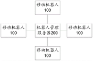
结合第七方面,本发明实施例提供了第七方面的第五种可能的实施方式,其中,所述系统还包括与所述移动机器人连接的机器人管理服务器;所述机器人管理服务器中存储有所述移动机器人的工作场地对应的网格地图。In combination with the seventh aspect, the embodiment of the present invention provides a fifth possible implementation manner of the seventh aspect, wherein the system further includes a robot management server connected to the mobile robot; the robot management server stores a The grid map corresponding to the workplace of the mobile robot.
本发明实施例提供的移动机器人定位方法、导航方法和网格地图建立方法,当移动机器人在工作场地上运动时,通过读码器扫描当前定位标识,然后从网格地图中获取当前定位标识的坐标信息,根据当前定位标识的坐标信息,确定移动机器人在工作场地中的位置。其中,网格地图中除记录有定长定位标识的坐标信息之外,还记录有变长定位标识的坐标信息。变长定位标识的坐标信息中包括变长定位标识的横纵坐标和变长距离。由于网格地图中记录了变长定位标识的变长距离,因此,工作场地中的定位标识不需要全部等长间隔粘贴,可以根据需要设置变长定位标识。如果在定位标识铺设过程中遇到障碍物,可以只调整单个定位标识的粘贴位置,而不需要将整个工作场地中的定位标识都重新规划位置并重新粘贴,因此极大地节省了人力和时间。The mobile robot positioning method, navigation method and grid map establishment method provided by the embodiments of the present invention, when the mobile robot is moving on the work site, scan the current positioning mark through the code reader, and then obtain the current positioning mark from the grid map The coordinate information, according to the coordinate information of the current positioning mark, determines the position of the mobile robot in the work site. Wherein, in addition to the coordinate information of the fixed-length positioning mark recorded in the grid map, the coordinate information of the variable-length positioning mark is also recorded. The coordinate information of the variable-length positioning mark includes the horizontal and vertical coordinates and the variable-length distance of the variable-length positioning mark. Since the variable-length distance of the variable-length positioning marks is recorded in the grid map, the positioning marks in the workplace do not need to be pasted at equal intervals, and the variable-length positioning marks can be set as required. If obstacles are encountered during the laying of positioning marks, only the sticking position of a single positioning mark can be adjusted, instead of re-planning and re-pasting the positioning marks in the entire work site, which greatly saves manpower and time.
本发明的其他特征和优点将在随后的说明书中阐述,或者,部分特征和优点可以从说明书推知或毫无疑义地确定,或者通过实施本发明的上述技术即可得知。Other features and advantages of the present invention will be set forth in the following description, or some of the features and advantages can be inferred or unambiguously determined from the description, or can be known by implementing the above-mentioned techniques of the present invention.
为使本发明的上述目的、特征和优点能更明显易懂,下文特举较佳实施例,并配合所附附图,作详细说明如下。In order to make the above-mentioned objects, features and advantages of the present invention more comprehensible, preferred embodiments will be described in detail below together with the accompanying drawings.
附图说明Description of drawings
为了更清楚地说明本发明具体实施方式或现有技术中的技术方案,下面将对具体实施方式或现有技术描述中所需要使用的附图作简单地介绍,显而易见地,下面描述中的附图是本发明的一些实施方式,对于本领域普通技术人员来讲,在不付出创造性劳动的前提下,还可以根据这些附图获得其他的附图。In order to more clearly illustrate the specific implementation of the present invention or the technical solutions in the prior art, the following will briefly introduce the accompanying drawings that need to be used in the specific implementation or description of the prior art. Obviously, the accompanying drawings in the following description The drawings show some implementations of the present invention, and those skilled in the art can obtain other drawings based on these drawings without any creative work.
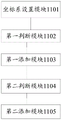
图1示出了现有技术中所采用的二维码的示意图;FIG. 1 shows a schematic diagram of a two-dimensional code used in the prior art;
图2示出了本发明实施例所提供的一种移动机器人的结构示意图;Fig. 2 shows a schematic structural diagram of a mobile robot provided by an embodiment of the present invention;
图3示出了本发明实施例所提供的一种移动机器人定位方法的流程图;Fig. 3 shows a flow chart of a positioning method for a mobile robot provided by an embodiment of the present invention;
图4示出了本发明实施例所提供的一种移动机器人所在工作场地及定位标识的结构示意图;Fig. 4 shows a schematic structural diagram of a mobile robot's work site and positioning marks provided by an embodiment of the present invention;
图5示出了本发明实施例所提供的一种移动机器人在工作场地中的示意图;Fig. 5 shows a schematic diagram of a mobile robot provided by an embodiment of the present invention in a work site;
图6示出了本发明实施例所提供的一种移动机器人导航方法的流程图;FIG. 6 shows a flow chart of a mobile robot navigation method provided by an embodiment of the present invention;
图7示出了本发明实施例所提供的一种网格地图建立方法的流程图;Fig. 7 shows a flow chart of a grid map establishment method provided by an embodiment of the present invention;
图8示出了本发明实施例所提供的工作场地中充电桩处的一种网格地图的结构示意图;Fig. 8 shows a schematic structural diagram of a grid map at a charging pile in a work site provided by an embodiment of the present invention;
图9示出了本发明实施例所提供的一种移动机器人定位装置的结构框图;Fig. 9 shows a structural block diagram of a mobile robot positioning device provided by an embodiment of the present invention;
图10示出了本发明实施例所提供的一种移动机器人导航装置的结构框图;Fig. 10 shows a structural block diagram of a mobile robot navigation device provided by an embodiment of the present invention;
图11示出了本发明实施例所提供的一种网格地图建立装置的结构框图;Fig. 11 shows a structural block diagram of a grid map creation device provided by an embodiment of the present invention;
图12示出了本发明实施例所提供的一种移动机器人定位系统的结构框图;Fig. 12 shows a structural block diagram of a mobile robot positioning system provided by an embodiment of the present invention;
图13示出了本发明实施例所提供的工作场地中的两个区域交界处的一种网格地图的结构示意图;Fig. 13 shows a schematic structural diagram of a grid map at the junction of two areas in the workplace provided by an embodiment of the present invention;
图14~15示出了本发明实施例所提供的工作场地中障碍物处的一种网格地图的结构示意图;14 to 15 show a schematic structural diagram of a grid map at an obstacle in a work site provided by an embodiment of the present invention;
图16示出了本发明实施例所提供的工作场地中工作台附近的一种网格地图的结构示意图;Fig. 16 shows a schematic structural diagram of a grid map near a workbench in a worksite provided by an embodiment of the present invention;
图17示出了本发明实施例所提供的工作场地中工作台附近的另一种网格地图的结构示意图。FIG. 17 shows a schematic structural diagram of another grid map near a workbench in a worksite provided by an embodiment of the present invention.
具体实施方式detailed description
为使本发明实施例的目的、技术方案和优点更加清楚,下面将结合附图对本发明的技术方案进行清楚、完整地描述,显然,所描述的实施例是本发明一部分实施例,而不是全部的实施例。基于本发明中的实施例,本领域普通技术人员在没有做出创造性劳动前提下所获得的所有其他实施例,都属于本发明保护的范围。In order to make the purpose, technical solutions and advantages of the embodiments of the present invention clearer, the technical solutions of the present invention will be clearly and completely described below in conjunction with the accompanying drawings. Obviously, the described embodiments are part of the embodiments of the present invention, not all of them. the embodiment. Based on the embodiments of the present invention, all other embodiments obtained by persons of ordinary skill in the art without making creative efforts belong to the protection scope of the present invention.
针对现有的由于现有的定位标识均采用等长间隔粘贴,在一些地形复杂的工作场地中,很难规划出合理的网格,规划每个定位标识的粘贴位置需要耗费大量时间。并且,如果在定位标识铺设过程中遇到障碍物,需要调整个定位标识的粘贴位置时,整个工作场地中的定位标识都需要重新规划位置并重新粘贴,不仅浪费了很多时间,也浪费了大量人力。基于此,本发明实施例提供了一种移动机器人定位方法、导航方法和网格地图建立方法,有助于灵活改变单个定位标识的粘贴位置,可以提高网格规划的效率,节约时间。As the existing positioning marks are pasted at equal intervals, it is difficult to plan a reasonable grid in some work sites with complex terrain, and it takes a lot of time to plan the pasting position of each positioning mark. Moreover, if obstacles are encountered during the laying of positioning signs, and the sticking position of each positioning mark needs to be adjusted, the positioning marks in the entire work site need to be re-planned and re-pasted, which not only wastes a lot of time, but also wastes a lot of time. manpower. Based on this, embodiments of the present invention provide a mobile robot positioning method, a navigation method, and a grid map establishment method, which help to flexibly change the pasting position of a single positioning mark, can improve the efficiency of grid planning, and save time.
实施例一:Embodiment one:
首先,参照图2来描述用于实现本发明实施例的移动机器人定位方法的示例移动机器人100。该移动机器人100可以是但不限于自动化流水线系统中使用的AGV小车。First, an example
如图2所示,移动机器人100包括一个或多个处理器102、一个或多个存储装置104、驱动装置106、通讯装置108以及读码器110,这些组件通过总线系统112和/或其它形式的连接机构(未示出)互连。应当注意,图2所示的移动机器人100的组件和结构只是示例性的,而非限制性的,根据需要,所述移动机器人也可以具有其他组件和结构。As shown in FIG. 2 , the
所述处理器102可以是中央处理单元(CPU)或者具有数据处理能力和/或指令执行能力的其它形式的处理单元,并且可以控制所述移动机器人100中的其它组件以执行期望的功能。The processor 102 may be a central processing unit (CPU) or other form of processing unit having data processing capabilities and/or instruction execution capabilities, and may control other components in the
所述存储装置104可以包括一个或多个计算机程序产品,所述计算机程序产品可以包括各种形式的计算机可读存储介质,例如易失性存储器和/或非易失性存储器。所述易失性存储器例如可以包括随机存取存储器(RAM)和/或高速缓冲存储器(cache)等。所述非易失性存储器例如可以包括只读存储器(ROM)、硬盘、闪存等。在所述计算机可读存储介质上可以存储一个或多个计算机程序指令,处理器102可以运行所述程序指令,以实现下文所述的本发明实施例中(由处理器实现)的客户端功能以及/或者其它期望的功能。在所述计算机可读存储介质中还可以存储各种应用程序和各种数据,例如所述应用程序使用和/或产生的各种数据等。The storage device 104 may include one or more computer program products, which may include various forms of computer-readable storage media, such as volatile memory and/or non-volatile memory. The volatile memory may include, for example, random access memory (RAM) and/or cache memory (cache). The non-volatile memory may include, for example, a read-only memory (ROM), a hard disk, a flash memory, and the like. One or more computer program instructions can be stored on the computer-readable storage medium, and the processor 102 can execute the program instructions to realize the client functions (implemented by the processor) in the embodiments of the present invention described below and/or other desired functionality. Various application programs and various data, such as various data used and/or generated by the application programs, may also be stored in the computer-readable storage medium.
所述驱动装置106可以包括电机驱动器、电机及制动机构等,驱动装置106在处理器102的控制下,带动移动机器人行进或停止行进。The driving device 106 may include a motor driver, a motor, a braking mechanism, etc., and the driving device 106 drives the mobile robot to move or stop moving under the control of the processor 102 .
所述通讯装置108可以是无线传输模块,用于与机器人管理服务器连接。通讯装置108也可以是有线连接接口,用于连接控制主机,上传数据或下载应用程序、规划路径等。The communication device 108 may be a wireless transmission module for connecting with the robot management server. The communication device 108 can also be a wired connection interface, which is used for connecting to the control host, uploading data or downloading application programs, and planning routes.
所述读码器110具有摄像头和图像处理功能,用于捕获定位标识,解码捕获的定位标识,实现移动机器人的定位,把定位信息反馈给处理器102。The code reader 110 has a camera and an image processing function, and is used to capture the positioning mark, decode the captured positioning mark, realize the positioning of the mobile robot, and feed back the positioning information to the processor 102 .
实施例二:Embodiment two:
本实施例提供了一种移动机器人定位方法,需要说明的是,在附图的流程图示出的步骤可以在诸如一组计算机可执行指令的计算机系统中执行,并且,虽然在流程图中示出了逻辑顺序,但是在某些情况下,可以以不同于此处的顺序执行所示出或描述的步骤。以下对本实施例进行详细介绍。This embodiment provides a method for positioning a mobile robot. It should be noted that the steps shown in the flow chart of the accompanying drawings can be executed in a computer system such as a set of computer-executable instructions, and although the steps shown in the flow chart A logical order is shown, but in some cases the steps shown or described may be performed in an order different from that presented here. This embodiment will be described in detail below.
图3示出了本发明实施例所提供的一种移动机器人定位方法的流程图,如图3所示,该方法包括如下步骤:Fig. 3 shows a flow chart of a mobile robot positioning method provided by an embodiment of the present invention. As shown in Fig. 3, the method includes the following steps:
步骤S302,扫描当前定位标识。Step S302, scanning the current location mark.
其中,定位标识布设于移动机器人的工作场地中,可以是具有方向性的一维码或二维码,也可以是其它位置标定图形。其中,二维码可以是DM二维码或QR二维码,DM二维码有两条相互垂直的直线段边界,中间是文本信息;QR二维码没有直线段边界,但有三个辅助定位黑色方块,用于标定方向。Wherein, the positioning marks are arranged in the work site of the mobile robot, and may be directional one-dimensional codes or two-dimensional codes, or other position calibration graphics. Among them, the two-dimensional code can be a DM two-dimensional code or a QR two-dimensional code. The DM two-dimensional code has two mutually perpendicular straight line boundaries, and the text information is in the middle; the QR two-dimensional code has no straight line boundary, but has three auxiliary positioning Black squares are used to mark the direction.
定位标识内可以存储该定位标识的编号,每个编号对应一个唯一的定位标识。移动机器人上安装有读码器,移动机器人在工作场地中移动时,通过读码器可以捕获当前定位标识,获取定位标识中存储的编号。定位标识之间的间隔可以保证移动机器人的读码器在同一时刻最多捕获一个定位标识。The number of the positioning mark can be stored in the positioning mark, and each number corresponds to a unique positioning mark. A barcode reader is installed on the mobile robot. When the mobile robot moves in the workplace, the barcode reader can capture the current positioning mark and obtain the number stored in the position mark. The interval between the positioning marks can ensure that the barcode reader of the mobile robot captures at most one positioning mark at the same time.
步骤S304,从网格地图中获取当前定位标识的坐标信息。Step S304, acquiring the coordinate information of the current location mark from the grid map.
该网格地图与移动机器人的工作场地对应,网格地图可以存储在移动机器人中,也可以存储在机器人管理服务器中。所述机器人管理服务器与工作场地中的多个移动机器人通讯连接,向每个移动机器人下达工作任务。网格地图中存储有定位标识的编号与定位标识的坐标信息之间的对应关系,移动机器人通过读码器扫描当前定位标识,可以获取当前定位标识中存储的编号,进而从网格地图中获取该编号对应的定位标识的坐标信息。The grid map corresponds to the working site of the mobile robot, and the grid map can be stored in the mobile robot or in the robot management server. The robot management server communicates with multiple mobile robots in the workplace, and issues work tasks to each mobile robot. The corresponding relationship between the number of the positioning mark and the coordinate information of the positioning mark is stored in the grid map. The mobile robot can scan the current positioning mark through the code reader to obtain the number stored in the current positioning mark, and then obtain it from the grid map. The coordinate information of the positioning mark corresponding to the number.
网格地图中可以记录有定长定位标识的坐标信息和变长定位标识的坐标信息,所述定长定位标识的坐标信息包括定长定位标识的横坐标和纵坐标,所述变长定位标识的坐标信息包括变长定位标识的横坐标、纵坐标和变长距离。所述定长定位标识与相邻的定位标识之间的距离等于基准间隔距离,网格地图中记录了该基准间隔距离。需要说明的是,定位标识的横坐标和纵坐标可以是一个单位坐标值,所述单位坐标值的一个坐标单位表示一个基准间隔距离,详见下述举例。The coordinate information of the fixed-length positioning mark and the coordinate information of the variable-length positioning mark can be recorded in the grid map, and the coordinate information of the fixed-length positioning mark includes the abscissa and ordinate of the fixed-length positioning mark, and the variable-length positioning mark The coordinate information includes the abscissa, ordinate and variable-length distance of the variable-length positioning mark. The distance between the fixed-length positioning marks and adjacent positioning marks is equal to the reference interval distance, which is recorded in the grid map. It should be noted that the abscissa and ordinate of the positioning mark may be a unit coordinate value, and one coordinate unit of the unit coordinate value represents a reference interval distance, see the following examples for details.
例如,如图4所示的网格地图中,横向基准间隔距离和纵向基准间隔距离均为l,编号为A、B、C和E、F、G的定位标识为定长定位标识,定长定位标识的坐标信息包括定长定位标识的横坐标和纵坐标。定位标识A的坐标信息为A:(1,1),定位标识B的坐标信息为B:(2,1),定位标识C的坐标信息为C:(3,1),定位标识E的坐标信息为E:(1,2),定位标识F的坐标信息为F:(2,2),定位标识G的坐标信息为G:(3,2)。其中,定位标识G的横坐标3表示定位标识G与纵向坐标轴之间的距离为3个基准间隔距离,定位标识G的纵坐标2表示定位标识G与横向坐标轴之间的距离为2个基准间隔距离。For example, in the grid map shown in Figure 4, the horizontal reference interval distance and the vertical reference interval distance are both 1, and the positioning marks numbered as A, B, C and E, F, G are fixed-length positioning marks, and the fixed-length The coordinate information of the positioning mark includes the abscissa and ordinate of the fixed-length positioning mark. The coordinate information of positioning mark A is A: (1,1), the coordinate information of positioning mark B is B: (2,1), the coordinate information of positioning mark C is C: (3,1), and the coordinate information of positioning mark E The information is E:(1,2), the coordinate information of the positioning mark F is F:(2,2), and the coordinate information of the positioning mark G is G:(3,2). Among them, the
定位标识I与定位标识E之间的距离小于基准间隔距离l,比基准间隔距离l短d1。定位标识D与定位标识C之间的距离大于基准间隔距离l,比基准间隔距离l长d2。因此,编号为D、H、I、J、K、M、N、P、Q和R的定位标识为变长定位标识。变长定位标识的坐标信息包括变长定位标识的横坐标、纵坐标和变长距离。定位标识D的坐标信息为D:(4,1),Dx=d2,其中,Dx表示定位标识D的横向变长距离。定位标识I的坐标信息为I:(1,3),Iy=-d1,其中,Iy表示定位标识I的纵向变长距离。定位标识J的坐标信息为J:(2,3),Jy=-d1,其中,Jy表示定位标识J的纵向变长距离。定位标识K的坐标信息为K:(3,3),Ky=-d1,其中,Ky表示定位标识K的纵向变长距离。定位标识M的坐标信息为M:(4,3),Mx=d2,My=-d1,其中,Mx表示定位标识M的横向变长距离,My表示定位标识M的纵向变长距离。The distance between the positioning mark I and the positioning mark E is smaller than the reference separation distance l, and d 1 shorter than the reference separation distance l. The distance between the positioning mark D and the positioning mark C is greater than the reference separation distance l, and d 2 longer than the reference separation distance l. Therefore, location identifiers numbered D, H, I, J, K, M, N, P, Q, and R are variable-length location identifiers. The coordinate information of the variable-length positioning mark includes the abscissa, the ordinate and the variable-length distance of the variable-length positioning mark. The coordinate information of the positioning mark D is D: (4,1), Dx=d 2 , where Dx represents the lateral lengthening distance of the positioning mark D. The coordinate information of the positioning mark I is I: (1,3), Iy=-d 1 , wherein, Iy represents the longitudinal lengthening distance of the positioning mark I. The coordinate information of the positioning mark J is J:(2,3), Jy=-d 1 , where Jy represents the longitudinal lengthening distance of the positioning mark J. The coordinate information of the positioning mark K is K:(3,3), Ky=-d 1 , where Ky represents the longitudinal lengthening distance of the positioning mark K. The coordinate information of the positioning mark M is M: (4,3), Mx=d 2 , My=-d 1 , where Mx represents the horizontal lengthening distance of the positioning mark M, and My represents the vertical lengthening distance of the positioning mark M.
其中,变长距离的正负可以体现变长距离的变长方向。例如,如果定位标识的横向变长距离为正,表示定位标识距纵向坐标轴的距离较基准距离增长;反之,如果定位标识的横向变长距离为负,表示定位标识距纵向坐标轴的距离较基准距离缩短。如果定位标识的纵向变长距离为正,表示定位标识距横向坐标轴的距离较基准距离增长;反之,如果定位标识的纵向变长距离为负,表示定位标识距横向坐标轴的距离较基准距离缩短。Wherein, the sign of the variable length distance can reflect the variable length direction of the variable length distance. For example, if the horizontal lengthening distance of the positioning mark is positive, it means that the distance between the positioning mark and the longitudinal axis is longer than the reference distance; Base distance shortened. If the longitudinal lengthening distance of the positioning mark is positive, it means that the distance between the positioning mark and the horizontal coordinate axis is longer than the reference distance; on the contrary, if the vertical lengthening distance of the positioning mark is negative, it means that the distance between the positioning mark and the horizontal coordinate axis is longer than the reference distance shorten.
虽然定位标识N与定位标识I之间的距离等于基准间隔距离,但由于定位标识I的坐标信息中包括纵向变长距离,因此定位标识N的坐标信息中也包括纵向变长距离。定位标识N的坐标信息为N:(1,4),Ny=-d1,其中,Ny表示定位标识N的纵向变长距离。定位标识P的坐标信息为P:(2,4),Py=-d1,其中,Py表示定位标识P的纵向变长距离。定位标识Q的坐标信息为Q:(3,4),Qy=-d1,其中,Qy表示定位标识Q的纵向变长距离。定位标识R的坐标信息为R:(4,4),Rx=d2,Ry=-d1,其中,Rx表示定位标识R的横向变长距离,Ry表示定位标识R的纵向变长距离。Although the distance between the positioning mark N and the positioning mark I is equal to the reference interval distance, since the coordinate information of the positioning mark I includes the longitudinal lengthening distance, the coordinate information of the positioning mark N also includes the longitudinal lengthening distance. The coordinate information of the positioning mark N is N:(1,4), Ny=-d 1 , where Ny represents the longitudinal lengthening distance of the positioning mark N. The coordinate information of the positioning mark P is P: (2,4), Py=-d 1 , where Py represents the longitudinal lengthening distance of the positioning mark P. The coordinate information of the positioning mark Q is Q:(3,4), Qy=-d 1 , where Qy represents the longitudinal lengthening distance of the positioning mark Q. The coordinate information of the positioning mark R is R: (4,4), Rx=d 2 , Ry=-d 1 , where Rx represents the horizontal lengthening distance of the positioning mark R, and Ry represents the vertical lengthening distance of the positioning mark R.
由于网格地图中记录了变长定位标识的变长距离,因此,工作场地中的定位标识不需要全部等长间隔粘贴,在遇到特殊情况时,可以只调整单个或单排定位标识的粘贴位置。Since the variable length distance of the variable length positioning marks is recorded in the grid map, the positioning marks in the workplace do not need to be pasted at equal intervals. In special cases, only a single or single row of positioning marks can be pasted. Location.
步骤S306,根据当前定位标识的坐标信息,确定移动机器人在工作场地中的位置。Step S306, according to the coordinate information of the current positioning mark, determine the position of the mobile robot in the work site.
可选地,可以根据当前定位标识的坐标信息,确定当前定位标识在工作场地中的位置,确定当前定位标识相对于移动机器人的位置,根据当前定位标识在工作场地中的位置和当前定位标识相对于移动机器人的位置,确定移动机器人在工作场地中的位置。在一些实施例中,可以先执行确定当前定位标识相对于移动机器人的位置的步骤,然后执行根据当前定位标识的坐标信息确定当前定位标识在工作场地中的位置的步骤。在另一些实施例中,可以先执行根据当前定位标识的坐标信息确定当前定位标识在工作场地中的位置的步骤,然后执行确定当前定位标识相对于移动机器人的位置的步骤。Optionally, the position of the current positioning mark in the work site can be determined according to the coordinate information of the current positioning mark, and the position of the current positioning mark relative to the mobile robot can be determined. Based on the position of the mobile robot, the position of the mobile robot in the work site is determined. In some embodiments, the step of determining the position of the current positioning marker relative to the mobile robot may be performed first, and then the step of determining the position of the current positioning marker in the work site according to the coordinate information of the current positioning marker may be performed. In some other embodiments, the step of determining the position of the current positioning mark in the work site according to the coordinate information of the current positioning mark may be performed first, and then the step of determining the position of the current positioning mark relative to the mobile robot may be performed.
例如,如图5所示,移动机器人在工作场地中移动时,可以通过读码器捕获当前定位标识,根据当前定位标识在读码器捕获的图像中的位置,确定当前定位标识相对于移动机器人的位置。上述当前定位标识相对于移动机器人的位置也可以包括相对方向。如定位标识为QR二维码,可以根据QR二维码的三个黑色定位方块,确定当前定位标识与移动机器人的相对方向,进而确定移动机器人的运动方向。For example, as shown in Figure 5, when the mobile robot is moving in the workplace, the current positioning mark can be captured by the code reader, and the position of the current positioning mark relative to the mobile robot can be determined according to the position of the current positioning mark in the image captured by the code reader . The position of the above-mentioned current positioning identifier relative to the mobile robot may also include a relative direction. If the positioning mark is a QR two-dimensional code, the relative direction between the current positioning mark and the mobile robot can be determined according to the three black positioning squares of the QR two-dimensional code, and then the moving direction of the mobile robot can be determined.
在一种可选的实施例中,如果当前定位标识的坐标信息包括横坐标和纵坐标,可以根据当前定位标识的横坐标、纵坐标和基准间隔距离,确定当前定位标识在工作场地中的位置。例如,如果当前定位标识为图4中所示的定位标识F,定位标识F的坐标信息为F:(2,2),基准间隔距离为l,则定位标识F在工作场地中的横向位置为横坐标与基准间隔距离的乘积2*l,定位标识F在工作场地中的纵向位置为纵坐标与基准间隔距离的乘积2*l,当前定位标识在工作场地中的位置可以表示为(2*l,2*l)。在某些实施例中,基准间隔距离可以包括横向基准间隔距离和纵向基准间隔距离,横向基准间隔距离和纵向基准间隔距离可以相等,也可以不相等。In an optional embodiment, if the coordinate information of the current positioning mark includes abscissa and ordinate, the position of the current positioning mark in the work site can be determined according to the abscissa, ordinate and reference interval distance of the current positioning mark . For example, if the current positioning mark is the positioning mark F shown in Figure 4, the coordinate information of the positioning mark F is F: (2, 2), and the reference interval distance is l, then the lateral position of the positioning mark F in the work site is The product of the abscissa and the reference interval distance is 2*l, the longitudinal position of the positioning mark F in the work site is the product of the ordinate and the
如果当前定位标识的坐标信息包括横坐标、纵坐标和变长距离,根据当前定位标识的横坐标、纵坐标、基准间隔距离和变长距离,确定当前定位标识在工作场地中的位置。例如,如果当前定位标识为图4中所示的定位标识D,定位标识D的坐标信息为D:(4,1),Dx=d2,基准间隔距离为l,则定位标识D在工作场地中的横向位置为横坐标与基准间隔距离的乘积4*l+d2,定位标识F在工作场地中的纵向位置为纵坐标与基准间隔距离的乘积1*l,当前定位标识在工作场地中的位置可以表示为(4*l+d2,1*l)。如果当前定位标识为图4中所示的定位标识M,定位标识M的坐标信息为M:(4,3),Mx=d2,My=-d1,则定位标识M在工作场地中的横向位置为横坐标与基准间隔距离的乘积4*l+d2,则定位标识M在工作场地中的纵向位置为纵坐标与基准间隔距离的乘积3*l+(-d1),当前定位标识在工作场地中的位置可以表示为(4*l+d2,3*l+(-d1))。If the coordinate information of the current positioning mark includes abscissa, ordinate and variable length distance, the position of the current positioning mark in the work site is determined according to the abscissa, ordinate, reference interval distance and variable length distance of the current positioning mark. For example, if the current positioning mark is the positioning mark D shown in Figure 4, the coordinate information of the positioning mark D is D: (4,1), Dx=d 2 , and the reference interval distance is l, then the positioning mark D is at the work site The horizontal position in is the product of the abscissa and the
由上述举例可以看出,在具体实施例中,如果基准间隔距离包括横向基准间隔距离和纵向基准间隔距离,变长距离包括横向变长距离和纵向变长距离;根据当前定位标识的横坐标、纵坐标、基准间隔距离和变长距离,确定当前定位标识在所述工作场地中的位置可以通过以下步骤实现:As can be seen from the above example, in a specific embodiment, if the reference separation distance includes a horizontal reference separation distance and a longitudinal reference separation distance, the variable length distance includes a horizontal variable length distance and a vertical variable length distance; according to the abscissa of the current positioning mark, Ordinate, reference interval distance and variable length distance, determining the position of the current positioning mark in the work site can be achieved through the following steps:
(1)计算当前定位标识的横坐标与横向基准间隔距离的乘积,作为横向预估位置;(1) Calculate the product of the abscissa of the current positioning mark and the distance of the lateral reference interval, as the estimated lateral position;
(2)根据横向预估位置与所述横向变长距离之和,确定当前定位标识的横向位置;(2) Determine the lateral position of the current positioning mark according to the sum of the lateral estimated position and the lateral variable length distance;
(3)计算当前定位标识的纵坐标与纵向基准间隔距离的乘积,作为纵向预估位置;(3) Calculate the product of the ordinate of the current positioning mark and the longitudinal reference interval distance as the longitudinal estimated position;
(4)根据纵向预估位置与所述纵向变长距离之和,确定当前定位标识的纵向位置;(4) Determine the longitudinal position of the current positioning mark according to the sum of the longitudinal estimated position and the longitudinal lengthening distance;
(5)结合横向位置和纵向位置,确定当前定位标识在工作场地中的位置。(5) Combining the horizontal position and the vertical position, determine the position of the current positioning mark in the work site.
需要说明的是,确定当前定位标识位置的步骤的执行顺序并不以上述的具体顺序为限制,可以根据需要相互交换。例如,步骤(3)和(4)也可以在步骤(1)和(2)之前执行。It should be noted that the execution order of the steps of determining the position of the current positioning marker is not limited to the above specific order, and can be exchanged as required. For example, steps (3) and (4) can also be performed before steps (1) and (2).
已知当前定位标识在工作场地中的位置和当前定位标识相对于移动机器人的位置之后,根据当前定位标识在工作场地中的位置和当前定位标识相对于移动机器人的位置,可以确定移动机器人在工作场地中的位置。After the position of the current positioning mark in the work site and the position of the current positioning mark relative to the mobile robot are known, according to the position of the current positioning mark in the work site and the position of the current positioning mark relative to the mobile robot, it can be determined that the mobile robot is working position in the field.
本发明实施例提供的移动机器人定位方法,当移动机器人在工作场地上运动时,移动机器人通过读码器扫描当前定位标识,然后从网格地图中获取当前定位标识的坐标信息,根据当前定位标识的坐标信息,确定移动机器人在工作场地中的位置。其中,网格地图中除记录有定长定位标识的坐标信息之外,还记录有变长定位标识的坐标信息。变长定位标识的坐标信息中包括变长定位标识的横纵坐标和变长距离。由于网格地图中记录了变长定位标识的变长距离,因此,工作场地中的定位标识不需要全部等长间隔粘贴,可以根据需要设置变长定位标识。如果在定位标识铺设过程中遇到障碍物,可以只调整单个定位标识的粘贴位置,而不需要将整个工作场地中的定位标识都重新规划位置并重新粘贴,因此极大地节省了人力和时间。In the mobile robot positioning method provided by the embodiment of the present invention, when the mobile robot is moving on the work site, the mobile robot scans the current positioning mark through the code reader, and then obtains the coordinate information of the current positioning mark from the grid map, and according to the current positioning mark coordinate information to determine the position of the mobile robot in the workplace. Wherein, in addition to the coordinate information of the fixed-length positioning mark recorded in the grid map, the coordinate information of the variable-length positioning mark is also recorded. The coordinate information of the variable-length positioning mark includes the horizontal and vertical coordinates and the variable-length distance of the variable-length positioning mark. Since the variable-length distance of the variable-length positioning marks is recorded in the grid map, the positioning marks in the workplace do not need to be pasted at equal intervals, and the variable-length positioning marks can be set as required. If obstacles are encountered during the laying of positioning marks, only the sticking position of a single positioning mark can be adjusted, instead of re-planning and re-pasting the positioning marks in the entire work site, which greatly saves manpower and time.
实施例三:Embodiment three:
在上述移动机器人定位方法的基础上,本实施例提供了一种移动机器人导航方法。图6示出了本发明实施例所提供的一种移动机器人导航方法的流程图,如图6所示,该方法包括如下步骤:On the basis of the above mobile robot positioning method, this embodiment provides a mobile robot navigation method. Fig. 6 shows a flow chart of a mobile robot navigation method provided by an embodiment of the present invention. As shown in Fig. 6, the method includes the following steps:
步骤S602,扫描当前定位标识。Step S602, scanning the current location mark.
移动机器人上安装有读码器,移动机器人的工作场地中粘贴有定位标识。移动机器人在工作场地中移动时,通过读码器可以捕获当前定位标识,获取当前定位标识中存储的编号。A code reader is installed on the mobile robot, and a positioning mark is pasted on the working site of the mobile robot. When the mobile robot is moving in the workplace, the current location identification can be captured by the code reader, and the number stored in the current location identification can be obtained.
步骤S604,从网格地图中获取当前定位标识的坐标信息和目标定位标识的坐标信息。Step S604, acquiring the coordinate information of the current positioning mark and the coordinate information of the target positioning mark from the grid map.
所述目标定位标识为预设的导航路径中当前定位标识对应的下一定位标识。所述网格地图中记录有定长定位标识的坐标信息和变长定位标识的坐标信息,所述定长定位标识的坐标信息包括定长定位标识的横坐标和纵坐标,所述变长定位标识的坐标信息包括变长定位标识的横坐标、纵坐标和变长距离。The target location identifier is the next location identifier corresponding to the current location identifier in the preset navigation route. The coordinate information of the fixed-length positioning mark and the coordinate information of the variable-length positioning mark are recorded in the grid map, the coordinate information of the fixed-length positioning mark includes the abscissa and ordinate of the fixed-length positioning mark, and the variable-length positioning mark The coordinate information of the mark includes the abscissa, the ordinate and the variable-length distance of the variable-length positioning mark.
移动机器人根据当前定位标识的编号和目标定位标识的编号,可以从网格地图中分别获取当前定位标识的坐标信息和目标定位标识的坐标信息。According to the number of the current positioning mark and the number of the target positioning mark, the mobile robot can respectively obtain the coordinate information of the current positioning mark and the coordinate information of the target positioning mark from the grid map.
步骤S606,根据当前定位标识的坐标信息和目标定位标识的坐标信息,确定移动机器人从当前定位标识移动至目标定位标识的移动方向和移动距离。Step S606, according to the coordinate information of the current positioning mark and the coordinate information of the target positioning mark, determine the moving direction and moving distance of the mobile robot from the current positioning mark to the target positioning mark.
移动机器人根据当前定位标识和目标定位标识的坐标信息,可以确定移动方向。移动方向可以是沿横向坐标轴正向行进、沿横向坐标轴负向行进、沿纵向坐标轴正向行进或沿纵向坐标轴负向行进。例如,如果当前定位标识为C,目标定位标识为D。定位标识C的横坐标为3,纵坐标为1,定位标识D的横坐标为4,纵坐标为1。由此可以确定,移动机器人的移动方向为沿横向坐标轴正向行进。从网格地图中可以获知,定位标识C的坐标信息中不包含变长距离,定位标识D的坐标中包含横向变长距离Dx=d2,由此可以确定,从当前定位标识C到目标定位标识D,移动机器人的移动距离为基准间隔距离l与定位标识D的横向变长距离d2之和。The mobile robot can determine the moving direction according to the coordinate information of the current positioning mark and the target positioning mark. The moving direction may be traveling in the positive direction along the horizontal coordinate axis, traveling in the negative direction along the horizontal coordinate axis, traveling in the positive direction along the longitudinal coordinate axis or traveling in the negative direction along the longitudinal coordinate axis. For example, if the current location ID is C, the target location ID is D. The abscissa of the positioning mark C is 3, and the ordinate is 1, and the abscissa of the positioning mark D is 4, and the ordinate is 1. From this, it can be determined that the moving direction of the mobile robot is moving forward along the horizontal coordinate axis. It can be known from the grid map that the coordinate information of the positioning mark C does not include the variable length distance, and the coordinate information of the positioning mark D includes the horizontal variable length distance Dx=d 2 , thus it can be determined that from the current positioning mark C to the target positioning Mark D, the moving distance of the mobile robot is the sum of the reference interval distance l and the lateral lengthening distance d2 of the positioning mark D.
步骤S608,根据所述移动方向和移动距离,引导移动机器人向目标定位标识行进。Step S608, according to the moving direction and the moving distance, guide the mobile robot to move towards the target location mark.
本发明实施例提供的移动机器人导航方法,当移动机器人在工作场地上运动时,移动机器人扫描当前定位标识,然后从网格地图中获取当前定位标识的坐标信息和目标定位标识的坐标信息,根据当前定位标识的坐标信息和目标定位标识的坐标信息,确定移动机器人的移动方向和移动距离,根据移动方向和移动距离,引导移动机器人向目标定位标识行进。其中,网格地图中除记录有定长定位标识的坐标信息之外,还记录有变长定位标识的坐标信息。变长定位标识的坐标信息中包括变长定位标识的横纵坐标和变长距离。由于网格地图中记录了变长定位标识的变长距离,因此,工作场地中的定位标识不需要全部等长间隔粘贴,可以根据需要设置变长定位标识。如果在定位标识铺设过程中遇到障碍物,可以只调整单个定位标识的粘贴位置,而不需要将整个工作场地中的定位标识都重新规划位置并重新粘贴,因此极大地节省了人力和时间。In the mobile robot navigation method provided by the embodiment of the present invention, when the mobile robot is moving on the work site, the mobile robot scans the current positioning mark, and then obtains the coordinate information of the current positioning mark and the coordinate information of the target positioning mark from the grid map, according to The coordinate information of the current positioning mark and the coordinate information of the target positioning mark determine the moving direction and moving distance of the mobile robot, and guide the mobile robot to move to the target positioning mark according to the moving direction and moving distance. Wherein, in addition to the coordinate information of the fixed-length positioning mark recorded in the grid map, the coordinate information of the variable-length positioning mark is also recorded. The coordinate information of the variable-length positioning mark includes the horizontal and vertical coordinates and the variable-length distance of the variable-length positioning mark. Since the variable-length distance of the variable-length positioning marks is recorded in the grid map, the positioning marks in the workplace do not need to be pasted at equal intervals, and the variable-length positioning marks can be set as required. If obstacles are encountered during the laying of positioning marks, only the sticking position of a single positioning mark can be adjusted, instead of re-planning and re-pasting the positioning marks in the entire work site, which greatly saves manpower and time.
实施例四:Embodiment four:
本发明实施例提供了一种网格地图建立方法,该方法可以由移动机器人执行,或者由机器人管理服务器执行。该网格地图中记录有定位标识的坐标信息,定位标识设置在移动机器人的工作场地中。An embodiment of the present invention provides a method for establishing a grid map, and the method can be executed by a mobile robot, or by a robot management server. The coordinate information of the positioning mark is recorded in the grid map, and the positioning mark is set in the work site of the mobile robot.
图7示出了本发明实施例所提供的一种网格地图建立方法的流程图,如图7所示,该方法包括如下步骤:Fig. 7 shows a flowchart of a method for establishing a grid map provided by an embodiment of the present invention. As shown in Fig. 7, the method includes the following steps:
步骤S702,设置网格地图的横向坐标轴和纵向坐标轴。Step S702, setting the horizontal coordinate axis and the vertical coordinate axis of the grid map.
例如,可以沿移动机器人工作场地的某一边界设置横向坐标轴,沿垂直于该边界的另一边界设置纵向坐标轴。横向坐标轴与纵向坐标轴的交汇点作为坐标原点。For example, a horizontal coordinate axis may be set along a certain boundary of the mobile robot's work site, and a vertical coordinate axis may be set along another boundary perpendicular to the boundary. The intersection point of the horizontal coordinate axis and the vertical coordinate axis is used as the coordinate origin.
步骤S704,如果当前定位标识与横向坐标轴之间存在中间定位标识,判断当前定位标识和中间定位标识中是否包括变长定位标识;如果是,执行步骤S706;如果否,执行步骤S708。Step S704, if there is an intermediate positioning mark between the current positioning mark and the horizontal coordinate axis, judge whether the current positioning mark and the intermediate positioning mark include a variable-length positioning mark; if yes, perform step S706; if not, perform step S708.
为网格地图中的每个定位标识设置坐标信息。如可以沿纵向坐标轴上坐标增大的方向,依次确定每个定位标识的纵向坐标信息。先判断当前定位标识与横向坐标轴之间是否存在中间定位标识,如果存在,则执行判断当前定位标识和中间定位标识中是否包括变长定位标识的步骤;如果不存在,则判断当前定位标识与横向坐标轴之间的距离是否等于纵向基准间隔距离,如果是,则设置当前定位标识的纵坐标为1;如果不是,则将当前定位标识与横向坐标轴之间的距离减去纵向基准间隔距离得到的差值,作为纵向变长距离,将当前定位标识的纵向变长距离添加至当前定位标识的坐标信息中。Set coordinate information for each location marker in the grid map. For example, the longitudinal coordinate information of each positioning mark can be sequentially determined along the direction of increasing coordinates on the longitudinal coordinate axis. First judge whether there is an intermediate positioning mark between the current positioning mark and the horizontal coordinate axis, if it exists, then perform the step of judging whether the current positioning mark and the intermediate positioning mark include a variable-length positioning mark; if not, then judge the current positioning mark and the intermediate positioning mark. Whether the distance between the horizontal coordinate axes is equal to the vertical reference interval distance, if yes, set the vertical coordinate of the current positioning mark to 1; if not, subtract the vertical reference interval distance from the distance between the current positioning mark and the horizontal coordinate axis The obtained difference is used as the vertical lengthening distance, and the vertical lengthening distance of the current positioning mark is added to the coordinate information of the current positioning mark.
例如,图4中所示的编号为A、B、C和D的定位标识与横向坐标轴之间的距离均等于纵向基准间隔距离,则设置四个定位标识的纵坐标均为1。For example, the distances between the positioning marks numbered A, B, C and D shown in FIG. 4 and the horizontal axis are all equal to the longitudinal reference interval distance, and the vertical coordinates of the four positioning marks are all set to 1.
步骤S706,根据变长定位标识的纵向变长距离确定当前定位标识的纵向变长距离,将当前定位标识的纵向变长距离添加至当前定位标识的坐标信息中。Step S706: Determine the longitudinal lengthening distance of the current positioning mark according to the longitudinal lengthening distance of the variable length positioning mark, and add the vertical lengthening distance of the current positioning mark to the coordinate information of the current positioning mark.
如果当前定位标识和中间定位标识中包括变长定位标识,可以根据变长定位标识的纵向变长距离确定当前定位标识的纵向变长距离。例如,对于图4中所示的定位标识K,定位标识K与横向坐标轴之间存在中间定位标识—定位标识G和定位标识C,这两个中间定位标识均为定长定位标识,但定位标识K为变长定位标识,其纵向变长距离为-d1,则可以确定定位标识K的纵向变长距离为-d1,将Ky=-d1添加至定位标识K的坐标信息中。If the variable-length positioning mark is included in the current positioning mark and the intermediate positioning mark, the longitudinal lengthening distance of the current positioning mark can be determined according to the longitudinal lengthening distance of the variable-length positioning mark. For example, for the positioning mark K shown in Figure 4, there is an intermediate positioning mark between the positioning mark K and the horizontal coordinate axis—the positioning mark G and the positioning mark C, and these two intermediate positioning marks are all fixed-length positioning marks, but the positioning Mark K is a variable-length positioning mark, and its longitudinal lengthening distance is -d 1 , then it can be determined that the longitudinal lengthening distance of positioning mark K is -d 1 , and Ky=-d 1 is added to the coordinate information of positioning mark K.
对于图4中所示的定位标识Q,定位标识Q与横向坐标轴之间存在中间定位标识—定位标识K、定位标识G和定位标识C。其中,定位标识K为变长定位标识,其纵向变长距离为-d1,则可以根据定位标识K的纵向变长距离确定定位标识Q的纵向变长距离为-d1,将Qy=-d1添加至定位标识Q的坐标信息中。在另一实施例中,假设定位标识Q与定位标识K之间的距离大于纵向基准间隔距离,比纵向基准间隔距离长d3,则定位标识Q的纵向变长距离既包括定位标识K与定位标识G之间的变长距离,又包括定位标识Q与定位标识K之间的变长距离,因此可以表示为-d1+d3,将Qy=-d1+d3添加至定位标识Q的坐标信息中。For the positioning mark Q shown in FIG. 4 , there are intermediate positioning marks—positioning mark K, positioning mark G, and positioning mark C—between the positioning mark Q and the horizontal coordinate axis. Wherein, the positioning mark K is a variable-length positioning mark, and its longitudinal lengthening distance is -d 1 , then the longitudinal lengthening distance of the positioning mark Q can be determined as -d 1 according to the longitudinal lengthening distance of the positioning mark K, and Qy=- d 1 is added to the coordinate information of the location identifier Q. In another embodiment, assuming that the distance between the positioning mark Q and the positioning mark K is greater than the longitudinal reference interval distance and d3 longer than the longitudinal reference interval distance, the longitudinal lengthening distance of the positioning mark Q includes both the positioning mark K and the positioning mark. The variable length distance between the marks G also includes the variable length distance between the positioning mark Q and the positioning mark K, so it can be expressed as -d 1 +d 3 , and Qy=-d 1 +d 3 is added to the positioning mark Q in the coordinate information of .
步骤S708,根据当前定位标识在网格地图中的位置设置当前定位标识的纵坐标。Step S708, setting the ordinate of the current positioning mark according to the position of the current positioning mark in the grid map.
如果当前定位标识和中间定位标识中不包括变长定位标识,可以根据当前定位标识在网格地图中的位置设置当前定位标识的纵坐标。例如,对于图4中所示的定位标识G,定位标识G与横向坐标轴之间存在中间定位标识—定位标识C。定位标识G和定位标识C均不是变长定位标识,因此,可以根据定位标识G在网格地图中的位置设置定位标识G的纵坐标为2。If the variable-length positioning mark is not included in the current positioning mark and the intermediate positioning mark, the vertical coordinate of the current positioning mark can be set according to the position of the current positioning mark in the grid map. For example, for the positioning mark G shown in FIG. 4 , there is an intermediate positioning mark—the positioning mark C—between the positioning mark G and the horizontal coordinate axis. Neither the positioning mark G nor the positioning mark C is a variable-length positioning mark. Therefore, the vertical coordinate of the positioning mark G can be set to 2 according to the position of the positioning mark G in the grid map.
步骤S710,如果当前定位标识与纵向坐标轴之间存在中间定位标识,判断当前定位标识和中间定位标识中是否包括变长定位标识;如果是,执行步骤S712;如果否,执行步骤S714。Step S710, if there is an intermediate positioning mark between the current positioning mark and the longitudinal coordinate axis, determine whether the current positioning mark and the intermediate positioning mark include a variable-length positioning mark; if yes, perform step S712; if not, perform step S714.
同样可以沿横向坐标轴上坐标增大的方向,依次确定每个定位标识的横向坐标信息。先判断当前定位标识与纵向坐标轴之间是否存在中间定位标识,如果存在,则执行判断当前定位标识和中间定位标识中是否包括变长定位标识的步骤;如果不存在,则判断当前定位标识与纵向坐标轴之间的距离是否等于纵向基准间隔距离,如果是,则设置当前定位标识的横坐标为1;如果不是,则将当前定位标识与纵向坐标轴之间的距离减去纵向基准间隔距离得到的差值,作为横向变长距离,将当前定位标识的横向变长距离添加至当前定位标识的坐标信息中。Similarly, the horizontal coordinate information of each positioning mark can be sequentially determined along the direction of increasing coordinates on the horizontal coordinate axis. First judge whether there is an intermediate positioning mark between the current positioning mark and the longitudinal coordinate axis, if it exists, then execute the step of judging whether the variable-length positioning mark is included in the current positioning mark and the intermediate positioning mark; if not, then judge the current positioning mark and the intermediate positioning mark Whether the distance between the vertical coordinate axes is equal to the vertical reference interval distance, if yes, set the abscissa of the current positioning mark to 1; if not, subtract the vertical reference interval distance from the distance between the current positioning mark and the longitudinal coordinate axis The obtained difference is used as the horizontal variable length distance, and the horizontal variable length distance of the current positioning mark is added to the coordinate information of the current positioning mark.
例如,图4中所示的编号为A、E、I和N的定位标识与纵向坐标轴之间的距离均等于横向基准间隔距离,则设置四个定位标识的横坐标均为1。For example, the distances between the positioning marks numbered A, E, I and N shown in FIG. 4 and the longitudinal axis are all equal to the horizontal reference interval distance, so the abscissas of the four positioning marks are all set to 1.
步骤S712,根据变长定位标识的横向变长距离确定当前定位标识的横向变长距离,将当前定位标识的横向变长距离添加至当前定位标识的坐标信息中。Step S712: Determine the horizontal variable length distance of the current positioning mark according to the horizontal variable length distance of the variable length positioning mark, and add the horizontal variable length distance of the current positioning mark to the coordinate information of the current positioning mark.
如果当前定位标识和中间定位标识中包括变长定位标识,可以根据变长定位标识的横向变长距离确定当前定位标识的横向变长距离。例如,对于图4中所示的定位标识H,定位标识H与纵向坐标轴之间存在中间定位标识—定位标识E、定位标识F和定位标识G,这三个中间定位标识均为定长定位标识,但定位标识H为变长定位标识,其横向变长距离为d2,则可以确定定位标识H的横向变长距离为d2,将Hx=d2添加至定位标识H的坐标信息中。If the variable length positioning mark is included in the current positioning mark and the intermediate positioning mark, the lateral lengthening distance of the current positioning mark can be determined according to the lateral lengthening distance of the variable length positioning mark. For example, for the positioning mark H shown in Figure 4, there are intermediate positioning marks between the positioning mark H and the longitudinal coordinate axis—the positioning mark E, the positioning mark F and the positioning mark G, and these three intermediate positioning marks are fixed-length positioning However, the positioning mark H is a variable-length positioning mark, and its horizontal lengthening distance is d 2 , then it can be determined that the lateral lengthening distance of the positioning mark H is d 2 , and Hx=d 2 is added to the coordinate information of the positioning mark H .
步骤S714,根据当前定位标识在网格地图中的位置设置当前定位标识的横坐标。Step S714, setting the abscissa of the current positioning mark according to the position of the current positioning mark in the grid map.
如果当前定位标识和中间定位标识中不包括变长定位标识,可以根据当前定位标识在网格地图中的位置设置当前定位标识的横坐标。例如,对于图4中所示的定位标识G,定位标识G与纵向坐标轴之间存在中间定位标识—定位标识E和定位标识F。定位标识G、定位标识E和定位标识F均不是变长定位标识,因此,可以根据定位标识G在网格地图中的位置设置定位标识G的横坐标为3。If the variable-length positioning mark is not included in the current positioning mark and the intermediate positioning mark, the abscissa of the current positioning mark can be set according to the position of the current positioning mark in the grid map. For example, for the positioning mark G shown in FIG. 4 , there are intermediate positioning marks—positioning mark E and positioning mark F—between the positioning mark G and the longitudinal coordinate axis. The positioning mark G, the positioning mark E, and the positioning mark F are not variable-length positioning marks. Therefore, the abscissa of the positioning mark G can be set to 3 according to the position of the positioning mark G in the grid map.
根据上述方法,可以确定网格地图中每个定位标识的坐标信息,完成网格地图的建立。上述网格地图建立方法并不以图7以及上述的具体顺序为限制,可以根据实际需要相互交换,如步骤S710和步骤S704之前执行。According to the above method, the coordinate information of each positioning mark in the grid map can be determined, and the establishment of the grid map can be completed. The above-mentioned grid map establishment method is not limited to FIG. 7 and the specific sequence described above, and can be exchanged according to actual needs, such as executing before step S710 and step S704.
通过上述网格地图建立方法建立的网格地图中,除记录有定长定位标识的横纵坐标之外,还记录有变长定位标识的坐标信息。变长定位标识的坐标信息中包括变长定位标识的横纵坐标和变长距离。由于网格地图中记录了变长定位标识的变长距离,因此,工作场地中的定位标识不需要全部等长间隔粘贴,可以根据需要设置变长定位标识。如果在定位标识铺设过程中遇到障碍物,可以只调整单个定位标识的粘贴位置,而不需要将整个工作场地中的定位标识都重新规划位置并重新粘贴,因此极大地节省了人力和时间。In the grid map established by the above grid map establishment method, in addition to recording the horizontal and vertical coordinates of the fixed-length positioning mark, coordinate information of the variable-length positioning mark is also recorded. The coordinate information of the variable-length positioning mark includes the horizontal and vertical coordinates and the variable-length distance of the variable-length positioning mark. Since the variable-length distance of the variable-length positioning marks is recorded in the grid map, the positioning marks in the workplace do not need to be pasted at equal intervals, and the variable-length positioning marks can be set as required. If obstacles are encountered during the laying of positioning marks, only the sticking position of a single positioning mark can be adjusted, instead of re-planning and re-pasting the positioning marks in the entire work site, which greatly saves manpower and time.
可选地,网格地图中还记录有第一目标对象的坐标信息。在确定第一目标对象的坐标信息时,可以确定最接近第一目标对象的第一定位标识与第一目标对象之间的第一距离是否等于预设的基准间隔距离;如果是,根据第一定位标识的变长距离,确定第一目标对象的变长距离。如果否,根据第一距离与基准间隔距离之差和第一定位标识的变长距离,确定第一目标对象的变长距离。Optionally, coordinate information of the first target object is also recorded in the grid map. When determining the coordinate information of the first target object, it can be determined whether the first distance between the first positioning mark closest to the first target object and the first target object is equal to the preset reference distance; if so, according to the first The variable length distance of the positioning mark is determined to determine the variable length distance of the first target object. If not, determine the lengthening distance of the first target object according to the difference between the first distance and the reference separation distance and the lengthening distance of the first positioning mark.
例如,上述第一目标对象可以是工作场地中的充电桩,充电桩可以安装在工作场地边缘的墙上,用于为移动机器人充电。为了使移动机器人能够准确的找到充电桩所在的位置,在网格地图中还标注有充电桩,并记录有充电桩的坐标信息。在具体实施例中,大部分充电桩设置在平坦的墙面上,而个别充电桩的安装位置可能正处于墙面的凸起处,如图8所示。1号充电桩、2号充电桩和4号充电桩均设置在平坦的墙面上,其中,1号充电桩与最接近的定位标识A1之间的距离等于基准间隔距离,可以根据定位标识A1的变长距离,确定1号充电桩的变长距离。2号充电桩和4号充电桩与1号充电桩的情况相同,在此不再赘述。3号充电桩设置在墙面的凸起处,与最接近的定位标识C1之间的距离不等于基准间隔距离,比基准间隔距离小dy,即定位标识C1与3号充电桩之间的第一距离减去基准间隔距离之差为-dy。根据第一距离与基准间隔距离之差-dy和定位标识C1的变长距离,可以确定3号充电桩的变长距离。For example, the above-mentioned first target object may be a charging pile in the work site, and the charging pile may be installed on a wall at the edge of the work site for charging the mobile robot. In order to enable the mobile robot to accurately find the location of the charging pile, the charging pile is also marked on the grid map, and the coordinate information of the charging pile is recorded. In a specific embodiment, most of the charging piles are installed on a flat wall, while individual charging piles may be installed on the protrusions of the wall, as shown in FIG. 8 . Charging pile No. 1, charging pile No. 2, and charging pile No. 4 are all set on a flat wall, and the distance between charging pile No. 1 and the closest positioning mark A1 is equal to the reference interval distance, which can be determined according to the positioning mark A1 Determine the variable length distance of the No. 1 charging pile. The situation of the No. 2 charging pile and the No. 4 charging pile is the same as that of the No. 1 charging pile, and will not be repeated here. The No. 3 charging pile is set on the raised part of the wall, and the distance between it and the closest positioning mark C1 is not equal to the reference interval distance, which is dy smaller than the reference interval distance, that is, the distance between the positioning mark C1 and the No. 3 charging pile. The difference between one distance minus the reference separation distance is -dy. According to the difference -dy between the first distance and the reference interval distance and the variable length distance of the positioning mark C1, the variable length distance of the No. 3 charging pile can be determined.
实施例五:Embodiment five:
对应于实施例二中所提供的移动机器人定位方法,本实施例提供了一种移动机器人定位装置,应用于移动机器人,移动机器人的工作场地中设置有定位标识。图9示出了本发明实施例所提供的一种移动机器人定位装置的结构示意图,如图9所示,该装置包括以下模块:Corresponding to the mobile robot positioning method provided in the second embodiment, this embodiment provides a mobile robot positioning device, which is applied to the mobile robot, and a positioning mark is set in the work site of the mobile robot. Fig. 9 shows a schematic structural diagram of a mobile robot positioning device provided by an embodiment of the present invention. As shown in Fig. 9, the device includes the following modules:
第一扫描模块91,用于扫描当前定位标识;The
信息获取模块92,用于从网格地图中获取所述当前定位标识的坐标信息;网格地图中记录有定长定位标识和变长定位标识的坐标信息,定长定位标识的坐标信息包括定长定位标识的横坐标和纵坐标,变长定位标识的坐标信息包括变长定位标识的横坐标、纵坐标和变长距离;The
定位模块93,用于根据当前定位标识的坐标信息,确定移动机器人在工作场地中的位置。The positioning module 93 is configured to determine the position of the mobile robot in the work site according to the coordinate information of the current positioning mark.
其中,定位模块93还可以用于:根据当前定位标识的坐标信息,确定当前定位标识在所述工作场地中的位置;确定定位标识相对于移动机器人的位置;根据当前定位标识在工作场地中的位置和定位标识相对于移动机器人的位置,确定移动机器人在工作场地中的位置。Wherein, the positioning module 93 can also be used to: determine the position of the current positioning mark in the work site according to the coordinate information of the current positioning mark; determine the position of the positioning mark relative to the mobile robot; The location and orientation identifies the location of the mobile robot relative to the location of the mobile robot in the work site.
可选地,所述网络地图中还记录有基准间隔距离。定位模块93还可以用于:如果当前定位标识的坐标信息包括横坐标和纵坐标;根据当前定位标识的横坐标、纵坐标和所述基准间隔距离,确定当前定位标识在所述工作场地中的位置;如果当前定位标识的坐标信息包括横坐标、纵坐标和变长距离,根据当前定位标识的横坐标、纵坐标、基准间隔距离和变长距离,确定当前定位标识在工作场地中的位置。Optionally, a reference interval distance is also recorded in the network map. The positioning module 93 can also be used for: if the coordinate information of the current positioning mark includes an abscissa and a ordinate; according to the abscissa, the ordinate and the reference interval distance of the current positioning mark, determine the position of the current positioning mark in the work site Position; if the coordinate information of the current positioning mark includes abscissa, ordinate and variable length distance, determine the position of the current positioning mark in the work site according to the abscissa, ordinate, reference interval distance and variable length distance of the current positioning mark.
所述基准间隔距离包括横向基准间隔距离和纵向基准间隔距离;所述变长距离包括横向变长距离和纵向变长距离。定位模块93还可以用于:计算当前定位标识的横坐标与横向基准间隔距离的乘积,作为横向预估位置;根据横向预估位置与横向变长距离之和,确定当前定位标识的横向位置;计算当前定位标识的纵坐标与纵向基准间隔距离的乘积,作为纵向预估位置;根据纵向预估位置与纵向变长距离之和,确定当前定位标识的纵向位置;结合横向位置和纵向位置,确定当前定位标识在工作场地中的位置。The reference separation distance includes a horizontal reference separation distance and a longitudinal reference separation distance; the lengthening distance includes a horizontal lengthening distance and a longitudinal lengthening distance. The positioning module 93 can also be used to: calculate the product of the abscissa of the current positioning mark and the horizontal reference interval distance as the estimated lateral position; determine the lateral position of the current positioning mark according to the sum of the estimated lateral position and the lateral variable length distance; Calculate the product of the vertical coordinate of the current positioning mark and the vertical reference interval distance as the estimated vertical position; determine the vertical position of the current positioning mark according to the sum of the estimated vertical position and the longitudinal lengthening distance; combine the horizontal position and the vertical position to determine The current location marks the position in the work site.
本发明实施例提供的移动机器人定位装置,当移动机器人在工作场地上运动时,通过读码器扫描当前定位标识,然后从网格地图中获取当前定位标识的坐标信息,根据当前定位标识的坐标信息,确定移动机器人在工作场地中的位置。其中,网格地图中除记录有定长定位标识的坐标信息之外,还记录有变长定位标识的坐标信息。变长定位标识的坐标信息中包括变长定位标识的横纵坐标和变长距离。由于网格地图中记录了变长定位标识的变长距离,因此,工作场地中的定位标识不需要全部等长间隔粘贴,可以根据需要设置变长定位标识。如果在定位标识铺设过程中遇到障碍物,可以只调整单个定位标识的粘贴位置,而不需要将整个工作场地中的定位标识都重新规划位置并重新粘贴,因此极大地节省了人力和时间。The mobile robot positioning device provided by the embodiment of the present invention, when the mobile robot is moving on the work site, scans the current positioning mark through the code reader, and then obtains the coordinate information of the current positioning mark from the grid map, according to the coordinate information of the current positioning mark information to determine the position of the mobile robot in the workplace. Wherein, in addition to the coordinate information of the fixed-length positioning mark recorded in the grid map, the coordinate information of the variable-length positioning mark is also recorded. The coordinate information of the variable-length positioning mark includes the horizontal and vertical coordinates and the variable-length distance of the variable-length positioning mark. Since the variable-length distance of the variable-length positioning marks is recorded in the grid map, the positioning marks in the workplace do not need to be pasted at equal intervals, and the variable-length positioning marks can be set as required. If obstacles are encountered during the laying of positioning marks, only the sticking position of a single positioning mark can be adjusted, instead of re-planning and re-pasting the positioning marks in the entire work site, which greatly saves manpower and time.
实施例六:Embodiment six:
对应于实施例三中所提供的移动机器人导航方法,本实施例提供了一种移动机器人导航装置,应用于移动机器人,移动机器人的工作场地中设置有定位标识。图10示出了本发明实施例所提供的一种移动机器人导航装置的结构示意图,如图10所示,该装置包括以下模块:Corresponding to the mobile robot navigation method provided in the third embodiment, this embodiment provides a mobile robot navigation device, which is applied to the mobile robot, and a positioning mark is set in the work site of the mobile robot. Fig. 10 shows a schematic structural diagram of a mobile robot navigation device provided by an embodiment of the present invention. As shown in Fig. 10, the device includes the following modules:
第二扫描模块1001,用于扫描当前定位标识;The
坐标获取模块1002,用于从网格地图中获取所述当前定位标识的坐标信息和目标定位标识的坐标信息;所述目标定位标识为预设的导航路径中所述当前定位标识对应的下一定位标识;所述网格地图中记录有定长定位标识的坐标信息和变长定位标识的坐标信息,所述定长定位标识的坐标信息包括定长定位标识的横坐标和纵坐标,所述变长定位标识的坐标信息包括变长定位标识的横坐标、纵坐标和变长距离;A coordinate
导航模块1003,用于根据所述当前定位标识的坐标信息和所述目标定位标识的坐标信息,确定所述移动机器人从当前定位标识移动至目标定位标识的移动方向和移动距离;根据所述移动方向和移动距离,引导所述移动机器人向所述目标定位标识行进。The navigation module 1003 is configured to determine the moving direction and moving distance of the mobile robot from the current positioning mark to the target positioning mark according to the coordinate information of the current positioning mark and the coordinate information of the target positioning mark; Direction and moving distance to guide the mobile robot to move towards the target location mark.
本发明实施例提供的移动机器人导航装置,当移动机器人在工作场地上运动时,移动机器人扫描当前定位标识,然后从网格地图中获取当前定位标识的坐标信息和目标定位标识的坐标信息,根据当前定位标识的坐标信息和目标定位标识的坐标信息,确定移动机器人的移动方向和移动距离,根据移动方向和移动距离,引导移动机器人向目标定位标识行进。其中,网格地图中除记录有定长定位标识的坐标信息之外,还记录有变长定位标识的坐标信息。变长定位标识的坐标信息中包括变长定位标识的横纵坐标和变长距离。由于网格地图中记录了变长定位标识的变长距离,因此,工作场地中的定位标识不需要全部等长间隔粘贴,可以根据需要设置变长定位标识。如果在定位标识铺设过程中遇到障碍物,可以只调整单个定位标识的粘贴位置,而不需要将整个工作场地中的定位标识都重新规划位置并重新粘贴,因此极大地节省了人力和时间。The mobile robot navigation device provided by the embodiment of the present invention, when the mobile robot is moving on the work site, the mobile robot scans the current positioning mark, and then obtains the coordinate information of the current positioning mark and the coordinate information of the target positioning mark from the grid map, according to The coordinate information of the current positioning mark and the coordinate information of the target positioning mark determine the moving direction and moving distance of the mobile robot, and guide the mobile robot to move to the target positioning mark according to the moving direction and moving distance. Wherein, in addition to the coordinate information of the fixed-length positioning mark recorded in the grid map, the coordinate information of the variable-length positioning mark is also recorded. The coordinate information of the variable-length positioning mark includes the horizontal and vertical coordinates and the variable-length distance of the variable-length positioning mark. Since the variable-length distance of the variable-length positioning marks is recorded in the grid map, the positioning marks in the workplace do not need to be pasted at equal intervals, and the variable-length positioning marks can be set as required. If obstacles are encountered during the laying of positioning marks, only the sticking position of a single positioning mark can be adjusted, instead of re-planning and re-pasting the positioning marks in the entire work site, which greatly saves manpower and time.
实施例七:Embodiment seven:
对应于实施例四中所提供的网格地图建立方法,本实施例提供了一种网格地图建立装置,应用于移动机器人或机器人管理服务器。网格地图中记录有定位标识的坐标信息,定位标识用于设置在移动机器人的工作场地中。图11示出了本发明实施例所提供的一种网格地图建立装置的结构示意图,如图11所示,该装置包括以下模块:Corresponding to the method for creating a grid map provided in
坐标系设置模块1101,用于设置所述网格地图的横向坐标轴和纵向坐标轴。A coordinate system setting module 1101, configured to set the horizontal coordinate axis and the vertical coordinate axis of the grid map.
第一判断模块1102,用于如果当前定位标识与所述横向坐标轴之间存在中间定位标识,判断中间定位标识中是否包括变长定位标识。The first judging module 1102 is configured to judge whether a variable-length positioning mark is included in the intermediate positioning mark if there is an intermediate positioning mark between the current positioning mark and the horizontal coordinate axis.
第一添加模块1103,用于如果中间定位标识中包括变长定位标识时,根据变长定位标识的纵向变长距离确定当前定位标识的纵向变长距离,将当前定位标识的纵向变长距离添加至当前定位标识的坐标信息中。The first adding module 1103 is used to determine the longitudinal lengthening distance of the current positioning mark according to the longitudinal lengthening distance of the variable length positioning mark if the intermediate positioning mark includes a variable length positioning mark, and add the longitudinal lengthening distance of the current positioning mark to to the coordinate information of the current location marker.
第二判断模块1104,用于如果当前定位标识与纵向坐标轴之间存在中间定位标识,判断中间定位标识中是否包括变长定位标识。The second judging module 1104 is configured to judge whether a variable-length positioning mark is included in the intermediate positioning mark if there is an intermediate positioning mark between the current positioning mark and the longitudinal coordinate axis.
第二添加模块1105,用于如果中间定位标识中包括变长定位标识时,根据变长定位标识的横向变长距离确定当前定位标识的横向变长距离,将当前定位标识的横向变长距离添加至当前定位标识的坐标信息中。The second adding module 1105 is used to determine the horizontal lengthening distance of the current positioning mark according to the horizontal lengthening distance of the variable length positioning mark if the intermediate positioning mark includes a variable length positioning mark, and add the horizontal lengthening distance of the current positioning mark to to the coordinate information of the current location marker.
在该实施例中,本发明实施例提供的移动机器人定位装置还可以包括第三添加模块,第三添加模块与第二添加模块连接,用于确定最接近第一目标对象的定位标识与第一目标对象之间的第一距离是否等于预设的基准间隔距离;如果否,根据所述第一距离与所述基准间隔距离之差和所述第一定位标识的变长距离,确定所述第一目标对象的变长距离,将第一目标对象的变长距离添加至所述第一目标对象的坐标信息中。通过上述网格地图建立装置建立的网格地图中,除记录有定长定位标识的横纵坐标之外,还记录有变长定位标识的坐标信息。变长定位标识的坐标信息中包括变长定位标识的横纵坐标和变长距离。由于网格地图中记录了变长定位标识的变长距离,因此,工作场地中的定位标识不需要全部等长间隔粘贴,可以根据需要设置变长定位标识。如果在定位标识铺设过程中遇到障碍物,可以只调整单个定位标识的粘贴位置,而不需要将整个工作场地中的定位标识都重新规划位置并重新粘贴,因此极大地节省了人力和时间。In this embodiment, the mobile robot positioning device provided by the embodiment of the present invention may further include a third adding module, which is connected to the second adding module, and is used to determine the location mark closest to the first target object and the first Whether the first distance between the target objects is equal to the preset reference distance; if not, according to the difference between the first distance and the reference distance and the lengthening distance of the first positioning mark, determine the first A variable length distance of the target object, adding the variable length distance of the first target object to the coordinate information of the first target object. In the grid map created by the above-mentioned grid map creation device, in addition to recording the horizontal and vertical coordinates of the fixed-length positioning mark, coordinate information of the variable-length positioning mark is also recorded. The coordinate information of the variable-length positioning mark includes the horizontal and vertical coordinates and the variable-length distance of the variable-length positioning mark. Since the variable-length distance of the variable-length positioning marks is recorded in the grid map, the positioning marks in the workplace do not need to be pasted at equal intervals, and the variable-length positioning marks can be set as required. If obstacles are encountered during the laying of positioning marks, only the sticking position of a single positioning mark can be adjusted, instead of re-planning and re-pasting the positioning marks in the entire work site, which greatly saves manpower and time.
实施例八:Embodiment eight:
本实施例还提供了一种移动机器人定位系统,如图12所示,该系统包括移动机器人100,与移动机器人连接的机器人管理服务器200以及布设在所述移动机器人的工作场地中的定位标识。所述机器人管理服务器200中存储有所述移动机器人的工作场地对应的网格地图。机器人管理服务器200可以与工作场地中的多个移动机器人100通讯连接,向移动机器人100下达工作任务。移动机器人通过本发明实施例二中的移动机器人定位方法进行定位。This embodiment also provides a mobile robot positioning system. As shown in FIG. 12 , the system includes a
其中,定位标识可以是具有方向性的一维码或二维码,也可以是其它位置标定图形。定位标识包括定长定位标识和变长定位标识,定长定位标识为坐标信息不包括变长距离的定位标识,变长定位标识为坐标信息包括变长距离的定位标识,变长距离可以包括横向变长距离和纵向变长距离。定长定位标识可以理解为与相邻的定位标识之间的间隔等于预设的基准间隔距离的定位标识;变长定位标识可以理解为与相邻的定位标识之间的间隔大于或小于预设的基准间隔距离的定位标识。Wherein, the positioning mark may be a directional one-dimensional code or two-dimensional code, or other position marking graphics. Positioning marks include fixed-length positioning marks and variable-length positioning marks. Fixed-length positioning marks are positioning marks whose coordinate information does not include variable-length distances. Variable-length positioning marks are positioning marks whose coordinate information includes variable-length distances. Variable-length distances can include horizontal Zoom distance and vertical zoom distance. A fixed-length positioning mark can be understood as a positioning mark whose distance from an adjacent positioning mark is equal to a preset reference interval distance; a variable-length positioning mark can be understood as a positioning mark whose distance from an adjacent positioning mark is greater or smaller than a preset The positioning identifier of the reference interval distance.
在一种可选的实施例中,还可以设置具有变长距离的目标对象。如图7所示,可以将3号充电桩设置为具有变长距离的目标对象。可以理解的是,也可以将该变长距离添加到定位标识C1的坐标信息中,将定位标识C1作为变长定位标识。In an optional embodiment, target objects with variable lengths may also be set. As shown in Fig. 7, No. 3 charging pile can be set as the target object with variable length. It can be understood that the variable-length distance can also be added to the coordinate information of the positioning mark C1, and the positioning mark C1 can be used as the variable-length positioning mark.
在一种可选的实施例中,如果工作场地包括至少两个工作区域,在工作区域的交界区内设置有变长定位标识。如图13所示,移动机器人的工作场地中包括独立施工的两个区域,两个区域边缘的定位标识A2和定位标识B2无法对准,在现有技术的等长网格体系结构下,需要重新规划和粘贴其中一个区域的定位标识,导致部署的极大困难和时间浪费。在本发明实施例中,可以在定位标识A2和定位标识B2之间设置定位标识D2和定位标识C2。定位标识B2变长横向连接到定位标识C2,定位标识C2纵向变长连接到定位标识D2,定位标识D2和定位标识A2在一条平行于横向坐标轴的直线上,定位标识D2再横向变长连接到定位标识A2,使两个工作区域通过变长定位标识完整地连接起来,节约了大量时间。In an optional embodiment, if the work site includes at least two work areas, a variable-length positioning mark is set in the border area of the work areas. As shown in Figure 13, the working site of the mobile robot includes two areas of independent construction, and the positioning mark A2 and the positioning mark B2 at the edge of the two areas cannot be aligned. Under the current equal-length grid architecture, it is necessary Re-planning and pasting the positioning logo of one of the areas resulted in great difficulty in deployment and a waste of time. In the embodiment of the present invention, a positioning mark D2 and a positioning mark C2 may be set between the positioning mark A2 and the positioning mark B2. Positioning mark B2 becomes longer and horizontally connected to positioning mark C2, and positioning mark C2 becomes longitudinally longer and connects to positioning mark D2. Positioning mark D2 and positioning mark A2 are on a straight line parallel to the horizontal coordinate axis, and positioning mark D2 is connected to horizontally with longer length. To the positioning mark A2, the two working areas are completely connected through the variable-length positioning mark, which saves a lot of time.
在一种可选的实施例中,如果所述工作场地中具有障碍物,规划道路需要避开所述障碍物,临近所述障碍物设置有至少一个变长定位标识。如图14和图15所示,在定位标识铺设过程中,定位标识C3和定位标识D3之间有障碍物,会影响移动机器人的通行,在这种情况下,可以提前将定位标识A3与定位标识B3之间的距离加长,同时向上移动定位标识C3和定位标识D3,躲开障碍物,使定位标识B3、定位标识C3和定位标识D3仍处于同一排或同一列。In an optional embodiment, if there is an obstacle in the work site and the planned road needs to avoid the obstacle, at least one variable-length positioning mark is provided adjacent to the obstacle. As shown in Figure 14 and Figure 15, during the laying process of the positioning mark, there are obstacles between the positioning mark C3 and the positioning mark D3, which will affect the passage of the mobile robot. In this case, the positioning mark A3 and the positioning mark can be combined in advance. The distance between the marks B3 is lengthened, and the positioning mark C3 and the positioning mark D3 are moved upward at the same time to avoid obstacles, so that the positioning mark B3, the positioning mark C3 and the positioning mark D3 are still in the same row or column.
在一种可选的实施例中,在所述工作场地中与第二目标对象平齐的位置设置有至少一个变长定位标识。例如,第二目标对象可以是工作台,如图16所示,在工作场地中与工作台平齐的位置设置有变长定位标识C4。结合图16,移动机器人要到C4位置给工作台送物料,按等长网格规划路径,移动机器人不可能正好对准工作台,将原有的定位标识B4和定位标识C4之间的距离加长,即可使定位标识C4准确地和工作台对准。In an optional embodiment, at least one variable-length positioning mark is set at a position on the working site that is level with the second target object. For example, the second target object may be a workbench. As shown in FIG. 16 , a variable-length positioning mark C4 is set at a position flush with the workbench in the work site. Combined with Figure 16, the mobile robot needs to deliver materials to the workbench at position C4, and the path is planned according to the equal-length grid. It is impossible for the mobile robot to be aligned with the workbench, and the distance between the original positioning mark B4 and the positioning mark C4 is lengthened , that is, the positioning mark C4 can be accurately aligned with the workbench.
在一种可选的实施例中,在所述工作场地中临近所述第三目标对象的位置设置有至少一排变长定位标识。例如,第三目标对象也可以是工作台,如图17所示,由于移动机器人通常托着货架到站点进行某种工作,工作人员将货品放入移动机器人所托的货架或从机器人托的货架上取下商品,货架的正反两面或四面都可能存放商品,需要在工作场地中临近第三目标对象的位置设置有至少一排变长定位标识(包括图17所示的编号为A5、B5、C5和D5的定位标识等),并将变长定位标识添加到当前定位标识的坐标信息中,由此可以将临近工作站的一排定位标识纵向距离拉长,移动机器人在临近拣选工作站的定位标识上旋转时,不会影响到主干道上的机器人带货架行走。In an optional embodiment, at least one row of variable-length positioning marks is set at a position close to the third target object in the work site. For example, the third target object can also be a workbench, as shown in Figure 17, since the mobile robot usually carries a shelf to the site for some kind of work, the worker puts the goods into the shelf held by the mobile robot or from the shelf held by the robot Take off the goods on the shelf, the front and back sides or four sides of the shelf may store goods, it is necessary to set up at least one row of variable-length positioning marks (including the numbers A5 and B5 shown in Figure 17) near the third target object in the workplace , C5 and D5 positioning marks, etc.), and add the variable-length positioning mark to the coordinate information of the current positioning mark, so that the longitudinal distance of a row of positioning marks adjacent to the workstation can be lengthened, and the positioning of the mobile robot near the picking workstation When the sign is rotated, it will not affect the walking of the robot with the shelf on the main road.
进一步,本实施例还提供了一种计算机可读存储介质,所述计算机可读存储介质上存储有计算机程序,所述计算机程序被处理器运行时执行上述前述实施例二或实施例三所提供的方法的步骤。Further, this embodiment also provides a computer-readable storage medium, where a computer program is stored on the computer-readable storage medium, and when the computer program is run by a processor, the above-mentioned second or third embodiment provides steps of the method.
所述功能如果以软件功能单元的形式实现并作为独立的产品销售或使用时,可以存储在一个计算机可读取存储介质中。基于这样的理解,本发明的技术方案本质上或者说对现有技术做出贡献的部分或者该技术方案的部分可以以软件产品的形式体现出来,该计算机软件产品存储在一个存储介质中,包括若干指令用以使得一台计算机设备(可以是个人计算机,服务器,或者网络设备等)执行本发明各个实施例所述方法的全部或部分步骤。而前述的存储介质包括:U盘、移动硬盘、只读存储器(ROM,Read-Only Memory)、随机存取存储器(RAM,Random Access Memory)、磁碟或者光盘等各种可以存储程序代码的介质。If the functions described above are realized in the form of software function units and sold or used as independent products, they can be stored in a computer-readable storage medium. Based on this understanding, the essence of the technical solution of the present invention or the part that contributes to the prior art or the part of the technical solution can be embodied in the form of a software product, and the computer software product is stored in a storage medium, including Several instructions are used to make a computer device (which may be a personal computer, a server, or a network device, etc.) execute all or part of the steps of the methods described in various embodiments of the present invention. The aforementioned storage medium includes: U disk, mobile hard disk, read-only memory (ROM, Read-Only Memory), random access memory (RAM, Random Access Memory), magnetic disk or optical disk and other media that can store program codes. .
最后应说明的是:以上所述实施例,仅为本发明的具体实施方式,用以说明本发明的技术方案,而非对其限制,本发明的保护范围并不局限于此,尽管参照前述实施例对本发明进行了详细的说明,本领域的普通技术人员应当理解:任何熟悉本技术领域的技术人员在本发明揭露的技术范围内,其依然可以对前述实施例所记载的技术方案进行修改或可轻易想到变化,或者对其中部分技术特征进行等同替换;而这些修改、变化或者替换,并不使相应技术方案的本质脱离本发明实施例技术方案的精神和范围,都应涵盖在本发明的保护范围之内。因此,本发明的保护范围应以所述权利要求的保护范围为准。Finally, it should be noted that: the above-described embodiments are only specific implementations of the present invention, used to illustrate the technical solutions of the present invention, rather than limiting them, and the scope of protection of the present invention is not limited thereto, although referring to the foregoing The embodiment has described the present invention in detail, and those skilled in the art should understand that any person familiar with the technical field can still modify the technical solutions described in the foregoing embodiments within the technical scope disclosed in the present invention Changes can be easily thought of, or equivalent replacements are made to some of the technical features; and these modifications, changes or replacements do not make the essence of the corresponding technical solutions deviate from the spirit and scope of the technical solutions of the embodiments of the present invention, and should be included in the scope of the present invention within the scope of protection. Therefore, the protection scope of the present invention should be determined by the protection scope of the claims.
Claims (15)
Priority Applications (2)
| Application Number | Priority Date | Filing Date | Title |
|---|---|---|---|
| CN201811478230.3A CN109459032B (en) | 2018-12-04 | 2018-12-04 | Mobile robot positioning method, navigation method and grid map establishing method |
| JP2019165857A JP2020091837A (en) | 2018-12-04 | 2019-09-12 | Mobile robot positioning method, navigation method, and grid map creation method |
Applications Claiming Priority (1)
| Application Number | Priority Date | Filing Date | Title |
|---|---|---|---|
| CN201811478230.3A CN109459032B (en) | 2018-12-04 | 2018-12-04 | Mobile robot positioning method, navigation method and grid map establishing method |
Publications (2)
| Publication Number | Publication Date |
|---|---|
| CN109459032A CN109459032A (en) | 2019-03-12 |
| CN109459032B true CN109459032B (en) | 2022-12-27 |
Family
ID=65612462
Family Applications (1)
| Application Number | Title | Priority Date | Filing Date |
|---|---|---|---|
| CN201811478230.3A Active CN109459032B (en) | 2018-12-04 | 2018-12-04 | Mobile robot positioning method, navigation method and grid map establishing method |
Country Status (2)
| Country | Link |
|---|---|
| JP (1) | JP2020091837A (en) |
| CN (1) | CN109459032B (en) |
Families Citing this family (12)
| Publication number | Priority date | Publication date | Assignee | Title |
|---|---|---|---|---|
| CN111796589A (en) * | 2019-04-04 | 2020-10-20 | 上海快仓智能科技有限公司 | Navigation control method, intelligent storage system and automatic guided vehicle |
| CN110580721A (en) * | 2019-09-04 | 2019-12-17 | 吴怡锦 | Continuous area positioning system and method based on global identification map and visual image identification |
| CN110539307A (en) * | 2019-09-09 | 2019-12-06 | 北京极智嘉科技有限公司 | Robot, robot positioning method, positioning navigation system and positioning mark |
| CN112686959B (en) * | 2019-10-18 | 2024-06-11 | 菜鸟智能物流控股有限公司 | Correction method and device for image to be identified |
| CN111125554A (en) * | 2019-12-17 | 2020-05-08 | 上海秒针网络科技有限公司 | Information pushing method and device, storage medium and electronic device |
| CN113642352B (en) * | 2020-04-27 | 2023-12-19 | 菜鸟智能物流控股有限公司 | Method and device for acquiring text information of express delivery bill and terminal equipment |
| CN114089735B (en) * | 2021-01-29 | 2025-09-19 | 北京京东乾石科技有限公司 | Method and device for adjusting goods shelf pose by movable robot |
| CN114387593A (en) * | 2021-11-15 | 2022-04-22 | 董刚松 | Automatic unmanned aerial vehicle identification method |
| CN115661240B (en) * | 2022-09-28 | 2025-08-19 | 中国电信股份有限公司 | Position information determining method and device, electronic equipment and storage medium |
| CN116898313B (en) * | 2023-06-21 | 2025-07-11 | 浙江强鹰科技股份有限公司 | Intelligent nursing robot and control method thereof |
| CN119188741B (en) * | 2024-09-20 | 2026-03-24 | 珠海格力电器股份有限公司 | Workpiece coordinate system calibration device and method for industrial robots and industrial robots |
| CN119901273B (en) * | 2024-12-20 | 2025-09-19 | 酷睿程(北京)科技有限公司 | Method, system, device, medium and chip for providing map service |
Citations (4)
| Publication number | Priority date | Publication date | Assignee | Title |
|---|---|---|---|---|
| CN103345247A (en) * | 2013-06-20 | 2013-10-09 | 无锡普智联科高新技术有限公司 | Mobile robot positioning method used for correcting code adherence errors |
| CN105388899A (en) * | 2015-12-17 | 2016-03-09 | 中国科学院合肥物质科学研究院 | An AGV navigation control method based on two-dimension code image tags |
| CN107687855A (en) * | 2017-08-22 | 2018-02-13 | 广东美的智能机器人有限公司 | Robot localization method, apparatus and robot |
| CN108225303A (en) * | 2018-01-18 | 2018-06-29 | 水岩智能科技(宁波)有限公司 | Two-dimensional code positioning label, and positioning navigation system and method based on two-dimensional code |
Family Cites Families (10)
| Publication number | Priority date | Publication date | Assignee | Title |
|---|---|---|---|---|
| JP3076639B2 (en) * | 1991-09-10 | 2000-08-14 | 東京瓦斯株式会社 | Drawing database creation method and drawing information display method |
| JP2000214926A (en) * | 1999-01-22 | 2000-08-04 | Sogo Keibi Hosho Co Ltd | Traveling position detection means for autonomous moving objects |
| JP2007033119A (en) * | 2005-07-25 | 2007-02-08 | Fuji Xerox Co Ltd | Deviation detection device |
| JP4962742B2 (en) * | 2008-12-11 | 2012-06-27 | 株式会社安川電機 | Mobile system |
| JP2010145199A (en) * | 2008-12-18 | 2010-07-01 | Seiko Epson Corp | Recognition method and recognition system using barcode, and control method and control system using barcode |
| KR20100111795A (en) * | 2009-04-08 | 2010-10-18 | (주) 한호기술 | Self control moving system for robot and self control moving robot |
| JP6589279B2 (en) * | 2015-01-20 | 2019-10-16 | 村田機械株式会社 | Traveling vehicle system |
| JP5973610B1 (en) * | 2015-03-27 | 2016-08-23 | 本田技研工業株式会社 | Control equipment for unmanned work vehicles |
| US10054951B2 (en) * | 2016-05-25 | 2018-08-21 | Fuji Xerox Co., Ltd. | Mobile robot indoor localization and navigation system and method |
| CN107560620B (en) * | 2017-08-31 | 2019-12-20 | 珠海市一微半导体有限公司 | Path navigation method, chip and robot |
-
2018
- 2018-12-04 CN CN201811478230.3A patent/CN109459032B/en active Active
-
2019
- 2019-09-12 JP JP2019165857A patent/JP2020091837A/en active Pending
Patent Citations (4)
| Publication number | Priority date | Publication date | Assignee | Title |
|---|---|---|---|---|
| CN103345247A (en) * | 2013-06-20 | 2013-10-09 | 无锡普智联科高新技术有限公司 | Mobile robot positioning method used for correcting code adherence errors |
| CN105388899A (en) * | 2015-12-17 | 2016-03-09 | 中国科学院合肥物质科学研究院 | An AGV navigation control method based on two-dimension code image tags |
| CN107687855A (en) * | 2017-08-22 | 2018-02-13 | 广东美的智能机器人有限公司 | Robot localization method, apparatus and robot |
| CN108225303A (en) * | 2018-01-18 | 2018-06-29 | 水岩智能科技(宁波)有限公司 | Two-dimensional code positioning label, and positioning navigation system and method based on two-dimensional code |
Also Published As
| Publication number | Publication date |
|---|---|
| CN109459032A (en) | 2019-03-12 |
| JP2020091837A (en) | 2020-06-11 |
Similar Documents
| Publication | Publication Date | Title |
|---|---|---|
| CN109459032B (en) | Mobile robot positioning method, navigation method and grid map establishing method | |
| JP7527663B2 (en) | Self-propelled printing robot and printing method with line printing path optimization | |
| KR102342152B1 (en) | Methods and systems for creating and aligning environment maps | |
| EP3805701A1 (en) | Route planning method for mobile vehicle | |
| US20220004671A1 (en) | Method and Arrangement for Creating a Digital Building Model | |
| CN113762140B (en) | Map building method based on robot, electronic equipment and storage medium | |
| CN110174108A (en) | A Humanoid AGV Autonomous Positioning and Navigation Method Based on Topological Map | |
| Schreiber et al. | Multi-drive feature association for automated map generation using low-cost sensor data | |
| CN113994172B (en) | Method for creating generally applicable feature maps | |
| CN113741425A (en) | Full-coverage path planning method and navigation system | |
| CN110861082A (en) | Auxiliary mapping method and device, mapping robot and storage medium | |
| CN108363391B (en) | Robot and its control method | |
| WO2021053111A1 (en) | Positioning of mobile device in underground worksite | |
| CN115574822B (en) | Robot vision positioning method, device and system | |
| CN116079722B (en) | Train bottom inspection robot bottom inspection control method and device, robot and storage medium | |
| CN114995424B (en) | Control method of mobile workstation and related equipment thereof | |
| CN114019953B (en) | Map construction method, device, equipment and storage medium | |
| CN113985880B (en) | Multi-robot path planning method, multi-robot system and robot | |
| CN114510035A (en) | Robot remote surveying method, device and storage medium | |
| CN118129728A (en) | A route planning method for an intelligent robot under a shelf | |
| JP7036269B1 (en) | Route creation device, route management system, route creation program and route creation method | |
| CN109029416B (en) | Automatic guided transport vehicle autonomous navigation method and automatic guided transport vehicle | |
| CN115587151A (en) | Method and apparatus for using shared SLAM map for vehicle | |
| CN115523937B (en) | Path planning method, device and storage medium | |
| JP7369375B1 (en) | Management support system for buildings or civil engineering structures |
Legal Events
| Date | Code | Title | Description |
|---|---|---|---|
| PB01 | Publication | ||
| PB01 | Publication | ||
| SE01 | Entry into force of request for substantive examination | ||
| SE01 | Entry into force of request for substantive examination | ||
| CB02 | Change of applicant information |
Address after: 100000 Beijing Haidian District, Dongbei Wangxi Road, No. 8 Building, No. 2 District 106-1 Applicant after: BEIJING KUANGSHI ROBOT TECHNOLOGY Co.,Ltd. Applicant after: BEIJING KUANGSHI TECHNOLOGY Co.,Ltd. Address before: 100000 Beijing Haidian District, Dongbei Wangxi Road, No. 8 Building, No. 2 District 106-1 Applicant before: BEIJING ARES ROBOT TECHNOLOGY CO.,LTD. Applicant before: BEIJING KUANGSHI TECHNOLOGY Co.,Ltd. |
|
| CB02 | Change of applicant information | ||
| GR01 | Patent grant | ||
| GR01 | Patent grant | ||
| CP03 | Change of name, title or address |
Address after: 106-1, area 2, building 9, 8 dongbeiwangxi Road, Haidian District, Beijing Patentee after: Beijing Force Aggregation Robot Technology Co.,Ltd. Country or region after: China Patentee after: BEIJING KUANGSHI TECHNOLOGY Co.,Ltd. Address before: 106-1, area 2, building 9, 8 dongbeiwangxi Road, Haidian District, Beijing Patentee before: BEIJING KUANGSHI ROBOT TECHNOLOGY Co.,Ltd. Country or region before: China Patentee before: BEIJING KUANGSHI TECHNOLOGY Co.,Ltd. |
|
| CP03 | Change of name, title or address | ||
| TR01 | Transfer of patent right |
Effective date of registration: 20250205 Address after: No. 257, 2nd Floor, Building 9, No. 2 Huizhu Road, Kangmei Street, Liangjiang New District, Yubei District, Chongqing 401123 Patentee after: Force Aggregation (Chongqing) Robot Technology Co.,Ltd. Country or region after: China Address before: 106-1, area 2, building 9, 8 dongbeiwangxi Road, Haidian District, Beijing Patentee before: Beijing Force Aggregation Robot Technology Co.,Ltd. Country or region before: China Patentee before: BEIJING KUANGSHI TECHNOLOGY Co.,Ltd. |
|
| TR01 | Transfer of patent right | ||
| PE01 | Entry into force of the registration of the contract for pledge of patent right |
Denomination of invention: Mobile robot localization methods navigation methods and grid map building methods Granted publication date: 20221227 Pledgee: Bank of Communications Co.,Ltd. Chongqing Branch Pledgor: Force Aggregation (Chongqing) Robot Technology Co.,Ltd. Registration number: Y2026980007153 |
|
| PE01 | Entry into force of the registration of the contract for pledge of patent right |